close
-
Layers w
- Weather Layers
- Pro
- Pro
- Pro
- Pro
- Pro
- Pro
- More Layers
- Pro
- Pro
- Pro
- Pro
-
Upgrade to

3D
Trail Conditions
- Unknown
- Snow Groomed
- Snow Packed
- Snow Covered
- Snow Cover Partial
- Freeze/thaw Cycle
- Icy
- Prevalent Mud
- Wet
- Variable
- Ideal
- Dry
- Very Dry
Trail Flow (Ridden Direction)
Trailforks scans users ridelogs to determine the most popular direction each trail is ridden. A good flowing trail network will have most trails flowing in a single direction according to their intension.
The colour categories are based on what percentage of riders are riding a trail in its intended direction.
The colour categories are based on what percentage of riders are riding a trail in its intended direction.
- > 96%
- > 90%
- > 80%
- > 70%
- > 50%
- < 50%
- bi-directional trail
- no data
Trail Last Ridden
Trailforks scans ridelogs to determine the last time a trail was ridden.
- < 2 days
- < 1 week
- < 2 weeks
- < 1 month
- < 6 months
- > 6 months
Trail Ridden Direction
The intended direction a trail should be ridden.
- Downhill Only
- Downhill Primary
- Both Directions
- Uphill Primary
- Uphill Only
- One Direction
Contribute Details
Colors indicate trail is missing specified detail.
- Description
- Photos
- Description & Photos
- Videos
Trail Popularity ?
Trailforks scans ridelogs to determine which trails are ridden the most in the last 9 months.
Trails are compared with nearby trails in the same city region with a possible 25 colour shades.
Think of this as a heatmap, more rides = more kinetic energy = warmer colors.
- most popular
- popular
- less popular
- not popular
ATV/ORV/OHV Filter
Max Vehicle Width
inches
US Cell Coverage
Legend

Radar Time
Activity Recordings
Trailforks uses anonymized public activity data.
?
Activity Recordings
Trailforks uses anonymized public activity data.
?
Personal Heatmap
▶
Activity Types
all
/
none
▶
Options
2
Date range
month
–
Winter Trails
Warning
A routing network for winter maps does not exist. Selecting trails using the winter trails layer has been disabled.
Missing Trails
Most Popular
Least Popular
Trails are colored based on popularity. The more popular a trail is, the more red. Less popular trails trend towards green.
Jump Magnitude Heatmap
Heatmap of where riders jump on trails. Zoom in to see individual jumps, click circles to view jump details.
BC Backroad Status
![map legend]()
Service Road Atlas is a free to use, community-driven service for viewing and creating reports on the numerous back-country service roads around B.C. and Alberta.

Slope Aspect
Direction the slope faces
Trails Deemphasized
Trails are shown in grey.
Only show trails with no bike usage.
Suggested Layers
Based on selected activity type
Save the current map location and zoom level as your default home location whenever this page is loaded.
SavePopular Trail Networks
view all areas »
No description for Central has been added yet!
Login or register to submit one.
Region Details
- 73
- 16
- 55
- 84
- 52
- 14
Stats
- Avg Trail Rating
- Trails (view details)
- 399
- Trails Mountain Bike
- 303
- Trails E-Bike
- 95
- Trails Gravel Bike
- 46
- Trails Adaptive Bike
- 49
- Trails Winter Fat Bike
- 77
- Trails Horse
- 102
- Trails Hike
- 321
- Trails Trail Running
- 317
- Trails Dirtbike/Moto
- 37
- Trails Observed Trials
- 16
- Trails ATV/ORV/OHV
- 37
- Trails Snowmobile
- 4
- Trails Snowshoe
- 48
- Trails Downhill Ski
- 22
- Trails Backcountry Ski
- 6
- Trails Nordic Ski
- 70
- Total Distance
- 896 miles
- Total Descent
- 101,941 ft
- Total Vertical
- 11,919 ft
- Highest Trailhead
- 11,925 ft
- Reports
- 5,677
- Photos
- 810
- Ridden Counter
- 11,796
Sub Regions
- Converse County (22)
- Douglas (22)
- Fremont County (205)
- Lander (205)
- Alpine Science Institute (17)
- Bus Loop (43)
- Commissary ridge (1)
- Government Draw (12)
- Jeffrey City (6)
- Johnny Behind the Rocks (23)
- Sinks Canyon (38)
- Willow Creek (20)
- Lander (205)
- Natrona County (64)
- Casper (64)
- Glenrock (3)
- Duncan Ranch (4)
- Riverton (1)
- Shoshoni (4)
- Area-X (7)
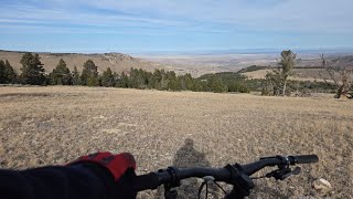
Popular Central Mountain Biking Trails
• 100 ★ 4.0 • 2 miles • 365 ft • 299 •
is a flowy piece of many loops at JBR, but stands alone as an excellent trail in its own right. The southern half of this one-time cow trail was rebuilt by LCC up out of the wash, and the ripping northern quarter connecting to the Twin...
• 95 ★ 4.9 • 2 miles • 288 ft • 291 •
One of the most scenic, rip-roaring trails in Wyoming. Fast flowing fun with enough rock to keep you on your toes. Beautiful views of the Wind River range and the Derby Dome anticline's uplifted red rocks. Once a use-created trail...
• 85 ★ 4.5 • 3 miles • 350 ft • 256 •
Slightly techy ridge line with some loose sections, can be done in either direction, a tech climb heading North with a fun descent to the draw, or an easier tech climb followed by a fun descent heading South to finish right by the...
• 90 ★ 4.5 • 4 miles • 69 ft • 255 •
From the top, a winding, mostly gentle climb around takes you to beautiful meadows full of wildflowers, gorgeous views of the high country, many optional dirt and limestone features, and an exciting steep section. Brewers is probably...
• 100 ★ 4.7 • 1 mile • 0 ft • 234 •
Great flowing blue singletrack with lots of optional line choices for more advanced riders. This section is groomed in the winter by the Lander Cycling Club.
• 80 ★ 4.0 • 1 mile • 154 ft • 229 •
Fast fun tour of the overlooking Lander, or a meandering sagebrush steppe journey. Your choice.
• 100 ★ 4.6 • 5 miles • 133 ft • 207 •
is an intermediate mountain biking trail spanning from Worthen Reservoir to . While very slowly losing elevation and incredibly well built, is a great ride on its own or in addition to its more challenging counterpart.
Central Mountain Bike Routes
Sheep Bridge/Middle Fork Shuttle Featured
★ 5.0 • 12 miles • 431 ft • 3 • Shuttled •
Top to bottom Sheep Bridge/Middle Fork Trail Shuttle ride. This is a challenging descent for the advanced...
Full Brewers Shuttle Featured
★ 5.0 • 14 miles • 246 ft • 5 • Shuttled •
Top to bottom Brewers Trail Shuttle ride. is relatively cross country, with lots of whoops and berms to...
Blue Ridge Shuttle Featured
★ 5.0 • 15 miles • 522 ft • 3 • Shuttled •
Standard route for shuttling . Highly recommend popping up Lookout Trail to the Lookout for killer views...
★ 5.0 • 14 miles • 2,150 ft • 28 • Loop •
All the technical climbs and most of the speedy descents at for those spring skill tune-ups before the...
★ 5.0 • 8 miles • 888 ft • 4 • Loop •
Set amidst the beauty and serenity of Casper Mountain, choose from a challenging 8 mile or 16 mile (2...
★ 5.0 • 5 miles • 633 ft • 12 • Loop •
This 5.2 mile loop at the Central Wyoming College's Alpine Science Institute near Lander includes 3 miles...
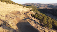
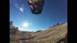
Photos of Central Mountain Bike
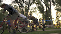
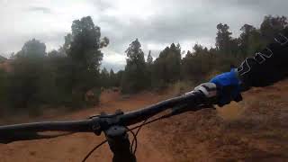
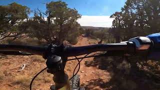
Videos of Central Mountain Bike
trail: J-Line
0:22 |
293 |
Jan 13, 2023
trail: Middle Brewers
0:02 |
218 |
Jun 27, 2018

trail: Sinks Canyon Trail
0:05 |
97 |
Jun 30, 2017
trail: Flowin' Johnny
4:24 |
80 |
Nov 26, 2025 , Lander
trail: Red Ridge
5:58 |
41 |
Nov 26, 2025 , Lander
trail: Enchanted Forest
24:53 |
85 |
Nov 26, 2025 , Lander
trail: Jackalope Jump
0:35 |
49 |
Nov 26, 2025 , Douglas
Recent Trail Reports
National Scenic Trails & Official Routes
-
Continental Divide Trail
- Mountain Bike
- Hike
- Trail Running

Activity Feed
| username | action | type | title | date |
|---|---|---|---|---|
| PRTT | add | trail | activity #97853431 | Jun 26, 2026 @ 1:15pm 20 hours |
| datdudegg22 | ridden | trail | activity #97829149 | Jun 26, 2026 @ 6:11am 1 day |
| DWARD15 | add | photo | activity #97545254 | Jun 21, 2026 @ 11:27pm Jun 21, 2026 |
| DWARD15 | add | report | activity #97544706 and 4 more | Jun 21, 2026 @ 11:08pm Jun 21, 2026 |
| johnthestanart | wishlist | route | activity #97525440 | Jun 21, 2026 @ 3:27pm Jun 21, 2026 |
Recent Comments
| username | type | title | comment | date |
|---|---|---|---|---|
| trail | the trail needs some love, the first quarter... | Jun 13, 2026 @ 4:04pm Jun 13, 2026 | ||
| trail | Definitely a trail more suited for hikers that... | Sep 17, 2025 @ 4:42pm Sep 17, 2025 | ||
| trail | The entire Brewers and Enchanted forest trails... | Sep 3, 2025 @ 7:40am Sep 3, 2025 | ||
| trail | Rippin' fun! Great green flow trail | Sep 3, 2025 @ 7:35am Sep 3, 2025 | ||
| trail | Why does this even show up as an option to... | Sep 1, 2025 @ 5:41pm Sep 1, 2025 |
Local Badges
-

Epic Ride 50k302 awarded -

Top 10 Trails0 awarded -
Top 10 Trails1 awarded -
Epic Ride 50k204 awarded -

Completionist0 awarded -

Big Ride 30k982 awarded
Bike & Skill Parks
| name | type | city | rating |
|---|---|---|---|
| Lander Bike Park | skill park | Lander | |
| ASI Bike Skills Play Area | skill park | Lander | |
| BoomTown MX | skill park | Casper | |
| Douglas Mountain Trails and Bike Park | skill park | Douglas |
Activity Type Stats
| activitytype | trails | distance | descent | descent distance | total vertical | rating | global rank | state rank | photos | reports | routes | ridelogs |
|---|---|---|---|---|---|---|---|---|---|---|---|---|
| Mountain Bike | 300 | 787 miles | 83,455 ft | 348 miles | 10,541 ft | 731 | 5,636 | 25 | 15,792 | |||
| E-Bike | 95 | 366 miles | 33,629 ft | 152 miles | 5,636 ft | 6 | 1,953 | 1 | 512 | |||
| Gravel Bike | 46 | 208 miles | 16,490 ft | 81 miles | 5,801 ft | 743 | 4 | 179 | ||||
| Adaptive Bike | 49 | 223 miles | 18,199 ft | 86 miles | 5,801 ft | 761 | 3 | |||||
| Winter Fat Bike | 77 | 185 miles | 19,957 ft | 84 miles | 9,701 ft | 2 | 1,527 | 2 | 15 | |||
| Horse | 102 | 467 miles | 42,326 ft | 204 miles | 6,831 ft | 5 | 1,405 | 3 | ||||
| Hike | 321 | 825 miles | 88,120 ft | 357 miles | 11,919 ft | 65 | 5,613 | 4 | 2,597 | |||
| Trail Running | 317 | 832 miles | 90,059 ft | 362 miles | 11,919 ft | 5,554 | 5 | 1,323 | ||||
| Dirtbike/Moto | 37 | 243 miles | 17,139 ft | 98 miles | 5,387 ft | 610 | 6 | |||||
| Observed Trials | 16 | 102 miles | 5,745 ft | 38 miles | 3,763 ft | 236 | 5 | |||||
| ATV/ORV/OHV | 37 | 253 miles | 18,369 ft | 104 miles | 5,387 ft | 609 | 12 | |||||
| Snowmobile | 4 | 28 miles | 3,159 ft | 13 miles | 2,392 ft | 274 | 3 | |||||
| Snowshoe | 48 | 122 miles | 11,175 ft | 56 miles | 4,400 ft | 1 | 798 | 1 | 200 | |||
| Downhill Ski | 22 | 4 miles | 4,465 ft | 4 miles | 558 ft | 38 | 74 | |||||
| Backcountry Ski | 6 | 29 miles | 3,156 ft | 13 miles | 3,753 ft | 129 | 129 | |||||
| Nordic Ski | 70 | 66 miles | 7,165 ft | 29 miles | 4,150 ft | 1 | 809 | 1 | 765 |
Activities
- Central Mountain Biking Trails
- Central E-Biking Trails
- Central Gravel Biking Trails
- Central Adaptive Biking Trails
- Central Winter Fat Biking Trails
- Central Horseback Trails
- Central Hiking Trails
- Central Trail Running Trails
- Central Dirtbiking Trails
- Central Observed Trials Trails
- Central ATVing/Offroading Trails
- Central Snowshoeing Trails
- Central Skiing Trails
- Central Backcountry Skiing Trails
- Central Nordic Skiing Trails
Trails
Points of Interest
- By chuktA
 TRAILFORKS NFTA & contributors
 - Admins: WP, chuktA
- #17986 - 2,406 views
- central activity log | embed map of Central mountain bike trails | central mountain biking points of interest polygons
Downloading of trail gps tracks in kml & gpx formats is enabled for Central.
You must login to download files.