close
-
Layers w
- Weather Layers
- Pro
- Pro
- Pro
- Pro
- Pro
- Pro
- More Layers
- Pro
- Pro
- Pro
- Pro
-
Upgrade to

3D
Trail Conditions
- Unknown
- Snow Groomed
- Snow Packed
- Snow Covered
- Snow Cover Partial
- Freeze/thaw Cycle
- Icy
- Prevalent Mud
- Wet
- Variable
- Ideal
- Dry
- Very Dry
Trail Flow (Ridden Direction)
Trailforks scans users ridelogs to determine the most popular direction each trail is ridden. A good flowing trail network will have most trails flowing in a single direction according to their intension.
The colour categories are based on what percentage of riders are riding a trail in its intended direction.
The colour categories are based on what percentage of riders are riding a trail in its intended direction.
- > 96%
- > 90%
- > 80%
- > 70%
- > 50%
- < 50%
- bi-directional trail
- no data
Trail Last Ridden
Trailforks scans ridelogs to determine the last time a trail was ridden.
- < 2 days
- < 1 week
- < 2 weeks
- < 1 month
- < 6 months
- > 6 months
Trail Ridden Direction
The intended direction a trail should be ridden.
- Downhill Only
- Downhill Primary
- Both Directions
- Uphill Primary
- Uphill Only
- One Direction
Contribute Details
Colors indicate trail is missing specified detail.
- Description
- Photos
- Description & Photos
- Videos
Trail Popularity ?
Trailforks scans ridelogs to determine which trails are ridden the most in the last 9 months.
Trails are compared with nearby trails in the same city region with a possible 25 colour shades.
Think of this as a heatmap, more rides = more kinetic energy = warmer colors.
- most popular
- popular
- less popular
- not popular
ATV/ORV/OHV Filter
Max Vehicle Width
inches
US Cell Coverage
Legend

Radar Time
Activity Recordings
Trailforks uses anonymized public activity data.
?
Activity Recordings
Trailforks uses anonymized public activity data.
?
Personal Heatmap
▶
Activity Types
all
/
none
▶
Options
2
Date range
month
–
Winter Trails
Warning
A routing network for winter maps does not exist. Selecting trails using the winter trails layer has been disabled.
Missing Trails
Most Popular
Least Popular
Trails are colored based on popularity. The more popular a trail is, the more red. Less popular trails trend towards green.
Jump Magnitude Heatmap
Heatmap of where riders jump on trails. Zoom in to see individual jumps, click circles to view jump details.
BC Backroad Status
![map legend]()
Service Road Atlas is a free to use, community-driven service for viewing and creating reports on the numerous back-country service roads around B.C. and Alberta.

Slope Aspect
Direction the slope faces
Trails Deemphasized
Trails are shown in grey.
Only show trails with no bike usage.
Suggested Layers
Based on selected activity type
Save the current map location and zoom level as your default home location whenever this page is loaded.
SavePopular Trail Networks
view all areas »
No description for Central has been added yet!
Login or register to submit one.
Region Details
- 2,400
- 877
- 2,190
- 1,276
- 437
- 96
- 6
Stats
- Avg Trail Rating
- Trails (view details)
- 8,152
- Trails Mountain Bike
- 7,292
- Trails E-Bike
- 2,842
- Trails Gravel Bike
- 620
- Trails Adaptive Bike
- 1,437
- Trails Winter Fat Bike
- 2,032
- Trails Horse
- 1,193
- Trails Hike
- 7,504
- Trails Trail Running
- 7,407
- Trails Dirtbike/Moto
- 571
- Trails Observed Trials
- 5
- Trails ATV/ORV/OHV
- 337
- Trails Snowmobile
- 564
- Trails Snowshoe
- 5,186
- Trails Downhill Ski
- 211
- Trails Backcountry Ski
- 50
- Trails Nordic Ski
- 3,218
- Total Distance
- 4,101 miles
- Total Descent
- 243,843 ft
- Total Vertical
- 1,515 ft
- Highest Trailhead
- 1,758 ft
- Reports
- 87,148
- Photos
- 13,292
- Ridden Counter
- 1,233,302
Articles
Race Report: Ontario Enduro Series Round 1 - Huntsville
Jul 21, 2025 from pinkbike.com
Despite the terrain in Ontario not allowing for big mountain enduros, the energy and momentum to make it a viable destination for staged enduro...
Race Report: Canadian Enduro League Eastern Cup, Huntsville, Ontario
Jul 19, 2024 from pinkbike.com
The We Are One Canadian Enduro League Presented By Leatt Eastern Cup tested riders on the Hidden Valley Ski Resort trail network.

Grow Cycling Foundation's Inglewood Pumptrack is Officially Open
Sep 27, 2023 from pinkbike.com
This weekend was the official opening of the Inglewood Pumptrack, thanks to the work of Grow Cycling and its founder, Eliot Jackson.
Results: Canadian National Championships 2019
Jul 28, 2019 from pinkbike.com
Check out all the results from the 2019 Canadian National Championships.
Sub Regions
- City of Toronto (1,778)
- Etobicoke (275)
- Centennial Park (14)
- Etobicoke Creek (150)
- Mimico Creek (84)
- North York (63)
- Scarborough (196)
- Gates Gully (15)
- Highland Creek (86)
- L'Amoreaux Park (12)
- Scarborough Bluffs (54)
- Toronto (1,287)
- Biidaasige Park (10)
- Cedarvale (18)
- Central Toronto (139)
- Crothers Woods (35)
- David A. Balfour Ravine Park (33)
- Don Valley (414)
- Don Valley Brick Works Park (8)
- Earl Bales Park (49)
- G. Ross Lord Park (19)
- Gatineau Hydro Corridor (48)
- High Park (20)
- Humber River Valley (140)
- Sherwood Park (3)
- Toronto Port Lands (41)
- Warden Woods (92)
- West Don Parklands (52)
- Rouge National Urban Park (49)
- Etobicoke (275)
- Durham Region (922)
- Ajax (83)
- Bowmanville (3)
- Clarington (200)
- Oshawa (93)
- Pickering (32)
- Scugog Township (27)
- Uxbridge (375)
- Brock Tract (20)
- CountrySide Preserve (6)
- Dagmar North Trails (47)
- Durham Forest Main Tract (93)
- Durham Regional Forest - Brookdale Tract (5)
- Durham Regional Forest - Clubine/Norton Tract (3)
- Durham Regional Forest - Goodwood Tract (3)
- Durham Regional Forest - Roseville Track (5)
- Durham Regional Forest - Timbers Tract (9)
- Glen Major Forest (38)
- Higgins (7)
- North Walkers Woods (11)
- Secord Forest and Wildlife Area (7)
- Town Of Uxbridge (48)
- Trail Hub (41)
- TRCA Skyloft (7)
- Walker Woods (43)
- Whitby (129)
- Halton Region (443)
- Burlington (51)
- Halton Hills (25)
- Milton (231)
- Oakville (116)
- Muskoka District (399)
- Bracebridge (169)
- Bonnie Lake (14)
- J.P. McVittie Nature Reserve (2)
- Resource Management Centre (42)
- Riverside Bike Park (10)
- South Monck (51)
- Wilson's Falls (8)
- Georgian Bay Township (26)
- Gravenhurst (63)
- Huntsville (69)
- Lake Of Bays Township (50)
- Muskoka Lakes Township (25)
- Bracebridge (169)
- Peel Region (477)
- Alton (3)
- Brampton (99)
- Caledon (184)
- Mississauga (192)
- Alton (3)
- Simcoe County (2,236)
- Adjala-Tosorontio (38)
- Barrie (164)
- Bradford (134)
- Clearview Township (199)
- Collingwood (166)
- Essa Township (44)
- Innisfil (24)
- Midland (68)
- New Tecumseth (14)
- Orillia (12)
- Oro-Medonte (655)
- Copeland Forest (182)
- East Coulson Swamp Reserve (0)
- Hardwood Ski and Bike (130)
- Horseshoe Valley Bike Park (29)
- Oro Hills (4)
- SCMBC - Amos Tract Trail Network (4)
- SCMBC - Heights of Horseshoe (14)
- SCMBC - ORO Trail Network (57)
- Simcoe County Forest - Amos Tract (5)
- Simcoe County Forest - Arbour Tract (4)
- Simcoe County Forest - Barton Tract (1)
- Simcoe County Forest - Boys Tract (2)
- Simcoe County Forest - Breedon Tract (12)
- Simcoe County Forest - Centennial Tract (2)
- Simcoe County Forest - Crawford Tract (9)
- Simcoe County Forest - Douglas Tract (8)
- Simcoe County Forest - Drury Main Tract (22)
- Simcoe County Forest - Elsie Mills Tract (6)
- Simcoe County Forest - Hutchison/Brown Tract (5)
- Simcoe County Forest - Johnson Tract (8)
- Simcoe County Forest - Marrin Tract (4)
- Simcoe County Forest - North Barr Tract (32)
- Simcoe County Forest - Oro Tract (0)
- Simcoe County Forest - Schumacher Tract (11)
- Simcoe County Forest - South Barr Tract (10)
- Simcoe County Forest - Strachan Tract (41)
- Simcoe County Forest - Sutherland Tract (5)
- Simcoe County Forest - Tustin Tract (8)
- The Heights Ski & Country Club (7)
- Penetanguishene (30)
- Ramara (14)
- Severn (59)
- Matchedash Bay Provincial Wildlife Area (8)
- SCMBC - Severn/Ramara Trail Network (6)
- Simcoe County Forest - Corry Tract (6)
- Simcoe County Forest - Hanes Tract (3)
- Simcoe County Forest - Macdonald Tract (5)
- Simcoe County Forest - Silver Creek (7)
- Simcoe County Forest - Slessor Tract (3)
- Simcoe County Forest - Turnbull Tract (7)
- Thomas C. Agnew Nature Reserve (4)
- Springwater (393)
- Crown Land - Springwater (7)
- Doran Park (3)
- Green Pine Park (2)
- Hydro Hill (37)
- SCMBC - Hickling Trail Network (8)
- Simcoe Admin/Sports Complex Trail Area (80)
- Simcoe County Forest - Caston Tract (1)
- Simcoe County Forest - Cooper Tract (1)
- Simcoe County Forest - Coughlin Tract (13)
- Simcoe County Forest - Craighurst Tract (8)
- Simcoe County Forest - Fisher Tract (1)
- Simcoe County Forest - Freele Tract (4)
- Simcoe County Forest - Graham Tract (11)
- Simcoe County Forest - Hendrie Main Tract (34)
- Simcoe County Forest - Hickling Tract (2)
- Simcoe County Forest - Ivey Tract (2)
- Simcoe County Forest - Midhurst Tract (7)
- Simcoe County Forest - Millennium Tract (5)
- Simcoe County Forest - Museum Tract (8)
- Simcoe County Forest - O'Niell Tract (4)
- Simcoe County Forest - Orr Lake (28)
- Simcoe County Forest - Orrock Creek North East Tract (8)
- Simcoe County Forest - Orrock Creek North/South Tracts (35)
- Simcoe County Forest - Phelpston Tract (10)
- Simcoe County Forest - Smith/Tiffin Tracts (5)
- Simcoe County Forest - Stoney Tract (11)
- Simcoe County Forest - Williams Tract (3)
- Snow Valley Area Trails (22)
- Snow Valley Ski Resort (14)
- Springwater KOA (3)
- Springwater Provincial Park (18)
- Tay Township (21)
- Tiny (78)
- Wasaga Beach (171)
- York Region (1,142)
- Aurora (61)
- East Gwillimbury (109)
- Georgina (53)
- Holland Landing (53)
- King Township (105)
- Markham (92)
- Cornell Rouge Woods (5)
- Huntington Park (14)
- Rouge Valley Park (12)
- Royal Orchard Park (2)
- South Milne Park (15)
- Toogood Pond (13)
- Newmarket (44)
- Richmond Hill (283)
- Briar Nine Park & Reserve (7)
- Elgin Mills Greenway (9)
- Jefferson Forest (131)
- Lake Wilcox Park (4)
- Laurentian Park (11)
- Mill Pond Park (12)
- Oak Ridges Corridor (62)
- Rocking Horse Ranch (7)
- Trans Richmond Hill (5)
- Schomberg (4)
- Vaughan (160)
- Whitchurch-Stouffville (155)
- Pangman Springs Conservation Area (2)
- Stouffville Creek Park (0)
- Vandorf Park (4)
- Whitchurch Conservation Area (2)
- York Regional Forest - Clarke Tract (9)
- York Regional Forest - Dainty Tract (3)
- York Regional Forest - Davis Drive Tract (18)
- York Regional Forest - Drysdale Tract (8)
- York Regional Forest - Eldred King Tract (19)
- York Regional Forest - Hall Tract (16)
- York Regional Forest - Hollidge Tract (13)
- York Regional Forest - Mitchell Tract (4)
- York Regional Forest - North Tract (28)
- York Regional Forest - Patterson Tract (8)
- York Regional Forest - Porritt Tract (5)
- York Regional Forest - Robinson Tract (7)
- York Regional Forest - Scout Tract (4)
- Nokiidaa Trail System (52)
Popular Central Mountain Biking Trails
• 100 ★ 4.4 • 1 mile • 148 ft • 2,390 •
Rolling up and down trail along the valley wall with some challenging rooted climbs and a few steep descents depending on which line riders take. It can take a few rides to learn when and where to carry your speed to overcome the next...
• 100 ★ 4.2 • 3,130 ft • 30 ft • 2,380 •
COVID 19 (Dec 2021) update - via LSCA - DIRECTIONAL SIGNAGE removed.. Flow through pines NW to SW. Berms. Rollers. Some excellent banked sections. Inset rocks and power climbs.
• 100 ★ 4.1 • 2,303 ft • 55 ft • 2,328 •
COVID 19 (Dec 2021) update - via LSCA - DIRECTIONAL SIGNAGE removed.
• 100 ★ 4.1 • 1 mile • 77 ft • 2,312 •
Highly rated popular blue difficulty singletrack. This mountain bike primary trail can be used both directions and has a moderate overall physical rating with a 77 ft blue climb. Trail visibility is always easy to follow. On average it takes 9 minutes to complete this trail.
• 100 ★ 4.1 • 1,650 ft • 22 ft • 2,291 •
Highly rated popular black diamond difficulty singletrack. This mountain bike primary trail and has a moderate overall physical rating with a 22 ft blue climb. It features berm, drop, jump, roller coaster and other. Trail visibility is always easy to follow. On average it takes 2 minutes to complete this trail.
• 100 ★ 3.8 • 1,640 ft • 6 ft • 2,213 •
COVID 19 (Dec 2021) update - via LSCA - DIRECTIONAL SIGNAGE removed. 2017 Edition
• 100 ★ 4.6 • 1,093 ft • 13 ft • 2,196 •
COVID 19 (Dec 2021) update - via LSCA - DIRECTIONAL SIGNAGE removed..
• 100 ★ 4.5 • 3,228 ft • 59 ft • 2,178 •
leading to doubletrack and Oakie Dokey leading to .
Central Mountain Bike Routes
Fun Course Featured
★ 5.0 • 3 miles • 199 ft • 5 • Loop •
An easy beginner course. Starts with slow climb to high point on double track. Easy single track and ends...
SCMBC Oro FatBike 2025 Featured
★ 5.0 • 14 miles • 982 ft • 10 • Loop •
SCMBC Oro fat bike route for 2025
Agreement Forest Easy Featured
★ 5.0 • 10 miles • 261 ft • 20 • Loop •
EASIER ROUTE FOR FIRST RIDE AT AGREEMENT FOREST
★ 1.0 • 11 miles • 1,485 ft • 30 • Loop •
Every HMBA trail at Hidden Valley / Deerhurst in the main area. Does not include the Driving Range trails.
2019/20 HAFTA FAT BIKE LOOP Featured
10 miles • 367 ft • 37 • Loop •
HAFTA's 2019/20 WINTER LOOP (AF only)
★ 5.0 • 37 miles • 1,589 ft • 16 • Loop •
A mostly paved loop linking together the don trail, waterfront trail, highland creek trail, and Gatineau...
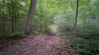
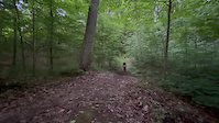
Photos of Central Mountain Bike
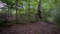
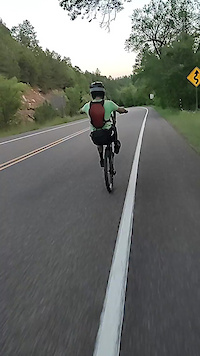
Videos of Central Mountain Bike
featured
![Copeland - April 16th, 2017]()
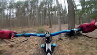
trail: Copeland Downhill
4:14 |
907 |
Apr 16, 2017
trail: Broken Spokes
0:06 |
1 |
Jun 19, 2026
trail: Broken Spokes
0:04 |
1 |
Jun 19, 2026
trail: Broken Spokes
0:04 |
3 |
Jun 19, 2026
trail: Trinity Bellwoods X-ing
0:12 |
9 |
May 1, 2026
trail: Donaconda
0:22 |
27 |
Apr 19, 2026

trail: Castle Frank
0:43 |
44 |
Mar 29, 2026

trail: ST0
0:41 |
6 |
Feb 17, 2026
Current Trail Warnings
| status | trail | date | condition | user | info |
|---|---|---|---|---|---|
| The Flats Don Valley | Jun 20, 2026 @ 2:46pm (America/Toronto) 1 day | Variable | Jsole71 | As of June 20, the river is very high... | |
| Humber Woods Humber River Valley | Jun 20, 2026 @ 4:59pm (America/Toronto) 1 day | Variable | KeirenH | tree down | |
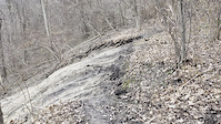
| Double Track - Sign Post 4 to 5 Copeland Forest | Jun 20, 2026 @ 12:03pm (America/Vancouver) 1 day | Unknown | trailforks Trailforks |
Recent Trail Reports
Activity Feed
| username | action | type | title | date |
|---|---|---|---|---|
| bcintor | add | report | activity #97516688 and 3 more | Jun 21, 2026 @ 1:35pm 1 hours |
| Collins26 | wishlist | route | activity #97512562 | Jun 21, 2026 @ 12:50pm 2 hours |
| wadeendeman | ridden | trail | activity #97509747 | Jun 21, 2026 @ 12:20pm 2 hours |
| donsmithmtb | add | report | activity #97508382 and 5 more | Jun 21, 2026 @ 12:05pm 3 hours |
| extremumadventura | checkin | trail | activity #97487759 | Jun 21, 2026 @ 8:29am 6 hours |
Recent Comments
| username | type | title | comment | date |
|---|---|---|---|---|
| report | Gonna let this one drop on its own then deal... | Jun 20, 2026 @ 2:17pm 1 day | ||
| trail | Someone has done an awful job and cut out a... | Jun 20, 2026 @ 2:13pm 1 day | ||
| report | Totally not passable overgrown with fallen... | Jun 20, 2026 @ 7:23am 1 day | ||
| report | Hmm, that's the telltale sign of the social... | Jun 20, 2026 @ 6:08am 1 day | ||
| report | This might be for the wrong trail, rode it on... | Jun 19, 2026 @ 11:08am 2 days |
Local Badges
-

Horseshoe Single Ride Thriller v218 awarded -

Completionist217 awarded -
HMBA Singletrack7 awarded -

The Jeffy Whole Enchillada!5 awarded -

BRMC Double Track Dabbler3 awarded -

MORCA Double Black Diamonds!48 awarded
Bike & Skill Parks
| name | type | city | rating |
|---|---|---|---|
| Horseshoe Valley Bike Park | bike park | Oro-Medonte | |
| Crother's Woods Skill Park / Pump Track | skill park | Toronto | |
| Sunnyside Bike Park | skill park | Toronto | |
| Ellis Leuschner Challenge Park | skill park | Mississauga | |
| Clarkson Dirt Jump Park | skill park | Mississauga |
Upcoming Local Events
-
-
-
Local Products
Local Products
Activity Type Stats
| activitytype | trails | distance | descent | descent distance | total vertical | rating | global rank | state rank | photos | reports | routes | ridelogs |
|---|---|---|---|---|---|---|---|---|---|---|---|---|
| Mountain Bike | 7,292 | 3,607 miles | 191,253 ft | 1,200 miles | 1,516 ft | 10,741 | 86,338 | 379 | 792,216 | |||
| E-Bike | 2,842 | 1,466 miles | 75,066 ft | 491 miles | 1,404 ft | 40 | 68,899 | 61 | 13,780 | |||
| Gravel Bike | 620 | 414 miles | 19,524 ft | 144 miles | 1,329 ft | 4 | 13,070 | 43 | 5,430 | |||
| Adaptive Bike | 1,437 | 840 miles | 29,816 ft | 263 miles | 1,329 ft | 1 | 10,906 | 16 | 47 | |||
| Winter Fat Bike | 2,032 | 1,020 miles | 51,955 ft | 341 miles | 1,293 ft | 25 | 26,768 | 22 | 889 | |||
| Horse | 1,193 | 676 miles | 33,993 ft | 234 miles | 1,362 ft | 11,608 | 1 | 181 | ||||
| Hike | 7,504 | 3,833 miles | 203,087 ft | 1,284 miles | 1,516 ft | 2,375 | 84,936 | 69 | 44,546 | |||
| Trail Running | 7,407 | 3,804 miles | 201,453 ft | 1,274 miles | 1,516 ft | 47 | 84,886 | 100 | 62,192 | |||
| Dirtbike/Moto | 571 | 464 miles | 17,940 ft | 150 miles | 833 ft | 4 | 10,137 | 3 | 491 | |||
| Observed Trials | 5 | 7 miles | 630 ft | 3 miles | 361 ft | 1 | 215 | 1 | 274 | |||
| ATV/ORV/OHV | 337 | 255 miles | 8,694 ft | 87 miles | 1,001 ft | 9 | 10,105 | 1 | 206 | |||
| Snowmobile | 564 | 483 miles | 15,945 ft | 176 miles | 1,020 ft | 2 | 792 | 1 | 125 | |||
| Snowshoe | 5,186 | 2,658 miles | 142,287 ft | 877 miles | 1,509 ft | 12 | 15,199 | 39 | 3,173 | |||
| Downhill Ski | 211 | 46 miles | 21,772 ft | 38 miles | 1,217 ft | 8 | 724 | 6,348 | ||||
| Backcountry Ski | 50 | 27 miles | 2,697 ft | 11 miles | 1,444 ft | 965 | 12 | 975 | ||||
| Nordic Ski | 3,218 | 1,871 miles | 78,799 ft | 593 miles | 1,512 ft | 1 | 8,303 | 15 | 10,906 |
Activities
- Central Mountain Biking Trails
- Central E-Biking Trails
- Central Gravel Biking Trails
- Central Adaptive Biking Trails
- Central Winter Fat Biking Trails
- Central Horseback Trails
- Central Hiking Trails
- Central Trail Running Trails
- Central Dirtbiking Trails
- Central Observed Trials Trails
- Central ATVing/Offroading Trails
- Central Snowmobiling Trails
- Central Snowshoeing Trails
- Central Skiing Trails
- Central Backcountry Skiing Trails
- Central Nordic Skiing Trails
Trails
- By markholloway
 Trailforks Map Team & contributors
 - Admins: Canadmos
- #9946 - 26,456 views
- central activity log | embed map of Central mountain bike trails | central mountain biking points of interest polygons
Downloading of trail gps tracks in kml & gpx formats is enabled for Central.
You must login to download files.