close
-
Layers w
- Weather Layers
- Pro
- Pro
- Pro
- Pro
- Pro
- Pro
- More Layers
- Pro
- Pro
- Pro
- Pro
-
Upgrade to

3D
Trail Conditions
- Unknown
- Snow Groomed
- Snow Packed
- Snow Covered
- Snow Cover Partial
- Freeze/thaw Cycle
- Icy
- Prevalent Mud
- Wet
- Variable
- Ideal
- Dry
- Very Dry
Trail Flow (Ridden Direction)
Trailforks scans users ridelogs to determine the most popular direction each trail is ridden. A good flowing trail network will have most trails flowing in a single direction according to their intension.
The colour categories are based on what percentage of riders are riding a trail in its intended direction.
The colour categories are based on what percentage of riders are riding a trail in its intended direction.
- > 96%
- > 90%
- > 80%
- > 70%
- > 50%
- < 50%
- bi-directional trail
- no data
Trail Last Ridden
Trailforks scans ridelogs to determine the last time a trail was ridden.
- < 2 days
- < 1 week
- < 2 weeks
- < 1 month
- < 6 months
- > 6 months
Trail Ridden Direction
The intended direction a trail should be ridden.
- Downhill Only
- Downhill Primary
- Both Directions
- Uphill Primary
- Uphill Only
- One Direction
Contribute Details
Colors indicate trail is missing specified detail.
- Description
- Photos
- Description & Photos
- Videos
Trail Popularity ?
Trailforks scans ridelogs to determine which trails are ridden the most in the last 9 months.
Trails are compared with nearby trails in the same city region with a possible 25 colour shades.
Think of this as a heatmap, more rides = more kinetic energy = warmer colors.
- most popular
- popular
- less popular
- not popular
ATV/ORV/OHV Filter
Max Vehicle Width
inches
US Cell Coverage
Legend

Radar Time
Activity Recordings
Trailforks uses anonymized public activity data.
?
Activity Recordings
Trailforks uses anonymized public activity data.
?
Personal Heatmap
▶
Activity Types
all
/
none
▶
Options
2
Date range
month
–
Winter Trails
Warning
A routing network for winter maps does not exist. Selecting trails using the winter trails layer has been disabled.
Missing Trails
Most Popular
Least Popular
Trails are colored based on popularity. The more popular a trail is, the more red. Less popular trails trend towards green.
Jump Magnitude Heatmap
Heatmap of where riders jump on trails. Zoom in to see individual jumps, click circles to view jump details.
BC Backroad Status
![map legend]()
Service Road Atlas is a free to use, community-driven service for viewing and creating reports on the numerous back-country service roads around B.C. and Alberta.

Slope Aspect
Direction the slope faces
Trails Deemphasized
Trails are shown in grey.
Only show trails with no bike usage.
Suggested Layers
Based on selected activity type
Save the current map location and zoom level as your default home location whenever this page is loaded.
SavePopular Trail Networks
view all areas »
No description for Central Indiana has been added yet!
Login or register to submit one.
Stats
- Avg Trail Rating
- Trails (view details)
- 485
- Trails Mountain Bike
- 231
- Trails E-Bike
- 85
- Trails Horse
- 22
- Trails Hike
- 453
- Trails Trail Running
- 452
- Trails Dirtbike/Moto
- 3
- Trails Observed Trials
- 2
- Trails ATV/ORV/OHV
- 3
- Trails Snowshoe
- 1
- Trails Backcountry Ski
- 1
- Total Distance
- 397 miles
- Total Descent
- 18,599 ft
- Total Vertical
- 668 ft
- Highest Trailhead
- 1,111 ft
- Reports
- 27,418
- Photos
- 394
- Ridden Counter
- 31,378
Sub Regions
- Blackford County (13)
- Hartford City (14)
- Wilderness Park (13)
- Hartford City (14)
- Boone County (5)
- Lebanon (1)
- Zionsville (4)
- Lebanon (1)
- Delaware County (22)
- Muncie (22)
- Prairie Creek Trails (11)
- Muncie (22)
- Hamilton County (12)
- Fishers (7)
- Noblesville (0)
- Westfield (5)
- Hendricks County (18)
- Avon (8)
- North Salem (9)
- Henry County (2)
- New Castle (2)
- Howard County (3)
- Kokomo (3)
- Kokomo (3)
- Johnson County (0)
- Madison County (11)
- Anderson (11)
- Marion County (74)
- Montgomery County (0)
- Crawfordsville (0)
- Crawfordsville (0)
- Owen County (4)
- Parke County (0)
- Marshall (0)
- Marshall (0)
- Putnam County (1)
- Tippecanoe County (17)
- Lafayette (17)
- Union County (0)
- Vigo County (33)
- Terre Haute (33)
- Griffin Bike Park (29)
- Terre Haute (33)
- Wayne County (13)
- Richmond (13)
- Hayes Arboretum (13)
- Richmond (13)
Popular Central Indiana Mountain Biking Trails
• 100 ★ 4.1 • 2 miles • 49 ft • 433 •
The is on land donated by Oliver Daugherty to the Central Indiana Land Trust. The trail in a recreation easement thanks to Oliver Daugherty. The area was historically used to quarry sand. Sections are in woods, but much of the look is...
• 100 ★ 4.0 • 2 miles • 5 ft • 418 •
This section of Town Run is a long the white river and twists and turns through a wooded floodplain. The trail is directional, with the direction changing by day. Please look at the directional signs at the trail head.
• 100 ★ 5.0 • 1,657 ft • 15 ft • 410 •
This is a short section between Talking Tree and the 465 Bridge. If twists through a wooded area along the White River. The trail is directional by day. Please look at the directional signage at intersections.
• 95 ★ 4.5 • 1,522 ft • 24 ft • 409 •
Popular blue difficulty singletrack. This mountain bike primary trail can be used one direction. It features drop. Trail visibility is always easy to follow. On average it takes 2 minutes to complete this trail.
• 90 ★ 5.0 • 2 miles • 29 ft • 400 •
Popular green difficulty singletrack. This mountain bike primary trail can be used one direction and has a moderate overall physical rating with a 29 ft green climb. It features berm and drop. Trail visibility is always easy to follow. On average it takes 13 minutes to complete this trail.
• 75 ★ 3.7 • 4 miles • 410 ft • 361 •
Intermediate skill level trail with technical climbs along ravines, roots, and a long flowy downhill section towards the end.
• 80 ★ 4.3 • 1 mile • 79 ft • 360 •
Nice relaxing loop around the base of Mann Hill. Parts run along the side of the hill. MIld grades allow some decent speed to be achieved in some sections while avoiding any difficult climbing. All users allowed
• 95 ★ 4.0 • 1,998 ft • 0 ft • 346 •
An intense rock garden leads to a string of tabletops before exiting the woods into the powerline easement. Here, more tabletops, broken up by a number of sweeping berms, lead down the hill to yet more tabletops, a series of...
Central Indiana Mountain Bike Routes
Expert Loop Featured
★ 4.0 • 8 miles • 179 ft • 10 • Loop •
This loop begins with the fast and flowy Beginner loop but branches off for much more challenging terrain...
★ 4.5 • 5 miles • 98 ft • 3 • Loop •
Smooth, fast, flowy trail with creek crossings, jumps, bridges, and many aquatic views. Begins with the...
★ 3.4 • 7 miles • 99 ft • 8 • Loop •
The full loop consisting of the north and south ends of Town Run Trail Park.
★ 5.0 • 4 miles • 164 ft • 3 • Loop •
This mostly 10-ft.-wide loop has been optimized for adaptive MTB riders and youth racing, with NICA...
2 miles • 26 ft • 1 •
This is an easy moderately flat 2 mile loop which connects both the Intermediate and Expert trails. Please...
★ 5.0 • 7 miles • 427 ft • 13 •
his trail starts with the "fingers" series of switchbacks and straightens out to a flowing section leading...
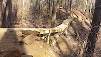
Photos of Central Indiana Mountain Bike
Videos of Central Indiana Mountain Bike
trail: AWOL
0:09 |
14 |
Oct 27, 2024

trail: AWOL
0:42 |
69 |
Jan 25, 2024
trail: Recon Trail
0:05 |
355 |
Aug 5, 2022
trail: Big Fire North
0:48 |
147 |
Nov 20, 2021

trail: Big Fire South
3:08 |
155 |
Nov 20, 2021

trail: Power Line DH
0:33 |
299 |
Nov 20, 2021
trail: AWOL
0:08 |
|
Nov 16, 2021
trail: KA-BAR
0:22 |
218 |
Jan 18, 2021
Current Trail Warnings
| status | trail | date | condition | user | info |
|---|---|---|---|---|---|
| Proving Grounds Expert Drop Griffin Bike Park | Jun 21, 2026 @ 7:39pm (America/Indiana/Indianapolis) Jun 21, 2026 | Prevalent Mud | RichMoore65 FOGBP | ||
| Pro Pump Track Griffin Bike Park | Jun 21, 2026 @ 7:39pm (America/Indiana/Indianapolis) Jun 21, 2026 | Prevalent Mud | RichMoore65 FOGBP | ||
| Dual Slalom Track Griffin Bike Park | Jun 21, 2026 @ 7:38pm (America/Indiana/Indianapolis) Jun 21, 2026 | Prevalent Mud | RichMoore65 FOGBP |
Recent Trail Reports
Activity Feed
| username | action | type | title | date |
|---|---|---|---|---|
| KennethLDn23q | vote | trail | activity #97724627 | Jun 24, 2026 @ 2:34pm 18 hours |
| CamPayne1998 | wishlist | region | activity #97648726 | Jun 23, 2026 @ 1:19pm 2 days |
| RichMoore65 | add | report | activity #97638253 and 29 more | Jun 23, 2026 @ 10:49am 2 days |
| Jeff1462 | add | report | activity #97555028 and 2 more | Jun 22, 2026 @ 5:29am Jun 22, 2026 |
| RichMoore65 | add | report | activity #97530486 and 34 more | Jun 21, 2026 @ 4:38pm Jun 21, 2026 |
Recent Comments
| username | type | title | comment | date |
|---|---|---|---|---|
| trail | Hikers hike the mtn bike trail. Mtn bikers... | Oct 25, 2025 @ 6:17am Oct 25, 2025 | ||
| trail | Seemingly abandoned and unrideable same with... | Oct 23, 2025 @ 9:30am Oct 23, 2025 | ||
| trail | Dirt part of trail now has signs saying closed... | Sep 10, 2025 @ 1:16pm Sep 10, 2025 | ||
| trail | Seems to now be closed | Sep 10, 2025 @ 1:15pm Sep 10, 2025 | ||
| trail | Seems to now be closed | Sep 10, 2025 @ 1:15pm Sep 10, 2025 |
Local Badges
-

Epic Ride Descent 2k0 awarded -

Epic Mountain Bike Climb 2k0 awarded -

Climbing 10k Badge0 awarded -

Mountain Biking 100k Badge0 awarded -
Epic Ride Descent 2k0 awarded -
Epic Ride Descent 2k0 awarded
Bike & Skill Parks
| name | type | city | rating |
|---|---|---|---|
| The Headquarters Mountain Bike Skills Park | skill park | Indianapolis | |
| Indy Cycloplex BMX / Skate Park | skill park | Indianapolis | |
| Lake Sullivan BMX Track | skill park | Indianapolis | |
| Wildcat Creek | skill park | Lafayette |
Upcoming Local Events
Local Trail Supporters
- City of Anderson
Local Trail Supporters
- City of Anderson
Activity Type Stats
| activitytype | trails | distance | descent | descent distance | total vertical | rating | global rank | state rank | photos | reports | routes | ridelogs |
|---|---|---|---|---|---|---|---|---|---|---|---|---|
| Mountain Bike | 230 | 281 miles | 10,135 ft | 87 miles | 653 ft | 375 | 27,741 | 12 | 53,247 | |||
| E-Bike | 85 | 130 miles | 2,999 ft | 43 miles | 581 ft | 22,730 | 3 | 1,652 | ||||
| Horse | 22 | 33 miles | 1,411 ft | 17 miles | 341 ft | 3,787 | 4 | |||||
| Hike | 453 | 380 miles | 17,070 ft | 118 miles | 669 ft | 7 | 27,128 | 2 | 2,824 | |||
| Trail Running | 452 | 379 miles | 17,070 ft | 118 miles | 669 ft | 14 | 27,129 | 3 | 2,607 | |||
| Dirtbike/Moto | 3 | 561 ft | 26 ft | 16 ft | 3,745 | 1 | ||||||
| Observed Trials | 2 | 4,593 ft | 95 ft | 1,742 ft | 30 ft | 1 | 4 | |||||
| ATV/ORV/OHV | 3 | 545 ft | 112 ft | 10 ft | 3,744 | 1 | ||||||
| Snowshoe | 1 | 554 ft | 17 | 1 | 3 | |||||||
| Backcountry Ski | 1 | 36 ft | 10 ft | 16 | 1 | 10 |
Activities
Trails
Points of Interest
- Wetlands Habitat & Observational Boardwalk Viewpoint
- Upper Falls Viewpoint
- [falls] Upper Cataract Falls Other
- Upper Falls Shelter Cabin
- [falls] Lower Cataract Falls Other
- Lower Cataract Falls Viewpoint
- Eagle Aerie Overlook Viewpoint
- Pileated Peak Overlook Viewpoint
- Cardinal Perch Overlook Viewpoint
- Volleyball Pit Other
- By Larsacus
 TRAILFORKS & contributors
 - Admins: HMBA
- #22798 - 4,949 views
- central indiana activity log | embed map of Central Indiana mountain bike trails | central indiana mountain biking points of interest polygons
Downloading of trail gps tracks in kml & gpx formats is enabled for Central Indiana.
You must login to download files.