close
-
Layers w
- Weather Layers
- Pro
- Pro
- Pro
- Pro
- Pro
- Pro
- More Layers
- Pro
- Pro
- Pro
- Pro
-
Upgrade to

3D
Trail Conditions
- Unknown
- Snow Groomed
- Snow Packed
- Snow Covered
- Snow Cover Partial
- Freeze/thaw Cycle
- Icy
- Prevalent Mud
- Wet
- Variable
- Ideal
- Dry
- Very Dry
Trail Flow (Ridden Direction)
Trailforks scans users ridelogs to determine the most popular direction each trail is ridden. A good flowing trail network will have most trails flowing in a single direction according to their intension.
The colour categories are based on what percentage of riders are riding a trail in its intended direction.
The colour categories are based on what percentage of riders are riding a trail in its intended direction.
- > 96%
- > 90%
- > 80%
- > 70%
- > 50%
- < 50%
- bi-directional trail
- no data
Trail Last Ridden
Trailforks scans ridelogs to determine the last time a trail was ridden.
- < 2 days
- < 1 week
- < 2 weeks
- < 1 month
- < 6 months
- > 6 months
Trail Ridden Direction
The intended direction a trail should be ridden.
- Downhill Only
- Downhill Primary
- Both Directions
- Uphill Primary
- Uphill Only
- One Direction
Contribute Details
Colors indicate trail is missing specified detail.
- Description
- Photos
- Description & Photos
- Videos
Trail Popularity ?
Trailforks scans ridelogs to determine which trails are ridden the most in the last 9 months.
Trails are compared with nearby trails in the same city region with a possible 25 colour shades.
Think of this as a heatmap, more rides = more kinetic energy = warmer colors.
- most popular
- popular
- less popular
- not popular
ATV/ORV/OHV Filter
Max Vehicle Width
inches
US Cell Coverage
Legend

Radar Time
Activity Recordings
Trailforks uses anonymized public activity data.
?
Activity Recordings
Trailforks uses anonymized public activity data.
?
Personal Heatmap
▶
Activity Types
all
/
none
▶
Options
2
Date range
month
–
Winter Trails
Warning
A routing network for winter maps does not exist. Selecting trails using the winter trails layer has been disabled.
Missing Trails
Most Popular
Least Popular
Trails are colored based on popularity. The more popular a trail is, the more red. Less popular trails trend towards green.
Jump Magnitude Heatmap
Heatmap of where riders jump on trails. Zoom in to see individual jumps, click circles to view jump details.
BC Backroad Status
![map legend]()
Service Road Atlas is a free to use, community-driven service for viewing and creating reports on the numerous back-country service roads around B.C. and Alberta.

Slope Aspect
Direction the slope faces
Trails Deemphasized
Trails are shown in grey.
Only show trails with no bike usage.
Suggested Layers
Based on selected activity type
Save the current map location and zoom level as your default home location whenever this page is loaded.
SaveCentral Macedonia is part of Macedonia the largest and second in population geografic apartment of Greece.A place of great history, virgin mountains and spectacular beaches.
source: Macedonia
Links
Stats
- Avg Trail Rating
- Trails (view details)
- 411
- Trails Mountain Bike
- 534
- Trails E-Bike
- 446
- Trails Gravel Bike
- 3
- Trails Adaptive Bike
- 2
- Trails Winter Fat Bike
- 2
- Trails Horse
- 14
- Trails Hike
- 461
- Trails Trail Running
- 444
- Trails Dirtbike/Moto
- 10
- Trails Observed Trials
- 2
- Trails ATV/ORV/OHV
- 7
- Total Distance
- 249 miles
- Total Descent
- 83,792 ft
- Total Vertical
- 6,393 ft
- Highest Trailhead
- 6,394 ft
- Reports
- 3,439
- Photos
- 483
- Ridden Counter
- 12,822
Popular Trail Networks
view all areas »Sub Regions
- Imathia (9)
- Veria (5)
- Veria (5)
- Kavala Prefecture (4)
- Kavala (2)
- Kavala (2)
- Pieria (29)
- Exochi (1)
- Katerini,Svoronos (0)
- Litochoro (23)
- Mount Olympus (20)
- Palios Panteleimonas (4)
- Exochi (1)
- Prefecture of Chalkidiki (10)
- Prefecture of Thessaloniki (435)
- Thessaloniki (430)
- Chortiatis (50)
- Kedrinos Lofos(Seih Sou) (203)
- Kouri (11)
- Livadi (2)
- Oreokastro (25)
- Thermi (43)
- Volvi (13)
- Stavros (13)
- Thessaloniki (430)
- Serres (11)
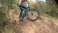
Popular Central Macedonia Mountain Biking Trails
• 75 ★ 4.7 • 1,332 ft • 0 ft • 120 •
Independent, low segment of a trail complex at Oreokastro area. Usually well maintained by local Riding Club. Playful, flowy with a mellow descent. Several burms , small jumps ( tabletops and doubles). One of the most fun tracks in the...
• 90 ★ 4.4 • 2,776 ft • 32 ft • 111 •
Highly rated popular blue difficulty singletrack. This mountain bike primary trail can be used downhill primary with a 32 ft green climb. It features berm and jump. On average it takes 2 minutes to complete this trail.
• 90 ★ 4.0 • 1,247 ft • 0 ft • 110 •
Χρειάζεται απαραίτητα εμπειρία, λόγω της αυξημένης κλίσης και τα κλειστά εσάκια στις στροφές, το καθιστούν επικίνδυνο για...
• 95 ★ 4.0 • 1,594 ft • 0 ft • 103 •
Popular green difficulty singletrack. This mountain bike primary trail can be used both directions and has a easy overall physical rating. It features berm and jump. Trail visibility is always easy to follow. On average it takes 1 minutes to complete this trail.
• 90 ★ 5.0 • 3,287 ft • 0 ft • 102 •
Independent, low segment of a trail complex at Oreokastro area. Usually well maintained by local Riding Club. Playful, flowy with a mellow descent. Several burms , small jumps ( tabletops and doubles). One of the most fun tracks in the...
Central Macedonia Mountain Bike Routes
6 miles • 1,152 ft • 3 •
Το Action Bike Club μετα απο 10 χρόνια ''παυσης'' φέρνει ξανά τα...
11 miles • 2,325 ft • 9 • Point to Point •
Starting from the Kouri Main trail, this route takes you all the way down to Thessaloniki through the...
13 miles • 2,402 ft • 10 • Loop •
Nice Round at Xortiatis not very difficult
9 miles • 675 ft • 2 •
Route to go from to sykaeon trail. All trails: , Fortress, end of Giannoula Descent 1, Soft East Reverb,...
Photos of Central Macedonia Mountain Bike
Videos of Central Macedonia Mountain Bike
trail: Abalaea
0:06 |
34 |
Nov 18, 2025
trail: Villa Barrel
2:05 |
7 |
May 10, 2025

trail: Orgasmatron
2:22 |
175 |
Jul 18, 2021

trail: Letatara Pt1.
0:45 |
36 |
Mar 13, 2021

trail: Blue Lada
2:07 |
64 |
Mar 13, 2021
trail: Galopoula jumping
0:08 |
258 |
Nov 23, 2020
trail: Karavi
0:07 |
288 |
Jan 5, 2020
trail: Tulumba
0:52 |
147 |
May 27, 2019
Current Trail Warnings
| status | trail | date | condition | user | info |
|---|---|---|---|---|---|
| Giannoula III Thessaloniki | May 31, 2026 @ 11:29pm (Europe/Athens) May 31, 2026 | Unknown | cain1977 | Σχεδόν κλειστό... | |
| Letatara Pt2. Kedrinos Lofos(Seih Sou) | May 25, 2026 @ 11:57pm (Europe/Athens) May 25, 2026 | Prevalent Mud | cain1977 | ΠΡΟΣΟΧΗ!!!! Εκτός οτι... | |
| Letatara Pt1. Kedrinos Lofos(Seih Sou) | May 25, 2026 @ 11:57pm (Europe/Athens) May 25, 2026 | Prevalent Mud | cain1977 | ΠΡΟΣΟΧΗ!!!! Εκτός οτι... |
Recent Trail Reports
Activity Feed
| username | action | type | title | date |
|---|---|---|---|---|
| cain1977 | add | report | activity #97425217 and 17 more | Jun 20, 2026 @ 12:55pm 2 days |
| cain1977 | add | report | activity #97133921 | Jun 16, 2026 @ 1:12pm Jun 16, 2026 |
| Dunzioh | comment | trail | activity #97052896 | Jun 15, 2026 @ 10:54am Jun 15, 2026 |
| PeriklisLagos | add | report | activity #96848423 and 2 more | Jun 12, 2026 @ 9:54pm Jun 12, 2026 |
| Lefteris00 | add | report | activity #96793859 | Jun 12, 2026 @ 4:18am Jun 12, 2026 |
Recent Comments
| username | type | title | comment | date |
|---|---|---|---|---|
| trail | nice off camber training trail | Jun 15, 2026 @ 10:54am Jun 15, 2026 | ||
| report | Μονο απο την όψη που έχει... | May 26, 2026 @ 12:12pm May 26, 2026 | ||
| trail | Έχουν φυτρώσει μεγάλα... | May 10, 2026 @ 9:11am May 10, 2026 | ||
| trail | Το μονοπάτι είναι... | May 10, 2026 @ 9:06am May 10, 2026 | ||
| report | Ευχαριστούμε για την... | Apr 29, 2026 @ 8:28am Apr 29, 2026 |
Local Badges
-

Epic Mountain Bike Climb 2k0 awarded -

10 Black Trails15 awarded -

Big Ride 30k21 awarded -
Epic Mountain Bike Climb 2k0 awarded -

Top 10 Trails0 awarded -

Climbing 10k Badge0 awarded
Bike & Skill Parks
| name | type | city | rating |
|---|---|---|---|
| Panorama Sport Center pump track | skill park | Thessaloniki | |
| Panorama Sport Center BMX/Skate park | skill park | Thessaloniki |
Local Trail Supporters
- Hellenic Mountain Bicycling Association
Activity Type Stats
| activitytype | trails | distance | descent | descent distance | total vertical | rating | global rank | state rank | photos | reports | routes | ridelogs |
|---|---|---|---|---|---|---|---|---|---|---|---|---|
| Mountain Bike | 502 | 248 miles | 83,497 ft | 146 miles | 6,394 ft | 463 | 3,484 | 25 | 28,798 | |||
| E-Bike | 446 | 208 miles | 67,434 ft | 118 miles | 6,394 ft | 9 | 3,273 | 17 | 4,060 | |||
| Gravel Bike | 3 | 9 | 23 | 54 | ||||||||
| Adaptive Bike | 2 | 11 | ||||||||||
| Winter Fat Bike | 2 | 11 | ||||||||||
| Horse | 14 | 53 miles | 4,377 ft | 14 miles | 4,560 ft | 428 | ||||||
| Hike | 461 | 218 miles | 68,097 ft | 119 miles | 6,394 ft | 1 | 3,351 | 1 | 1,084 | |||
| Trail Running | 444 | 214 miles | 66,342 ft | 116 miles | 6,394 ft | 13 | 3,346 | 1 | 932 | |||
| Dirtbike/Moto | 10 | 16 miles | 1,555 ft | 4 miles | 1,847 ft | 559 | ||||||
| Observed Trials | 2 | 14 | ||||||||||
| ATV/ORV/OHV | 7 | 38 miles | 2,844 ft | 10 miles | 4,177 ft | 339 |
Activities
Trails
- By brenthillier
 NSMBA TRAILFORKS & contributors
 - Admins: haristheodoropoulos, mikesf, HMBA
- #11369 - 2,343 views
- central macedonia activity log | embed map of Central Macedonia mountain bike trails | central macedonia mountain biking points of interest
Downloading of trail gps tracks in kml & gpx formats is enabled for Central Macedonia.
You must login to download files.