close
-
Layers w
- Weather Layers
- Pro
- Pro
- Pro
- Pro
- Pro
- Pro
- More Layers
- Pro
- Pro
- Pro
- Pro
-
Upgrade to

3D
Trail Conditions
- Unknown
- Snow Groomed
- Snow Packed
- Snow Covered
- Snow Cover Partial
- Freeze/thaw Cycle
- Icy
- Prevalent Mud
- Wet
- Variable
- Ideal
- Dry
- Very Dry
Trail Flow (Ridden Direction)
Trailforks scans users ridelogs to determine the most popular direction each trail is ridden. A good flowing trail network will have most trails flowing in a single direction according to their intension.
The colour categories are based on what percentage of riders are riding a trail in its intended direction.
The colour categories are based on what percentage of riders are riding a trail in its intended direction.
- > 96%
- > 90%
- > 80%
- > 70%
- > 50%
- < 50%
- bi-directional trail
- no data
Trail Last Ridden
Trailforks scans ridelogs to determine the last time a trail was ridden.
- < 2 days
- < 1 week
- < 2 weeks
- < 1 month
- < 6 months
- > 6 months
Trail Ridden Direction
The intended direction a trail should be ridden.
- Downhill Only
- Downhill Primary
- Both Directions
- Uphill Primary
- Uphill Only
- One Direction
Contribute Details
Colors indicate trail is missing specified detail.
- Description
- Photos
- Description & Photos
- Videos
Trail Popularity ?
Trailforks scans ridelogs to determine which trails are ridden the most in the last 9 months.
Trails are compared with nearby trails in the same city region with a possible 25 colour shades.
Think of this as a heatmap, more rides = more kinetic energy = warmer colors.
- most popular
- popular
- less popular
- not popular
ATV/ORV/OHV Filter
Max Vehicle Width
inches
US Cell Coverage
Legend

Radar Time
Activity Recordings
Trailforks uses anonymized public activity data.
?
Activity Recordings
Trailforks uses anonymized public activity data.
?
Personal Heatmap
▶
Activity Types
all
/
none
▶
Options
2
Date range
month
–
Winter Trails
Warning
A routing network for winter maps does not exist. Selecting trails using the winter trails layer has been disabled.
Missing Trails
Most Popular
Least Popular
Trails are colored based on popularity. The more popular a trail is, the more red. Less popular trails trend towards green.
Jump Magnitude Heatmap
Heatmap of where riders jump on trails. Zoom in to see individual jumps, click circles to view jump details.
BC Backroad Status
![map legend]()
Service Road Atlas is a free to use, community-driven service for viewing and creating reports on the numerous back-country service roads around B.C. and Alberta.

Slope Aspect
Direction the slope faces
Trails Deemphasized
Trails are shown in grey.
Only show trails with no bike usage.
Suggested Layers
Based on selected activity type
Save the current map location and zoom level as your default home location whenever this page is loaded.
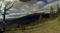
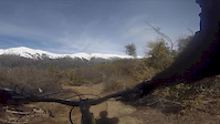
SaveEl Cerro Catedral es una de las mecas del MTB de la Argentina. Desde inicios de los años 90 fue sede de las competencias más importantes desarrolladas en la Argentina y en todos estos años se han construidos muchos circuitos para dichas competencias.
Dependiendo el año en ocasiones en el verano se abre al público para ascender con los medios de elevación y en bici, pero la mayor parte del año se debe ascender pedaleando por los caminos que existen en la montaña.
Estos caminos son en la mayoría esquiables en invierno y por tanto tienen bastante pendiente lo que exige mucho físicamente para llegar a las largadas de los circuitos.
Casi todos los circuitos tienen más de 500mts de desnivel, bastante pendiente y son de dificultad alta o muy alta.
Tener mucho cuidado al transitar por los caminos por haber vehículos de la empresa concesionaria trabajando.
En los alrededores existen otros recorridos que no necesariamente se encuentran en el centro de esqui.
Primary Trail Type: All-Mountain & Downhill
Shuttleable: YES
Land Status: Ski Resort
 google parking directions
 Activities Click to view
- Mountain Bike
24 trails
- E-Bike
11 trails
- Horse
1 trails
- Hike
25 trails
- Trail Running
21 trails
- Observed Trials
0 trails
Region Details
- 6
- 8
- 7
- 2
Region Status
Open as of May 31, 2026Stats
- Avg Trail Rating
- Trails (view details)
- 28
- Trails Mountain Bike
- 24
- Trails E-Bike
- 11
- Trails Horse
- 1
- Trails Hike
- 25
- Trails Trail Running
- 21
- Total Distance
- 41 miles
- Total Descent
- 14,848 ft
- Total Vertical
- 4,169 ft
- Highest Trailhead
- 6,853 ft
- Reports
- 259
- Photos
- 89
- Ridden Counter
- 1,589
Popular Cerro Catedral Mountain Biking Trails
• 100 ★ 4.6 • 4 miles • 340 ft • 196 •
La paco es uno de los recorridos más transitados por los ciclistas tanto locales como los que visitan Bariloche. Es uno recorrido exclusivo para bicis dentro del parque nacional y conecta el cerro catedral con el Lago Gutierrez con la...
• 70 ★ 0.0 • 4,462 ft • 202 ft • 57 •
Por límites geográficos su acceso no está dentro de Parques Nacionales pero se determinó que la picada a Frey desde Catedral si le corresponde a Parques. Esta todavia en debate pero puede que si se encuentra a alguien utilizando el...
• 85 ★ 0.0 • 484 ft • 12 ft • 57 •
Popular black diamond difficulty singletrack. This mountain bike primary trail can be used uphill primary and has a extreme overall physical rating with a 12 ft black diamond climb. On average it takes 1 minutes to complete this trail.
• 70 ★ 4.5 • 4,354 ft • 10 ft • 51 •
La muerte de los bumps es un circuito que antiguamente fue construido y utilizado por las motos de enduro. Posteriormente fue adoptado por los ciclistas que lo utilizan mucho ya que permite agregar un bonus al plan de hacer una paco. El...
• 45 ★ 4.5 • 3,845 ft • 0 ft • 22 •
Pista Seis es un circuito sobre las laderas del cerro Catedral. En los últimos años se lo ha utilizado para competencias y videos de MTB internacionales por lo "distinto"al resto ya que en sectores uno desciende por una canaleta que...
• 40 ★ 4.5 • 1 mile • 6 ft • 20 •
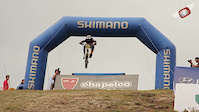
El es un reconocido circuito de descenso en el Cerro Catedral. El mismo fue construido en el 2009 para albergar fechas del Shimano y desde entonces es un clásico del reconocido centro invernal. Es 100% descenso y orientado para tal uso...
• 5 ★ 0.0 • 3,593 ft • 3 ft • 10 •
Histórico tiene su nombre porque fue uno de los primeros circuitos utilizados en el Cerro Catedral para competencias de descenso. Es una buena opción cuando uno esta empezando a bajar en lugares más técnicos o no puede subir a los...
Cerro Catedral Mountain Bike Routes
29 miles • 5,552 ft • 14 •
2 miles • 159 ft • 1 • Point to Point •
Alternativa a Chapelquito para evitar la laguna artificial
23 miles • 4,936 ft • 0 •
• 12 miles • 2,183 ft • 3 •
• 14 miles • 4,039 ft • 6 •
• 13 miles • 1,937 ft • 1 •
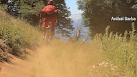
Photos of Cerro Catedral Mountain Bike
Videos of Cerro Catedral Mountain Bike

Recent Trail Reports
| status | trail | date | condition | info | user |
|---|---|---|---|---|---|
| Camino acceso a cumbre cerro San Martín | May 26, 2026 @ 11:20am (America/Coyhaique) May 26, 2026 | Ideal | Hugocalcagno | ||
| La muerte de los bumps | May 26, 2026 @ 11:20am (America/Coyhaique) May 26, 2026 | Ideal | Hugocalcagno | ||
| Trail to Bumps | May 26, 2026 @ 11:20am (America/Coyhaique) May 26, 2026 | Ideal | Hugocalcagno | ||
| La Paco | May 20, 2026 @ 12:49pm (America/Coyhaique) May 20, 2026 | Variable | Hugocalcagno | ||
| Shortcut Arriba | Aug 27, 2025 @ 12:35pm Aug 27, 2025 | Ideal | Hugocalcagno | ||
| Chimanguito climb | Aug 9, 2025 @ 1:55pm Aug 9, 2025 | Ideal | Hugocalcagno | ||
| Open | Apr 12, 2025 @ 6:55pm Apr 12, 2025 | Ideal | Juangabriel | ||
| Camino a open e ixs | Apr 20, 2024 @ 9:10am Apr 20, 2024 | Ideal | Hugocalcagno | ||
| Upper Zacalapata climb | Mar 4, 2024 @ 5:43am Mar 4, 2024 | Very Dry | Hugocalcagno | ||
| Trail to Cruce de Picadas | Jan 13, 2024 @ 4:12am Jan 13, 2024 | Dry | mk-dir7 |
Activity Feed
| username | action | type | title | date |
|---|---|---|---|---|
| Hugocalcagno | add | photo | activity #96145363 | Jun 3, 2026 @ 4:18am Jun 3, 2026 |
| Hugocalcagno | add | photo | activity #95987896 and 1 more | May 31, 2026 @ 4:52pm May 31, 2026 |
| Hugocalcagno | add | report | activity #95987765 | May 31, 2026 @ 4:50pm May 31, 2026 |
| Hugocalcagno | add | report | activity #95573385 and 2 more | May 26, 2026 @ 10:17am May 26, 2026 |
| Hugocalcagno | add | report | activity #95122716 | May 20, 2026 @ 11:30am May 20, 2026 |
Recent Comments
| username | type | title | comment | date |
|---|---|---|---|---|
| trail | Fun quick trail. The entry is the steepest... | Dec 10, 2025 @ 6:16am Dec 10, 2025 | ||
| trail | This trail is significantly easier than Picada... | Dec 5, 2025 @ 7:32am Dec 5, 2025 | ||
| trail | Ideal para hacerlo con alguien que recien se... | Nov 17, 2021 @ 6:50pm Nov 17, 2021 | ||
| trail | Me encanto! Lo hice hoy con una bici rigida y... | Jun 6, 2021 @ 5:04pm Jun 6, 2021 | ||
| trail | Muy buen track. Hacerlo en otra temporada o... | Mar 5, 2021 @ 2:48am Mar 5, 2021 |
Nearby Areas
| name | distance | ||||
|---|---|---|---|---|---|
| Cerro San Martin | 1 | 4 | 2 | 0.8 km | |
| Parque Central | 29 | 1 | 2 | 2.4 km | |
| Colonia Suiza y Llao Llao | 3 | 9 | 8 | 5 | 4.4 km |
| Cerro Otto | 2 | 2 | 5 | 1 | 4.6 km |
| La Estepa | 6 | 1 | 11.7 km |
Local Badges
-

Completionist0 awarded
Activity Type Stats
| activitytype | trails | distance | descent | descent distance | total vertical | rating | global rank | state rank | photos | reports | routes | ridelogs |
|---|---|---|---|---|---|---|---|---|---|---|---|---|
| Mountain Bike | 24 | 39 miles | 14,780 ft | 19 miles | 4,150 ft | #1,133 | #6 | 89 | 258 | 7 | 1,646 | |
| E-Bike | 11 | 17 miles | 5,377 ft | 8 miles | 3,862 ft | #993 | #9 | 221 | 1 | 117 | ||
| Horse | 1 | 1 mile | 302 ft | 5,128 ft | 302 ft | #466 | #14 | 72 | ||||
| Hike | 25 | 35 miles | 10,525 ft | 15 miles | 4,170 ft | #1,127 | #11 | 247 | 206 | |||
| Trail Running | 21 | 32 miles | 10,456 ft | 14 miles | 3,862 ft | #659 | #8 | 247 | 1 | 125 |
Frequently Asked Questions About Cerro Catedral
▼
What are the highest rated mountain biking trails in Cerro Catedral?
The highest rated mountain biking trails in Cerro Catedral are:
- La Paco (4.3/5)
- Condor (4.2/5)
- La muerte de los bumps (4.1/5)
- Open (4.1/5)
- Pista Seis (4.1/5)
▼
What is the best time of the year to ride in Cerro Catedral?
Based on ride log data, the most popular months to ride in Cerro Catedral are:
- February (24 activities)
- March (15 activities)
- October (14 activities)
▼
Where can I park to ride in Cerro Catedral?
There are 3 parking locations listed in Cerro Catedral. The most popular parking spots are: View all parking and trailhead locations on the map to plan your visit.
▼
What is the longest trail in Cerro Catedral?
The longest trail in Cerro Catedral is La Paco at 4.0 miles. View all trails sorted by distance.
Activities
Trails
Points of Interest
- By cepidh
 & contributors
 - Admins: apply
- #8474 - 8,468 views
- cerro catedral activity log | embed map of Cerro Catedral mountain bike trails | cerro catedral mountain biking points of interest
Downloading of trail gps tracks in kml & gpx formats is enabled for Cerro Catedral.
You must login to download files.