close
-
Layers w
- Weather Layers
- Pro
- Pro
- Pro
- Pro
- Pro
- Pro
- More Layers
- Pro
- Pro
- Pro
- Pro
-
Upgrade to

3D
Trail Conditions
- Unknown
- Snow Groomed
- Snow Packed
- Snow Covered
- Snow Cover Partial
- Freeze/thaw Cycle
- Icy
- Prevalent Mud
- Wet
- Variable
- Ideal
- Dry
- Very Dry
Trail Flow (Ridden Direction)
Trailforks scans users ridelogs to determine the most popular direction each trail is ridden. A good flowing trail network will have most trails flowing in a single direction according to their intension.
The colour categories are based on what percentage of riders are riding a trail in its intended direction.
The colour categories are based on what percentage of riders are riding a trail in its intended direction.
- > 96%
- > 90%
- > 80%
- > 70%
- > 50%
- < 50%
- bi-directional trail
- no data
Trail Last Ridden
Trailforks scans ridelogs to determine the last time a trail was ridden.
- < 2 days
- < 1 week
- < 2 weeks
- < 1 month
- < 6 months
- > 6 months
Trail Ridden Direction
The intended direction a trail should be ridden.
- Downhill Only
- Downhill Primary
- Both Directions
- Uphill Primary
- Uphill Only
- One Direction
Contribute Details
Colors indicate trail is missing specified detail.
- Description
- Photos
- Description & Photos
- Videos
Trail Popularity ?
Trailforks scans ridelogs to determine which trails are ridden the most in the last 9 months.
Trails are compared with nearby trails in the same city region with a possible 25 colour shades.
Think of this as a heatmap, more rides = more kinetic energy = warmer colors.
- most popular
- popular
- less popular
- not popular
ATV/ORV/OHV Filter
Max Vehicle Width
inches
US Cell Coverage
Legend

Radar Time
Activity Recordings
Trailforks uses anonymized public activity data.
?
Activity Recordings
Trailforks uses anonymized public activity data.
?
Personal Heatmap
▶
Activity Types
all
/
none
▶
Options
2
Date range
month
–
Winter Trails
Warning
A routing network for winter maps does not exist. Selecting trails using the winter trails layer has been disabled.
Missing Trails
Most Popular
Least Popular
Trails are colored based on popularity. The more popular a trail is, the more red. Less popular trails trend towards green.
Jump Magnitude Heatmap
Heatmap of where riders jump on trails. Zoom in to see individual jumps, click circles to view jump details.
BC Backroad Status
![map legend]()
Service Road Atlas is a free to use, community-driven service for viewing and creating reports on the numerous back-country service roads around B.C. and Alberta.

Slope Aspect
Direction the slope faces
Trails Deemphasized
Trails are shown in grey.
Only show trails with no bike usage.
Suggested Layers
Based on selected activity type
Save the current map location and zoom level as your default home location whenever this page is loaded.
Save
No description for Chamberlain Hill has been added yet!
Login or register to submit one.
 google parking directions
google parking directionsLinks
Activities Click to view
- Mountain Bike
14 trails
- Hike
14 trails
- Trail Running
14 trails
Region Details
- 1
- 5
- 2
- 2
Region Status
Closed as of 3 hoursStats
- Avg Trail Rating
- Trails (view details)
- 10
- Trails Mountain Bike
- 14
- Trails Hike
- 14
- Trails Trail Running
- 14
- Trails Snowshoe
- 1
- Total Distance
- 6 miles
- Total Descent
- 1,523 ft
- Total Vertical
- 635 ft
- Highest Trailhead
- 934 ft
- Reports
- 871
- Photos
- 120
- Ridden Counter
- 7,294
Popular Chamberlain Hill Mountain Biking Trails
• 100 ★ 0.0 • 3,267 ft • 52 ft • 956 •
Popular green difficulty singletrack. This multi-use trail can be used downhill primary. On average it takes 4 minutes to complete this trail.
• 100 ★ 3.5 • 4,921 ft • 318 ft • 843 •
Popular blue difficulty singletrack. This multi-use trail can be used downhill primary. On average it takes 13 minutes to complete this trail.
Chamberlain Hill Mountain Bike Routes
★ 4.0 • 48 miles • 8,694 ft • 20 • Loop •
Richmond Mountain Trails meets Fellowship of the Wheel (RichFellow) Tour 5 MTB Networks- Chamberlain Hill,...
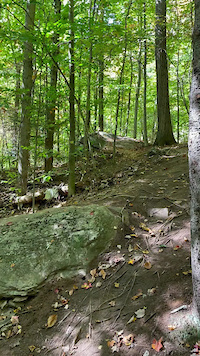
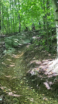
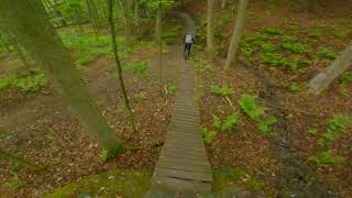
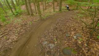
Photos of Chamberlain Hill Mountain Bike

Current Trail Warnings
| status | trail | date | condition | user | info |
|---|---|---|---|---|---|
| Updog - New | Jun 18, 2026 @ 1:36pm (America/New_York) 3 hours | Wet | ridedigrepeat RMT | Big Rain. Needs time to dry. | |
| Shimmy | Jun 18, 2026 @ 1:36pm (America/New_York) 3 hours | Wet | ridedigrepeat RMT | Big Rain. Needs time to dry. | |
| Rekon | Jun 18, 2026 @ 1:36pm (America/New_York) 3 hours | Wet | ridedigrepeat RMT | Big Rain. Needs time to dry. |
Recent Trail Reports
| status | trail | date | condition | info | user |
|---|---|---|---|---|---|
| Gryla | Jun 18, 2026 @ 1:36pm (America/New_York) 3 hours | Wet | ridedigrepeat RMT | ||
| Full House | Jun 18, 2026 @ 1:36pm (America/New_York) 3 hours | Wet | ridedigrepeat RMT | ||
| D.L. | Jun 18, 2026 @ 1:36pm (America/New_York) 3 hours | Wet | ridedigrepeat RMT | ||
| Cross Vermont Trail (Johnnie Brook Trail) | Jun 18, 2026 @ 1:36pm (America/New_York) 3 hours | Wet | ridedigrepeat RMT | ||
| CoCo | Jun 18, 2026 @ 1:36pm (America/New_York) 3 hours | Wet | ridedigrepeat RMT | ||
| OLD ~ Lower Full House | Nov 2, 2025 @ 7:22pm (America/New_York) Nov 2, 2025 | Wet | merrickgillies Velomont |
Activity Feed
| username | action | type | title | date |
|---|---|---|---|---|
| ridedigrepeat | add | report | activity #97261976 and 10 more | Jun 18, 2026 @ 10:36am 3 hours |
| ridedigrepeat | add | report | activity #96530473 and 9 more | Jun 8, 2026 @ 4:29am Jun 8, 2026 |
| ridedigrepeat | add | report | activity #96456959 and 10 more | Jun 7, 2026 @ 7:06am Jun 7, 2026 |
| JakeSaltz | add | photo | activity #96284111 and 3 more | Jun 5, 2026 @ 3:38am Jun 5, 2026 |
| ridedigrepeat | add | report | activity #96229164 | Jun 4, 2026 @ 8:18am Jun 4, 2026 |
Recent Comments
| username | type | title | comment | date |
|---|---|---|---|---|
| trail | The main feature has three options: a drop, a... | Sep 16, 2025 @ 10:46am Sep 16, 2025 | ||
| trail | Couple cool combos for the rock rolls. The... | Aug 17, 2025 @ 5:55pm Aug 17, 2025 | ||
| trail | Best trail at Chamberlain! | Sep 23, 2024 @ 11:18am Sep 23, 2024 | ||
| trail | Even the b-line is insaneo | Jun 6, 2024 @ 2:20pm Jun 6, 2024 | ||
| trail | What a difference a season makes! This trail... | May 24, 2024 @ 9:08pm May 24, 2024 |
Nearby Areas
| name | distance | ||||
|---|---|---|---|---|---|
| Hillside | 1 | 4 | 1.3 km | ||
| Richmond River Trail | 5 | 1.5 km | |||
| Preston Forest Legacy | 3 | 1 | 1 | 1.5 km | |
| Maple Wind Farm | 4 | 1 | 1 | 2.2 km | |
| Andrews Community Forest | 2 | 3 | 2.2 km |
Activity Type Stats
| activitytype | trails | distance | descent | descent distance | total vertical | rating | global rank | state rank | photos | reports | routes | ridelogs |
|---|---|---|---|---|---|---|---|---|---|---|---|---|
| Mountain Bike | 14 | 6 miles | 1,522 ft | 3 miles | 636 ft | #2,412 | #831 | 139 | 860 | 1 | 7,789 | |
| Hike | 14 | 6 miles | 1,522 ft | 3 miles | 636 ft | #13,358 | #5,666 | 857 | 126 | |||
| Trail Running | 14 | 6 miles | 1,522 ft | 3 miles | 636 ft | #12,098 | #4,786 | 857 | 230 | |||
| Snowshoe | 1 | 2,562 ft | 207 ft | 2,024 ft | 203 ft | 11 | 11 |
Frequently Asked Questions About Chamberlain Hill
▼
What are the highest rated mountain biking trails in Chamberlain Hill?
The highest rated mountain biking trails in Chamberlain Hill are:
- Full House (4.6/5)
- CoCo (4.4/5)
- Pop Rocks (4.2/5)
- Shimmy (4.2/5)
- Rekon (4.1/5)
▼
What is the best time of the year to ride in Chamberlain Hill?
Based on ride log data, the most popular months to ride in Chamberlain Hill are:
- July (178 activities)
- September (144 activities)
- June (128 activities)
▼
Where can I park to ride in Chamberlain Hill?
There are 1 parking locations listed in Chamberlain Hill.
▼
What is the longest trail in Chamberlain Hill?
The longest trail in Chamberlain Hill is Full House at 1.3 miles. View all trails sorted by distance.
- By cbrunner9
 STP & contributors
 - Admins: RMT, RMT
- #24868 - 23,074 views
- chamberlain hill activity log | embed map of Chamberlain Hill mountain bike trails | chamberlain hill mountain biking points of interest
Downloading of trail gps tracks in kml & gpx formats is enabled for Chamberlain Hill.
You must login to download files.