close
-
Layers w
- Weather Layers
- Pro
- Pro
- Pro
- Pro
- Pro
- Pro
- More Layers
- Pro
- Pro
- Pro
- Pro
-
Upgrade to

3D
Trail Conditions
- Unknown
- Snow Groomed
- Snow Packed
- Snow Covered
- Snow Cover Partial
- Freeze/thaw Cycle
- Icy
- Prevalent Mud
- Wet
- Variable
- Ideal
- Dry
- Very Dry
Trail Flow (Ridden Direction)
Trailforks scans users ridelogs to determine the most popular direction each trail is ridden. A good flowing trail network will have most trails flowing in a single direction according to their intension.
The colour categories are based on what percentage of riders are riding a trail in its intended direction.
The colour categories are based on what percentage of riders are riding a trail in its intended direction.
- > 96%
- > 90%
- > 80%
- > 70%
- > 50%
- < 50%
- bi-directional trail
- no data
Trail Last Ridden
Trailforks scans ridelogs to determine the last time a trail was ridden.
- < 2 days
- < 1 week
- < 2 weeks
- < 1 month
- < 6 months
- > 6 months
Trail Ridden Direction
The intended direction a trail should be ridden.
- Downhill Only
- Downhill Primary
- Both Directions
- Uphill Primary
- Uphill Only
- One Direction
Contribute Details
Colors indicate trail is missing specified detail.
- Description
- Photos
- Description & Photos
- Videos
Trail Popularity ?
Trailforks scans ridelogs to determine which trails are ridden the most in the last 9 months.
Trails are compared with nearby trails in the same city region with a possible 25 colour shades.
Think of this as a heatmap, more rides = more kinetic energy = warmer colors.
- most popular
- popular
- less popular
- not popular
ATV/ORV/OHV Filter
Max Vehicle Width
inches
US Cell Coverage
Legend

Radar Time
Activity Recordings
Trailforks uses anonymized public activity data.
?
Activity Recordings
Trailforks uses anonymized public activity data.
?
Personal Heatmap
▶
Activity Types
all
/
none
▶
Options
2
Date range
month
–
Winter Trails
Warning
A routing network for winter maps does not exist. Selecting trails using the winter trails layer has been disabled.
Missing Trails
Most Popular
Least Popular
Trails are colored based on popularity. The more popular a trail is, the more red. Less popular trails trend towards green.
Jump Magnitude Heatmap
Heatmap of where riders jump on trails. Zoom in to see individual jumps, click circles to view jump details.
BC Backroad Status
![map legend]()
Service Road Atlas is a free to use, community-driven service for viewing and creating reports on the numerous back-country service roads around B.C. and Alberta.

Slope Aspect
Direction the slope faces
Trails Deemphasized
Trails are shown in grey.
Only show trails with no bike usage.
Suggested Layers
Based on selected activity type
Save the current map location and zoom level as your default home location whenever this page is loaded.
Save
No description for Chambery has been added yet!
Login or register to submit one.
This region uses the Uk/Euro style trail grading system.
Activities Click to view
- Mountain Bike
101 trails
- E-Bike
70 trails
- Adaptive Bike
0 trails
- Horse
2 trails
- Hike
95 trails
- Trail Running
95 trails
- Dirtbike/Moto
1 trails
- Observed Trials
1 trails
- ATV/ORV/OHV
1 trails
- Downhill Ski
68 trails
Region Details
- 23
- 11
- 38
- 12
- 4
- 1
Region Status
Open as of Jun 16, 2026Stats
- Avg Trail Rating
- Trails (view details)
- 160
- Trails Mountain Bike
- 101
- Trails E-Bike
- 70
- Trails Horse
- 2
- Trails Hike
- 95
- Trails Trail Running
- 95
- Trails Dirtbike/Moto
- 1
- Trails Observed Trials
- 1
- Trails ATV/ORV/OHV
- 1
- Trails Downhill Ski
- 68
- Total Distance
- 91 miles
- Total Descent Distance
- 66 miles
- Total Descent
- 59,686 ft
- Total Vertical
- 4,895 ft
- Highest Trailhead
- 6,002 ft
- Reports
- 103
- Photos
- 90
- Ridden Counter
- 1,629
Popular Chambery Mountain Biking Trails
• 100 ★ 3.0 • 5,072 ft • 43 ft • 52 •
Descente courte mais sympathique. idéal pour une sortie rapide depuis Chambéry ou pour terminer une sortie un peu plus longue. Terrain varié sans grande difficulté. Attention : sentier partagé avec des familles et des traileurs.
• 45 ★ 3.5 • 1 mile • 10 ft • 33 • • hike
Très belle descente qui alterne les surfaces et les paysages. Pas de grosse difficulté hormis deux arbres en travers qui nécessitent de mettre pieds à terre. Plusieurs options sont possible à la fin.
• 95 ★ 4.5 • 2 miles • 17 ft • 33 •
Joli single en forêt. Croise plusieurs fois la grosse piste forestière. Les embranchements sont parfois peu visibles avec des petits cairns et branches au sol. La version originale débute 100m plus au nord. s’enchaîne depuis la...
• 90 ★ 5.0 • 1 mile • 0 ft • 32 • • hike
Superbe descente depuis le Mont St Michel vers le hameau de . Un début rapide avec une portion intermédiaire très technique et un peu plus engagé. Le final est un bel enchaînement d'épingle.
• 100 ★ 3.0 • 1,985 ft • 0 ft • 31 • • hike
Sentier plutôt roulant entrecoupé par une piste. Un court passage technique sur rochers puis un passage sur un tronc (chicken-line après 2m sur le tronc ou saut de côté au bout du tronc sur la droite). Pensez à repérer avant de...
• 100 ★ 5.0 • 2,585 ft • 0 ft • 29 • • hike
Popular red difficulty singletrack. This hike primary trail can be used both directions. On average it takes 5 minutes to complete this trail.
Chambery Mountain Bike Routes
★ 5.0 • 11 miles • 3,002 ft • 5 • Loop •
Large parking lot, climb on the road until Pragondran village. Road is not so steep and easy to climb....
★ 4.0 • 17 miles • 4,994 ft • 11 • Loop •
Parking facile sur une grande place. Montée jusqu'au village de Pragondran par une route avec quelques...
8 miles • 2,144 ft • 2 • Out & Back •
par les chemins pour éviter au mieux la D8. De Saint-Saturnin, descendre au col Saint-Saturnin par un...
8 miles • 2,087 ft • 4 • Loop •
Cette boucle combine, depuis le sommet du Malpassant, la descente du sentier des crêtes jusqu'au Roc...
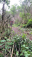
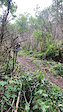
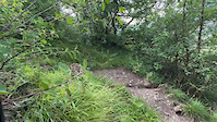
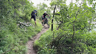
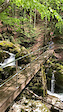
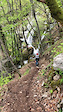
Photos of Chambery Mountain Bike
Videos of Chambery Mountain Bike
trail: Balcons De Chignin
0:07 |
21 |
Jun 12, 2024
trail: Balcons De Chignin
0:08 |
9 |
Jun 12, 2024
trail: Balcons De Chignin
0:08 |
7 |
Jun 12, 2024
trail: Balcons De Chignin
0:10 |
9 |
Jun 12, 2024
trail: Descente de la Doria
0:06 |
29 |
Apr 25, 2022

trail: Descente de la Doria
0:09 |
14 |
Apr 24, 2022
trail: Descente de la Doria
0:20 |
12 |
Apr 24, 2022
trail: Descente de la Doria
0:04 |
12 |
Apr 24, 2022
Recent Trail Reports
| status | trail | date | condition | info | user |
|---|---|---|---|---|---|
| L'ail Des Ours | Jun 17, 2026 @ 8:59am (Europe/Paris) Jun 16, 2026 | Ideal | Mickey38 | ||
| La Grenouille | Jun 14, 2026 @ 10:57am (Europe/Paris) Jun 14, 2026 | Unknown | Mickey38 | ||
| Les Echaus | Apr 23, 2026 @ 2:38pm (Europe/Paris) Apr 23, 2026 | Variable | Mickey38 | ||
| Pre Bon | Mar 11, 2026 @ 9:39pm (Europe/Paris) Mar 11, 2026 | Unknown | Jeremy7379 | ||
| Liaison de St Grat | Oct 4, 2025 @ 11:34am (Europe/Monaco) Oct 4, 2025 | Dry | Etienne-H | ||
| Liaison de la Pourrette | Oct 4, 2025 @ 11:34am (Europe/Monaco) Oct 4, 2025 | Dry | Etienne-H | ||
| La Croix de la Coche | Oct 4, 2025 @ 11:34am (Europe/Monaco) Oct 4, 2025 | Ideal | Etienne-H | ||
| La Lentille | Oct 4, 2025 @ 11:34am (Europe/Monaco) Oct 4, 2025 | Ideal | Etienne-H | ||
| Gorgeat | Oct 4, 2025 @ 11:34am (Europe/Monaco) Oct 4, 2025 | Ideal | Etienne-H | ||
| Le Bout du monde | Jun 28, 2025 @ 2:58am Jun 28, 2025 | Ideal | jaseridesbikes |
Activity Feed
| username | action | type | title | date |
|---|---|---|---|---|
| freerider48 | add | trail | activity #97247358 | Jun 18, 2026 @ 6:22am 2 days |
| freerider48 | update | trail | activity #97246668 and 1 more | Jun 18, 2026 @ 6:06am 2 days |
| freerider48 | add | poi | activity #97246629 and 1 more | Jun 18, 2026 @ 6:05am 2 days |
| Mickey38 | add | trail | activity #97246598 and 19 more | Jun 18, 2026 @ 6:05am 2 days |
| Mickey38 | vote | trail | activity #97245823 | Jun 18, 2026 @ 5:46am 2 days |
Recent Comments
| username | type | title | comment | date |
|---|---|---|---|---|
| trail | Aucun intérêt, goulet ravin des eaux de... | Jun 14, 2026 @ 7:39am Jun 14, 2026 | ||
| trail | Enroulable. Très glissant avec les feuilles... | Nov 1, 2025 @ 10:44am Nov 1, 2025 | ||
| trail | Enroulable. Très glissant avec les feuilles... | Nov 1, 2025 @ 10:41am Nov 1, 2025 | ||
| trail | Sentier très fun, du bon grip même un peu... | Nov 1, 2025 @ 10:40am Nov 1, 2025 | ||
| trail | Une descente qui se mérite, longue montée... | Jul 26, 2025 @ 7:20am Jul 26, 2025 |
Local Badges
-

Epic Mountain Bike Climb 2k84 awarded -

Climbing 10k Badge30 awarded -

Mountain Biking 100k Badge3 awarded -

Epic Ride Descent 2k84 awarded -

Descent 10k Badge30 awarded -

Descent 100k Badge3 awarded
Activity Type Stats
| activitytype | trails | distance | descent | descent distance | total vertical | rating | global rank | state rank | photos | reports | routes | ridelogs |
|---|---|---|---|---|---|---|---|---|---|---|---|---|
| Mountain Bike | 101 | 58 miles | 33,507 ft | 35 miles | 3,878 ft | #2,858 | #77 | 73 | 103 | 4 | 4,561 | |
| E-Bike | 70 | 16 miles | 13,602 ft | 14 miles | 3,333 ft | #2,979 | #168 | 95 | 3 | 295 | ||
| Horse | 2 | #874 | #38 | 17 | ||||||||
| Hike | 95 | 49 miles | 30,512 ft | 32 miles | 3,878 ft | #2,638 | #67 | 99 | 1 | 260 | ||
| Trail Running | 95 | 49 miles | 30,512 ft | 32 miles | 3,878 ft | #2,818 | #76 | 99 | 1 | 195 | ||
| Dirtbike/Moto | 1 | #509 | #19 | |||||||||
| Observed Trials | 1 | #172 | #21 | |||||||||
| ATV/ORV/OHV | 1 | #352 | #17 | |||||||||
| Downhill Ski | 68 | 34 miles | 26,178 ft | 31 miles | 2,769 ft | #135 | #21 | 47 |
Frequently Asked Questions About Chambery
▼
What are the best places to ride in Chambery?
Chambery has 6 areas to explore for mountain biking.
▼
What are the highest rated mountain biking trails in Chambery?
The highest rated mountain biking trails in Chambery are:
- La Boisserette (4.3/5)
- Antene Mia (4.1/5)
- Gorgeat (4.1/5)
- Le gratte-cul (4.1/5)
- Grands Prés (4.1/5)
▼
What is the best time of the year to ride in Chambery?
Based on ride log data, the most popular months to ride in Chambery are:
- July (5 activities)
- August (2 activities)
- June (2 activities)
▼
Where can I park to ride in Chambery?
Check the Chambery trail map for trailhead and parking information. Community members regularly update access and parking details for trails in the area.
Activities
Trails
- By paco-jones
 & contributors
 - Admins: LSBP, freerider48, provencemb, fredhornybsm, Whipperman
- #19762 - 6,857 views
- chambery activity log | embed map of Chambery mountain bike trails | chambery mountain biking points of interest
Downloading of trail gps tracks in kml & gpx formats is enabled for Chambery.
You must login to download files.