close
-
Layers w
- Weather Layers
- Pro
- Pro
- Pro
- Pro
- Pro
- Pro
- More Layers
- Pro
- Pro
- Pro
- Pro
-
Upgrade to

3D
Trail Conditions
- Unknown
- Snow Groomed
- Snow Packed
- Snow Covered
- Snow Cover Partial
- Freeze/thaw Cycle
- Icy
- Prevalent Mud
- Wet
- Variable
- Ideal
- Dry
- Very Dry
Trail Flow (Ridden Direction)
Trailforks scans users ridelogs to determine the most popular direction each trail is ridden. A good flowing trail network will have most trails flowing in a single direction according to their intension.
The colour categories are based on what percentage of riders are riding a trail in its intended direction.
The colour categories are based on what percentage of riders are riding a trail in its intended direction.
- > 96%
- > 90%
- > 80%
- > 70%
- > 50%
- < 50%
- bi-directional trail
- no data
Trail Last Ridden
Trailforks scans ridelogs to determine the last time a trail was ridden.
- < 2 days
- < 1 week
- < 2 weeks
- < 1 month
- < 6 months
- > 6 months
Trail Ridden Direction
The intended direction a trail should be ridden.
- Downhill Only
- Downhill Primary
- Both Directions
- Uphill Primary
- Uphill Only
- One Direction
Contribute Details
Colors indicate trail is missing specified detail.
- Description
- Photos
- Description & Photos
- Videos
Trail Popularity ?
Trailforks scans ridelogs to determine which trails are ridden the most in the last 9 months.
Trails are compared with nearby trails in the same city region with a possible 25 colour shades.
Think of this as a heatmap, more rides = more kinetic energy = warmer colors.
- most popular
- popular
- less popular
- not popular
ATV/ORV/OHV Filter
Max Vehicle Width
inches
US Cell Coverage
Legend

Radar Time
Activity Recordings
Trailforks uses anonymized public activity data.
?
Activity Recordings
Trailforks uses anonymized public activity data.
?
Personal Heatmap
▶
Activity Types
all
/
none
▶
Options
2
Date range
month
–
Winter Trails
Warning
A routing network for winter maps does not exist. Selecting trails using the winter trails layer has been disabled.
Missing Trails
Most Popular
Least Popular
Trails are colored based on popularity. The more popular a trail is, the more red. Less popular trails trend towards green.
Jump Magnitude Heatmap
Heatmap of where riders jump on trails. Zoom in to see individual jumps, click circles to view jump details.
BC Backroad Status
![map legend]()
Service Road Atlas is a free to use, community-driven service for viewing and creating reports on the numerous back-country service roads around B.C. and Alberta.

Slope Aspect
Direction the slope faces
Trails Deemphasized
Trails are shown in grey.
Only show trails with no bike usage.
Suggested Layers
Based on selected activity type
Save the current map location and zoom level as your default home location whenever this page is loaded.
Save
No description for Charleston has been added yet!
Login or register to submit one.
Activities Click to view
- Mountain Bike
95 trails
- E-Bike
10 trails
- Gravel Bike
0 trails
- Adaptive Bike
0 trails
- Winter Fat Bike
0 trails
- Hike
120 trails
- Trail Running
120 trails
- Nordic Ski
4 trails
Region Details
- 8
- 2
- 22
- 49
- 9
Region Status
Caution as of Jun 22, 2026Local Trail Association
Stats
- Avg Trail Rating
- Trails (view details)
- 117
- Trails Mountain Bike
- 95
- Trails E-Bike
- 10
- Trails Horse
- 1
- Trails Hike
- 120
- Trails Trail Running
- 120
- Trails ATV/ORV/OHV
- 1
- Trails Nordic Ski
- 4
- Total Distance
- 98 miles
- Total Descent
- 20,088 ft
- Total Vertical
- 1,034 ft
- Highest Trailhead
- 1,609 ft
- Reports
- 616
- Photos
- 70
- Ridden Counter
- 3,287
Articles

West Virginia: From the Bottom to the Top
Nov 9, 2017 from pinkbike.com
Dive in and discover what West Virginia has up its sleeve when it comes to mountain biking.
Sub Regions
-
Jones Woodland
- 3
- 1
-
Kanawha State Forest
- 3
- 24
- 9
-
Little Creek Park
- 16
- 24
Popular Charleston Mountain Biking Trails
• 85 ★ 4.5 • 4,446 ft • 20 ft • 145 •
1 mile. A steep challenging downhill trail from Middle Ridge Road to Trail. Look for the right hand alternative route around the steepest section "spectator falls".
• 95 ★ 4.0 • 1 mile • 459 ft • 136 •
A moderate trail ascending Pigeon Roost Hollow up to the West Boundary Road.
• 65 ★ 4.6 • 7 miles • 468 ft • 125 •
Fast and flowly. Use the gated gravel road for your climb and fly downhill on the ! This connects to the gravel road many times, allowing it to be done in small sections if desired.
• 95 ★ 4.5 • 1 mile • 17 ft • 104 •
Popular blue difficulty singletrack. This mountain bike primary trail can be used both directions. It features berm, bridge, drop, jump and rock garden. On average it takes 10 minutes to complete this trail.
• 60 ★ 5.0 • 1 mile • 444 ft • 102 •
Moderately popular blue difficulty singletrack. This mountain bike primary trail can be used uphill primary and has a moderate overall physical rating with a 444 ft blue climb. On average it takes 15 minutes to complete this trail.
• 75 ★ 3.3 • 1 mile • 96 ft • 90 •
2 1/2 miles. Fairly level trail beginning at the footbridge below the lake and following Davis Creek to Copperhead Rock below the stables. The trail can also be accessed from the forest office and the pool area. Easy with moderate sections.
• 55 ★ 4.9 • 2 miles • 718 ft • 89 •
1 1/2 miles. This trail begins on the C-26 Gas Well Road and ends in Dunlop Hollow. Bikers watch for signs, #1 Store Trail and the northern portion of Pine Ridge Trail are for hikers only. Moderate with difficult sections.
• 55 ★ 3.8 • 3 miles • 9 ft • 82 •
is the biggest elevation change of any trail at KSF. The top is easy wide open trail. After it crosses the oil well access road it becomes very narrow with some exposure and levels out at a rock garden. A little more down followed by a...
Charleston Mountain Bike Routes
17 miles • 3,070 ft • 6 •
Your official course map for the 2026 Enduro for Round 1 of the WV Enduro Series!! Set in Kanwaha State...
17 miles • 3,070 ft • 5 • Loop • Race •
Your official course map for the 2026 Enduro for Round 1 of the WV Enduro Series!! Set in Kanwaha State...
21 miles • 3,120 ft • 6 • Loop • Race •
Your WV Enduro Series Championship race course for 2025!! Stage 1: Don Rickles Pro / Ebike Stage: Stage 2:...
17 miles • 3,163 ft • 8 • Loop • Race •
Your official course map for the 2026 Enduro for Round 1 of the WV Enduro Series!! Set in Kanwaha State...
17 miles • 3,265 ft • 6 • Race •
2025 Enduro. Stage 1 - Raw and Wriggling (Pro Stage) Stage 2 - Don Rickles Stage 3 - (EBIKE ONLY STAGE)...
Photos of Charleston Mountain Bike
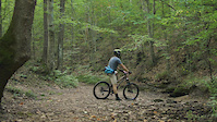
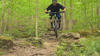
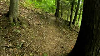
Videos of Charleston Mountain Bike

trail: Mossy Rock Trail
0:42 |
231 |
Nov 5, 2017
trail: Boiling Springs Trail
0:28 |
119 |
Aug 20, 2017
trail: Teaberry Rock Trail
0:23 |
256 |
May 3, 2017
trail: Loop Trail
21:17 |
253 |
Jun 26, 2022 , Charleston
Recent Trail Reports
| status | trail | date | condition | info | user |
|---|---|---|---|---|---|
| Pigeon Roost | Apr 19, 2026 @ 9:55am (America/Indiana/Vevay) Apr 19, 2026 | Ideal | abi-ridefierce RMBA | ||
| Honybee | Apr 19, 2026 @ 9:55am (America/Indiana/Vevay) Apr 19, 2026 | Ideal | abi-ridefierce RMBA | ||
| Black Bear Trail | Apr 19, 2026 @ 9:55am (America/Indiana/Vevay) Apr 19, 2026 | Ideal | abi-ridefierce RMBA | ||
| Bat Portal | Apr 19, 2026 @ 9:55am (America/Indiana/Vevay) Apr 19, 2026 | Ideal | abi-ridefierce RMBA | ||
| Don Rickles | Apr 19, 2026 @ 9:55am (America/Indiana/Vevay) Apr 19, 2026 | Ideal | abi-ridefierce RMBA | ||
| Raw and Wriggling | Apr 19, 2026 @ 9:55am (America/Indiana/Vevay) Apr 19, 2026 | Ideal | abi-ridefierce RMBA | ||
| Teaberry Rock Trail | Apr 3, 2026 @ 1:25pm (America/New_York) Apr 3, 2026 | Dry | awinn17 | ||
| Davis Creek Trail | Apr 3, 2026 @ 1:23pm (America/New_York) Apr 3, 2026 | Variable | awinn17 | ||
| Access Rd | Feb 21, 2026 @ 6:14pm (America/New_York) Feb 21, 2026 | Unknown | WVMtbiker1964 | ||
| Middle Ridge Trail | Feb 21, 2026 @ 6:12pm (America/New_York) Feb 21, 2026 | Unknown | WVMtbiker1964 |
Activity Feed
| username | action | type | title | date |
|---|---|---|---|---|
| wweha | comment | trail | activity #96938555 | Jun 13, 2026 @ 9:42pm Jun 13, 2026 |
| clintadams0 | wishlist | region | activity #95815496 | May 29, 2026 @ 6:10pm May 29, 2026 |
| cbmiii | wishlist | route | activity #94984757 | May 18, 2026 @ 10:18am May 18, 2026 |
| KadenDeg24 | ridden | trail | activity #94902477 and 16 more | May 17, 2026 @ 7:49am May 17, 2026 |
| Johnnycakes30 | wishlist | region | activity #93117888 | Apr 21, 2026 @ 5:25pm Apr 21, 2026 |
Recent Comments
| username | type | title | comment | date |
|---|---|---|---|---|
| trail | Two trees down on Deer Lick trail. | Jun 13, 2026 @ 9:42pm Jun 13, 2026 | ||
| trail | The name is Don Rickles. Not Don Wriggles. ... | Oct 21, 2025 @ 7:43pm Oct 21, 2025 | ||
| trail | Not really a black and not worth the trouble... | Dec 8, 2024 @ 3:08pm Dec 8, 2024 | ||
| trail | Trail head has a No Bicycles sign. | Aug 28, 2024 @ 3:33pm Aug 28, 2024 | ||
| trail | Pretty much impassable near the top of the... | Jul 1, 2024 @ 1:33pm Jul 1, 2024 |
Local Badges
-

10 Blue Trails53 awarded -

Epic Ride Climb 2k2 awarded -

Climbing 10k Badge25 awarded -

Climbing 100k Badge0 awarded -

Epic Ride Descent 2k3 awarded -

Descent 10k Badge25 awarded
Bike & Skill Parks
| name | type | city | rating |
|---|---|---|---|
| Bible Center Bike Park | skill park | Charleston | |
| Bible Center Church Bike Park | skill park | Charleston |
Local Mountain Biking Directory
-
Elk City Cycles
-
West Virginia State Parks
![West Virginia State Parks]()
-
Charleston Bicycle CenterBike Shop
-
Company BicycleBike Shop
Local Trail Supporters
- Kanawha Valley Trail Alliance
Activity Type Stats
| activitytype | trails | distance | descent | descent distance | total vertical | rating | global rank | state rank | photos | reports | routes | ridelogs |
|---|---|---|---|---|---|---|---|---|---|---|---|---|
| Mountain Bike | 95 | 79 miles | 15,417 ft | 39 miles | 1,033 ft | #1,375 | #519 | 55 | 610 | 6 | 6,097 | |
| E-Bike | 10 | 8 miles | 1,253 ft | 5 miles | 856 ft | #5,491 | #1,708 | 1 | 530 | 4 | 376 | |
| Horse | 1 | 4,787 ft | 3 ft | 138 ft | 400 ft | 32 | ||||||
| Hike | 120 | 97 miles | 19,623 ft | 46 miles | 1,033 ft | #1,407 | #640 | 13 | 609 | 466 | ||
| Trail Running | 120 | 97 miles | 19,623 ft | 46 miles | 1,033 ft | #1,743 | #579 | 1 | 609 | 250 | ||
| ATV/ORV/OHV | 1 | 3 miles | 299 ft | 1 mile | 59 ft | 3 | 4 | |||||
| Nordic Ski | 4 | 3 miles | 318 ft | 2 miles | 157 ft | #1,286 | #580 | 11 | 7 |
Frequently Asked Questions About Charleston
▼
What are the best places to ride in Charleston?
Charleston has 4 areas to explore for mountain biking. The top rated areas are:
▼
What are the highest rated mountain biking trails in Charleston?
The highest rated mountain biking trails in Charleston are:
- Pine Ridge Trail (4.5/5)
- Ballard Trail (4.3/5)
- Middle Ridge Trail (4.3/5)
- Snail Bite (4.2/5)
- Wildcat Ridge (4.2/5)
▼
What is the best time of the year to ride in Charleston?
Based on ride log data, the most popular months to ride in Charleston are:
- May (73 activities)
- July (53 activities)
- April (40 activities)
▼
Where can I park to ride in Charleston?
There are 12 parking locations listed in Charleston. The most popular parking spots are: View all parking and trailhead locations on the map to plan your visit.
Activities
Trails
- By medardlefevre & contributors
- Admins: SHARC
- #16159 - 6,033 views
- charleston activity log | embed map of Charleston mountain bike trails | charleston mountain biking points of interest
Downloading of trail gps tracks in kml & gpx formats is enabled for Charleston.
You must login to download files.