close
-
Layers w
- Weather Layers
- Pro
- Pro
- Pro
- Pro
- Pro
- Pro
- More Layers
- Pro
- Pro
- Pro
- Pro
-
Upgrade to

3D
Trail Conditions
- Unknown
- Snow Groomed
- Snow Packed
- Snow Covered
- Snow Cover Partial
- Freeze/thaw Cycle
- Icy
- Prevalent Mud
- Wet
- Variable
- Ideal
- Dry
- Very Dry
Trail Flow (Ridden Direction)
Trailforks scans users ridelogs to determine the most popular direction each trail is ridden. A good flowing trail network will have most trails flowing in a single direction according to their intension.
The colour categories are based on what percentage of riders are riding a trail in its intended direction.
The colour categories are based on what percentage of riders are riding a trail in its intended direction.
- > 96%
- > 90%
- > 80%
- > 70%
- > 50%
- < 50%
- bi-directional trail
- no data
Trail Last Ridden
Trailforks scans ridelogs to determine the last time a trail was ridden.
- < 2 days
- < 1 week
- < 2 weeks
- < 1 month
- < 6 months
- > 6 months
Trail Ridden Direction
The intended direction a trail should be ridden.
- Downhill Only
- Downhill Primary
- Both Directions
- Uphill Primary
- Uphill Only
- One Direction
Contribute Details
Colors indicate trail is missing specified detail.
- Description
- Photos
- Description & Photos
- Videos
Trail Popularity ?
Trailforks scans ridelogs to determine which trails are ridden the most in the last 9 months.
Trails are compared with nearby trails in the same city region with a possible 25 colour shades.
Think of this as a heatmap, more rides = more kinetic energy = warmer colors.
- most popular
- popular
- less popular
- not popular
ATV/ORV/OHV Filter
Max Vehicle Width
inches
US Cell Coverage
Legend

Radar Time
Activity Recordings
Trailforks uses anonymized public activity data.
?
Activity Recordings
Trailforks uses anonymized public activity data.
?
Personal Heatmap
▶
Activity Types
all
/
none
▶
Options
2
Date range
month
–
Winter Trails
Warning
A routing network for winter maps does not exist. Selecting trails using the winter trails layer has been disabled.
Missing Trails
Most Popular
Least Popular
Trails are colored based on popularity. The more popular a trail is, the more red. Less popular trails trend towards green.
Jump Magnitude Heatmap
Heatmap of where riders jump on trails. Zoom in to see individual jumps, click circles to view jump details.
BC Backroad Status
![map legend]()
Service Road Atlas is a free to use, community-driven service for viewing and creating reports on the numerous back-country service roads around B.C. and Alberta.

Slope Aspect
Direction the slope faces
Trails Deemphasized
Trails are shown in grey.
Only show trails with no bike usage.
Suggested Layers
Based on selected activity type
Save the current map location and zoom level as your default home location whenever this page is loaded.
Save
No description for Charlevoix has been added yet!
Login or register to submit one.
Activities Click to view
- Mountain Bike
130 trails
- E-Bike
93 trails
- Gravel Bike
22 trails
- Adaptive Bike
12 trails
- Winter Fat Bike
5 trails
- Hike
109 trails
- Trail Running
110 trails
- Nordic Ski
35 trails
Stats
- Avg Trail Rating
- Trails (view details)
- 288
- Trails Mountain Bike
- 130
- Trails E-Bike
- 93
- Trails Gravel Bike
- 22
- Trails Adaptive Bike
- 12
- Trails Winter Fat Bike
- 5
- Trails Hike
- 109
- Trails Trail Running
- 110
- Trails Snowmobile
- 1
- Trails Snowshoe
- 16
- Trails Downhill Ski
- 63
- Trails Backcountry Ski
- 1
- Trails Nordic Ski
- 35
- Total Distance
- 449 miles
- Total Descent
- 100,985 ft
- Total Vertical
- 3,413 ft
- Highest Trailhead
- 3,435 ft
- Reports
- 510
- Photos
- 175
- Ridden Counter
- 36,271
Articles

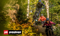
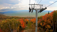
Video: Riding Quebec's Newest Bike Park Blind with Christina Chappetta & Jason Lucas - First Impressions
Sep 14, 2021 from pinkbike.com
Christina and Jason ride Quebec's newest lift-accessed bike park.
Destination Showcase: Ride Québec City Part 3 - Côte-de-Beaupré
Mar 31, 2021 from pinkbike.com
Christina Chappetta, Vaea Verbeeck, and Alex Volokov explore one of the most iconic venues to ever hold a mountain bike race in the world.
Sub Regions
- Baie-Saint-Paul (51)
- Le Domaine des Cimes (21)
- Le Genévrier (29)
- La Malbaie (27)
- Petite-Rivière-Saint-François (39)
- Saint-Urbain (13)
Popular Charlevoix Mountain Biking Trails
• 100 ★ 3.5 • 1 mile • 29 ft • 1,803 •
Popular green difficulty machine groomed. This mountain bike primary trail can be used downhill only. It features bridge. Trail visibility is always easy to follow. On average it takes 6 minutes to complete this trail.
• 80 ★ 3.6 • 2 miles • 30 ft • 1,622 •
Sentier le plus accessible du réseau, est l'introduction parfaite aux descentes du Massif. One of the easier trail on the mountain, it's the perfect intro to Le Massif's long descents.
• 80 ★ 3.3 • 1 mile • 10 ft • 1,560 •
Suite logique de - poursuit la route la plus facile vers la base. Second part of the easiest way down, from . Nice viewpoints along the trail.
• 70 ★ 3.1 • 2 miles • 294 ft • 1,497 •
À l'origine, c'est un autobus scolaire qui remontait les skieurs au Massif! Premier sentier de vélo à avoir été construit au Massif, est une douce montée vers le Mont à Liguori et offre parmi les plus beaux panoramas de la...
• 95 ★ 4.1 • 2,375 ft • 0 ft • 1,493 •
Sentier rapide avec plusieurs modules - hip, tables, doubles et virages surélevés Fast trail with lots of features - hip jump, doubles, berms and tabletops.
• 100 ★ 4.3 • 2,037 ft • 0 ft • 1,415 •
, la version 2.0 du : rapide, roulant, avec de gros berms et maintenant un pont de 10' de haut (qui se saute pour les plus téméraires!). , the 2.0 version of Basil. The trail is fast, flowy, with big berms and rollers and now a huge...
• 75 ★ 3.2 • 3,189 ft • 0 ft • 1,410 •
Roulant et rapide mais un peu plus pentu le reste de la route facile, il offre un petit défi supplémentaire pour retourner à la télécabine, sans rien de technique. Fast and flowy but a little steeper than the rest of the "easiest...
• 65 ★ 4.1 • 4 miles • 3 ft • 1,403 •
Une longue descente de près de 6 km avec nombreux virages surélevés et ponts de bois. Ce sentier ultra fluide a été pensé pour que tous les niveaux de cyclistes y trouvent leur compte. Ça semble ne jamais vouloir s'arrêter! A...
Charlevoix Mountain Bike Routes
★ 4.0 • 7 miles • 367 ft • 3 • Point to Point •
This has to be the longest downhill run east of the rockies! Quite accessible with countless berms and...
★ 5.0 • 5 miles • 307 ft • 5 •
Le grand tour du Massif, par les sentiers et Histoire sans fin. Montée tranquille par vers le Mont...
5 miles • 45 ft • 4 • Point to Point •
The Verde circuit is the easiest way to descend the mountain. The tracks are quite easy in themselves, but...
4 miles • 122 ft • 7 •
A great way to get to the bottom of Le Massif! This route takes you through all the harder trail on the...
11 miles • 2,841 ft • 0 •
6 miles • 789 ft • 0 •
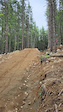
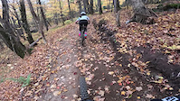
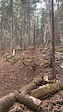
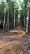
Photos of Charlevoix Mountain Bike
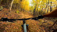
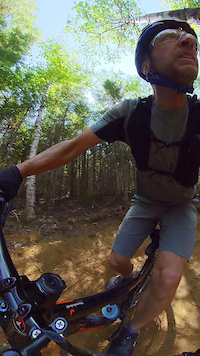
Videos of Charlevoix Mountain Bike
trail: Stecrere
0:09 |
21 |
Sep 2, 2024
trail: Histoire Sans Fin
0:18 |
67 |
Oct 7, 2023
trail: L'Enduro
0:10 |
41 |
Jun 9, 2023
trail: Cassonade
0:09 |
40 |
Jun 9, 2023
trail: Piège à r'nard à ours
0:08 |
116 |
Oct 10, 2021
trail: Cassonade
0:55 |
85 |
Jul 12, 2021
trail: Histoire Sans Fin
6:01 |
323 |
Oct 9, 2020
trail: Ferrotitane fluide
0:40 |
310 |
Sep 28, 2020
Recent Trail Reports
Activity Feed
| username | action | type | title | date |
|---|---|---|---|---|
| megnesiumcl2 | wishlist | region | activity #96458109 | Jun 7, 2026 @ 7:21am Jun 7, 2026 |
| cfoster92 | rsvp | event | activity #96307513 | Jun 5, 2026 @ 10:39am Jun 5, 2026 |
| ArianeGxbJ6r | wishlist | region | activity #96252673 | Jun 4, 2026 @ 2:36pm Jun 4, 2026 |
| jonathanNwrwcr | add | report | activity #96187575 | Jun 3, 2026 @ 4:17pm Jun 3, 2026 |
| jonathanNwrwcr | add | photo | activity #96187418 | Jun 3, 2026 @ 4:15pm Jun 3, 2026 |
Recent Comments
| username | type | title | comment | date |
|---|---|---|---|---|
| trail | Also agree it should be double black. Very... | Jul 19, 2025 @ 9:44am Jul 19, 2025 | ||
| report | Décevant | Jul 2, 2025 @ 11:35am Jul 2, 2025 | ||
| trail | This was a great trail, just fun, can get some... | Aug 9, 2024 @ 6:02pm Aug 9, 2024 | ||
| report | Large tree down blocking trail just before... | Jul 3, 2024 @ 12:10pm Jul 3, 2024 | ||
| trail | Plusieurs beaux petits features, à faire une... | Sep 22, 2023 @ 4:41pm Sep 22, 2023 |
Local Badges
-

Completionist0 awarded -
Completionist0 awarded -
Completionist0 awarded -
Completionist0 awarded -

Top 10 Trails41 awarded -

Big Ride 30k1,234 awarded
Bike & Skill Parks
| name | type | city | rating |
|---|---|---|---|
| Le Massif de Charlevoix | bike park | Petite-Rivière-Saint-François | |
| Zone d'habileté/Skill zone "La Chouenne" | skill park | Petite-Rivière-Saint-François | |
| Pump Track & Skate Park Clermont | skill park | La Malbaie | |
| Pump Track Baie-Saint-Paul | skill park | Baie-Saint-Paul | |
| Parc d’habileté | skill park | Saint-Urbain |
Local Trail Supporters
![]()
- Velosolutions Global
![]()
![]()
- Sentiers de l'Est
- Antoine Fafard
![]()
Local Trail Association
Activity Type Stats
| activitytype | trails | distance | descent | descent distance | total vertical | rating | global rank | state rank | photos | reports | routes | ridelogs |
|---|---|---|---|---|---|---|---|---|---|---|---|---|
| Mountain Bike | 130 | 88 miles | 18,655 ft | 43 miles | 3,031 ft | 152 | 505 | 16 | 9,996 | |||
| E-Bike | 93 | 77 miles | 16,047 ft | 38 miles | 2,484 ft | 490 | 2 | 165 | ||||
| Gravel Bike | 22 | 46 miles | 7,060 ft | 16 miles | 2,454 ft | 26 | ||||||
| Adaptive Bike | 12 | 13 miles | 2,041 ft | 6 miles | 2,320 ft | 21 | 2 | |||||
| Winter Fat Bike | 5 | 11 miles | 459 ft | 3 miles | 381 ft | 5 | 5 | |||||
| Hike | 109 | 302 miles | 46,119 ft | 126 miles | 3,412 ft | 23 | 462 | 2,720 | ||||
| Trail Running | 110 | 302 miles | 46,640 ft | 128 miles | 3,363 ft | 461 | 368 | |||||
| Snowmobile | 1 | 1 mile | 240 ft | 1 mile | 240 ft | 2 | 1 | |||||
| Snowshoe | 16 | 23 miles | 4,062 ft | 11 miles | 2,346 ft | 3 | 209 | |||||
| Downhill Ski | 63 | 31 miles | 33,133 ft | 30 miles | 2,448 ft | 2 | 2,599 | |||||
| Backcountry Ski | 1 | 1 mile | 85 ft | 2,037 ft | 82 ft | 2 | 1 | 661 | ||||
| Nordic Ski | 35 | 80 miles | 8,333 ft | 34 miles | 3,363 ft | 3 | 887 |
Frequently Asked Questions About Charlevoix
▼
What are the best places to ride in Charlevoix?
Charlevoix has 11 areas to explore for mountain biking. The top rated areas are:
▼
What are the highest rated mountain biking trails in Charlevoix?
The highest rated mountain biking trails in Charlevoix are:
- Ferrotitane fluide (4.3/5)
- Histoire Sans Fin (4.2/5)
- La Cigale (4.2/5)
- Pesto (4.1/5)
- La Fais-Pas-Simple (4.1/5)
▼
What is the best time of the year to ride in Charlevoix?
Based on ride log data, the most popular months to ride in Charlevoix are:
- July (159 activities)
- September (131 activities)
- August (115 activities)
▼
What is the longest trail in Charlevoix?
The longest trail in Charlevoix is Haute-du-Gouffre at 17.4 miles. View all trails sorted by distance.
Activities
Trails
Points of Interest
- View of the Vallée des Hautes-Gorges-de-la-Rivière-Malbaie Viewpoint
- Mont St-Michael Summit
- Mont Élie Summit
- Neptune Viewpoint
- Mine Coulombe-Ouest Viewpoint
- Chalet du sommet / Summit Lodge
- Chalet de la base / Base lodge
- Tipi Other
- Refuge Cabin
- Mirador Viewpoint
- Montagne du Lac à l'Ange (3,543 ft)
- Mont Bleu (3,445 ft)
- Montagne des Érables (3,379 ft)
- By StephaneMarceau
 TRAILFORKS & contributors
 - Admins: VQ, bigjay, StephaneMarceau, Canadmos, QVDM, quebecsingletrack, CCC
- #8703 - 10,848 views
- charlevoix activity log | embed map of Charlevoix mountain bike trails | charlevoix mountain biking points of interest
Downloading of trail gps tracks in kml & gpx formats is enabled for Charlevoix.
You must login to download files.