close
-
Layers w
- Weather Layers
- Pro
- Pro
- Pro
- Pro
- Pro
- Pro
- More Layers
- Pro
- Pro
- Pro
- Pro
-
Upgrade to

3D
Trail Conditions
- Unknown
- Snow Groomed
- Snow Packed
- Snow Covered
- Snow Cover Partial
- Freeze/thaw Cycle
- Icy
- Prevalent Mud
- Wet
- Variable
- Ideal
- Dry
- Very Dry
Trail Flow (Ridden Direction)
Trailforks scans users ridelogs to determine the most popular direction each trail is ridden. A good flowing trail network will have most trails flowing in a single direction according to their intension.
The colour categories are based on what percentage of riders are riding a trail in its intended direction.
The colour categories are based on what percentage of riders are riding a trail in its intended direction.
- > 96%
- > 90%
- > 80%
- > 70%
- > 50%
- < 50%
- bi-directional trail
- no data
Trail Last Ridden
Trailforks scans ridelogs to determine the last time a trail was ridden.
- < 2 days
- < 1 week
- < 2 weeks
- < 1 month
- < 6 months
- > 6 months
Trail Ridden Direction
The intended direction a trail should be ridden.
- Downhill Only
- Downhill Primary
- Both Directions
- Uphill Primary
- Uphill Only
- One Direction
Contribute Details
Colors indicate trail is missing specified detail.
- Description
- Photos
- Description & Photos
- Videos
Trail Popularity ?
Trailforks scans ridelogs to determine which trails are ridden the most in the last 9 months.
Trails are compared with nearby trails in the same city region with a possible 25 colour shades.
Think of this as a heatmap, more rides = more kinetic energy = warmer colors.
- most popular
- popular
- less popular
- not popular
ATV/ORV/OHV Filter
Max Vehicle Width
inches
US Cell Coverage
Legend

Radar Time
Activity Recordings
Trailforks uses anonymized public activity data.
?
Activity Recordings
Trailforks uses anonymized public activity data.
?
Personal Heatmap
▶
Activity Types
all
/
none
▶
Options
2
Date range
month
–
Winter Trails
Warning
A routing network for winter maps does not exist. Selecting trails using the winter trails layer has been disabled.
Missing Trails
Most Popular
Least Popular
Trails are colored based on popularity. The more popular a trail is, the more red. Less popular trails trend towards green.
Jump Magnitude Heatmap
Heatmap of where riders jump on trails. Zoom in to see individual jumps, click circles to view jump details.
BC Backroad Status
![map legend]()
Service Road Atlas is a free to use, community-driven service for viewing and creating reports on the numerous back-country service roads around B.C. and Alberta.

Slope Aspect
Direction the slope faces
Trails Deemphasized
Trails are shown in grey.
Only show trails with no bike usage.
Suggested Layers
Based on selected activity type
Save the current map location and zoom level as your default home location whenever this page is loaded.
SavePopular Trail Networks
view all areas »
No description for Charlotte has been added yet!
Login or register to submit one.
Activities Click to view
- Mountain Bike
196 trails
- E-Bike
98 trails
- Gravel Bike
1 trails
- Adaptive Bike
0 trails
- Winter Fat Bike
0 trails
- Hike
213 trails
- Trail Running
212 trails
Region Details
- 23
- 37
- 39
- 58
- 25
- 4
Region Status
Open as of May 12, 2026Stats
- Avg Trail Rating
- Trails (view details)
- 213
- Trails Mountain Bike
- 203
- Trails E-Bike
- 98
- Trails Gravel Bike
- 1
- Trails Hike
- 213
- Trails Trail Running
- 212
- Total Distance
- 151 miles
- Total Descent
- 11,263 ft
- Total Vertical
- 275 ft
- Highest Trailhead
- 800 ft
- Reports
- 2,636
- Photos
- 376
- Ridden Counter
- 61,194
Articles

North Carolina's 5 Most Popular Trail Networks According to Trailforks Data
Oct 20, 2021 from pinkbike.com
North Carolina is covered by trails of all varieties, and offers up opportunities for riders of all stripes.
Sub Regions
-
Airline Bike Park
- 3
- 6
- 7
-
Backyard Trails
- 2
- 7
- 8
- 3
-
Ballantyne District Park
- 3
-
Briar Creek Greenway
- 8
-
Colonel Francis J. Beatty Community Park
- 10
- 8
- 2
-
James Boyce Park
- 6
- 5
- 1
-
Marion Diehl Park
- 1
-
Park Road Park
- 1
- 2
- 2
-
Renaissance Park
- 2
- 1
-
Sherman Branch
- 3
-
Southwest District Park
- 3
- 4
-
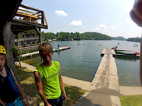
U.S. National Whitewater Center
- 7
- 19
- 5
Popular Charlotte Mountain Biking Trails
• 100 ★ 3.8 • 1,768 ft • 55 ft • 1,158 •
Popular blue difficulty singletrack. This mountain bike primary trail can be used one direction. On average it takes 1 minutes to complete this trail.
• 60 ★ 3.3 • 2 miles • 229 ft • 1,150 •
This is a classic WWC trail, some roots, mostly smooth single track with medium climbs. It switch backs a lot near the lake and has a good downhill run to the lake before climbing back up. This trail has frequent riders, runners and...
• 100 ★ 4.0 • 500 ft • 6 ft • 1,084 •
Popular blue difficulty singletrack. This mountain bike primary trail can be used one direction. On average it takes minutes to complete this trail.
• 85 ★ 4.0 • 4,403 ft • 60 ft • 1,065 •
is a blast. It has 2 very good rooty climbs, and a couple of nice short shoots/drops. Very fun.
• 55 ★ 4.2 • 1,325 ft • 30 ft • 1,004 •
Moderately popular blue difficulty machine groomed. This mountain bike primary trail can be used one direction and has a moderate overall physical rating with a 30 ft blue climb. It features jump and pump track. On average it takes 2 minutes to complete this trail.
• 70 ★ 4.0 • 2,864 ft • 71 ft • 962 •
Tower 92 is the premiere jump line at the USNWC. There is a shady climb to the top, then the jumps start. It has about 13-14 (give or take) jumps, all forgiving with no consequences if cased.
• 75 ★ 3.6 • 2,133 ft • 35 ft • 945 •
Smooth flowy trail typical of the WWC. Easy climb for a fun descent.
• 100 ★ 4.2 • 5 miles • 499 ft • 936 •
Highly rated popular blue difficulty singletrack. This mountain bike primary trail can be used both directions and has a moderate overall physical rating with a 499 ft blue climb. It features bridge, drop, jump and roller coaster. On average it takes 36 minutes to complete this trail.
Charlotte Mountain Bike Routes
★ 2.0 • 8 miles • 565 ft • 5 • Loop •
Good route - just under one hour. Start with some climbing on Marion Diehl, recover on , then some fun...
39 miles • 2,556 ft • 20 •
Bike Route that connects the US National Whitewater Center to Rocky Branch in Belmont to Trail in...
17 miles • 1,644 ft • 13 • Loop •
Just a little loop around the Whitewater Center, most importantly ending at the island bar area.
6 miles • 365 ft • 5 • Loop •
The Francis Beatty Loop with the black trails included.
★ 1.0 • 5 miles • 284 ft • 13 • Point to Point •
Mostly blue trail with a variety of green and one black trail.
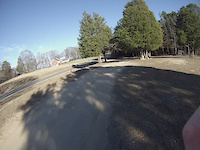
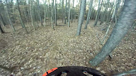
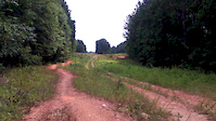
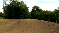
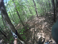
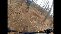
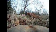
Photos of Charlotte Mountain Bike
Videos of Charlotte Mountain Bike
trail: Pump Track
0:27 |
103 |
Jan 9, 2018
trail: Goat Hill
0:00 |
912 |
Jan 17, 2016
trail: Tower 93
0:37 |
675 |
Oct 2, 2015
trail: Pump Track
0:11 |
178 |
May 31, 2014
trail: Carpet
0:16 |
943 |
Mar 29, 2014
trail: Pump Track
0:31 |
227 |
Jan 1, 2013
trail: Prairie Dog
0:17 |
292 |
Nov 29, 2012
trail: Pump Track
0:23 |
166 |
Mar 7, 2012
Recent Trail Reports
Activity Feed
| username | action | type | title | date |
|---|---|---|---|---|
| Cavmen | wishlist | region | activity #97081658 | Jun 15, 2026 @ 6:59pm 2 days |
| AntMan3d | ridden | trail | activity #97048474 | Jun 15, 2026 @ 9:51am 2 days |
| jwstreng | ridden | trail | activity #96935492 | Jun 13, 2026 @ 7:57pm Jun 13, 2026 |
| ekawbuod | wishlist | region | activity #96912652 | Jun 13, 2026 @ 1:41pm Jun 13, 2026 |
| ekawbuod | wishlist | region | activity #96912508 | Jun 13, 2026 @ 1:39pm Jun 13, 2026 |
Recent Comments
| username | type | title | comment | date |
|---|---|---|---|---|
| trail | Tarheel trailblazers have done a lot of work... | May 12, 2026 @ 1:08pm May 12, 2026 | ||
| trail | Blocked off on 4/22/2026 about midway, no... | Apr 22, 2026 @ 9:57am Apr 22, 2026 | ||
| trail | Agree with ThomasJvIZ3M8 very overgrown and... | Dec 30, 2025 @ 7:20am Dec 30, 2025 | ||
| trail | sucks for us. a fun route on the return | Oct 3, 2025 @ 9:12am Oct 3, 2025 | ||
| trail | Very very overgrown. Hard to navigate. Poison... | Jul 11, 2025 @ 2:57pm Jul 11, 2025 |
Local Badges
-

Top 10 Trails24 awarded -

Descent 100k Badge22 awarded -

Big Ride 30k9,807 awarded -

Epic Ride 50k3,491 awarded -

Descent 10k Badge270 awarded -

Completionist0 awarded
Bike & Skill Parks
| name | type | city | rating |
|---|---|---|---|
| U.S. National Whitewater Center | bike park | Charlotte | |
| The Colonel | skill park | Charlotte | |
| Fred Alexander Park Pump Track | skill park | Charlotte |
Activity Type Stats
| activitytype | trails | distance | descent | descent distance | total vertical | rating | global rank | state rank | photos | reports | routes | ridelogs |
|---|---|---|---|---|---|---|---|---|---|---|---|---|
| Mountain Bike | 196 | 138 miles | 10,217 ft | 52 miles | 249 ft | #181 | #69 | 393 | 2,657 | 13 | 79,810 | |
| E-Bike | 98 | 63 miles | 4,885 ft | 25 miles | 249 ft | #526 | #726 | 3 | 2,402 | 2,200 | ||
| Gravel Bike | 1 | #410 | #1,002 | 2 | 1 | 268 | ||||||
| Hike | 213 | 143 miles | 10,052 ft | 53 miles | 276 ft | #541 | #248 | 2 | 2,613 | 1,139 | ||
| Trail Running | 212 | 143 miles | 10,052 ft | 53 miles | 276 ft | #778 | #291 | 2,618 | 3,377 |
Frequently Asked Questions About Charlotte
▼
What are the best places to ride in Charlotte?
Charlotte has 17 areas to explore for mountain biking. The top rated areas are:
▼
What are the highest rated mountain biking trails in Charlotte?
The highest rated mountain biking trails in Charlotte are:
- Airline (4.4/5)
- Backyard Trails (4.3/5)
- Beatty Black (4.3/5)
- Co-Pilot (4.2/5)
- Divebomb (4.2/5)
▼
What is the best time of the year to ride in Charlotte?
Based on ride log data, the most popular months to ride in Charlotte are:
- July (643 activities)
- October (600 activities)
- September (577 activities)
▼
Where can I park to ride in Charlotte?
There are 23 parking locations listed in Charlotte. The most popular parking spots are: View all parking and trailhead locations on the map to plan your visit.
Activities
Trails
- By caleb93
 & contributors
 - Admins: THTB, FritzNeal
- #4381 - 25,749 views
- charlotte activity log | embed map of Charlotte mountain bike trails | charlotte mountain biking points of interest
Downloading of trail gps tracks in kml & gpx formats is enabled for Charlotte.
You must login to download files.