close
-
Layers w
- Weather Layers
- Pro
- Pro
- Pro
- Pro
- Pro
- Pro
- More Layers
- Pro
- Pro
- Pro
- Pro
-
Upgrade to

3D
Trail Conditions
- Unknown
- Snow Groomed
- Snow Packed
- Snow Covered
- Snow Cover Partial
- Freeze/thaw Cycle
- Icy
- Prevalent Mud
- Wet
- Variable
- Ideal
- Dry
- Very Dry
Trail Flow (Ridden Direction)
Trailforks scans users ridelogs to determine the most popular direction each trail is ridden. A good flowing trail network will have most trails flowing in a single direction according to their intension.
The colour categories are based on what percentage of riders are riding a trail in its intended direction.
The colour categories are based on what percentage of riders are riding a trail in its intended direction.
- > 96%
- > 90%
- > 80%
- > 70%
- > 50%
- < 50%
- bi-directional trail
- no data
Trail Last Ridden
Trailforks scans ridelogs to determine the last time a trail was ridden.
- < 2 days
- < 1 week
- < 2 weeks
- < 1 month
- < 6 months
- > 6 months
Trail Ridden Direction
The intended direction a trail should be ridden.
- Downhill Only
- Downhill Primary
- Both Directions
- Uphill Primary
- Uphill Only
- One Direction
Contribute Details
Colors indicate trail is missing specified detail.
- Description
- Photos
- Description & Photos
- Videos
Trail Popularity ?
Trailforks scans ridelogs to determine which trails are ridden the most in the last 9 months.
Trails are compared with nearby trails in the same city region with a possible 25 colour shades.
Think of this as a heatmap, more rides = more kinetic energy = warmer colors.
- most popular
- popular
- less popular
- not popular
ATV/ORV/OHV Filter
Max Vehicle Width
inches
US Cell Coverage
Legend

Radar Time
Activity Recordings
Trailforks uses anonymized public activity data.
?
Activity Recordings
Trailforks uses anonymized public activity data.
?
Personal Heatmap
▶
Activity Types
all
/
none
▶
Options
2
Date range
month
–
Winter Trails
Warning
A routing network for winter maps does not exist. Selecting trails using the winter trails layer has been disabled.
Missing Trails
Most Popular
Least Popular
Trails are colored based on popularity. The more popular a trail is, the more red. Less popular trails trend towards green.
Jump Magnitude Heatmap
Heatmap of where riders jump on trails. Zoom in to see individual jumps, click circles to view jump details.
BC Backroad Status
![map legend]()
Service Road Atlas is a free to use, community-driven service for viewing and creating reports on the numerous back-country service roads around B.C. and Alberta.

Slope Aspect
Direction the slope faces
Trails Deemphasized
Trails are shown in grey.
Only show trails with no bike usage.
Suggested Layers
Based on selected activity type
Save the current map location and zoom level as your default home location whenever this page is loaded.
Save
No description for Chesapeake has been added yet!
Login or register to submit one.
Activities Click to view
- Mountain Bike
35 trails
- E-Bike
23 trails
- Gravel Bike
0 trails
- Adaptive Bike
0 trails
- Horse
8 trails
- Hike
67 trails
- Trail Running
40 trails
Region Details
- 2
- 2
- 26
- 3
Region Status
Open as of Oct 6, 2024Stats
- Avg Trail Rating
- Trails (view details)
- 46
- Trails Mountain Bike
- 35
- Trails E-Bike
- 23
- Trails Horse
- 8
- Trails Hike
- 67
- Trails Trail Running
- 40
- Total Distance
- 12 miles
- Total Descent
- 243 ft
- Total Vertical
- 64 ft
- Highest Trailhead
- 67 ft
- Reports
- 736
- Photos
- 71
- Ridden Counter
- 1,047
Sub Regions
-
Indian River Park
- 17
- 2
-
Northwest River Park
- 8
-
Oak Grove Lake
- 1
- 1
Popular Chesapeake Mountain Biking Trails
• 80 ★ 3.6 • 3 miles • 19 ft • 154 •
Popular green difficulty singletrack. This multi-use trail can be used one direction and has a easy overall physical rating with a 19 ft green climb. It features bridge and ladder bridge. Trail visibility is always easy to follow. On average it takes 30 minutes to complete this trail.
• 95 ★ 3.0 • 1,004 ft • 2 ft • 68 •
Popular green difficulty singletrack. This multi-use trail can be used both directions and has a easy overall physical rating with a 2 ft green climb.
• 100 ★ 3.0 • 492 ft • 0 ft • 68 •
Popular green difficulty singletrack. This multi-use trail can be used both directions and has a easy overall physical rating with a 0 ft green climb. It features jump. Adaptive MTB rating: amtb green.
• 90 ★ 2.0 • 712 ft • 0 ft • 66 •
Popular green difficulty singletrack. This multi-use trail can be used one direction and has a easy overall physical rating with a 0 ft green climb.
• 95 ★ 2.0 • 961 ft • 0 ft • 66 •
Popular green difficulty doubletrack. This multi-use trail can be used both directions and has a easy overall physical rating with a 0 ft green climb.
• 100 ★ 4.0 • 833 ft • 0 ft • 66 •
Popular blue difficulty singletrack. This multi-use trail can be used one direction and has a hard overall physical rating with a 0 ft blue climb. It features jump and skinny.
• 85 ★ 0.0 • 459 ft • 0 ft • 62 •
Popular green difficulty singletrack. This multi-use trail can be used both directions and has a easy overall physical rating.
• 85 ★ 4.0 • 951 ft • 5 ft • 62 •
Popular blue difficulty singletrack. This multi-use trail can be used one direction and has a moderate overall physical rating with a 5 ft blue climb. It features berm, bridge and jump.
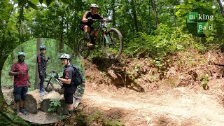
Photos of Chesapeake Mountain Bike
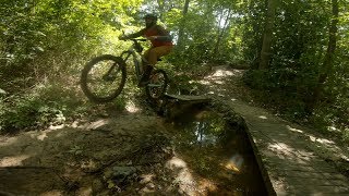
Videos of Chesapeake Mountain Bike
8:17 |
294 |
Jul 2, 2022
youtuber
![More Flow in Virginia! Indian River State Park...]()

10:03 |
275 |
Apr 10, 2022
trail: Outer Loop
20:53 |
1528 |
Mar 6, 2020 , Chesapeake
Recent Trail Reports
| status | trail | date | condition | info | user |
|---|---|---|---|---|---|
| Sidewinder Trail | Oct 6, 2024 @ 7:41am Oct 6, 2024 | Variable | Bear1977 MAH | ||
| Flat Main Entrance Trail | Oct 6, 2024 @ 7:41am Oct 6, 2024 | Variable | Bear1977 MAH | ||
| Jump Trail | Oct 6, 2024 @ 7:41am Oct 6, 2024 | Variable | Bear1977 MAH | ||
| Shortcut Trail (to Sidewinder and Ridgeline Trail) | Oct 6, 2024 @ 7:41am Oct 6, 2024 | Variable | Bear1977 MAH | ||
| Ridgeline Trail | Oct 6, 2024 @ 7:41am Oct 6, 2024 | Variable | Bear1977 MAH | ||
| Lower Trail | Oct 6, 2024 @ 7:41am Oct 6, 2024 | Variable | Bear1977 MAH | ||
| Beginner Jump Line Trail | Oct 6, 2024 @ 7:41am Oct 6, 2024 | Wet | Bear1977 MAH | ||
| Alternate Trail 1 | Oct 6, 2024 @ 7:41am Oct 6, 2024 | Variable | Bear1977 MAH | ||
| Outer Loop | Oct 6, 2024 @ 7:41am Oct 6, 2024 | Variable | Bear1977 MAH | ||
| Shortcut Trail | Aug 3, 2024 @ 3:31am Aug 3, 2024 | Ideal | Bear1977 MAH |
Activity Feed
| username | action | type | title | date |
|---|---|---|---|---|
| jcaballero39 | wishlist | region | activity #90076343 | Mar 6, 2026 @ 12:04pm Mar 6, 2026 |
| JoseokVayk | ridden | trail | activity #87490762 | Jan 19, 2026 @ 1:23pm Jan 19, 2026 |
| demie251 | ridden | trail | activity #86969233 | Jan 10, 2026 @ 12:19pm Jan 10, 2026 |
| bikeclj | wishlist | region | activity #82021799 | Oct 9, 2025 @ 12:54pm Oct 9, 2025 |
| SteveB414 | comment | trail | activity #75043773 | Jul 2, 2025 @ 12:55pm Jul 2, 2025 |
Recent Comments
| username | type | title | comment | date |
|---|---|---|---|---|
| trail | This trail is not named Sidewinder. | Jul 2, 2025 @ 12:55pm Jul 2, 2025 | ||
| trail | Not sure who named these trails in Trailforks... | May 20, 2025 @ 7:58pm May 20, 2025 | ||
| trail | Top part is extremely muddy. The rest is OK,... | Feb 15, 2025 @ 10:23am Feb 15, 2025 | ||
| trail | Muddy | Jul 14, 2024 @ 7:14am Jul 14, 2024 | ||
| trail | yesterday was 99% dry. two trees down ... | Jan 15, 2024 @ 11:20am Jan 15, 2024 |
Local Badges
-

10 Green Trails7 awarded -

Epic Mountain Bike Climb 2k0 awarded -

Climbing 10k Badge0 awarded -

Mountain Biking 100k Badge0 awarded -

Epic Ride Descent 2k0 awarded -

Descent 10k Badge0 awarded
Bike & Skill Parks
| name | type | city | rating |
|---|---|---|---|
| Elizabeth City MX | skill park | Chesapeake |
Activity Type Stats
| activitytype | trails | distance | descent | descent distance | total vertical | rating | global rank | state rank | photos | reports | routes | ridelogs |
|---|---|---|---|---|---|---|---|---|---|---|---|---|
| Mountain Bike | 35 | 7 miles | 236 ft | 2 miles | 62 ft | #8,019 | #2,596 | 15 | 736 | 4,863 | ||
| E-Bike | 23 | 4 miles | 7 ft | 4,862 ft | 16 ft | #6,864 | #2,062 | 669 | 36 | |||
| Horse | 8 | #2,768 | #1,538 | 117 | ||||||||
| Hike | 67 | 12 miles | 243 ft | 2 miles | 62 ft | #1,341 | #612 | 56 | 713 | 173 | ||
| Trail Running | 40 | 8 miles | 236 ft | 2 miles | 62 ft | #8,052 | #2,682 | 713 | 124 |
Frequently Asked Questions About Chesapeake
▼
What are the best places to ride in Chesapeake?
Chesapeake has 5 areas to explore for mountain biking. The top rated areas are:
▼
What are the highest rated mountain biking trails in Chesapeake?
The highest rated mountain biking trails in Chesapeake are:
- Sidewinder Trail (4/5)
- Beginner Jump Line Trail (3.8/5)
- Lower Trail (3.8/5)
- Shortcut Trail (3.8/5)
- Ridgeline Trail (3.8/5)
▼
What is the best time of the year to ride in Chesapeake?
Based on ride log data, the most popular months to ride in Chesapeake are:
- August (111 activities)
- July (92 activities)
- September (79 activities)
▼
Where can I park to ride in Chesapeake?
There are 10 parking locations listed in Chesapeake. The most popular parking spots are: View all parking and trailhead locations on the map to plan your visit.
Activities
Trails
Points of Interest
- By onewordanthem & contributors
- Admins: apply
- #10540 - 3,444 views
- chesapeake activity log | embed map of Chesapeake mountain bike trails | chesapeake mountain biking points of interest
Downloading of trail gps tracks in kml & gpx formats is enabled for Chesapeake.
You must login to download files.