close
-
Layers w
- Weather Layers
- Pro
- Pro
- Pro
- Pro
- Pro
- Pro
- More Layers
- Pro
- Pro
- Pro
- Pro
-
Upgrade to

3D
Trail Conditions
- Unknown
- Snow Groomed
- Snow Packed
- Snow Covered
- Snow Cover Partial
- Freeze/thaw Cycle
- Icy
- Prevalent Mud
- Wet
- Variable
- Ideal
- Dry
- Very Dry
Trail Flow (Ridden Direction)
Trailforks scans users ridelogs to determine the most popular direction each trail is ridden. A good flowing trail network will have most trails flowing in a single direction according to their intension.
The colour categories are based on what percentage of riders are riding a trail in its intended direction.
The colour categories are based on what percentage of riders are riding a trail in its intended direction.
- > 96%
- > 90%
- > 80%
- > 70%
- > 50%
- < 50%
- bi-directional trail
- no data
Trail Last Ridden
Trailforks scans ridelogs to determine the last time a trail was ridden.
- < 2 days
- < 1 week
- < 2 weeks
- < 1 month
- < 6 months
- > 6 months
Trail Ridden Direction
The intended direction a trail should be ridden.
- Downhill Only
- Downhill Primary
- Both Directions
- Uphill Primary
- Uphill Only
- One Direction
Contribute Details
Colors indicate trail is missing specified detail.
- Description
- Photos
- Description & Photos
- Videos
Trail Popularity ?
Trailforks scans ridelogs to determine which trails are ridden the most in the last 9 months.
Trails are compared with nearby trails in the same city region with a possible 25 colour shades.
Think of this as a heatmap, more rides = more kinetic energy = warmer colors.
- most popular
- popular
- less popular
- not popular
ATV/ORV/OHV Filter
Max Vehicle Width
inches
US Cell Coverage
Legend

Radar Time
Activity Recordings
Trailforks uses anonymized public activity data.
?
Activity Recordings
Trailforks uses anonymized public activity data.
?
Personal Heatmap
▶
Activity Types
all
/
none
▶
Options
2
Date range
month
–
Winter Trails
Warning
A routing network for winter maps does not exist. Selecting trails using the winter trails layer has been disabled.
Missing Trails
Most Popular
Least Popular
Trails are colored based on popularity. The more popular a trail is, the more red. Less popular trails trend towards green.
Jump Magnitude Heatmap
Heatmap of where riders jump on trails. Zoom in to see individual jumps, click circles to view jump details.
BC Backroad Status
![map legend]()
Service Road Atlas is a free to use, community-driven service for viewing and creating reports on the numerous back-country service roads around B.C. and Alberta.

Slope Aspect
Direction the slope faces
Trails Deemphasized
Trails are shown in grey.
Only show trails with no bike usage.
Suggested Layers
Based on selected activity type
Save the current map location and zoom level as your default home location whenever this page is loaded.
Save
No description for Cheshire has been added yet!
Login or register to submit one.
This region uses the Uk/Euro style trail grading system.
Activities Click to view
- Mountain Bike
37 trails
- E-Bike
29 trails
- Horse
13 trails
- Hike
28 trails
- Trail Running
27 trails
Region Details
- 7
- 5
- 12
- 7
- 2
Stats
- Avg Trail Rating
- Trails (view details)
- 33
- Trails Mountain Bike
- 37
- Trails E-Bike
- 29
- Trails Horse
- 13
- Trails Hike
- 28
- Trails Trail Running
- 27
- Trails Observed Trials
- 2
- Trails ATV/ORV/OHV
- 2
- Total Distance
- 21 miles
- Total Descent
- 4,255 ft
- Total Vertical
- 1,645 ft
- Highest Trailhead
- 1,752 ft
- Reports
- 242
- Photos
- 367
- Ridden Counter
- 4,321
Articles
Video: Classic British Carnage in Muddy Ruts
Oct 27, 2020 from pinkbike.com
The UK has descended back into slop, slime and grease for the foreseeable future.
Sub Regions
- Chester (3)
- Macclesfield (14)
- Goyt Valley (4)
- Kerridge (0)
- Macclesfield Forest (9)
- Poynton (5)
- Lyme Park (4)
- Delamere Forest (14)
Popular Cheshire Mountain Biking Trails
• 85 ★ 4.5 • 2,260 ft • 0 ft • 219 •
Popular red difficulty singletrack. This mountain bike primary trail can be used downhill primary and has a hard overall physical rating. It features berm, drop, jump and rock garden. Trail visibility is sometimes hard to follow. On average it takes 7 minutes to complete this trail.
• 65 ★ 5.0 • 1,417 ft • 0 ft • 217 •
Moderately popular red difficulty doubletrack. This multi-use trail can be used downhill primary and has a hard overall physical rating with a 0 ft black diamond climb. It features drop and rock garden. Trail visibility is always easy to follow. On average it takes 1 minutes to complete this trail.
• 45 ★ 4.0 • 1 mile • 3 ft • 201 •
Moderately popular red difficulty mixed. This multi-use trail can be used both directions and has a hard overall physical rating with a 3 ft black diamond climb. It features drop and rock garden. Trail visibility is always easy to follow. On average it takes 11 minutes to complete this trail.
• 50 ★ 4.4 • 1 mile • 58 ft • 199 •
Danebower Hollow is a bridleway that traverses the Whetstone Ridge and links the A537 to the A54
• 70 ★ 0.0 • 1 mile • 236 ft • 144 •
Popular green difficulty family friendly dirt/gravel road. This multi-use trail can be used both directions and has a easy overall physical rating with a 236 ft green climb. Trail visibility is always easy to follow. On average it takes 14 minutes to complete this trail.
• 30 ★ 0.0 • 1,742 ft • 17 ft • 134 •
Loamy singletrack cutting through the forest from the top of old pale hill to the car park in delemere. Full of tight rutted switchbacks
• 100 ★ 0.0 • 2,484 ft • 5 ft • 128 •
Popular blue difficulty singletrack. This mountain bike primary trail can be used one direction.
• 80 ★ 0.0 • 2,008 ft • 64 ft • 112 •
Popular blue difficulty singletrack. This mountain bike primary trail can be used one direction.
Cheshire Mountain Bike Routes
4 miles • 79 ft • 0 • Loop •
Delamere Forest - Hunger Hill Trail (Blue Markers) Easy Family bike ride. All on forest roads Shorter...
• 7 miles • 500 ft • 1 •
• 6 miles • 526 ft • 6 •
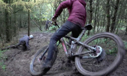
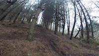
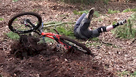
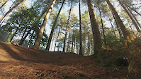
Photos of Cheshire Mountain Bike
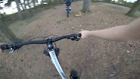
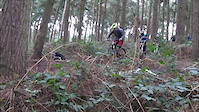
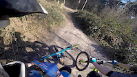
Videos of Cheshire Mountain Bike
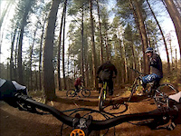
trail: 4X Delamere
0:22 |
310 |
Jan 29, 2018
![quick day at delamere [ MTB Edit]](https://ev1.pinkbike.org/vt/1/svt-469490-1.jpg)
trail: 4X Delamere
5:07 |
182 |
Apr 16, 2017
trail: 4X Delamere
4:03 |
124 |
Apr 16, 2017
trail: 4X Delamere
0:23 |
373 |
Apr 1, 2016
trail: Badgers
2:25 |
238 |
Mar 26, 2016
trail: 4X Delamere
3:17 |
126 |
Mar 10, 2016
trail: 4X Delamere
0:21 |
16693 |
Mar 3, 2016
trail: Badgers
0:59 |
77 |
Feb 27, 2016
Current Trail Warnings
| status | trail | date | condition | user | info |
|---|---|---|---|---|---|
| Whitegate Way Delamere Forest | Jun 14, 2026 @ 10:02am (Europe/Isle_of_Man) Jun 14, 2026 | Dry | AndyRoss | Gravel Bike Bridge is closed. You need to drop down... |
Recent Trail Reports
Activity Feed
| username | action | type | title | date |
|---|---|---|---|---|
| AndyRoss | add | report | activity #96953647 | Jun 14, 2026 @ 4:16am Jun 14, 2026 |
| scblurlt | add | report | activity #96552968 | Jun 8, 2026 @ 11:21am Jun 8, 2026 |
| trailforks | add | video | activity #94745227 | May 15, 2026 @ 6:00am May 15, 2026 |
| AlTeVw | ridden | trail | activity #94443129 | May 10, 2026 @ 10:59am May 10, 2026 |
| VDVoNc | add | report | activity #93803595 | May 1, 2026 @ 12:31pm May 1, 2026 |
Recent Comments
| username | type | title | comment | date |
|---|---|---|---|---|
| trail | Decent DH trail, bit of tech, quite muddy and... | Apr 21, 2026 @ 8:03am Apr 21, 2026 | ||
| trail | gnarliest trail i’ve ever ridden in my life | Sep 6, 2025 @ 6:41am Sep 6, 2025 | ||
| trail | Did this yesterday on hottest day of the year... | Apr 12, 2025 @ 12:42am Apr 12, 2025 | ||
| trail | Quite muddy in places today, much more rain... | Oct 12, 2024 @ 8:00am Oct 12, 2024 | ||
| trail | The direction is currently incorrect. The... | Oct 12, 2024 @ 6:02am Oct 12, 2024 |
Local Badges
-

Epic Mountain Bike Climb 2k58 awarded -

Climbing 10k Badge42 awarded -

Mountain Biking 100k Badge3 awarded -

Epic Ride Descent 2k58 awarded -

Descent 10k Badge42 awarded -

Descent 100k Badge3 awarded
Bike & Skill Parks
| name | type | city | rating |
|---|---|---|---|
| Manley Hill Bike Skills Area | skill park | Delamere | |
| Ellesmere Port Pumptrack | skill park | Chester | |
| Joshes Jumps | skill park | Chester | |
| Windmill Street Pumptrack | skill park | Macclesfield | |
| Harthill 4X | skill park | Chester |
Activity Type Stats
| activitytype | trails | distance | descent | descent distance | total vertical | rating | global rank | state rank | photos | reports | routes | ridelogs |
|---|---|---|---|---|---|---|---|---|---|---|---|---|
| Mountain Bike | 37 | 21 miles | 4,255 ft | 10 miles | 1,647 ft | 366 | 242 | 1 | 24,467 | |||
| E-Bike | 29 | 17 miles | 3,428 ft | 9 miles | 1,647 ft | 1 | 239 | 2 | 1,821 | |||
| Horse | 13 | 10 miles | 2,329 ft | 6 miles | 860 ft | 14 | ||||||
| Hike | 28 | 18 miles | 2,986 ft | 9 miles | 1,647 ft | 230 | 1,745 | |||||
| Trail Running | 27 | 18 miles | 2,697 ft | 8 miles | 1,647 ft | 228 | 523 | |||||
| Observed Trials | 2 | 2 miles | 223 ft | 1 mile | 837 ft | 2 | 2 | |||||
| ATV/ORV/OHV | 2 | 2,257 ft | 285 ft | 1,736 ft | 289 ft | 4 |
Frequently Asked Questions About Cheshire
▼
What are the best places to ride in Cheshire?
Cheshire has 5 areas to explore for mountain biking. The top rated areas are:
▼
What are the highest rated mountain biking trails in Cheshire?
The highest rated mountain biking trails in Cheshire are:
- West Gate Hase Bank (4.1/5)
- Oven Lane (4.1/5)
- Macc Forest DH Main Line (4.1/5)
- Danebower Hollow (Bridleway) (4.1/5)
- Whitegate Way (4.1/5)
▼
What is the best time of the year to ride in Cheshire?
Based on ride log data, the most popular months to ride in Cheshire are:
- May (48 activities)
- April (44 activities)
- July (36 activities)
▼
What is the longest trail in Cheshire?
The longest trail in Cheshire is Whitegate Way at 8.5 km. View all trails sorted by distance.
Activities
Trails
Points of Interest
- By brenthillier
 NSMBA TRAILFORKS & contributors
 - Admins: UKTP, 20twenty-p, wisey, MathieuC, cemoorelife
- #6795 - 15,670 views
- cheshire activity log | embed map of Cheshire mountain bike trails | cheshire mountain biking points of interest
Downloading of trail gps tracks in kml & gpx formats is enabled for Cheshire.
You must login to download files.