close
-
Layers w
- Weather Layers
- Pro
- Pro
- Pro
- Pro
- Pro
- Pro
- More Layers
- Pro
- Pro
- Pro
- Pro
-
Upgrade to

3D
Trail Conditions
- Unknown
- Snow Groomed
- Snow Packed
- Snow Covered
- Snow Cover Partial
- Freeze/thaw Cycle
- Icy
- Prevalent Mud
- Wet
- Variable
- Ideal
- Dry
- Very Dry
Trail Flow (Ridden Direction)
Trailforks scans users ridelogs to determine the most popular direction each trail is ridden. A good flowing trail network will have most trails flowing in a single direction according to their intension.
The colour categories are based on what percentage of riders are riding a trail in its intended direction.
The colour categories are based on what percentage of riders are riding a trail in its intended direction.
- > 96%
- > 90%
- > 80%
- > 70%
- > 50%
- < 50%
- bi-directional trail
- no data
Trail Last Ridden
Trailforks scans ridelogs to determine the last time a trail was ridden.
- < 2 days
- < 1 week
- < 2 weeks
- < 1 month
- < 6 months
- > 6 months
Trail Ridden Direction
The intended direction a trail should be ridden.
- Downhill Only
- Downhill Primary
- Both Directions
- Uphill Primary
- Uphill Only
- One Direction
Contribute Details
Colors indicate trail is missing specified detail.
- Description
- Photos
- Description & Photos
- Videos
Trail Popularity ?
Trailforks scans ridelogs to determine which trails are ridden the most in the last 9 months.
Trails are compared with nearby trails in the same city region with a possible 25 colour shades.
Think of this as a heatmap, more rides = more kinetic energy = warmer colors.
- most popular
- popular
- less popular
- not popular
ATV/ORV/OHV Filter
Max Vehicle Width
inches
US Cell Coverage
Legend

Radar Time
Activity Recordings
Trailforks uses anonymized public activity data.
?
Activity Recordings
Trailforks uses anonymized public activity data.
?
Personal Heatmap
▶
Activity Types
all
/
none
▶
Options
2
Date range
month
–
Winter Trails
Warning
A routing network for winter maps does not exist. Selecting trails using the winter trails layer has been disabled.
Missing Trails
Most Popular
Least Popular
Trails are colored based on popularity. The more popular a trail is, the more red. Less popular trails trend towards green.
Jump Magnitude Heatmap
Heatmap of where riders jump on trails. Zoom in to see individual jumps, click circles to view jump details.
BC Backroad Status
![map legend]()
Service Road Atlas is a free to use, community-driven service for viewing and creating reports on the numerous back-country service roads around B.C. and Alberta.

Slope Aspect
Direction the slope faces
Trails Deemphasized
Trails are shown in grey.
Only show trails with no bike usage.
Suggested Layers
Based on selected activity type
Save the current map location and zoom level as your default home location whenever this page is loaded.
SaveExplore nature’s diversity with prairie-to-peak ecosystems.
28 miles of trails for hiking, biking, with designated trails for equestrian and dog users. The only trails open for dogs use are Raccoon Ridge, Acorn Alley, Bobcat Way, and the designated portion of Soaring Kestrel. Please refer to this map for more info.
Limekiln Trailhead offers parking, restroom facilities, picnic tables, and a playground.
41 day-use, handicap accessible, picnic areas are scattered throughout the park, each with its own table and grill.
source: Cheyenne Mtn SP
Primary Trail Type: Cross-Country
Land Status: State Park
 google parking directions
Links
Activities Click to view
- Mountain Bike
24 trails
- Hike
28 trails
- Trail Running
28 trails
Region Details
- 1
- 11
- 6
- 5
- 1
Region Status
Open as of Jun 3, 2026Stats
- Avg Trail Rating
- Trails (view details)
- 28
- Trails Mountain Bike
- 24
- Trails Hike
- 28
- Trails Trail Running
- 28
- Trails Snowshoe
- 3
- Total Distance
- 30 miles
- Total Descent
- 6,486 ft
- Total Vertical
- 3,208 ft
- Highest Trailhead
- 9,224 ft
- Reports
- 272
- Photos
- 62
- Ridden Counter
- 6,124
Popular Cheyenne Mountain State Park Trails
• 85 ★ 3.5 • 2 miles • 322 ft • 394 •
After ascending trail, take to the summit and then enjoy a great ride on South and a great decesent down , fast and fun, watch out for hikers on the way down. A few rock gardens, mostly the climb is the challenge.
• 100 ★ 0.0 • 781 ft • 68 ft • 344 •
Popular black diamond difficulty singletrack. This mountain bike primary trail can be used both directions. On average it takes 2 minutes to complete this trail.
• 80 ★ 4.0 • 2 miles • 779 ft • 321 •
Popular blue difficulty singletrack. This mountain bike primary trail can be used both directions. On average it takes 29 minutes to complete this trail.
• 75 ★ 5.0 • 1 mile • 166 ft • 284 •
Popular blue difficulty singletrack. This mountain bike primary trail can be used both directions. On average it takes 8 minutes to complete this trail.
• 40 ★ 0.0 • 190 ft • 4 ft • 230 •
Moderately popular green difficulty singletrack. This mountain bike primary trail can be used both directions. On average it takes minutes to complete this trail.
Mountain Bike Routes
★ 4.0 • 13 miles • 1,620 ft • 29 • Loop •
This is a the most fun loop option I have found in the CMSP area
7 miles • 743 ft • 7 • Loop •
A popular route for hikers, trail runners, and mountain bikers. This route can become very muddy at times...
6 miles • 613 ft • 7 • Loop •
Nice beginners loop ridden during into to MTB class. Good climbs and some nice flow on the down hills. Few...
28 miles • 5,609 ft • 17 • Loop •
Dont feel like shuttling? Try this loop around Chyenne Mountain and Pikes Peak Trails. Its not quite 7000'...
• 14 miles • 2,331 ft • 8 •
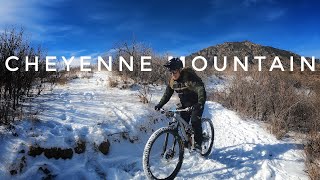
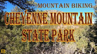
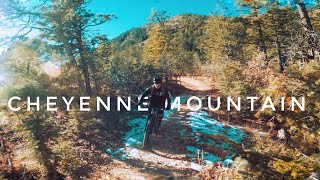
Photos of Cheyenne Mountain State Park Mountain Bike
Videos of Cheyenne Mountain State Park Mountain Bike
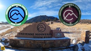
trail: Zook Loop
6:21 |
400 |
Jan 12, 2021 , Fort Carson

trail: Blackmer Loop
6:21 |
421 |
Jan 12, 2021 , Fort Carson
trail: Blackmer Loop
7:45 |
465 |
Jan 2, 2021 , Fort Carson
trail: South Talon
9:39 |
282 |
Dec 31, 2020 , Fort Carson

trail: North Talon
9:39 |
966 |
Dec 31, 2020 , Fort Carson

trail: Sundance
5:53 |
506 |
Dec 30, 2020 , Fort Carson
trail: North Talon
5:53 |
292 |
Dec 30, 2020 , Fort Carson

trail: Talon
5:53 |
308 |
Dec 30, 2020 , Fort Carson
Recent Trail Reports
| status | trail | date | condition | info | user |
|---|---|---|---|---|---|
| Boulder Run | Jun 3, 2026 @ 5:01pm (America/Denver) Jun 3, 2026 | Dry | dashraces | ||
| Blackmer Access | Jun 3, 2026 @ 5:01pm (America/Denver) Jun 3, 2026 | Ideal | dashraces | ||
| Zook Loop | Jun 3, 2026 @ 4:34pm (America/Denver) Jun 3, 2026 | Ideal | dashraces | ||
| Little Bear | Jun 3, 2026 @ 4:34pm (America/Denver) Jun 3, 2026 | Ideal | dashraces | ||
| Zook Loop (Access) | Jun 3, 2026 @ 4:34pm (America/Denver) Jun 3, 2026 | Ideal | dashraces | ||
| Talon | Mar 26, 2026 @ 7:11am (America/Denver) Mar 26, 2026 | Dry | CaseyMacD | ||
| North Talon | Mar 26, 2026 @ 7:10am (America/Denver) Mar 26, 2026 | Dry | CaseyMacD | ||
| South Talon | Mar 26, 2026 @ 7:09am (America/Denver) Mar 26, 2026 | Dry | CaseyMacD | ||
| Blackmer Loop | Mar 19, 2026 @ 7:08pm (America/Denver) Mar 19, 2026 | Dry | CaseyMacD | ||
| Sundance | Feb 12, 2026 @ 1:43pm (America/Denver) Feb 12, 2026 | Prevalent Mud | DennisLgGzgZ |
Activity Feed
| username | action | type | title | date |
|---|---|---|---|---|
| leedinwiddiejr | wishlist | region | activity #96837177 | Jun 12, 2026 @ 5:07pm Jun 12, 2026 |
| NickMyfFc | ridden | trail | activity #96557665 | Jun 8, 2026 @ 12:31pm Jun 8, 2026 |
| dashraces | add | report | activity #96555412 and 4 more | Jun 8, 2026 @ 11:57am Jun 8, 2026 |
| IadDH0 | wishlist | trail | activity #96195864 | Jun 3, 2026 @ 6:02pm Jun 3, 2026 |
| BorneoBatman1979 | wishlist | route | activity #95513360 | May 25, 2026 @ 12:27pm May 25, 2026 |
Recent Comments
| username | type | title | comment | date |
|---|---|---|---|---|
| trail | More fun ridden clockwise (as seen from above)... | Mar 19, 2026 @ 6:19pm Mar 19, 2026 | ||
| trail | Do in reverse direction. Cannot climb the rock... | Jul 8, 2025 @ 10:06am Jul 8, 2025 | ||
| report | Tree | Aug 10, 2024 @ 5:19pm Aug 10, 2024 | ||
| trail | CCW!? Only if you're an XC beast or have... | Jun 13, 2024 @ 9:28am Jun 13, 2024 | ||
| trail | Only the first 2.5 miles is open to bikes. | May 7, 2023 @ 7:03am May 7, 2023 |
Nearby Areas
| name | distance | ||||
|---|---|---|---|---|---|
| Stratton Open Space | 9 | 7 | 4 | 1 | 5.1 km |
| North Cheyenne Cañon Park | 3 | 15 | 11 | 1 | 5.6 km |
| Dorchester Park | 1 | 2 | 6 km | ||
| Fountain Park | 2 | 2 | 1 | 1 | 6.4 km |
| Bear Creek Park | 5 | 8 | 1 | 6.6 km |
Local Badges
-

Completionist0 awarded
Activity Type Stats
| activitytype | trails | distance | descent | descent distance | total vertical | rating | global rank | state rank | photos | reports | routes | ridelogs |
|---|---|---|---|---|---|---|---|---|---|---|---|---|
| Mountain Bike | 24 | 23 miles | 5,289 ft | 10 miles | 3,209 ft | #4,185 | #1,471 | 55 | 271 | 5 | 4,410 | |
| Hike | 28 | 30 miles | 6,486 ft | 12 miles | 3,209 ft | #5,779 | #2,080 | 7 | 272 | 2 | 398 | |
| Trail Running | 28 | 30 miles | 6,486 ft | 12 miles | 3,209 ft | #5,028 | #1,504 | 272 | 2 | 492 | ||
| Snowshoe | 3 | 4 miles | 367 ft | 1 mile | 833 ft | 1 | 1 |
Frequently Asked Questions About Cheyenne Mountain State Park
▼
What are the highest rated mountain biking trails in Cheyenne Mountain State Park?
The highest rated mountain biking trails in Cheyenne Mountain State Park are:
- South Talon (4.1/5)
- Sundance (4.1/5)
- Zook Loop (4.1/5)
- Medicine Wheel (4.1/5)
- Talon (4/5)
▼
What is the best time of the year to ride in Cheyenne Mountain State Park?
Based on ride log data, the most popular months to ride in Cheyenne Mountain State Park are:
- September (93 activities)
- July (92 activities)
- August (80 activities)
▼
Where can I park to ride in Cheyenne Mountain State Park?
There are 10 parking locations listed in Cheyenne Mountain State Park. The most popular parking spots are: View all parking and trailhead locations on the map to plan your visit.
▼
What is the longest trail in Cheyenne Mountain State Park?
The longest trail in Cheyenne Mountain State Park is Dixon Trail at 3.9 miles. View all trails sorted by distance.
Activities
Trails
- Hard trails in Cheyenne Mountain State Park
- Easy trails in Cheyenne Mountain State Park
- Favorite trails in Cheyenne Mountain State Park
- Most ridden trails in Cheyenne Mountain State Park
- Singletrack in Cheyenne Mountain State Park
- Viewpoint trails in Cheyenne Mountain State Park
- Trails with technical features in Cheyenne Mountain State Park
- Race routes in Cheyenne Mountain State Park
Points of Interest
- By lukeisdumb & contributors
- Admins: apply
- #4062 - 13,982 views
- cheyenne mountain state park activity log | embed map of Cheyenne Mountain State Park mountain bike trails | cheyenne mountain state park mountain biking points of interest
Downloading of trail gps tracks in kml & gpx formats is enabled for Cheyenne Mountain State Park.
You must login to download files.