close
-
Layers w
- Weather Layers
- Pro
- Pro
- Pro
- Pro
- Pro
- Pro
- More Layers
- Pro
- Pro
- Pro
- Pro
-
Upgrade to

3D
Trail Conditions
- Unknown
- Snow Groomed
- Snow Packed
- Snow Covered
- Snow Cover Partial
- Freeze/thaw Cycle
- Icy
- Prevalent Mud
- Wet
- Variable
- Ideal
- Dry
- Very Dry
Trail Flow (Ridden Direction)
Trailforks scans users ridelogs to determine the most popular direction each trail is ridden. A good flowing trail network will have most trails flowing in a single direction according to their intension.
The colour categories are based on what percentage of riders are riding a trail in its intended direction.
The colour categories are based on what percentage of riders are riding a trail in its intended direction.
- > 96%
- > 90%
- > 80%
- > 70%
- > 50%
- < 50%
- bi-directional trail
- no data
Trail Last Ridden
Trailforks scans ridelogs to determine the last time a trail was ridden.
- < 2 days
- < 1 week
- < 2 weeks
- < 1 month
- < 6 months
- > 6 months
Trail Ridden Direction
The intended direction a trail should be ridden.
- Downhill Only
- Downhill Primary
- Both Directions
- Uphill Primary
- Uphill Only
- One Direction
Contribute Details
Colors indicate trail is missing specified detail.
- Description
- Photos
- Description & Photos
- Videos
Trail Popularity ?
Trailforks scans ridelogs to determine which trails are ridden the most in the last 9 months.
Trails are compared with nearby trails in the same city region with a possible 25 colour shades.
Think of this as a heatmap, more rides = more kinetic energy = warmer colors.
- most popular
- popular
- less popular
- not popular
ATV/ORV/OHV Filter
Max Vehicle Width
inches
US Cell Coverage
Legend

Radar Time
Activity Recordings
Trailforks uses anonymized public activity data.
?
Activity Recordings
Trailforks uses anonymized public activity data.
?
Personal Heatmap
▶
Activity Types
all
/
none
▶
Options
2
Date range
month
–
Winter Trails
Warning
A routing network for winter maps does not exist. Selecting trails using the winter trails layer has been disabled.
Missing Trails
Most Popular
Least Popular
Trails are colored based on popularity. The more popular a trail is, the more red. Less popular trails trend towards green.
Jump Magnitude Heatmap
Heatmap of where riders jump on trails. Zoom in to see individual jumps, click circles to view jump details.
BC Backroad Status
![map legend]()
Service Road Atlas is a free to use, community-driven service for viewing and creating reports on the numerous back-country service roads around B.C. and Alberta.

Slope Aspect
Direction the slope faces
Trails Deemphasized
Trails are shown in grey.
Only show trails with no bike usage.
Suggested Layers
Based on selected activity type
Save the current map location and zoom level as your default home location whenever this page is loaded.
Save
No description for Chianale has been added yet!
Login or register to submit one.
This region uses the Uk/Euro style trail grading system.
Activities Click to view
- Mountain Bike
12 trails
- E-Bike
11 trails
- Hike
15 trails
- Trail Running
12 trails
Region Details
- 1
- 2
- 6
Region Status
Caution as of Sep 19, 2025Stats
- Avg Trail Rating
- Trails (view details)
- 15
- Trails Mountain Bike
- 12
- Trails E-Bike
- 11
- Trails Hike
- 15
- Trails Trail Running
- 12
- Trails Snowshoe
- 1
- Trails Backcountry Ski
- 1
- Total Distance
- 29 miles
- Total Descent Distance
- 16 miles
- Total Descent
- 15,376 ft
- Total Vertical
- 5,655 ft
- Highest Trailhead
- 10,059 ft
- Reports
- 35
- Photos
- 21
- Ridden Counter
- 788
Popular Chianale Mountain Biking Trails
• 100 ★ 4.5 • 1 mile • 203 ft • 143 • • hike
Very easy trail to avoid the main road beside the lake. Pay attention to hikers, especially in summer.
• 75 ★ 4.0 • 2 miles • 76 ft • 102 •
Easy trail that starts in Castello di Pontechianale and finishes in Casteldelfino. Great option to avoid the main road going downhill, not that easy when going uphill.
• 85 ★ 0.0 • 1 mile • 170 ft • 66 •
Popular blue difficulty singletrack. This mountain bike primary trail can be used downhill only. On average it takes 16 minutes to complete this trail.
• 95 ★ 0.0 • 2 miles • 7 ft • 66 • • hike
Popular red difficulty alpine singletrack. This hike primary trail can be used downhill only. Trail visibility is always easy to follow. On average it takes 25 minutes to complete this trail.
• 45 ★ 4.5 • 5 miles • 539 ft • 37 •
From Passo Valante over the Losetta-Pass to the tar road of Col Agnel.
• 70 ★ 0.0 • 1 mile • 29 ft • 17 •
Popular blue difficulty singletrack. This mountain bike primary trail can be used both directions. On average it takes 44 minutes to complete this trail.
• 35 ★ 0.0 • 4 miles • 2,879 ft • 12 • • hike
Less popular blue difficulty singletrack. This hike primary trail can be used both directions with a 2,879 ft blue climb. Trail visibility is always easy to follow.
• 25 ★ 1.0 • 1 mile • 1,453 ft • 9 • • hike
Less popular blue difficulty singletrack. This hike primary trail can be used both directions with a 1,453 ft blue climb. Trail visibility is always easy to follow.
Chianale Mountain Bike Routes
46 miles • 15,760 ft • 1 • Point to Point • Race •
Second day route for the Stone King Rally 2023
Photos of Chianale Mountain Bike
Videos of Chianale Mountain Bike
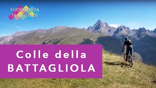
trail: DH Battagliola
8:21 |
2 |
May 26, 2026 , Chianale

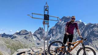
trail: Losetta_Real
13:11 |
10 |
May 26, 2026 , Chianale
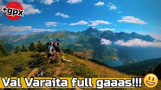
trail: DH Tre Chiosis
30:00 |
61 |
Jul 27, 2025 , Chianale
trail: DH Colle Della Bicocca
19:41 |
257 |
Jul 19, 2023 , Chianale

trail: DH Battagliola
19:41 |
123 |
Jul 19, 2023 , Chianale
Recent Trail Reports
| status | trail | date | condition | info | user |
|---|---|---|---|---|---|
| Losetta_Real | Sep 20, 2025 @ 8:50am (Europe/Monaco) Sep 19, 2025 | Ideal | Kajanda | ||
| DH Bagnur | Sep 4, 2025 @ 1:00pm Sep 4, 2025 | Dry | BeHoReken | ||
| Castello - Rifugio Vallanta | Sep 4, 2025 @ 12:56pm Sep 4, 2025 | Dry | BeHoReken | ||
| Pontechianale Casteldelfino | Aug 2, 2025 @ 9:22am Aug 2, 2025 | Dry | bikefritzel ZO-Biketrails | ||
| Lungolago Pontechianale | Aug 2, 2025 @ 9:22am Aug 2, 2025 | Ideal | bikefritzel ZO-Biketrails | ||
| DH Tre Chiosis | Jul 27, 2025 @ 2:15pm Jul 27, 2025 | Ideal | matteofornero | ||
| Giargiatte | Sep 12, 2024 @ 3:49am Sep 12, 2024 | Dry | MarkustxO9q7 | ||
| DH Battagliola | Jul 13, 2024 @ 10:56am Jul 13, 2024 | Dry | Builder83 | ||
| DH Colle Della Bicocca | Jul 13, 2024 @ 10:52am Jul 13, 2024 | Dry | Builder83 | ||
| Salita Rif. Helios | Sep 16, 2023 @ 11:25pm Sep 16, 2023 | Dry | Alessandro-B |
Activity Feed
| username | action | type | title | date |
|---|---|---|---|---|
| Mattebolla91 | add | video | activity #95616621 and 1 more | May 26, 2026 @ 11:48pm May 26, 2026 |
| Evoc2020 | ridden | trail | activity #95331933 | May 23, 2026 @ 10:15am May 23, 2026 |
| umtreiber | wishlist | route | activity #93004087 | Apr 20, 2026 @ 12:12am Apr 20, 2026 |
| AndreaLevet | ridden | trail | activity #92422769 and 2 more | Apr 11, 2026 @ 1:24pm Apr 11, 2026 |
| canyoncrank | wishlist | route | activity #92074609 | Apr 6, 2026 @ 1:35pm Apr 6, 2026 |
Recent Comments
| username | type | title | comment | date |
|---|---|---|---|---|
| trail | Per chi vuole raggiungere la cima del colle... | Aug 11, 2025 @ 9:05am Aug 11, 2025 | ||
| report | Belle descente avec un panorama superbe sur le... | Aug 10, 2023 @ 3:23am Aug 10, 2023 | ||
| trail | ENG: this is not a blue trail, by far. It is a... | Aug 13, 2022 @ 6:03am Aug 13, 2022 |
Local Badges
-

Epic Ride Descent 2k64 awarded -

Descent 10k Badge2 awarded -

Descent 100k Badge0 awarded -

Epic Mountain Bike Climb 2k6 awarded -

Climbing 10k Badge0 awarded -

Mountain Biking 100k Badge0 awarded
Activity Type Stats
| activitytype | trails | distance | descent | descent distance | total vertical | rating | global rank | state rank | photos | reports | routes | ridelogs |
|---|---|---|---|---|---|---|---|---|---|---|---|---|
| Mountain Bike | 12 | 27 miles | 14,908 ft | 16 miles | 5,656 ft | #6,100 | #481 | 21 | 35 | 1 | 619 | |
| E-Bike | 11 | 24 miles | 12,123 ft | 13 miles | 5,656 ft | #4,346 | #413 | 33 | 76 | |||
| Hike | 15 | 29 miles | 15,377 ft | 16 miles | 5,656 ft | #5,863 | #284 | 35 | 278 | |||
| Trail Running | 12 | 23 miles | 14,675 ft | 16 miles | 5,656 ft | #6,310 | #346 | 34 | 43 | |||
| Snowshoe | 1 | 1 mile | 243 ft | 3,455 ft | 177 ft | 1 | ||||||
| Backcountry Ski | 1 | 1 mile | 243 ft | 3,455 ft | 177 ft | 18 |
Frequently Asked Questions About Chianale
▼
What are the highest rated mountain biking trails in Chianale?
The highest rated mountain biking trails in Chianale are:
- Lungolago Pontechianale (4.1/5)
- Losetta_Real (4.1/5)
- Pontechianale Casteldelfino (4/5)
- DH Colle Della Bicocca (0/5)
- DH Battagliola (0/5)
▼
What is the best time of the year to ride in Chianale?
Based on ride log data, the most popular months to ride in Chianale are:
- August (3 activities)
- September (3 activities)
- June (1 activities)
▼
Where can I park to ride in Chianale?
Check the Chianale trail map for trailhead and parking information. Community members regularly update access and parking details for trails in the area.
▼
What is the longest trail in Chianale?
The longest trail in Chianale is Losetta_Real at 5.2 miles. View all trails sorted by distance.
Activities
Trails
Points of Interest
- By silviu86
 VSO & contributors
 - Admins: silviu86, adessoomaipiu
- #41899 - 1,519 views
- chianale activity log | embed map of Chianale mountain bike trails |
Downloading of trail gps tracks in kml & gpx formats is enabled for Chianale.
You must login to download files.