close
-
Layers w
- Weather Layers
- Pro
- Pro
- Pro
- Pro
- Pro
- Pro
- More Layers
- Pro
- Pro
- Pro
- Pro
-
Upgrade to

3D
Trail Conditions
- Unknown
- Snow Groomed
- Snow Packed
- Snow Covered
- Snow Cover Partial
- Freeze/thaw Cycle
- Icy
- Prevalent Mud
- Wet
- Variable
- Ideal
- Dry
- Very Dry
Trail Flow (Ridden Direction)
Trailforks scans users ridelogs to determine the most popular direction each trail is ridden. A good flowing trail network will have most trails flowing in a single direction according to their intension.
The colour categories are based on what percentage of riders are riding a trail in its intended direction.
The colour categories are based on what percentage of riders are riding a trail in its intended direction.
- > 96%
- > 90%
- > 80%
- > 70%
- > 50%
- < 50%
- bi-directional trail
- no data
Trail Last Ridden
Trailforks scans ridelogs to determine the last time a trail was ridden.
- < 2 days
- < 1 week
- < 2 weeks
- < 1 month
- < 6 months
- > 6 months
Trail Ridden Direction
The intended direction a trail should be ridden.
- Downhill Only
- Downhill Primary
- Both Directions
- Uphill Primary
- Uphill Only
- One Direction
Contribute Details
Colors indicate trail is missing specified detail.
- Description
- Photos
- Description & Photos
- Videos
Trail Popularity ?
Trailforks scans ridelogs to determine which trails are ridden the most in the last 9 months.
Trails are compared with nearby trails in the same city region with a possible 25 colour shades.
Think of this as a heatmap, more rides = more kinetic energy = warmer colors.
- most popular
- popular
- less popular
- not popular
ATV/ORV/OHV Filter
Max Vehicle Width
inches
US Cell Coverage
Legend

Radar Time
Activity Recordings
Trailforks uses anonymized public activity data.
?
Activity Recordings
Trailforks uses anonymized public activity data.
?
Personal Heatmap
▶
Activity Types
all
/
none
▶
Options
2
Date range
month
–
Winter Trails
Warning
A routing network for winter maps does not exist. Selecting trails using the winter trails layer has been disabled.
Missing Trails
Most Popular
Least Popular
Trails are colored based on popularity. The more popular a trail is, the more red. Less popular trails trend towards green.
Jump Magnitude Heatmap
Heatmap of where riders jump on trails. Zoom in to see individual jumps, click circles to view jump details.
BC Backroad Status
![map legend]()
Service Road Atlas is a free to use, community-driven service for viewing and creating reports on the numerous back-country service roads around B.C. and Alberta.

Slope Aspect
Direction the slope faces
Trails Deemphasized
Trails are shown in grey.
Only show trails with no bike usage.
Suggested Layers
Based on selected activity type
Save the current map location and zoom level as your default home location whenever this page is loaded.
Save
No description for Chiavari has been added yet!
Login or register to submit one.
This region uses the Uk/Euro style trail grading system.
Activities Click to view
- Mountain Bike
20 trails
- E-Bike
10 trails
- Gravel Bike
0 trails
- Adaptive Bike
0 trails
- Hike
6 trails
- Trail Running
6 trails
Region Details
- 4
- 8
- 5
- 1
Region Status
Open as of Jun 5, 2026Stats
- Avg Trail Rating
- Trails (view details)
- 19
- Trails Mountain Bike
- 20
- Trails E-Bike
- 10
- Trails Hike
- 6
- Trails Trail Running
- 6
- Total Distance
- 26 miles
- Total Descent
- 11,412 ft
- Total Vertical
- 3,951 ft
- Highest Trailhead
- 3,952 ft
- Reports
- 106
- Photos
- 32
- Ridden Counter
- 504
Popular Chiavari Mountain Biking Trails
• 75 ★ 3.7 • 3,845 ft • 62 ft • 34 •
Popular blue difficulty singletrack. This mountain bike primary trail can be used downhill only and has a moderate overall physical rating with a 62 ft blue climb. It features drop. On average it takes 7 minutes to complete this trail.
• 95 ★ 4.5 • 4,767 ft • 26 ft • 29 •
Dalla frazione di San Maurizio dei Monti discesa classica su Rapallo
• 90 ★ 0.0 • 5,220 ft • 301 ft • 28 •
Facile percorso che consente di accedere velocemente alla parte finale dei trail dell'Anchetta
• 50 ★ 0.0 • 4,039 ft • 101 ft • 27 •
In parte pavimentato in parte naturale, discesa alternativa all'asfalto su Chiavari. Attenzione all'innesto sulla Via Aurelia sempre trafficata.
• 65 ★ 3.0 • 1 mile • 0 ft • 24 •
Discesa lungo la mulattiera lastrica dal fino al centro cittadino. Percorso molto frequentato, moderare la velocità.
• 5 ★ 4.0 • 3 miles • 406 ft • 22 •
Less popular blue difficulty alpine singletrack. This mountain bike primary trail can be used both directions and has a hard overall physical rating with a 406 ft blue climb. Trail visibility is always easy to follow. On average it takes 1 hour3 minutes to complete this trail.
• 5 ★ 2.5 • 2 miles • 261 ft • 19 •
Percorso interessante su sentiero naturale dal P.sso della Crocetta fino quasi al centro cittadino (segnavia appunto zero barrato)
Chiavari Mountain Bike Routes
22 miles • 3,696 ft • 9 • Point to Point •
Partenza dal Santuario di Montallegro. Per salire si può usare la funivia oppure la strada. Per la...
5 miles • 494 ft • 0 •
Discesa dal Santuario di Montallegro fino a Chiavari. Bellissimo single track su terreno misto.
5 miles • 494 ft • 0 •
Discesa dal Santuario di Montallegro fino a Chiavari. Bellissimo single track su terreno misto.
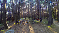
Photos of Chiavari Mountain Bike
Videos of Chiavari Mountain Bike
trail: Capra
2:21 |
240 |
Jan 18, 2017
Recent Trail Reports
| status | trail | date | condition | info | user |
|---|---|---|---|---|---|
| Anchetta | Jun 5, 2026 @ 7:45pm (Europe/Rome) Jun 5, 2026 | Dry | Christian1978 | ||
| Ramaceto 7 passi | Jun 8, 2026 @ 2:17pm (Europe/Rome) Jun 8, 2026 | Ideal | Edo83 | ||
| Ciansaben superiore | Apr 1, 2026 @ 9:47am (Europe/Rome) Apr 1, 2026 | Ideal | Christian1978 | ||
| Capra | Mar 8, 2026 @ 3:57pm (Europe/Rome) Mar 8, 2026 | Ideal | DeCif | ||
| Passo Groppallo | Jan 8, 2026 @ 1:19pm (Europe/Rome) Jan 8, 2026 | Ideal | kiazmtb | ||
| Montallegro-P.sso Crocetta | Nov 22, 2025 @ 9:49am (Europe/Rome) Nov 22, 2025 | Wet | Marietto64 | ||
| Zero Barrato | Oct 27, 2025 @ 3:10pm (Europe/Rome) Oct 27, 2025 | Ideal | giovanni-fk | ||
| Salita Sant'Agostino | Apr 2, 2025 @ 10:44am Apr 2, 2025 | Ideal | Trusce58 | ||
| Santuario di Montallegro | Feb 27, 2025 @ 7:12am Feb 27, 2025 | Ideal | Marietto64 | ||
| Madonna delle Grazie | Sep 22, 2024 @ 1:27am Sep 22, 2024 | Unknown | Mauro62 |
Activity Feed
| username | action | type | title | date |
|---|---|---|---|---|
| Christian1978 | add | report | activity #96535157 | Jun 8, 2026 @ 6:25am Jun 8, 2026 |
| Edo83 | add | report | activity #96532289 | Jun 8, 2026 @ 5:17am Jun 8, 2026 |
| Fabyus77 | ridden | route | activity #94813133 | May 16, 2026 @ 7:24am May 16, 2026 |
| Palinster | ridden | route | activity #93464381 | Apr 26, 2026 @ 11:42am Apr 26, 2026 |
| PaulyJUSBH | ridden | trail | activity #93362406 | Apr 25, 2026 @ 9:04am Apr 25, 2026 |
Recent Comments
| username | type | title | comment | date |
|---|---|---|---|---|
| trail | È aperta e fattibile con dei nuovi salti | Oct 26, 2025 @ 3:18am Oct 26, 2025 | ||
| trail | Not flowy at all, not worth the effort! | Oct 9, 2025 @ 7:51am Oct 9, 2025 | ||
| trail | Percorso questa settimana - pulito ma... | Aug 8, 2025 @ 4:39am Aug 8, 2025 | ||
| trail | E' sentiero molto bello ed estetico utilissimo... | Dec 29, 2024 @ 8:17am Dec 29, 2024 | ||
| trail | Bellissimo trail | Aug 26, 2024 @ 3:50am Aug 26, 2024 |
Local Badges
-

Epic Mountain Bike Climb 2k358 awarded -

Climbing 10k Badge26 awarded -

Mountain Biking 100k Badge5 awarded -

Epic Ride Descent 2k358 awarded -

Descent 10k Badge26 awarded -

Descent 100k Badge5 awarded
Activity Type Stats
| activitytype | trails | distance | descent | descent distance | total vertical | rating | global rank | state rank | photos | reports | routes | ridelogs |
|---|---|---|---|---|---|---|---|---|---|---|---|---|
| Mountain Bike | 20 | 26 miles | 11,411 ft | 17 miles | 3,950 ft | #5,188 | #377 | 11 | 106 | 4 | 1,941 | |
| E-Bike | 10 | 11 miles | 5,620 ft | 8 miles | 2,073 ft | #2,653 | #250 | 21 | 71 | 1 | 200 | |
| Hike | 6 | 8 miles | 2,717 ft | 4 miles | 3,166 ft | #9,391 | #629 | 88 | 99 | |||
| Trail Running | 6 | 8 miles | 2,717 ft | 4 miles | 3,166 ft | #8,929 | #607 | 88 | 47 |
Frequently Asked Questions About Chiavari
▼
What are the highest rated mountain biking trails in Chiavari?
The highest rated mountain biking trails in Chiavari are:
- Nido delle aquile (4.1/5)
- Passo Groppallo (4.1/5)
- Anchetta (4.1/5)
- Ramaceto 7 passi (4/5)
- Capra (4/5)
▼
What is the best time of the year to ride in Chiavari?
Based on ride log data, the most popular months to ride in Chiavari are:
- May (8 activities)
- October (3 activities)
- July (2 activities)
▼
Where can I park to ride in Chiavari?
Check the Chiavari trail map for trailhead and parking information. Community members regularly update access and parking details for trails in the area.
▼
What is the longest trail in Chiavari?
The longest trail in Chiavari is Ramaceto 7 passi at 3.2 miles. View all trails sorted by distance.
Activities
Trails
Points of Interest
- By paolinowrc & contributors
- Admins: denitopia, linomak
- #15140 - 3,826 views
- chiavari activity log | embed map of Chiavari mountain bike trails | chiavari mountain biking points of interest
Downloading of trail gps tracks in kml & gpx formats is enabled for Chiavari.
You must login to download files.