close
-
Layers w
- Weather Layers
- Pro
- Pro
- Pro
- Pro
- Pro
- Pro
- More Layers
- Pro
- Pro
- Pro
- Pro
-
Upgrade to

3D
Trail Conditions
- Unknown
- Snow Groomed
- Snow Packed
- Snow Covered
- Snow Cover Partial
- Freeze/thaw Cycle
- Icy
- Prevalent Mud
- Wet
- Variable
- Ideal
- Dry
- Very Dry
Trail Flow (Ridden Direction)
Trailforks scans users ridelogs to determine the most popular direction each trail is ridden. A good flowing trail network will have most trails flowing in a single direction according to their intension.
The colour categories are based on what percentage of riders are riding a trail in its intended direction.
The colour categories are based on what percentage of riders are riding a trail in its intended direction.
- > 96%
- > 90%
- > 80%
- > 70%
- > 50%
- < 50%
- bi-directional trail
- no data
Trail Last Ridden
Trailforks scans ridelogs to determine the last time a trail was ridden.
- < 2 days
- < 1 week
- < 2 weeks
- < 1 month
- < 6 months
- > 6 months
Trail Ridden Direction
The intended direction a trail should be ridden.
- Downhill Only
- Downhill Primary
- Both Directions
- Uphill Primary
- Uphill Only
- One Direction
Contribute Details
Colors indicate trail is missing specified detail.
- Description
- Photos
- Description & Photos
- Videos
Trail Popularity ?
Trailforks scans ridelogs to determine which trails are ridden the most in the last 9 months.
Trails are compared with nearby trails in the same city region with a possible 25 colour shades.
Think of this as a heatmap, more rides = more kinetic energy = warmer colors.
- most popular
- popular
- less popular
- not popular
ATV/ORV/OHV Filter
Max Vehicle Width
inches
US Cell Coverage
Legend

Radar Time
Activity Recordings
Trailforks uses anonymized public activity data.
?
Activity Recordings
Trailforks uses anonymized public activity data.
?
Personal Heatmap
▶
Activity Types
all
/
none
▶
Options
2
Date range
month
–
Winter Trails
Warning
A routing network for winter maps does not exist. Selecting trails using the winter trails layer has been disabled.
Missing Trails
Most Popular
Least Popular
Trails are colored based on popularity. The more popular a trail is, the more red. Less popular trails trend towards green.
Jump Magnitude Heatmap
Heatmap of where riders jump on trails. Zoom in to see individual jumps, click circles to view jump details.
BC Backroad Status
![map legend]()
Service Road Atlas is a free to use, community-driven service for viewing and creating reports on the numerous back-country service roads around B.C. and Alberta.

Slope Aspect
Direction the slope faces
Trails Deemphasized
Trails are shown in grey.
Only show trails with no bike usage.
Suggested Layers
Based on selected activity type
Save the current map location and zoom level as your default home location whenever this page is loaded.
Save
No description for Chico has been added yet!
Login or register to submit one.
Activities Click to view
- Mountain Bike
117 trails
- E-Bike
53 trails
- Gravel Bike
0 trails
- Adaptive Bike
0 trails
- Winter Fat Bike
0 trails
- Horse
20 trails
- Hike
96 trails
- Trail Running
96 trails
Region Details
- 25
- 1
- 32
- 40
- 14
- 4
Region Status
Caution as of May 21, 2026Stats
- Avg Trail Rating
- Trails (view details)
- 117
- Trails Mountain Bike
- 117
- Trails E-Bike
- 53
- Trails Horse
- 20
- Trails Hike
- 96
- Trails Trail Running
- 96
- Trails ATV/ORV/OHV
- 1
- Total Distance
- 119 miles
- Total Descent
- 20,078 ft
- Total Vertical
- 6,450 ft
- Highest Trailhead
- 6,623 ft
- Reports
- 1,122
- Photos
- 357
- Ridden Counter
- 13,195
Sub Regions
-
Lower Bidwell Park
- 1
- 5
-
Upper Bidwell Park
- 15
- 31
- 14
- 4
Popular Chico Mountain Biking Trails
• 100 ★ 4.0 • 1,483 ft • 12 ft • 482 •
Popular blue difficulty singletrack. This multi-use trail can be used downhill primary and has a moderate overall physical rating with a 12 ft blue climb. Trail visibility is always easy to follow. On average it takes 2 minutes to complete this trail.
• 90 ★ 3.9 • 2 miles • 140 ft • 447 •
Downhill switchback trail starting near the end of . The most popular trail off of . Was once built by bikers, for bikers - the only trail in the park like this. However, that was a long time ago and trails in the park don't hold up....
• 100 ★ 4.0 • 1,680 ft • 2 ft • 425 •
New unsanctioned trail through the olive grove bypassing a section of Annie .
• 95 ★ 4.7 • 2,346 ft • 32 ft • 357 •
Popular green difficulty family friendly singletrack. This multi-use trail can be used both directions and has a easy overall physical rating with a 32 ft green climb. Adaptive MTB rating: amtb green. Trail visibility is always easy to follow. On average it takes 1 minutes to complete this trail.
• 100 ★ 3.0 • 3,960 ft • 70 ft • 354 •
Unsanctioned but highly trafficked new trail connecting and Annie . Built by a hiker and rides as such.
• 90 ★ 4.0 • 3 miles • 163 ft • 303 •
Popular blue difficulty singletrack. This multi-use trail can be used both directions and has a moderate overall physical rating with a 163 ft blue climb. It features rock face and rock garden. Trail visibility is always easy to follow. On average it takes 23 minutes to complete this trail.
• 80 ★ 3.0 • 1 mile • 60 ft • 267 •
Popular black diamond difficulty singletrack. This multi-use trail can be used both directions and has a moderate overall physical rating with a 60 ft blue climb. Trail visibility is always easy to follow. On average it takes 9 minutes to complete this trail.
• 70 ★ 4.1 • 4 miles • 149 ft • 267 •
is probably fun for those who enjoy the thrill of cheating death. Bikes are allowed but it was never built for them and it has had little to no maintenance. There are brutal rock gardens, sharp lava rock, off camber corners, washed out...
Chico Mountain Bike Routes
16 miles • 2,118 ft • 6 •
This loop provides a sample of the major riding sectors in upper bidwell park. There are great views to be...
★ 5.0 • 9 miles • 1,101 ft • 4 • Loop • Race •
Popular route that includes a gradual rocky climb up North Rim with great views, then a fun DH down and...
★ 3.5 • 14 miles • 2,075 ft • 16 • Loop • Race •
Ride the course that is used for the Bidwell Bump XC race. Start at 5 mile and head up to . At the bottom...
★ 5.0 • 4 miles • 149 ft • 6 • Shuttled • Race •
One of the best shuttle DH runs to do in the park is to start at the top of , drop down to Humboldt,...
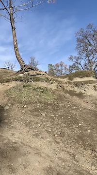
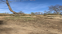
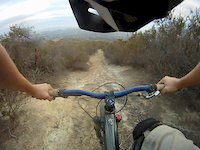
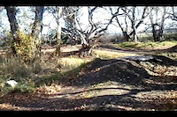
Photos of Chico Mountain Bike
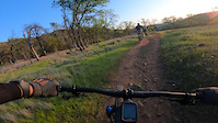
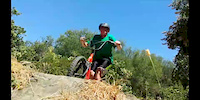
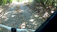
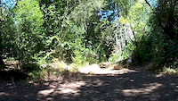
Videos of Chico Mountain Bike
trail: South Rim Trail
0:06 |
432 |
Jul 24, 2021
trail: South Rim Trail
0:06 |
|
Jul 24, 2021
trail: Annie Bidwell Trail
0:09 |
309 |
Mar 31, 2021
trail: The Grove
0:13 |
191 |
Jun 24, 2014
trail: 420
0:46 |
36 |
Nov 19, 2013
trail: The Grove
0:37 |
173 |
Aug 15, 2012
trail: Lower Trail
2:26 |
165 |
Aug 11, 2012
trail: Lower Trail
2:16 |
103 |
Aug 11, 2012
Recent Trail Reports
| status | trail | date | condition | info | user |
|---|---|---|---|---|---|
| The Filter | May 17, 2026 @ 3:45pm (America/Los_Angeles) May 17, 2026 | Ideal | Chicomecha | ||
| Secret/Disk Golf | Apr 11, 2026 @ 9:56pm (America/Los_Angeles) Apr 11, 2026 | Wet | jsally | ||
| Chico Canyon Rd | May 18, 2025 @ 2:21pm May 18, 2025 | Variable | harry8665 | ||
| Annie Bidwell Trail | May 18, 2025 @ 2:21pm May 18, 2025 | Variable | harry8665 | ||
| Sock On A Fence DH | May 9, 2025 @ 9:47pm May 9, 2025 | Dry | BransonXZHEKv | ||
| Upper Trail | Apr 23, 2025 @ 8:53pm Apr 23, 2025 | Dry | roldog27 | ||
| Old Live Oak | Apr 23, 2025 @ 8:49pm Apr 23, 2025 | Dry | roldog27 | ||
| B Trail | Apr 23, 2025 @ 1:59pm Apr 23, 2025 | Dry | roldog27 | ||
| Pine Trail | Apr 21, 2025 @ 7:23am Apr 21, 2025 | Ideal | BransonXZHEKv | ||
| Hacksaw | Mar 12, 2025 @ 9:02am Mar 12, 2025 | Ideal | BransonXZHEKv |
Activity Feed
| username | action | type | title | date |
|---|---|---|---|---|
| Amber95 | ridden | trail | activity #96479835 | Jun 7, 2026 @ 11:05am Jun 7, 2026 |
| Keithfiredive30eezC | wishlist | region | activity #95903057 | May 30, 2026 @ 6:26pm May 30, 2026 |
| brust1979 | wishlist | route | activity #95753401 | May 28, 2026 @ 8:05pm May 28, 2026 |
| zdwtc2 | vote | trail | activity #95416374 | May 24, 2026 @ 9:05am May 24, 2026 |
| trailforks | add | video | activity #95229942 | May 22, 2026 @ 3:00am May 22, 2026 |
Recent Comments
| username | type | title | comment | date |
|---|---|---|---|---|
| trail | Damn this was fucked up lol not rideable imo | May 18, 2026 @ 11:19pm May 18, 2026 | ||
| trail | Many of the photos here are of Old Live Oak... | Apr 23, 2025 @ 8:51pm Apr 23, 2025 | ||
| trail | Short and routy. If you have the legs it's a... | Oct 19, 2024 @ 4:28pm Oct 19, 2024 | ||
| report | B trail has reopened | Oct 19, 2024 @ 4:24pm Oct 19, 2024 | ||
| trail | Trashline was dozered in the Park Fire. | Aug 4, 2024 @ 3:08pm Aug 4, 2024 |
Local Badges
-

Top 10 Trails1 awarded -

Descent 100k Badge15 awarded -

Big Ride 30k4,758 awarded -

Epic Ride 50k1,497 awarded -

Descent 10k Badge108 awarded -

Completionist0 awarded
Bike & Skill Parks
| name | type | city | rating |
|---|---|---|---|
| Wildwood Pump Park | skill park | Chico |
Activity Type Stats
| activitytype | trails | distance | descent | descent distance | total vertical | rating | global rank | state rank | photos | reports | routes | ridelogs |
|---|---|---|---|---|---|---|---|---|---|---|---|---|
| Mountain Bike | 117 | 115 miles | 19,560 ft | 60 miles | 6,450 ft | #807 | #314 | 355 | 1,121 | 13 | 32,763 | |
| E-Bike | 53 | 51 miles | 12,224 ft | 30 miles | 1,355 ft | #2,465 | #1,001 | 1,053 | 1,546 | |||
| Horse | 20 | 24 miles | 3,406 ft | 12 miles | 1,135 ft | #1,519 | #893 | 733 | 4 | |||
| Hike | 96 | 104 miles | 17,365 ft | 55 miles | 6,450 ft | #1,997 | #850 | 2 | 1,080 | 1 | 1,254 | |
| Trail Running | 96 | 104 miles | 17,365 ft | 55 miles | 6,450 ft | #1,425 | #511 | 1,080 | 2 | 2,310 | ||
| ATV/ORV/OHV | 1 | 726 |
Frequently Asked Questions About Chico
▼
What are the best places to ride in Chico?
Chico has 3 areas to explore for mountain biking. The top rated areas are:
▼
What are the highest rated mountain biking trails in Chico?
The highest rated mountain biking trails in Chico are:
- Winston (4.3/5)
- Wildwood park singletrack (4.2/5)
- Wildwood Ave singletrack (4.2/5)
- Wildwood Park connector (4.2/5)
- Disk Golf DH (4.2/5)
▼
What is the best time of the year to ride in Chico?
Based on ride log data, the most popular months to ride in Chico are:
- July (153 activities)
- May (128 activities)
- September (117 activities)
▼
Where can I park to ride in Chico?
Activities
Trails
- By benuntu
 & contributors
 - Admins: CVTW
- #4357 - 17,230 views
- chico activity log | embed map of Chico mountain bike trails | chico mountain biking points of interest
Downloading of trail gps tracks in kml & gpx formats is enabled for Chico.
You must login to download files.