close
-
Layers w
- Weather Layers
- Pro
- Pro
- Pro
- Pro
- Pro
- Pro
- More Layers
- Pro
- Pro
- Pro
- Pro
-
Upgrade to

3D
Trail Conditions
- Unknown
- Snow Groomed
- Snow Packed
- Snow Covered
- Snow Cover Partial
- Freeze/thaw Cycle
- Icy
- Prevalent Mud
- Wet
- Variable
- Ideal
- Dry
- Very Dry
Trail Flow (Ridden Direction)
Trailforks scans users ridelogs to determine the most popular direction each trail is ridden. A good flowing trail network will have most trails flowing in a single direction according to their intension.
The colour categories are based on what percentage of riders are riding a trail in its intended direction.
The colour categories are based on what percentage of riders are riding a trail in its intended direction.
- > 96%
- > 90%
- > 80%
- > 70%
- > 50%
- < 50%
- bi-directional trail
- no data
Trail Last Ridden
Trailforks scans ridelogs to determine the last time a trail was ridden.
- < 2 days
- < 1 week
- < 2 weeks
- < 1 month
- < 6 months
- > 6 months
Trail Ridden Direction
The intended direction a trail should be ridden.
- Downhill Only
- Downhill Primary
- Both Directions
- Uphill Primary
- Uphill Only
- One Direction
Contribute Details
Colors indicate trail is missing specified detail.
- Description
- Photos
- Description & Photos
- Videos
Trail Popularity ?
Trailforks scans ridelogs to determine which trails are ridden the most in the last 9 months.
Trails are compared with nearby trails in the same city region with a possible 25 colour shades.
Think of this as a heatmap, more rides = more kinetic energy = warmer colors.
- most popular
- popular
- less popular
- not popular
ATV/ORV/OHV Filter
Max Vehicle Width
inches
US Cell Coverage
Legend

Radar Time
Activity Recordings
Trailforks uses anonymized public activity data.
?
Activity Recordings
Trailforks uses anonymized public activity data.
?
Personal Heatmap
▶
Activity Types
all
/
none
▶
Options
2
Date range
month
–
Winter Trails
Warning
A routing network for winter maps does not exist. Selecting trails using the winter trails layer has been disabled.
Missing Trails
Most Popular
Least Popular
Trails are colored based on popularity. The more popular a trail is, the more red. Less popular trails trend towards green.
Jump Magnitude Heatmap
Heatmap of where riders jump on trails. Zoom in to see individual jumps, click circles to view jump details.
BC Backroad Status
![map legend]()
Service Road Atlas is a free to use, community-driven service for viewing and creating reports on the numerous back-country service roads around B.C. and Alberta.

Slope Aspect
Direction the slope faces
Trails Deemphasized
Trails are shown in grey.
Only show trails with no bike usage.
Suggested Layers
Based on selected activity type
Save the current map location and zoom level as your default home location whenever this page is loaded.
Save
No description for Chillicothe has been added yet!
Login or register to submit one.
Activities Click to view
- Mountain Bike
131 trails
- E-Bike
62 trails
- Adaptive Bike
0 trails
- Horse
17 trails
- Hike
181 trails
- Trail Running
181 trails
Region Details
- 43
- 34
- 47
- 6
Region Status
Caution as of Sep 14, 2025Stats
- Avg Trail Rating
- Trails (view details)
- 180
- Trails Mountain Bike
- 131
- Trails E-Bike
- 62
- Trails Horse
- 17
- Trails Hike
- 181
- Trails Trail Running
- 181
- Total Distance
- 201 miles
- Total Descent
- 22,526 ft
- Total Vertical
- 686 ft
- Highest Trailhead
- 1,279 ft
- Reports
- 731
- Photos
- 42
- Ridden Counter
- 5,770
Sub Regions
-
Don Coppel Park
- 1
-
Great Seal State Park
- 5
- 33
- 6
-
Scioto Trail State Park
- 3
- 7
-
Tar Hollow State Forest
- 25
- 5
-
Tar Hollow State Park
- 1
Popular Chillicothe Mountain Biking Trails
• 100 ★ 4.5 • 3,976 ft • 122 ft • 171 •
Good ride in both directions but it's mostly downhill from Shawnee and mostly uphill from Rd.
• 95 ★ 0.0 • 4,005 ft • 13 ft • 161 •
Good ride in both directions but downhill from Shawnee and uphill from Lick Run Rd. Mostly ridden uphill.
• 100 ★ 2.0 • 1,299 ft • 0 ft • 158 •
This section is mostly in a grass field and easy.
• 100 ★ 5.0 • 1,834 ft • 0 ft • 156 •
Popular blue difficulty singletrack. This multi-use trail. On average it takes 3 minutes to complete this trail.
• 90 ★ 4.7 • 2,644 ft • 41 ft • 149 •
Very doable trail with optional steep rock drop in and big drop.
• 100 ★ 5.0 • 682 ft • 27 ft • 146 •
Popular blue difficulty singletrack. This multi-use trail. On average it takes 2 minutes to complete this trail.
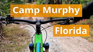
Chillicothe Mountain Bike Routes
1 mile • 53 ft • 2 • Point to Point •
Fun tech up top, followed by some nice flow
12 miles • 1,976 ft • 34 • Loop •
The June Great Seal FUNduro route in order Stage 4, 1, 2, 3.
1 mile • 68 ft • 0 •
Stage 1 Oct 2018 Great Seal Funduro This is the map from the October 2018 event...
12 miles • 2,030 ft • 19 • Loop • Race •
Great Seal June FUNduro 2021 Route. Sport and Novice do not do the North section.
• 11 miles • 1,762 ft • 11 •
• 3 miles • 487 ft • 8 •
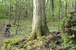
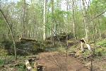
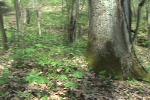
Photos of Chillicothe Mountain Bike
Videos of Chillicothe Mountain Bike
trail: Bunker Hill
14:47 |
57 |
Oct 28, 2025 , Chillicothe

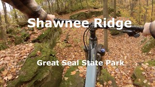
trail: Shawnee Ridge
47:18 |
566 |
Apr 6, 2021 , Chillicothe
trail: Rock Garden Loop
0:12 |
908 |
May 4, 2009
trail: Rock Garden Loop
0:13 |
540 |
May 4, 2009
trail: Rock Garden Loop
0:20 |
376 |
May 4, 2009
trail: Shawnee Ridge
0:31 |
574 |
Oct 26, 2020 , Chillicothe

trail: Rock Garden Loop
0:31 |
419 |
Oct 26, 2020 , Chillicothe
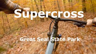
trail: Upper Supercross
0:33 |
372 |
Oct 26, 2020 , Chillicothe
Recent Trail Reports
| status | trail | date | condition | info | user |
|---|---|---|---|---|---|
| No Manure (Spandex) | Sep 14, 2025 @ 6:09pm (America/New_York) Sep 14, 2025 | Dry | MatthewDove COMBO-CRMP | ||
| Bunker Hill | Sep 14, 2025 @ 6:09pm (America/New_York) Sep 14, 2025 | Dry | MatthewDove COMBO-CRMP | ||
| Lick Run | Aug 10, 2025 @ 10:47am Aug 10, 2025 | Dry | Trosslivs2ride COMBO | ||
| Number 4 | Aug 3, 2025 @ 11:01am Aug 3, 2025 | Dry | Trosslivs2ride COMBO | ||
| Mount Ives Ridgetop Connector | Jul 26, 2025 @ 12:17pm Jul 26, 2025 | Ideal | Tamling | ||
| Mount Ives | Jul 26, 2025 @ 12:17pm Jul 26, 2025 | Ideal | Tamling | ||
| Lick Run Extension | Jul 26, 2025 @ 12:17pm Jul 26, 2025 | Ideal | Tamling | ||
| Sidewinder | Jul 26, 2025 @ 12:17pm Jul 26, 2025 | Variable | Tamling | ||
| Lick Run Extension (Switchback) | Jul 26, 2025 @ 12:17pm Jul 26, 2025 | Ideal | Tamling | ||
| Bunker Hill | Jul 5, 2025 @ 10:14am Jul 5, 2025 | Variable | Tamling |
Activity Feed
| username | action | type | title | date |
|---|---|---|---|---|
| o9lutv | wishlist | region | activity #92639450 | Apr 14, 2026 @ 8:17pm Apr 14, 2026 |
| LJ154320 | wishlist | region | activity #90104861 | Mar 7, 2026 @ 2:00am Mar 7, 2026 |
| XDptgv | wishlist | region | activity #89272684 | Feb 21, 2026 @ 4:53am Feb 21, 2026 |
| tarheelcb | wishlist | trail | activity #88269911 | Feb 3, 2026 @ 7:46am Feb 3, 2026 |
| Abaldhoff | wishlist | region | activity #84650464 | Nov 24, 2025 @ 5:21am Nov 24, 2025 |
Recent Comments
| username | type | title | comment | date |
|---|---|---|---|---|
| report | Large tree down across trail | Jul 5, 2025 @ 10:16am Jul 5, 2025 | ||
| report | D | Jun 12, 2022 @ 6:47am Jun 12, 2022 | ||
| trail | Not open to mountain biking. Called in late... | Apr 2, 2021 @ 1:20pm Apr 2, 2021 | ||
| trail | Two trees down lower cellar | Oct 31, 2020 @ 9:27am Oct 31, 2020 | ||
| trail | I don't know how this trail got pegged for a... | Oct 4, 2020 @ 1:53pm Oct 4, 2020 |
Local Badges
-

10 Blue Trails92 awarded -

Epic Ride Climb 2k9 awarded -

Climbing 10k Badge19 awarded -

Climbing 100k Badge0 awarded -

Epic Ride Descent 2k9 awarded -

Descent 10k Badge19 awarded
Bike & Skill Parks
| name | type | city | rating |
|---|---|---|---|
| Chilitown MX | skill park | Chillicothe |
Activity Type Stats
| activitytype | trails | distance | descent | descent distance | total vertical | rating | global rank | state rank | photos | reports | routes | ridelogs |
|---|---|---|---|---|---|---|---|---|---|---|---|---|
| Mountain Bike | 131 | 153 miles | 17,418 ft | 59 miles | 686 ft | #1,461 | #549 | 38 | 731 | 4 | 2,270 | |
| E-Bike | 62 | 85 miles | 6,955 ft | 28 miles | 577 ft | #2,130 | #944 | 2 | 693 | 2 | 247 | |
| Horse | 17 | 16 miles | 2,949 ft | 7 miles | 614 ft | #1,857 | #1,045 | 44 | ||||
| Hike | 181 | 201 miles | 22,526 ft | 78 miles | 686 ft | #889 | #405 | 2 | 731 | 1 | 127 | |
| Trail Running | 181 | 201 miles | 22,526 ft | 78 miles | 686 ft | #726 | #271 | 731 | 129 |
Frequently Asked Questions About Chillicothe
▼
What are the best places to ride in Chillicothe?
Chillicothe has 13 areas to explore for mountain biking. The top rated areas are:
▼
What are the highest rated mountain biking trails in Chillicothe?
The highest rated mountain biking trails in Chillicothe are:
- Rocky Knob (4.2/5)
- Rock Garden Loop (4.2/5)
- Lick Run Extension (Switchback) (4.1/5)
- Shawnee Ridge (4.1/5)
- Upper Supercross (4.1/5)
▼
What is the best time of the year to ride in Chillicothe?
Based on ride log data, the most popular months to ride in Chillicothe are:
- July (26 activities)
- October (14 activities)
- June (13 activities)
▼
Where can I park to ride in Chillicothe?
Activities
Trails
- By swampboy62 & contributors
- Admins: COMBO
- #6147 - 9,118 views
- chillicothe activity log | embed map of Chillicothe mountain bike trails | chillicothe mountain biking points of interest
Downloading of trail gps tracks in kml & gpx formats is enabled for Chillicothe.
You must login to download files.