close
-
Layers w
- Weather Layers
- Pro
- Pro
- Pro
- Pro
- Pro
- Pro
- More Layers
- Pro
- Pro
- Pro
- Pro
-
Upgrade to

3D
Trail Conditions
- Unknown
- Snow Groomed
- Snow Packed
- Snow Covered
- Snow Cover Partial
- Freeze/thaw Cycle
- Icy
- Prevalent Mud
- Wet
- Variable
- Ideal
- Dry
- Very Dry
Trail Flow (Ridden Direction)
Trailforks scans users ridelogs to determine the most popular direction each trail is ridden. A good flowing trail network will have most trails flowing in a single direction according to their intension.
The colour categories are based on what percentage of riders are riding a trail in its intended direction.
The colour categories are based on what percentage of riders are riding a trail in its intended direction.
- > 96%
- > 90%
- > 80%
- > 70%
- > 50%
- < 50%
- bi-directional trail
- no data
Trail Last Ridden
Trailforks scans ridelogs to determine the last time a trail was ridden.
- < 2 days
- < 1 week
- < 2 weeks
- < 1 month
- < 6 months
- > 6 months
Trail Ridden Direction
The intended direction a trail should be ridden.
- Downhill Only
- Downhill Primary
- Both Directions
- Uphill Primary
- Uphill Only
- One Direction
Contribute Details
Colors indicate trail is missing specified detail.
- Description
- Photos
- Description & Photos
- Videos
Trail Popularity ?
Trailforks scans ridelogs to determine which trails are ridden the most in the last 9 months.
Trails are compared with nearby trails in the same city region with a possible 25 colour shades.
Think of this as a heatmap, more rides = more kinetic energy = warmer colors.
- most popular
- popular
- less popular
- not popular
ATV/ORV/OHV Filter
Max Vehicle Width
inches
US Cell Coverage
Legend

Radar Time
Activity Recordings
Trailforks uses anonymized public activity data.
?
Activity Recordings
Trailforks uses anonymized public activity data.
?
Personal Heatmap
▶
Activity Types
all
/
none
▶
Options
2
Date range
month
–
Winter Trails
Warning
A routing network for winter maps does not exist. Selecting trails using the winter trails layer has been disabled.
Missing Trails
Most Popular
Least Popular
Trails are colored based on popularity. The more popular a trail is, the more red. Less popular trails trend towards green.
Jump Magnitude Heatmap
Heatmap of where riders jump on trails. Zoom in to see individual jumps, click circles to view jump details.
BC Backroad Status
![map legend]()
Service Road Atlas is a free to use, community-driven service for viewing and creating reports on the numerous back-country service roads around B.C. and Alberta.

Slope Aspect
Direction the slope faces
Trails Deemphasized
Trails are shown in grey.
Only show trails with no bike usage.
Suggested Layers
Based on selected activity type
Save the current map location and zoom level as your default home location whenever this page is loaded.
Save
No description for Chino has been added yet!
Login or register to submit one.
Activities Click to view
- Mountain Bike
76 trails
- Gravel Bike
2 trails
- Adaptive Bike
1 trails
- Winter Fat Bike
0 trails
- Horse
21 trails
- Hike
83 trails
- Trail Running
83 trails
Region Details
- 22
- 11
- 31
- 1
Region Status
Caution as of May 26, 2026Stats
- Avg Trail Rating
- Trails (view details)
- 68
- Trails Mountain Bike
- 76
- Trails E-Bike
- 2
- Trails Gravel Bike
- 2
- Trails Adaptive Bike
- 1
- Trails Horse
- 21
- Trails Hike
- 83
- Trails Trail Running
- 83
- Trails Observed Trials
- 1
- Trails Downhill Ski
- 3
- Trails Backcountry Ski
- 1
- Total Distance
- 94 miles
- Total Descent
- 18,111 ft
- Total Vertical
- 1,258 ft
- Highest Trailhead
- 1,709 ft
- Reports
- 1,068
- Photos
- 389
- Ridden Counter
- 4,278
Sub Regions
-
Chino Hills State Park
- 7
- 25
Popular Chino Mountain Biking Trails
• 100 ★ 3.8 • 6 miles • 0 ft • 501 •
Good beginner trail that leads up to Four Corners viewpoint.
• 70 ★ 3.5 • 4,857 ft • 17 ft • 324 •
Fun trail. Can get overgrown in the Spring.
• 100 ★ 3.6 • 2 miles • 215 ft • 315 •
Good ST along a ridgeline. Gets very overgrown at times.
• 75 ★ 2.5 • 4,723 ft • 229 ft • 258 •
Link between 4 corners and Aliso Canyon Area.
Chino Mountain Bike Routes
19 miles • 2,539 ft • 8 • Loop •
Starts at Rim Crest entrance to Chino Hills State Park. Head east on , down Little Canyon to Telegraph,...
• 18 miles • 2,354 ft • 4 •
• 17 miles • 1,879 ft • 5 •
• 19 miles • 2,394 ft • 7 •
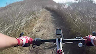
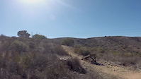
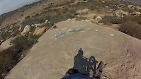
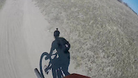
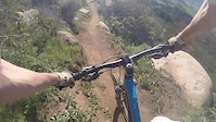
Photos of Chino Mountain Bike
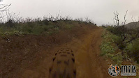
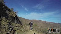
Videos of Chino Mountain Bike
trail: Raptor Ridge
2:28 |
248 |
Oct 13, 2017
trail: Sycamore
0:09 |
115 |
Sep 20, 2015

trail: Sycamore
0:28 |
204 |
Aug 10, 2015
trail: Sycamore
3:19 |
229 |
Aug 2, 2015
trail: Sycamore
2:24 |
150 |
May 5, 2015
trail: Sycamore
2:17 |
1174 |
Feb 18, 2015
trail: Sycamore
7:18 |
93 |
Feb 7, 2015
trail: Sycamore
27:14 |
313 |
Nov 16, 2014
Recent Trail Reports
| status | trail | date | condition | info | user |
|---|---|---|---|---|---|
| Bane Canyon Road | May 26, 2026 @ 2:54pm (America/Los_Angeles) May 26, 2026 | Unknown | KevinBoO9JK | ||
| San Juan Hill | May 26, 2026 @ 2:54pm (America/Los_Angeles) May 26, 2026 | Unknown | KevinBoO9JK | ||
| Bovinian Delight | May 26, 2026 @ 2:53pm (America/Los_Angeles) May 26, 2026 | Dry | KevinBoO9JK | ||
| Bovinian Climb | May 26, 2026 @ 2:52pm (America/Los_Angeles) May 26, 2026 | Dry | KevinBoO9JK | ||
| Lower South Ridge | May 22, 2026 @ 8:23am (America/Los_Angeles) May 22, 2026 | Dry | CamCadRacing | ||
| Upper Mud Canyon | May 22, 2026 @ 8:23am (America/Los_Angeles) May 22, 2026 | Ideal | CamCadRacing | ||
| Lower Aliso Canyon Singletrack | May 20, 2026 @ 11:06am (America/Los_Angeles) May 20, 2026 | Ideal | Paulsi53 | ||
| Powerline Trail | Apr 30, 2026 @ 10:49am (America/Los_Angeles) Apr 30, 2026 | Variable | Paulsi53 | ||
| Long Way Around | Apr 30, 2026 @ 10:49am (America/Los_Angeles) Apr 30, 2026 | Dry | Paulsi53 | ||
| Bane Canyon Dirt | Apr 27, 2026 @ 2:13pm (America/Los_Angeles) Apr 27, 2026 | Ideal | Paulsi53 |
Activity Feed
| username | action | type | title | date |
|---|---|---|---|---|
| czrb4ca | wishlist | trail | activity #97215208 | Jun 17, 2026 @ 4:11pm 3 days |
| czrb4ca | wishlist | region | activity #97215000 | Jun 17, 2026 @ 4:07pm 3 days |
| rkoski | wishlist | route | activity #96637948 | Jun 9, 2026 @ 4:41pm Jun 9, 2026 |
| OlivierLgRRWj | wishlist | trail | activity #95686061 | May 27, 2026 @ 9:54pm May 27, 2026 |
| OlivierLgRRWj | ridden | trail | activity #95686057 | May 27, 2026 @ 9:53pm May 27, 2026 |
Recent Comments
| username | type | title | comment | date |
|---|---|---|---|---|
| trail | No longer a singletrack, it's wide double... | Mar 3, 2026 @ 6:30pm Mar 3, 2026 | ||
| trail | Rode 3M and Bane Ridge today. Was hotter than... | Dec 16, 2025 @ 9:28pm Dec 16, 2025 | ||
| trail | In great condition, just a few deep ruts... | Dec 7, 2025 @ 7:04pm Dec 7, 2025 | ||
| trail | December 2025, the trail is overgrown and... | Dec 7, 2025 @ 8:56am Dec 7, 2025 | ||
| trail | Today was gnarly bumpy and the brush was blown... | Sep 27, 2025 @ 10:49pm Sep 27, 2025 |
Local Badges
-

10 Blue Trails14 awarded -

Epic Mountain Bike Climb 2k0 awarded -

Climbing 10k Badge2 awarded -

Mountain Biking 100k Badge0 awarded -

Epic Ride Descent 2k0 awarded -

Descent 10k Badge2 awarded
Activity Type Stats
| activitytype | trails | distance | descent | descent distance | total vertical | rating | global rank | state rank | photos | reports | routes | ridelogs |
|---|---|---|---|---|---|---|---|---|---|---|---|---|
| Mountain Bike | 76 | 91 miles | 17,461 ft | 47 miles | 1,257 ft | #2,009 | #728 | 400 | 1,068 | 3 | 14,126 | |
| E-Bike | 2 | 3 miles | 358 ft | 2 miles | 315 ft | 776 | 1,691 | |||||
| Gravel Bike | 2 | #696 | #1,205 | 2 | 9 | 69 | ||||||
| Adaptive Bike | 1 | #714 | #1,980 | 6 | ||||||||
| Horse | 21 | 25 miles | 4,911 ft | 11 miles | 1,099 ft | #1,705 | #971 | 144 | 1 | |||
| Hike | 83 | 94 miles | 18,110 ft | 48 miles | 1,257 ft | #2,827 | #1,059 | 1,066 | 312 | |||
| Trail Running | 83 | 94 miles | 18,110 ft | 48 miles | 1,257 ft | #2,475 | #737 | 1,066 | 336 | |||
| Observed Trials | 1 | 1 | 1 | |||||||||
| Downhill Ski | 3 | 2 | ||||||||||
| Backcountry Ski | 1 |
Frequently Asked Questions About Chino
▼
What are the best places to ride in Chino?
Chino has 1 areas to explore for mountain biking. The top rated areas are:
▼
What are the highest rated mountain biking trails in Chino?
The highest rated mountain biking trails in Chino are:
- 3M Trail (4.2/5)
- Upper Mud Canyon (4.1/5)
- Lower Aliso Canyon Singletrack (4.1/5)
- Prado Regional Loop (4.1/5)
- Butterfield Dirt (4.1/5)
▼
What is the best time of the year to ride in Chino?
Based on ride log data, the most popular months to ride in Chino are:
- January (72 activities)
- November (62 activities)
- February (60 activities)
▼
Where can I park to ride in Chino?
There are 3 parking locations listed in Chino. The most popular parking spots are: View all parking and trailhead locations on the map to plan your visit.
Activities
Trails
Points of Interest
- By rowdyphil & contributors
- Admins: apply
- #43655 - 3,173 views
- chino activity log | embed map of Chino mountain bike trails | chino mountain biking points of interest
Downloading of trail gps tracks in kml & gpx formats is enabled for Chino.
You must login to download files.