close
-
Layers w
- Weather Layers
- Pro
- Pro
- Pro
- Pro
- Pro
- Pro
- More Layers
- Pro
- Pro
- Pro
- Pro
-
Upgrade to

3D
Trail Conditions
- Unknown
- Snow Groomed
- Snow Packed
- Snow Covered
- Snow Cover Partial
- Freeze/thaw Cycle
- Icy
- Prevalent Mud
- Wet
- Variable
- Ideal
- Dry
- Very Dry
Trail Flow (Ridden Direction)
Trailforks scans users ridelogs to determine the most popular direction each trail is ridden. A good flowing trail network will have most trails flowing in a single direction according to their intension.
The colour categories are based on what percentage of riders are riding a trail in its intended direction.
The colour categories are based on what percentage of riders are riding a trail in its intended direction.
- > 96%
- > 90%
- > 80%
- > 70%
- > 50%
- < 50%
- bi-directional trail
- no data
Trail Last Ridden
Trailforks scans ridelogs to determine the last time a trail was ridden.
- < 2 days
- < 1 week
- < 2 weeks
- < 1 month
- < 6 months
- > 6 months
Trail Ridden Direction
The intended direction a trail should be ridden.
- Downhill Only
- Downhill Primary
- Both Directions
- Uphill Primary
- Uphill Only
- One Direction
Contribute Details
Colors indicate trail is missing specified detail.
- Description
- Photos
- Description & Photos
- Videos
Trail Popularity ?
Trailforks scans ridelogs to determine which trails are ridden the most in the last 9 months.
Trails are compared with nearby trails in the same city region with a possible 25 colour shades.
Think of this as a heatmap, more rides = more kinetic energy = warmer colors.
- most popular
- popular
- less popular
- not popular
ATV/ORV/OHV Filter
Max Vehicle Width
inches
US Cell Coverage
Legend

Radar Time
Activity Recordings
Trailforks uses anonymized public activity data.
?
Activity Recordings
Trailforks uses anonymized public activity data.
?
Personal Heatmap
▶
Activity Types
all
/
none
▶
Options
2
Date range
month
–
Winter Trails
Warning
A routing network for winter maps does not exist. Selecting trails using the winter trails layer has been disabled.
Missing Trails
Most Popular
Least Popular
Trails are colored based on popularity. The more popular a trail is, the more red. Less popular trails trend towards green.
Jump Magnitude Heatmap
Heatmap of where riders jump on trails. Zoom in to see individual jumps, click circles to view jump details.
BC Backroad Status
![map legend]()
Service Road Atlas is a free to use, community-driven service for viewing and creating reports on the numerous back-country service roads around B.C. and Alberta.

Slope Aspect
Direction the slope faces
Trails Deemphasized
Trails are shown in grey.
Only show trails with no bike usage.
Suggested Layers
Based on selected activity type
Save the current map location and zoom level as your default home location whenever this page is loaded.
Save
No description for Chongli has been added yet!
Login or register to submit one.
Activities Click to view
- Mountain Bike
11 trails
- Adaptive Bike
0 trails
- Hike
7 trails
- Trail Running
7 trails
Region Details
- 3
- 5
- 2
Region Status
Open as of Sep 13, 2025Stats
- Avg Trail Rating
- Trails (view details)
- 11
- Trails Mountain Bike
- 11
- Trails E-Bike
- 2
- Trails Hike
- 7
- Trails Trail Running
- 7
- Total Distance
- 11 miles
- Total Descent
- 5,530 ft
- Total Vertical
- 1,414 ft
- Highest Trailhead
- 6,845 ft
- Reports
- 13
- Photos
- 21
- Ridden Counter
- 62
Sub Regions
-
Duolemeidi
- 1
- 3
- 1
-
Taiwoo
- 2
- 1
- 1
Popular Chongli Mountain Biking Trails
• 75 ★ 4.5 • 4 miles • 18 ft • 15 •
Decently flowy although more bumpy and less flowy than the , no real jumps on this unless you like having close calls with trees ( again look to the ). If your bike has a bad front fork plus skinny tyres be prepared to lose the ability...
• 95 ★ 4.5 • 1 mile • 22 ft • 14 •
Popular blue difficulty singletrack. This mountain bike primary trail can be used downhill only. On average it takes 3 minutes to complete this trail.
• 85 ★ 5.0 • 1 mile • 10 ft • 12 •
Popular black diamond difficulty singletrack. This mountain bike primary trail can be used downhill primary and has a moderate overall physical rating. It features berm. On average it takes 6 minutes to complete this trail.
• 5 ★ 4.0 • 1 mile • 7 ft • 1 •
Less popular blue difficulty singletrack. This mountain bike primary trail can be used downhill only. It features berm.
• 55 ★ 0.0 • 2,474 ft • 0 ft • 1 •
,没有任何难度,你跑的快他就难,跑的慢就简单,没有任何的飞包碎石下高坠台等,是本地最适合练技术的小路,建议尝试控制在1分钟以内
Photos of Chongli Mountain Bike
Videos of Chongli Mountain Bike
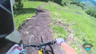
trail: Big Brother Trail
1260 |
Jun 22, 2015 , Chongli
Recent Trail Reports
| status | trail | date | condition | info | user |
|---|---|---|---|---|---|
| 兰山早餐道 | May 31, 2024 @ 11:46pm May 31, 2024 | Wet | cncnw-kingwjharasyu | ||
| Black trail | Oct 4, 2022 @ 1:31pm Oct 4, 2022 | Ideal | smons1 | ||
| Green Trail | Oct 4, 2022 @ 8:31pm Oct 4, 2022 | Ideal | smons1 | ||
| 地家庭道 w | Nov 6, 2019 @ 7:50am Nov 6, 2019 | Dry | Baining |
Activity Feed
| username | action | type | title | date |
|---|---|---|---|---|
| Shuming0u7NHX | wishlist | region | activity #85420142 | Dec 12, 2025 @ 2:30pm Dec 12, 2025 |
| kvUcMH | comment | trail | activity #79489372 | Sep 2, 2025 @ 8:21am Sep 2, 2025 |
| kvUcMH | comment | trail | activity #74043940 | Jun 18, 2025 @ 9:27am Jun 18, 2025 |
| kvUcMH | add | photo | activity #73185019 | Jun 6, 2025 @ 3:55am Jun 6, 2025 |
| apmata668 | add | trail | activity #72250327 | May 23, 2025 @ 5:45pm May 23, 2025 |
Recent Comments
| username | type | title | comment | date |
|---|---|---|---|---|
| trail | it is quite nicely build | Sep 2, 2025 @ 8:21am Sep 2, 2025 | ||
| trail | 这里有人吗 | Jun 18, 2025 @ 9:27am Jun 18, 2025 | ||
| trail | It’s the best ski and MTB resort in China,... | Sep 2, 2019 @ 5:44am Sep 2, 2019 |
Local Badges
-

Epic Mountain Bike Climb 2k0 awarded -

Climbing 10k Badge0 awarded -

Mountain Biking 100k Badge0 awarded -

Epic Ride Descent 2k0 awarded -

Descent 10k Badge0 awarded -

Descent 100k Badge0 awarded
Local Trail Supporters
- doyglas123
Activity Type Stats
| activitytype | trails | distance | descent | descent distance | total vertical | rating | global rank | state rank | photos | reports | routes | ridelogs |
|---|---|---|---|---|---|---|---|---|---|---|---|---|
| Mountain Bike | 11 | 11 miles | 5,531 ft | 9 miles | 1,414 ft | #2,212 | #2 | 21 | 13 | 960 | ||
| E-Bike | 2 | 10 | 2 | |||||||||
| Hike | 7 | 11 miles | 5,531 ft | 9 miles | 1,414 ft | #2,431 | #7 | 12 | 18 | |||
| Trail Running | 7 | 11 miles | 5,531 ft | 9 miles | 1,414 ft | #1,958 | #5 | 12 | 2 |
Frequently Asked Questions About Chongli
▼
What are the best places to ride in Chongli?
Chongli has 2 areas to explore for mountain biking. The top rated areas are:
▼
What are the highest rated mountain biking trails in Chongli?
The highest rated mountain biking trails in Chongli are:
- Black trail (4.2/5)
- Big Brother Trail (4.2/5)
- Blue Trail (4.1/5)
- Green Trail (4.1/5)
- 弯墙路线 (4/5)
▼
What is the best time of the year to ride in Chongli?
Based on ride log data, the most popular months to ride in Chongli are:
- July (7 activities)
- August (2 activities)
- May (2 activities)
▼
Where can I park to ride in Chongli?
Check the Chongli trail map for trailhead and parking information. Community members regularly update access and parking details for trails in the area.
- By brenthillier
 NSMBA TRAILFORKS & contributors
 - Admins: doyglas123
- #3393 - 3,496 views
- chongli activity log | embed map of Chongli mountain bike trails |
Downloading of trail gps tracks in kml & gpx formats is enabled for Chongli.
You must login to download files.