close
-
Layers w
- Weather Layers
- Pro
- Pro
- Pro
- Pro
- Pro
- Pro
- More Layers
- Pro
- Pro
- Pro
- Pro
-
Upgrade to

3D
Trail Conditions
- Unknown
- Snow Groomed
- Snow Packed
- Snow Covered
- Snow Cover Partial
- Freeze/thaw Cycle
- Icy
- Prevalent Mud
- Wet
- Variable
- Ideal
- Dry
- Very Dry
Trail Flow (Ridden Direction)
Trailforks scans users ridelogs to determine the most popular direction each trail is ridden. A good flowing trail network will have most trails flowing in a single direction according to their intension.
The colour categories are based on what percentage of riders are riding a trail in its intended direction.
The colour categories are based on what percentage of riders are riding a trail in its intended direction.
- > 96%
- > 90%
- > 80%
- > 70%
- > 50%
- < 50%
- bi-directional trail
- no data
Trail Last Ridden
Trailforks scans ridelogs to determine the last time a trail was ridden.
- < 2 days
- < 1 week
- < 2 weeks
- < 1 month
- < 6 months
- > 6 months
Trail Ridden Direction
The intended direction a trail should be ridden.
- Downhill Only
- Downhill Primary
- Both Directions
- Uphill Primary
- Uphill Only
- One Direction
Contribute Details
Colors indicate trail is missing specified detail.
- Description
- Photos
- Description & Photos
- Videos
Trail Popularity ?
Trailforks scans ridelogs to determine which trails are ridden the most in the last 9 months.
Trails are compared with nearby trails in the same city region with a possible 25 colour shades.
Think of this as a heatmap, more rides = more kinetic energy = warmer colors.
- most popular
- popular
- less popular
- not popular
ATV/ORV/OHV Filter
Max Vehicle Width
inches
US Cell Coverage
Legend

Radar Time
Activity Recordings
Trailforks uses anonymized public activity data.
?
Activity Recordings
Trailforks uses anonymized public activity data.
?
Personal Heatmap
▶
Activity Types
all
/
none
▶
Options
2
Date range
month
–
Winter Trails
Warning
A routing network for winter maps does not exist. Selecting trails using the winter trails layer has been disabled.
Missing Trails
Most Popular
Least Popular
Trails are colored based on popularity. The more popular a trail is, the more red. Less popular trails trend towards green.
Jump Magnitude Heatmap
Heatmap of where riders jump on trails. Zoom in to see individual jumps, click circles to view jump details.
BC Backroad Status
![map legend]()
Service Road Atlas is a free to use, community-driven service for viewing and creating reports on the numerous back-country service roads around B.C. and Alberta.

Slope Aspect
Direction the slope faces
Trails Deemphasized
Trails are shown in grey.
Only show trails with no bike usage.
Suggested Layers
Based on selected activity type
Save the current map location and zoom level as your default home location whenever this page is loaded.
Save
No description for Ciudad Colon has been added yet!
Login or register to submit one.
Activities Click to view
- Mountain Bike
45 trails
- E-Bike
10 trails
- Gravel Bike
0 trails
- Adaptive Bike
0 trails
- Winter Fat Bike
0 trails
- Hike
45 trails
- Trail Running
45 trails
Region Details
- 5
- 1
- 16
- 11
- 8
- 3
- 1
Region Status
Open as of Apr 19, 2026Stats
- Avg Trail Rating
- Trails (view details)
- 46
- Trails Mountain Bike
- 45
- Trails E-Bike
- 10
- Trails Hike
- 45
- Trails Trail Running
- 45
- Total Distance
- 25 miles
- Total Descent
- 9,907 ft
- Total Vertical
- 3,129 ft
- Highest Trailhead
- 5,822 ft
- Reports
- 195
- Photos
- 345
- Ridden Counter
- 5,508
Sub Regions
-
Los Senderos de Colón
- 1
- 16
- 11
- 7
- 2
- 1
Popular Ciudad Colon Mountain Biking Trails
• 100 ★ 4.5 • 1,424 ft • 63 ft • 240 •
Popular green difficulty singletrack. This mountain bike primary trail can be used uphill only and has a easy overall physical rating with a 63 ft green climb. It features bridge. On average it takes 3 minutes to complete this trail.
• 100 ★ 4.0 • 4,940 ft • 696 ft • 228 •
Popular blue difficulty singletrack. This mountain bike primary trail can be used uphill only and has a hard overall physical rating with a 696 ft blue climb. It features bridge. On average it takes 23 minutes to complete this trail.
• 90 ★ 4.5 • 1,158 ft • 48 ft • 211 •
Popular green difficulty singletrack. This mountain bike primary trail can be used uphill only and has a moderate overall physical rating with a 48 ft green climb. On average it takes 4 minutes to complete this trail.
• 95 ★ 4.7 • 1,210 ft • 10 ft • 183 •
Popular green difficulty singletrack. This mountain bike primary trail can be used downhill only and has a easy overall physical rating with a 10 ft green climb. On average it takes 1 minutes to complete this trail.
• 85 ★ 4.5 • 2,058 ft • 10 ft • 168 •
Popular green difficulty singletrack. This mountain bike primary trail can be used downhill only. On average it takes 2 minutes to complete this trail.
• 95 ★ 4.5 • 1,953 ft • 0 ft • 158 •
Most used trail to descend back to the parking lot, one of the easier ways to return
• 75 ★ 4.5 • 1,830 ft • 101 ft • 123 •
Popular green difficulty singletrack. This mountain bike primary trail can be used uphill only and has a moderate overall physical rating with a 101 ft green climb. On average it takes 6 minutes to complete this trail.
• 75 ★ 4.5 • 2,548 ft • 276 ft • 118 •
Popular black diamond difficulty singletrack. This mountain bike primary trail can be used uphill only and has a hard overall physical rating with a 276 ft black diamond climb. It features bridge. On average it takes 15 minutes to complete this trail.
Ciudad Colon Mountain Bike Routes
3 miles • 740 ft • 14 •
Una de las veltas más cortas que se puede hacer en el parque usando toda la subida del VIP. Buena opción...
★ 5.0 • 9 miles • 2,644 ft • 0 •
Es una ruta con muchos ascensos y descensos un poco técnicos, bastante caliente, solo el sector de la...
38 miles • 3,297 ft • 0 •
This route has everything, it is very hot but it has some rivers where you can take a dip
14 miles • 2,646 ft • 0 •
★ 1.0 • 3 miles • 945 ft • 15 • Point to Point • Race •
Para el primer enlace se cuenta con un tiempo máximo de 45 minutos. En la sección cronometrada de esta...
3 miles • 948 ft • 8 • Point to Point • Race •
Para el segundo enlace se cuenta con un tiempo máximo de 45 minutos. En la sección cronometrada de esta...
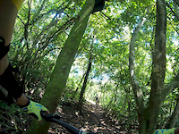
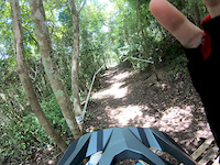
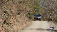
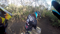
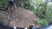
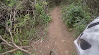
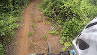
Photos of Ciudad Colon Mountain Bike
Videos of Ciudad Colon Mountain Bike
trail: Conector 3
2:48 |
89 |
Oct 11, 2018
trail: Abejas Montaña
5:40 |
131 |
Sep 24, 2018
trail: El Ciclón
2:01 |
1249 |
Apr 17, 2016
trail: El Ciclón
3:17 |
2996 |
Apr 16, 2016
trail: La Laja
0:29 |
548 |
Jul 20, 2015
trail: Bosque 2 Viejo
0:30 |
111 |
Jun 30, 2015

trail: La Laja
0:09 |
211 |
Jun 30, 2015
trail: El Filo
2:16 |
167 |
Jun 30, 2015
Recent Trail Reports
| status | trail | date | condition | info | user |
|---|---|---|---|---|---|
| Salida | Apr 19, 2026 @ 8:35am (America/Costa_Rica) Apr 19, 2026 | Dry | V1c70r | ||
| Chante Bajo | Apr 19, 2026 @ 8:35am (America/Costa_Rica) Apr 19, 2026 | Ideal | V1c70r | ||
| Peruano | Apr 19, 2026 @ 8:35am (America/Costa_Rica) Apr 19, 2026 | Ideal | V1c70r | ||
| Zig Zag | Apr 19, 2026 @ 8:35am (America/Costa_Rica) Apr 19, 2026 | Ideal | V1c70r | ||
| Bosque 1 | Apr 19, 2026 @ 8:35am (America/Costa_Rica) Apr 19, 2026 | Ideal | V1c70r | ||
| La Laja | Apr 19, 2026 @ 8:35am (America/Costa_Rica) Apr 19, 2026 | Dry | V1c70r | ||
| El Filo | Apr 19, 2026 @ 8:35am (America/Costa_Rica) Apr 19, 2026 | Ideal | V1c70r | ||
| Bronson | May 29, 2025 @ 8:42am May 29, 2025 | Wet | Javierrod | ||
| Conector 1 | Apr 22, 2024 @ 1:22am Apr 22, 2024 | Ideal | Vigoroflife | ||
| Meneca | Apr 22, 2024 @ 1:22am Apr 22, 2024 | Variable | Vigoroflife |
Activity Feed
| username | action | type | title | date |
|---|---|---|---|---|
| V1c70r | add | report | activity #92969796 and 6 more | Apr 19, 2026 @ 12:05pm Apr 19, 2026 |
| Nela04 | ridden | trail | activity #89966329 and 8 more | Mar 4, 2026 @ 11:48am Mar 4, 2026 |
| mkerobertson | wishlist | region | activity #88931312 | Feb 14, 2026 @ 6:02pm Feb 14, 2026 |
| cdb673 | wishlist | region | activity #81169384 | Sep 26, 2025 @ 6:53pm Sep 26, 2025 |
| AlonsobvWxf1 | wishlist | trail | activity #78221833 and 1 more | Aug 15, 2025 @ 9:08pm Aug 15, 2025 |
Recent Comments
| username | type | title | comment | date |
|---|---|---|---|---|
| trail | Great fast paced trail with all listed... | Jan 28, 2019 @ 4:40am Jan 28, 2019 |
Local Badges
-

10 Green Trails58 awarded -

10 Blue Trails51 awarded -

Epic Ride Climb 2k629 awarded -

Climbing 10k Badge95 awarded -

Climbing 100k Badge16 awarded -

Epic Ride Descent 2k640 awarded
Bike & Skill Parks
| name | type | city | rating |
|---|---|---|---|
| Los Senderos de Colón | bike park | Ciudad Colon | |
| Trail Love | skill park | Ciudad Colon |
Local Trail Supporters
- Roberto Castillo
Activity Type Stats
| activitytype | trails | distance | descent | descent distance | total vertical | rating | global rank | state rank | photos | reports | routes | ridelogs |
|---|---|---|---|---|---|---|---|---|---|---|---|---|
| Mountain Bike | 45 | 24 miles | 9,590 ft | 13 miles | 3,130 ft | #1,182 | #1 | 338 | 195 | 8 | 13,861 | |
| E-Bike | 10 | 5 miles | 2,966 ft | 3 miles | 804 ft | #1,427 | #6 | 1 | 181 | 1 | 1,012 | |
| Hike | 45 | 24 miles | 9,085 ft | 12 miles | 3,130 ft | #1,728 | #4 | 4 | 194 | 428 | ||
| Trail Running | 45 | 24 miles | 9,085 ft | 12 miles | 3,130 ft | #1,324 | #2 | 2 | 194 | 1 | 121 |
Frequently Asked Questions About Ciudad Colon
▼
What are the best places to ride in Ciudad Colon?
Ciudad Colon has 1 areas to explore for mountain biking. The top rated areas are:
▼
What are the highest rated mountain biking trails in Ciudad Colon?
▼
What is the best time of the year to ride in Ciudad Colon?
Based on ride log data, the most popular months to ride in Ciudad Colon are:
- February (40 activities)
- July (39 activities)
- March (35 activities)
▼
Where can I park to ride in Ciudad Colon?
There are 2 parking locations listed in Ciudad Colon. The most popular parking spots are:
Activities
Trails
Points of Interest
- By castpack
 LSC & contributors
 - Admins: castpack
- #7265 - 7,162 views
- ciudad colon activity log | embed map of Ciudad Colon mountain bike trails | ciudad colon mountain biking points of interest
Downloading of trail gps tracks in kml & gpx formats is enabled for Ciudad Colon.
You must login to download files.