close
-
Layers w
- Weather Layers
- Pro
- Pro
- Pro
- Pro
- Pro
- Pro
- More Layers
- Pro
- Pro
- Pro
- Pro
-
Upgrade to

3D
Trail Conditions
- Unknown
- Snow Groomed
- Snow Packed
- Snow Covered
- Snow Cover Partial
- Freeze/thaw Cycle
- Icy
- Prevalent Mud
- Wet
- Variable
- Ideal
- Dry
- Very Dry
Trail Flow (Ridden Direction)
Trailforks scans users ridelogs to determine the most popular direction each trail is ridden. A good flowing trail network will have most trails flowing in a single direction according to their intension.
The colour categories are based on what percentage of riders are riding a trail in its intended direction.
The colour categories are based on what percentage of riders are riding a trail in its intended direction.
- > 96%
- > 90%
- > 80%
- > 70%
- > 50%
- < 50%
- bi-directional trail
- no data
Trail Last Ridden
Trailforks scans ridelogs to determine the last time a trail was ridden.
- < 2 days
- < 1 week
- < 2 weeks
- < 1 month
- < 6 months
- > 6 months
Trail Ridden Direction
The intended direction a trail should be ridden.
- Downhill Only
- Downhill Primary
- Both Directions
- Uphill Primary
- Uphill Only
- One Direction
Contribute Details
Colors indicate trail is missing specified detail.
- Description
- Photos
- Description & Photos
- Videos
Trail Popularity ?
Trailforks scans ridelogs to determine which trails are ridden the most in the last 9 months.
Trails are compared with nearby trails in the same city region with a possible 25 colour shades.
Think of this as a heatmap, more rides = more kinetic energy = warmer colors.
- most popular
- popular
- less popular
- not popular
ATV/ORV/OHV Filter
Max Vehicle Width
inches
US Cell Coverage
Legend

Radar Time
Activity Recordings
Trailforks uses anonymized public activity data.
?
Activity Recordings
Trailforks uses anonymized public activity data.
?
Personal Heatmap
▶
Activity Types
all
/
none
▶
Options
2
Date range
month
–
Winter Trails
Warning
A routing network for winter maps does not exist. Selecting trails using the winter trails layer has been disabled.
Missing Trails
Most Popular
Least Popular
Trails are colored based on popularity. The more popular a trail is, the more red. Less popular trails trend towards green.
Jump Magnitude Heatmap
Heatmap of where riders jump on trails. Zoom in to see individual jumps, click circles to view jump details.
BC Backroad Status
![map legend]()
Service Road Atlas is a free to use, community-driven service for viewing and creating reports on the numerous back-country service roads around B.C. and Alberta.

Slope Aspect
Direction the slope faces
Trails Deemphasized
Trails are shown in grey.
Only show trails with no bike usage.
Suggested Layers
Based on selected activity type
Save the current map location and zoom level as your default home location whenever this page is loaded.
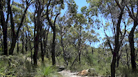
SaveA set of trails through Clandulla State Forest, ~50km south east of Mudgee.
Primary Trail Type: Cross-Country
AKA: Clandulla State Forest
Land Status: State Forest
Activities Click to view
- Mountain Bike
24 trails
- E-Bike
3 trails
- Hike
25 trails
- Trail Running
25 trails
Region Details
- 4
- 1
- 17
- 2
Region Status
Caution as of Jan 26, 2025Local Trail Association
Stats
- Avg Trail Rating
- Trails (view details)
- 24
- Trails Mountain Bike
- 25
- Trails E-Bike
- 3
- Trails Hike
- 25
- Trails Trail Running
- 25
- Total Distance
- 20 miles
- Total Descent
- 2,681 ft
- Total Vertical
- 263 ft
- Highest Trailhead
- 2,442 ft
- Reports
- 37
- Photos
- 1
- Ridden Counter
- 439
Popular Clandulla Trails Mountain Biking Trails
• 5 ★ 0.0 • 761 ft • 8 ft • 51 •
Less popular green difficulty singletrack. This mountain bike primary trail can be used one direction. On average it takes minutes to complete this trail.
• 5 ★ 0.0 • 1 mile • 55 ft • 46 •
Nice flowy singletrack which runs through undulating terrain and tall Eucalypt forest. becomes moderately technical in the 2nd half with a series of small jumps and a couple of rocky sections near the end. The trail ends at a fork just...
• 5 ★ 0.0 • 4,511 ft • 52 ft • 34 •
Less popular blue difficulty singletrack. This mountain bike primary trail can be used one direction. On average it takes 6 minutes to complete this trail.
• 5 ★ 5.0 • 1 mile • 146 ft • 28 •
A mostly XC trail with some short climbs, lots of long flowy sections and lots of rock. The trail ends out at a big rockface with great views out over Mt Vincent/Ilford. Take care on the final roll down to the rock and go right once...
• 5 ★ 0.0 • 2,103 ft • 14 ft • 26 •
Techy short downhill featuring a series of natural jumps at the top, limestone and deep gravel. Some rocky off camber sections which are super grippy in the dry. There's a steep rockface lefthander 3/4 of the way down that requires...
• 5 ★ 0.0 • 171 ft • 5 ft • 26 •
Less popular blue difficulty singletrack. This mountain bike primary trail can be used both directions. On average it takes 2 minutes to complete this trail.
• 5 ★ 0.0 • 3,642 ft • 43 ft • 18 •
Less popular blue difficulty singletrack. This mountain bike primary trail can be used one direction. On average it takes 5 minutes to complete this trail.
• 5 ★ 0.0 • 2 miles • 185 ft • 17 •
Less popular blue difficulty singletrack. This mountain bike primary trail can be used one direction. On average it takes 26 minutes to complete this trail.
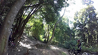
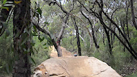
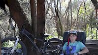
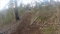
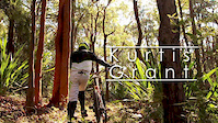
Videos of Clandulla Trails Mountain Bike
trail: Teaser
0:12 |
161 |
Oct 16, 2015
trail: Teaser
0:26 |
462 |
Dec 5, 2014

trail: Teaser
0:16 |
344 |
Nov 8, 2014
trail: Teaser
0:30 |
599 |
Jul 24, 2014
trail: Teaser
0:36 |
145 |
Jul 17, 2014
trail: Teaser
0:59 |
158 |
Jan 16, 2014

trail: Teaser
2:00 |
23063 |
Jan 11, 2014
trail: Teaser
0:29 |
483 |
Mar 24, 2013
Recent Trail Reports
| status | trail | date | condition | info | user |
|---|---|---|---|---|---|
| Gets Rowdy | Jan 26, 2025 @ 12:18pm Jan 26, 2025 | Very Dry | Peterz010 | ||
| Blood Slug Gully | Jan 26, 2025 @ 12:18pm Jan 26, 2025 | Very Dry | Peterz010 | ||
| Chunder Run | Jul 17, 2020 @ 3:28pm Jul 17, 2020 | Ideal | ChrisMackenzie | ||
| On the Rocks | Jul 17, 2020 @ 3:28pm Jul 17, 2020 | Ideal | ChrisMackenzie | ||
| Catching the Gnome | Jul 17, 2020 @ 3:28pm Jul 17, 2020 | Ideal | ChrisMackenzie | ||
| Ratshit | Jul 17, 2020 @ 3:28pm Jul 17, 2020 | Ideal | ChrisMackenzie | ||
| Teaser | Jul 17, 2020 @ 3:28pm Jul 17, 2020 | Ideal | ChrisMackenzie |
Activity Feed
| username | action | type | title | date |
|---|---|---|---|---|
| AnnapurnaP8dwYy | wishlist | region | activity #74734693 | Jun 28, 2025 @ 8:46am Jun 28, 2025 |
| Onig | wishlist | region | activity #69702671 | Apr 15, 2025 @ 2:35pm Apr 15, 2025 |
| Peterz010 | add | report | activity #65190716 and 1 more | Jan 25, 2025 @ 6:36pm Jan 25, 2025 |
| remymetailler | add | video | activity #51009833 | Apr 10, 2024 @ 10:00am Apr 10, 2024 |
| WillieJacobsz | update | region | activity #50800127 | Apr 4, 2024 @ 1:13pm Apr 4, 2024 |
Recent Comments
| username | type | title | comment | date |
|---|---|---|---|---|
| trail | Sorry it was tough to find mate, it's pretty... | Sep 15, 2019 @ 10:50pm Sep 15, 2019 | ||
| trail | Hmmm, maybe there's a single tank to the left... | Apr 21, 2019 @ 7:02pm Apr 21, 2019 | ||
| trail | Fire trail, not single track | Apr 21, 2019 @ 6:55pm Apr 21, 2019 |
Nearby Areas
| name | distance | ||||
|---|---|---|---|---|---|
| Mudgee Common | 8 | 16 | 2 | 3 | 30.7 km |
Local Badges
-

Completionist0 awarded
Activity Type Stats
| activitytype | trails | distance | descent | descent distance | total vertical | rating | global rank | state rank | photos | reports | routes | ridelogs |
|---|---|---|---|---|---|---|---|---|---|---|---|---|
| Mountain Bike | 24 | 20 miles | 2,680 ft | 9 miles | 262 ft | #7,672 | #370 | 1 | 38 | 135 | ||
| E-Bike | 3 | 3 miles | 469 ft | 2 miles | 256 ft | #8,432 | #470 | 34 | 7 | |||
| Hike | 25 | 20 miles | 2,680 ft | 9 miles | 262 ft | #8,317 | #275 | 38 | 4 | |||
| Trail Running | 25 | 20 miles | 2,680 ft | 9 miles | 262 ft | #7,476 | #255 | 38 |
Frequently Asked Questions About Clandulla Trails
▼
What are the highest rated mountain biking trails in Clandulla Trails?
The highest rated mountain biking trails in Clandulla Trails are:
- Chasing the Ape (4.1/5)
- Carwell Creek Track (4/5)
- Baked Bean Alley (4/5)
- Back Entry (4/5)
- Chunder Run (4/5)
▼
What is the best time of the year to ride in Clandulla Trails?
Based on ride log data, the most popular months to ride in Clandulla Trails are:
- June (3 activities)
- July (2 activities)
- November (2 activities)
▼
Where can I park to ride in Clandulla Trails?
Check the Clandulla Trails trail map for trailhead and parking information. Community members regularly update access and parking details for trails in the area.
▼
What is the longest trail in Clandulla Trails?
The longest trail in Clandulla Trails is Baked Bean Alley at 2.3 miles. View all trails sorted by distance.
- By Addzz
 TRAILFORKS NEMTB & contributors
 - Admins: MRMTB
- #14793 - 6,494 views
- clandulla trails activity log | embed map of Clandulla Trails mountain bike trails |
Downloading of trail gps tracks in kml & gpx formats is enabled for Clandulla Trails.
You must login to download files.