close
-
Layers w
- Weather Layers
- Pro
- Pro
- Pro
- Pro
- Pro
- Pro
- More Layers
- Pro
- Pro
- Pro
- Pro
-
Upgrade to

3D
Trail Conditions
- Unknown
- Snow Groomed
- Snow Packed
- Snow Covered
- Snow Cover Partial
- Freeze/thaw Cycle
- Icy
- Prevalent Mud
- Wet
- Variable
- Ideal
- Dry
- Very Dry
Trail Flow (Ridden Direction)
Trailforks scans users ridelogs to determine the most popular direction each trail is ridden. A good flowing trail network will have most trails flowing in a single direction according to their intension.
The colour categories are based on what percentage of riders are riding a trail in its intended direction.
The colour categories are based on what percentage of riders are riding a trail in its intended direction.
- > 96%
- > 90%
- > 80%
- > 70%
- > 50%
- < 50%
- bi-directional trail
- no data
Trail Last Ridden
Trailforks scans ridelogs to determine the last time a trail was ridden.
- < 2 days
- < 1 week
- < 2 weeks
- < 1 month
- < 6 months
- > 6 months
Trail Ridden Direction
The intended direction a trail should be ridden.
- Downhill Only
- Downhill Primary
- Both Directions
- Uphill Primary
- Uphill Only
- One Direction
Contribute Details
Colors indicate trail is missing specified detail.
- Description
- Photos
- Description & Photos
- Videos
Trail Popularity ?
Trailforks scans ridelogs to determine which trails are ridden the most in the last 9 months.
Trails are compared with nearby trails in the same city region with a possible 25 colour shades.
Think of this as a heatmap, more rides = more kinetic energy = warmer colors.
- most popular
- popular
- less popular
- not popular
ATV/ORV/OHV Filter
Max Vehicle Width
inches
US Cell Coverage
Legend

Radar Time
Activity Recordings
Trailforks uses anonymized public activity data.
?
Activity Recordings
Trailforks uses anonymized public activity data.
?
Personal Heatmap
▶
Activity Types
all
/
none
▶
Options
2
Date range
month
–
Winter Trails
Warning
A routing network for winter maps does not exist. Selecting trails using the winter trails layer has been disabled.
Missing Trails
Most Popular
Least Popular
Trails are colored based on popularity. The more popular a trail is, the more red. Less popular trails trend towards green.
Jump Magnitude Heatmap
Heatmap of where riders jump on trails. Zoom in to see individual jumps, click circles to view jump details.
BC Backroad Status
![map legend]()
Service Road Atlas is a free to use, community-driven service for viewing and creating reports on the numerous back-country service roads around B.C. and Alberta.

Slope Aspect
Direction the slope faces
Trails Deemphasized
Trails are shown in grey.
Only show trails with no bike usage.
Suggested Layers
Based on selected activity type
Save the current map location and zoom level as your default home location whenever this page is loaded.
SaveThis region is Unsanctioned, Ride at your own Risk!
No description for Claudie has been added yet! Login or register to submit one.Primary Trail Type: Cross-Country
Land Status: Private Property
 google parking directions
 Activities Click to view
- Mountain Bike
33 trails
- Hike
33 trails
- Trail Running
33 trails
Region Details
- 4
- 8
- 14
- 7
Region Status
Caution as of May 25, 2025Stats
- Avg Trail Rating
- Trails (view details)
- 33
- Trails Mountain Bike
- 35
- Trails Hike
- 33
- Trails Trail Running
- 33
- Total Distance
- 13 miles
- Total Descent
- 2,250 ft
- Total Vertical
- 414 ft
- Highest Trailhead
- 561 ft
- Reports
- 171
- Photos
- 24
- Ridden Counter
- 1,326
Popular Claudie Mountain Biking Trails
• 5 ★ 4.0 • 1,365 ft • 52 ft • 71 •
Less popular blue difficulty singletrack. This mountain bike primary trail can be used both directions and has a moderate overall physical rating with a 52 ft blue climb. On average it takes 4 minutes to complete this trail.
• 60 ★ 0.0 • 940 ft • 32 ft • 68 •
Moderately popular blue difficulty singletrack. This mountain bike primary trail can be used both directions and has a moderate overall physical rating with a 32 ft blue climb. On average it takes 1 minutes to complete this trail.
• 50 ★ 0.0 • 1,109 ft • 67 ft • 66 •
Moderately popular green difficulty singletrack. This mountain bike primary trail can be used both directions and has a easy overall physical rating with a 67 ft green climb. On average it takes 2 minutes to complete this trail.
• 5 ★ 0.0 • 559 ft • 3 ft • 58 •
Less popular green difficulty singletrack. This mountain bike primary trail can be used both directions and has a easy overall physical rating with a 3 ft green climb. On average it takes minutes to complete this trail.
• 60 ★ 0.0 • 1,028 ft • 34 ft • 58 •
Moderately popular blue difficulty singletrack. This mountain bike primary trail can be used both directions and has a moderate overall physical rating with a 34 ft blue climb. On average it takes 4 minutes to complete this trail.
• 5 ★ 0.0 • 520 ft • 36 ft • 52 •
Less popular green difficulty singletrack. This mountain bike primary trail can be used both directions and has a easy overall physical rating with a 36 ft green climb. On average it takes 1 minutes to complete this trail.
• 5 ★ 0.0 • 2,805 ft • 77 ft • 51 •
Very new and not completely finished. Needs to be ridden in and smoothed out a bit. North western section needs a blo or rake.
• 5 ★ 0.0 • 722 ft • 0 ft • 51 •
Less popular green difficulty singletrack. This mountain bike primary trail can be used both directions and has a easy overall physical rating with a 0 ft green climb. On average it takes 2 minutes to complete this trail.
Claudie Mountain Bike Routes
★ 5.0 • 4 miles • 397 ft • 15 • Loop •
Some trails heavy leaf cover and hard to spot - good idea to ride with a gps this time of year if you're...
6 miles • 656 ft • 12 • Loop •
This route tracks along the best directions for some of Claudie's trails.
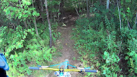
Photos of Claudie Mountain Bike
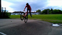
Videos of Claudie Mountain Bike
trail: Short But Sweet
0:42 |
573 |
Aug 19, 2013
trail: Charles
0:50 |
3639 |
Aug 18, 2011

trail: Charles
0:25 |
4755 |
Aug 10, 2011
Recent Trail Reports
| status | trail | date | condition | info | user |
|---|---|---|---|---|---|
| Nelly Knolly | May 25, 2025 @ 5:11am May 25, 2025 | Variable | ChrisNorfolk SJC | ||
| M&K | May 25, 2025 @ 5:11am May 25, 2025 | Variable | ChrisNorfolk SJC | ||
| M and K | May 25, 2025 @ 5:11am May 25, 2025 | Variable | ChrisNorfolk SJC | ||
| Hyper Extender | May 25, 2025 @ 5:11am May 25, 2025 | Variable | ChrisNorfolk SJC | ||
| Horse Trails No1 | May 25, 2025 @ 5:11am May 25, 2025 | Variable | ChrisNorfolk SJC | ||
| Double Track | May 25, 2025 @ 5:11am May 25, 2025 | Variable | ChrisNorfolk SJC | ||
| Double Track | May 25, 2025 @ 5:11am May 25, 2025 | Variable | ChrisNorfolk SJC | ||
| Charles | Feb 11, 2023 @ 8:18am Feb 11, 2023 | Dry | Stevejomo | ||
| D'under | Jun 12, 2022 @ 11:13am Jun 12, 2022 | Dry | jYYXeI | ||
| Connector - Rake Eater | Jul 22, 2019 @ 2:37pm Jul 22, 2019 | Dry | Bluebikebiker |
Activity Feed
| username | action | type | title | date |
|---|---|---|---|---|
| jessefromjupiter | wishlist | region | activity #94337025 | May 9, 2026 @ 7:19am May 9, 2026 |
| ChrisNorfolk | add | report | activity #72357342 and 6 more | May 25, 2025 @ 5:11am May 25, 2025 |
| trailforks | add | video | activity #57486159 | Aug 19, 2024 @ 11:17am Aug 19, 2024 |
| trailforks | add | video | activity #57475388 | Aug 19, 2024 @ 7:08am Aug 19, 2024 |
| ChrisNorfolk | update | region | activity #45072684 | Oct 10, 2023 @ 3:33am Oct 10, 2023 |
Recent Comments
| username | type | title | comment | date |
|---|---|---|---|---|
| trail | Very wet and muddy. Bugs were awful, started... | Jun 16, 2023 @ 4:25pm Jun 16, 2023 | ||
| trail | Trail restoration commenced today, May 2,... | May 2, 2021 @ 9:46am May 2, 2021 | ||
| trail | Trail restoration began today, May 2, 2021. ... | May 2, 2021 @ 9:45am May 2, 2021 | ||
| trail | O | Jul 19, 2020 @ 10:44am Jul 19, 2020 |
Nearby Areas
| name | distance | ||||
|---|---|---|---|---|---|
| Odell Park | 15 | 16 | 1 | 4.1 km | |
| Island View | 4 | 10 | 3 | 4.8 km | |
| Kingswood / Woodlot | 7 | 3 | 5.1 km | ||
| Killarney Lake | 11 | 1 | 1 | 5.3 km | |
| Tower Trails | 13 | 6.2 km |
Activity Type Stats
| activitytype | trails | distance | descent | descent distance | total vertical | rating | global rank | state rank | photos | reports | routes | ridelogs |
|---|---|---|---|---|---|---|---|---|---|---|---|---|
| Mountain Bike | 33 | 13 miles | 2,251 ft | 6 miles | 413 ft | #6,877 | #26 | 23 | 180 | 2 | 693 | |
| Hike | 33 | 12 miles | 2,142 ft | 5 miles | 413 ft | #9,486 | #23 | 178 | 26 | |||
| Trail Running | 33 | 12 miles | 2,142 ft | 5 miles | 413 ft | #8,536 | #19 | 1 | 178 | 44 |
Frequently Asked Questions About Claudie
▼
What are the highest rated mountain biking trails in Claudie?
The highest rated mountain biking trails in Claudie are:
- Thigh Master (4.1/5)
- Upper Subdivision (4.1/5)
- M and K (4/5)
- Charles (4/5)
- Horse Trails No1 (4/5)
▼
What is the best time of the year to ride in Claudie?
Based on ride log data, the most popular months to ride in Claudie are:
- August (6 activities)
- October (6 activities)
- July (6 activities)
▼
Where can I park to ride in Claudie?
There are 1 parking locations listed in Claudie. The most popular parking spots are:
▼
What is the longest trail in Claudie?
The longest trail in Claudie is Horse Trails No1 at 1.1 miles. View all trails sorted by distance.
Trails
Points of Interest
- By alexisberube RVC & contributors
- Admins: RVC
- #5692 - 10,780 views
- claudie activity log | embed map of Claudie mountain bike trails | claudie mountain biking points of interest
Downloading of trail gps tracks in kml & gpx formats is enabled for Claudie.
You must login to download files.