close
-
Layers w
- Weather Layers
- Pro
- Pro
- Pro
- Pro
- Pro
- Pro
- More Layers
- Pro
- Pro
- Pro
- Pro
-
Upgrade to

3D
Trail Conditions
- Unknown
- Snow Groomed
- Snow Packed
- Snow Covered
- Snow Cover Partial
- Freeze/thaw Cycle
- Icy
- Prevalent Mud
- Wet
- Variable
- Ideal
- Dry
- Very Dry
Trail Flow (Ridden Direction)
Trailforks scans users ridelogs to determine the most popular direction each trail is ridden. A good flowing trail network will have most trails flowing in a single direction according to their intension.
The colour categories are based on what percentage of riders are riding a trail in its intended direction.
The colour categories are based on what percentage of riders are riding a trail in its intended direction.
- > 96%
- > 90%
- > 80%
- > 70%
- > 50%
- < 50%
- bi-directional trail
- no data
Trail Last Ridden
Trailforks scans ridelogs to determine the last time a trail was ridden.
- < 2 days
- < 1 week
- < 2 weeks
- < 1 month
- < 6 months
- > 6 months
Trail Ridden Direction
The intended direction a trail should be ridden.
- Downhill Only
- Downhill Primary
- Both Directions
- Uphill Primary
- Uphill Only
- One Direction
Contribute Details
Colors indicate trail is missing specified detail.
- Description
- Photos
- Description & Photos
- Videos
Trail Popularity ?
Trailforks scans ridelogs to determine which trails are ridden the most in the last 9 months.
Trails are compared with nearby trails in the same city region with a possible 25 colour shades.
Think of this as a heatmap, more rides = more kinetic energy = warmer colors.
- most popular
- popular
- less popular
- not popular
ATV/ORV/OHV Filter
Max Vehicle Width
inches
US Cell Coverage
Legend

Radar Time
Activity Recordings
Trailforks uses anonymized public activity data.
?
Activity Recordings
Trailforks uses anonymized public activity data.
?
Personal Heatmap
▶
Activity Types
all
/
none
▶
Options
2
Date range
month
–
Winter Trails
Warning
A routing network for winter maps does not exist. Selecting trails using the winter trails layer has been disabled.
Missing Trails
Most Popular
Least Popular
Trails are colored based on popularity. The more popular a trail is, the more red. Less popular trails trend towards green.
Jump Magnitude Heatmap
Heatmap of where riders jump on trails. Zoom in to see individual jumps, click circles to view jump details.
BC Backroad Status
![map legend]()
Service Road Atlas is a free to use, community-driven service for viewing and creating reports on the numerous back-country service roads around B.C. and Alberta.

Slope Aspect
Direction the slope faces
Trails Deemphasized
Trails are shown in grey.
Only show trails with no bike usage.
Suggested Layers
Based on selected activity type
Save the current map location and zoom level as your default home location whenever this page is loaded.
SavePublic Park with a network of professionally built, all-weather trails. Opposite the National Cycling Centre.
Primary Trail Type: Cross-Country
Land Status: City Managed
Access Info:
National Cycling Centre.
This region uses the Uk/Euro style trail grading system.
Activities Click to view
- Mountain Bike
16 trails
- Hike
1 trails
- Trail Running
1 trails
Region Details
- 1
- 11
- 2
- 1
- 1
Region Status
Open as of Jun 30, 2025Stats
- Avg Trail Rating
- Trails (view details)
- 16
- Trails Mountain Bike
- 16
- Trails Hike
- 1
- Trails Trail Running
- 1
- Total Distance
- 4 miles
- Total Descent
- 479 ft
- Total Vertical
- 97 ft
- Highest Trailhead
- 295 ft
- Reports
- 52
- Photos
- 14
- Ridden Counter
- 1,590
Popular Clayton Vale Mountain Biking Trails
• 75 ★ 3.5 • 4,934 ft • 71 ft • 141 •
Popular blue difficulty singletrack. This mountain bike primary trail can be used one direction. Trail visibility is always easy to follow. On average it takes 9 minutes to complete this trail.
• 70 ★ 3.0 • 1,303 ft • 24 ft • 126 •
Popular green difficulty singletrack. This mountain bike primary trail. On average it takes 2 minutes to complete this trail.
• 80 ★ 3.0 • 1,365 ft • 10 ft • 117 •
Popular blue difficulty singletrack. This mountain bike primary trail can be used one direction. On average it takes 2 minutes to complete this trail.
• 85 ★ 3.0 • 463 ft • 23 ft • 117 •
Popular blue difficulty singletrack. This mountain bike primary trail can be used one direction. On average it takes minutes to complete this trail.
• 95 ★ 3.0 • 469 ft • 0 ft • 112 •
Popular black difficulty singletrack. This mountain bike primary trail can be used one direction. On average it takes minutes to complete this trail.
• 85 ★ 3.0 • 971 ft • 6 ft • 100 •
Popular red difficulty singletrack. This mountain bike primary trail can be used one direction. On average it takes 1 minutes to complete this trail.
• 50 ★ 3.0 • 2,116 ft • 59 ft • 87 •
Moderately popular blue difficulty singletrack. This mountain bike primary trail can be used one direction. On average it takes 3 minutes to complete this trail.
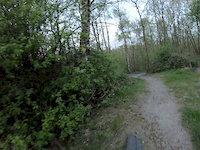
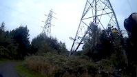
Photos of Clayton Vale Mountain Bike
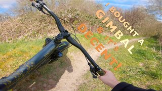
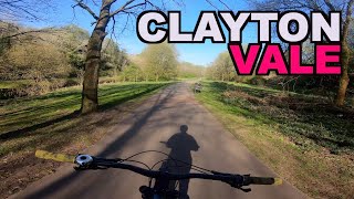
Videos of Clayton Vale Mountain Bike
0:58 |
193 |
Apr 18, 2019
3:48 |
310 |
Aug 2, 2016
8:45 |
674 |
Apr 15, 2020 , Manchester
4237 |
Apr 15, 2020 , Manchester
Recent Trail Reports
| status | trail | date | condition | info | user |
|---|---|---|---|---|---|
| Newton Heath Sidewinder First Descent | May 29, 2025 @ 1:54pm May 29, 2025 | Ideal | ElliottblwYe | ||
| Urban Red Rock-it Descent to Medlock | Mar 5, 2025 @ 4:52pm Mar 5, 2025 | Variable | JWXBO5 | ||
| Newton Heath Sidewinder Descent and Climb | Mar 5, 2025 @ 4:52pm Mar 5, 2025 | Variable | JWXBO5 | ||
| Clayton Vale Easy Rider Climb 2 | Mar 5, 2025 @ 4:52pm Mar 5, 2025 | Variable | JWXBO5 | ||
| Scorpions Tail | Feb 25, 2025 @ 12:56am Feb 25, 2025 | Dry | 7aeJZ | ||
| Newton Heath Sidewinder Outbound | Dec 9, 2024 @ 7:00am Dec 9, 2024 | Variable | 7aeJZ | ||
| Urban Red Rock-it Trail to split | Jul 5, 2021 @ 3:11pm Jul 5, 2021 | Wet | DirtyTrailRider | ||
| Newton Heath Sidewinder Short Climb | Jul 5, 2021 @ 3:08pm Jul 5, 2021 | Wet | DirtyTrailRider | ||
| Newton Heath Sidewinder Link | Jul 5, 2021 @ 3:08pm Jul 5, 2021 | Wet | DirtyTrailRider | ||
| Clayton Vale Easy Rider Velodrome Section | Jul 5, 2021 @ 3:06pm Jul 5, 2021 | Wet | DirtyTrailRider |
Activity Feed
| username | action | type | title | date |
|---|---|---|---|---|
| RyanD199 | wishlist | region | activity #92186562 | Apr 8, 2026 @ 8:34am Apr 8, 2026 |
| Nat1omvL0 | ridden | trail | activity #91694817 | Apr 1, 2026 @ 1:26am Apr 1, 2026 |
| DecQK7wVY | vote | trail | activity #80887221 | Sep 22, 2025 @ 5:11am Sep 22, 2025 |
| ElliottblwYe | add | photo | activity #72661415 and 6 more | May 29, 2025 @ 2:02pm May 29, 2025 |
| ElliottblwYe | checkin | trail | activity #72661069 and 5 more | May 29, 2025 @ 1:54pm May 29, 2025 |
Recent Comments
| username | type | title | comment | date |
|---|---|---|---|---|
| trail | Plenty of broken glass in random parts of the... | Oct 11, 2022 @ 5:11am Oct 11, 2022 | ||
| trail | Be careful on this section of the trail.... | Apr 21, 2020 @ 1:28am Apr 21, 2020 | ||
| trail | No sidewinder anymore,just straight line now | Jan 3, 2020 @ 5:01am Jan 3, 2020 |
Nearby Areas
| name | distance | ||||
|---|---|---|---|---|---|
| Philips Park | 9 | 6 km | |||
| Etherow Country Park | 1 | 7.8 km | |||
| Farmer Johns MTB Park | 7.8 km | ||||
| Roman Lakes | 5 | 8.9 km | |||
| Lyme Park | 1 | 2 | 11.3 km |
Activity Type Stats
| activitytype | trails | distance | descent | descent distance | total vertical | rating | global rank | state rank | photos | reports | routes | ridelogs |
|---|---|---|---|---|---|---|---|---|---|---|---|---|
| Mountain Bike | 16 | 4 miles | 479 ft | 2 miles | 98 ft | #10,472 | #368 | 7 | 52 | 4,079 | ||
| Hike | 1 | 1,302 ft | 20 ft | 364 ft | 16 ft | #11,720 | #336 | 43 | 68 | |||
| Trail Running | 1 | 1,302 ft | 20 ft | 364 ft | 16 ft | #10,715 | #314 | 43 | 67 |
Frequently Asked Questions About Clayton Vale
▼
What are the highest rated mountain biking trails in Clayton Vale?
The highest rated mountain biking trails in Clayton Vale are:
- Newton Heath Sidewinder Outbound (3.9/5)
- Clayton Vale Easy Rider Bypass (3.8/5)
- Newton Heath Sidewinder Short Climb (3.8/5)
- Newton Heath Sidewinder Link (3.8/5)
- Urban Red Rock-it Descent to Medlock (3.8/5)
▼
What is the best time of the year to ride in Clayton Vale?
Based on ride log data, the most popular months to ride in Clayton Vale are:
- July (17 activities)
- June (7 activities)
- May (5 activities)
▼
Where can I park to ride in Clayton Vale?
Check the Clayton Vale trail map for trailhead and parking information. Community members regularly update access and parking details for trails in the area.
▼
What is the longest trail in Clayton Vale?
The longest trail in Clayton Vale is Newton Heath Sidewinder Outbound at 4,934 ft. View all trails sorted by distance.
- By Architrail & contributors
- Admins: apply
- #8475 - 18,356 views
- clayton vale activity log | embed map of Clayton Vale mountain bike trails |
Downloading of trail gps tracks in kml & gpx formats is enabled for Clayton Vale.
You must login to download files.