close
-
Layers w
- Weather Layers
- Pro
- Pro
- Pro
- Pro
- Pro
- Pro
- More Layers
- Pro
- Pro
- Pro
- Pro
-
Upgrade to

3D
Trail Conditions
- Unknown
- Snow Groomed
- Snow Packed
- Snow Covered
- Snow Cover Partial
- Freeze/thaw Cycle
- Icy
- Prevalent Mud
- Wet
- Variable
- Ideal
- Dry
- Very Dry
Trail Flow (Ridden Direction)
Trailforks scans users ridelogs to determine the most popular direction each trail is ridden. A good flowing trail network will have most trails flowing in a single direction according to their intension.
The colour categories are based on what percentage of riders are riding a trail in its intended direction.
The colour categories are based on what percentage of riders are riding a trail in its intended direction.
- > 96%
- > 90%
- > 80%
- > 70%
- > 50%
- < 50%
- bi-directional trail
- no data
Trail Last Ridden
Trailforks scans ridelogs to determine the last time a trail was ridden.
- < 2 days
- < 1 week
- < 2 weeks
- < 1 month
- < 6 months
- > 6 months
Trail Ridden Direction
The intended direction a trail should be ridden.
- Downhill Only
- Downhill Primary
- Both Directions
- Uphill Primary
- Uphill Only
- One Direction
Contribute Details
Colors indicate trail is missing specified detail.
- Description
- Photos
- Description & Photos
- Videos
Trail Popularity ?
Trailforks scans ridelogs to determine which trails are ridden the most in the last 9 months.
Trails are compared with nearby trails in the same city region with a possible 25 colour shades.
Think of this as a heatmap, more rides = more kinetic energy = warmer colors.
- most popular
- popular
- less popular
- not popular
ATV/ORV/OHV Filter
Max Vehicle Width
inches
US Cell Coverage
Legend

Radar Time
Activity Recordings
Trailforks uses anonymized public activity data.
?
Activity Recordings
Trailforks uses anonymized public activity data.
?
Personal Heatmap
▶
Activity Types
all
/
none
▶
Options
2
Date range
month
–
Winter Trails
Warning
A routing network for winter maps does not exist. Selecting trails using the winter trails layer has been disabled.
Missing Trails
Most Popular
Least Popular
Trails are colored based on popularity. The more popular a trail is, the more red. Less popular trails trend towards green.
Jump Magnitude Heatmap
Heatmap of where riders jump on trails. Zoom in to see individual jumps, click circles to view jump details.
BC Backroad Status
![map legend]()
Service Road Atlas is a free to use, community-driven service for viewing and creating reports on the numerous back-country service roads around B.C. and Alberta.

Slope Aspect
Direction the slope faces
Trails Deemphasized
Trails are shown in grey.
Only show trails with no bike usage.
Suggested Layers
Based on selected activity type
Save the current map location and zoom level as your default home location whenever this page is loaded.
Save
No description for Clermont County has been added yet!
Login or register to submit one.
Activities Click to view
- Mountain Bike
57 trails
- E-Bike
39 trails
- Horse
37 trails
- Hike
99 trails
- Trail Running
99 trails
Region Details
- 34
- 13
- 7
- 2
Stats
- Avg Trail Rating
- Trails (view details)
- 100
- Trails Mountain Bike
- 57
- Trails E-Bike
- 39
- Trails Horse
- 37
- Trails Hike
- 99
- Trails Trail Running
- 99
- Total Distance
- 110 miles
- Total Descent
- 5,946 ft
- Total Vertical
- 428 ft
- Highest Trailhead
- 909 ft
- Reports
- 170
- Photos
- 44
- Ridden Counter
- 2,977
Sub Regions
- Batavia (6)
- Bethel (32)
- East Fork State Park (31)
- Edenton (2)
- Milford (21)
- Williamsburg (3)
Popular Clermont County Mountain Biking Trails
• 100 ★ 0.0 • 3 miles • 163 ft • 276 •
The has a bit more climbing with flowing corners and some semi- riding. You can access this loop directly from the off the gravel parking lot, off he or via the access trail out of the gravel lot.
• 100 ★ 4.0 • 4 miles • 62 ft • 223 •
Popular green difficulty paved path. This multi-use trail can be used both directions. On average it takes 17 minutes to complete this trail.
• 100 ★ 0.0 • 397 ft • 0 ft • 207 •
Popular green difficulty singletrack. This multi-use trail can be used both directions. On average it takes 1 minutes to complete this trail.
• 90 ★ 4.7 • 3 miles • 86 ft • 207 •
This is the easiest of the loops at East Fork designed to start building your MTB skills. It is relatively flat with only one or two semi- features.
• 95 ★ 3.5 • 1 mile • 64 ft • 197 •
is best suited to the advanced beginner that wants to practice log overs, creek crossing and have a little more climbing in your ride. It can be accessed from the Overlook Lot, Deer Run Lot or via the (P3, Tek Trail).
• 95 ★ 0.0 • 2 miles • 192 ft • 171 •
The has more features to practice your skills on with creek crossings, natural rideovers and rooty sections. It is also the connector between the Intermediate Trail (P2) and the Lakeside Trail. It can be accessed from the gravel lot via...
• 90 ★ 4.0 • 1 mile • 150 ft • 153 •
is the newest trail in the East Fork Trail system. This trail offers some of the more features at East Fork including skinnier trails, punchier climbs and narrow bridges and also includes the IMBA Trail Day section built by IMBA Trail...
• 80 ★ 0.0 • 1 mile • 48 ft • 72 •
Popular blue difficulty singletrack. This multi-use trail can be used both directions and has a moderate overall physical rating with a 48 ft blue climb. Trail visibility is always easy to follow. On average it takes 8 minutes to complete this trail.
Clermont County Mountain Bike Routes
6 miles • 319 ft • 2 •
Route includes almost all of Intermediate Loop, about half of the Technical Tail, all of the Lake Trail,...
10 miles • 469 ft • 5 •
Ameens route to knock out East Fork
• 16 miles • 1,329 ft • 11 •
• 12 miles • 950 ft • 6 •
• 10 miles • 820 ft • 6 •
• 13 miles • 1,208 ft • 6 •
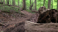
Photos of Clermont County Mountain Bike
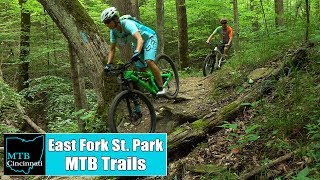
Videos of Clermont County Mountain Bike
trail: Technical Trail
0:08 |
|
Feb 14, 2021
1045 |
Jul 26, 2017
Recent Trail Reports
| status | trail | date | condition | info | user |
|---|---|---|---|---|---|
| Blue Heron Trail Stonelick State Park | May 3, 2026 @ 2:35pm (America/New_York) May 3, 2026 | Unknown | TravisXBluzv | ||
| Avoca Loop Milford | Oct 27, 2025 @ 10:51am (America/New_York) Oct 27, 2025 | Ideal | JDawg4K CORA | ||
| Technical Trail East Fork State Park | Sep 14, 2025 @ 7:19pm (America/New_York) Sep 14, 2025 | Dry | TP-MTBer | ||
| Lake Trail East Fork State Park | Aug 4, 2025 @ 5:46pm Aug 4, 2025 | Ideal | TP-MTBer | ||
| Intermediate Loop East Fork State Park | Jun 23, 2025 @ 3:24pm Jun 23, 2025 | Prevalent Mud | Mellowcat | ||
| NCT/BT - Steve Newman Worldwalker Perimeter Trail East Fork State Park | Sep 21, 2024 @ 1:06pm Sep 21, 2024 | Unknown | AmandaqTFyJY | ||
| Beach Trail East Fork State Park | Sep 1, 2024 @ 10:49am Sep 1, 2024 | Dry | TyeScott | ||
| Beginner Loop East Fork State Park | Aug 18, 2024 @ 10:00am Aug 18, 2024 | Variable | Mellowcat | ||
| Parking Area East Fork State Park | Jun 7, 2024 @ 4:16am Jun 7, 2024 | Variable | bgone | ||
| Little Miami Scenic Milford | May 5, 2024 @ 5:04am May 5, 2024 | Ideal | PONRoverlandA |
Activity Feed
| username | action | type | title | date |
|---|---|---|---|---|
| drdoogiehowsermtb | add | photo | activity #97050790 and 1 more | Jun 15, 2026 @ 10:24am Jun 15, 2026 |
| drdoogiehowsermtb | update | trail | activity #97050614 | Jun 15, 2026 @ 10:22am Jun 15, 2026 |
| update | event | activity #96756170 | Jun 11, 2026 @ 12:43pm Jun 11, 2026 | |
| update | event | activity #96753961 | Jun 11, 2026 @ 12:06pm Jun 11, 2026 | |
| Svcook | add | event | activity #96753948 | Jun 11, 2026 @ 12:06pm Jun 11, 2026 |
Recent Comments
| username | type | title | comment | date |
|---|---|---|---|---|
| trail | Muddy | Apr 27, 2024 @ 2:29pm Apr 27, 2024 | ||
| trail | Trail is hard to follow and overgrown. Not... | Sep 19, 2023 @ 4:57pm Sep 19, 2023 | ||
| trail | Super wet! Me and my some had to turn around.... | Jan 15, 2023 @ 7:18am Jan 15, 2023 | ||
| trail | Trail in okay condition. Some muddy spots... | Jun 3, 2020 @ 9:05am Jun 3, 2020 |
Local Badges
-

Descent 100k Badge1 awarded -

Climbing 10k Badge15 awarded -

Mountain Biking 100k Badge1 awarded -

Epic Ride Descent 2k1 awarded -

Descent 10k Badge15 awarded -

Big Ride 30k79 awarded
Activity Type Stats
| activitytype | trails | distance | descent | descent distance | total vertical | rating | global rank | state rank | photos | reports | routes | ridelogs |
|---|---|---|---|---|---|---|---|---|---|---|---|---|
| Mountain Bike | 57 | 67 miles | 2,956 ft | 20 miles | 427 ft | 39 | 169 | 2 | 6,810 | |||
| E-Bike | 39 | 37 miles | 1,289 ft | 10 miles | 413 ft | 150 | 45 | |||||
| Horse | 37 | 40 miles | 3,028 ft | 14 miles | 148 ft | 41 | ||||||
| Hike | 99 | 107 miles | 5,833 ft | 34 miles | 427 ft | 4 | 166 | 581 | ||||
| Trail Running | 99 | 107 miles | 5,833 ft | 34 miles | 427 ft | 1 | 166 | 691 |
Frequently Asked Questions About Clermont County
▼
What are the best places to ride in Clermont County?
Clermont County has 2 areas to explore for mountain biking. The top rated areas are:
▼
What are the highest rated mountain biking trails in Clermont County?
The highest rated mountain biking trails in Clermont County are:
- Beginner Loop (4.2/5)
- Beach Trail (4/5)
- Lake Trail (3.9/5)
- Intermediate Loop (0/5)
- Technical Trail (0/5)
▼
What is the best time of the year to ride in Clermont County?
Based on ride log data, the most popular months to ride in Clermont County are:
- July (37 activities)
- June (32 activities)
- September (24 activities)
▼
What is the longest trail in Clermont County?
The longest trail in Clermont County is NCT/BT- Steve Newman Worldwalker Perimeter Trail at 6.1 miles. View all trails sorted by distance.
Activities
Trails
Points of Interest
- By markholloway
 Trailforks Map Team & contributors
 - Admins: Chris-Campbell, CORA
- #23040 - 2,683 views
- clermont county activity log | embed map of Clermont County mountain bike trails | clermont county mountain biking points of interest
Downloading of trail gps tracks in kml & gpx formats is enabled for Clermont County.
You must login to download files.