close
-
Layers w
- Weather Layers
- Pro
- Pro
- Pro
- Pro
- Pro
- Pro
- More Layers
- Pro
- Pro
- Pro
- Pro
-
Upgrade to

3D
Trail Conditions
- Unknown
- Snow Groomed
- Snow Packed
- Snow Covered
- Snow Cover Partial
- Freeze/thaw Cycle
- Icy
- Prevalent Mud
- Wet
- Variable
- Ideal
- Dry
- Very Dry
Trail Flow (Ridden Direction)
Trailforks scans users ridelogs to determine the most popular direction each trail is ridden. A good flowing trail network will have most trails flowing in a single direction according to their intension.
The colour categories are based on what percentage of riders are riding a trail in its intended direction.
The colour categories are based on what percentage of riders are riding a trail in its intended direction.
- > 96%
- > 90%
- > 80%
- > 70%
- > 50%
- < 50%
- bi-directional trail
- no data
Trail Last Ridden
Trailforks scans ridelogs to determine the last time a trail was ridden.
- < 2 days
- < 1 week
- < 2 weeks
- < 1 month
- < 6 months
- > 6 months
Trail Ridden Direction
The intended direction a trail should be ridden.
- Downhill Only
- Downhill Primary
- Both Directions
- Uphill Primary
- Uphill Only
- One Direction
Contribute Details
Colors indicate trail is missing specified detail.
- Description
- Photos
- Description & Photos
- Videos
Trail Popularity ?
Trailforks scans ridelogs to determine which trails are ridden the most in the last 9 months.
Trails are compared with nearby trails in the same city region with a possible 25 colour shades.
Think of this as a heatmap, more rides = more kinetic energy = warmer colors.
- most popular
- popular
- less popular
- not popular
ATV/ORV/OHV Filter
Max Vehicle Width
inches
US Cell Coverage
Legend

Radar Time
Activity Recordings
Trailforks uses anonymized public activity data.
?
Activity Recordings
Trailforks uses anonymized public activity data.
?
Personal Heatmap
▶
Activity Types
all
/
none
▶
Options
2
Date range
month
–
Winter Trails
Warning
A routing network for winter maps does not exist. Selecting trails using the winter trails layer has been disabled.
Missing Trails
Most Popular
Least Popular
Trails are colored based on popularity. The more popular a trail is, the more red. Less popular trails trend towards green.
Jump Magnitude Heatmap
Heatmap of where riders jump on trails. Zoom in to see individual jumps, click circles to view jump details.
BC Backroad Status
![map legend]()
Service Road Atlas is a free to use, community-driven service for viewing and creating reports on the numerous back-country service roads around B.C. and Alberta.

Slope Aspect
Direction the slope faces
Trails Deemphasized
Trails are shown in grey.
Only show trails with no bike usage.
Suggested Layers
Based on selected activity type
Save the current map location and zoom level as your default home location whenever this page is loaded.
Save
No description for Cleveland has been added yet!
Login or register to submit one.
Activities Click to view
- Mountain Bike
37 trails
- E-Bike
24 trails
- Adaptive Bike
0 trails
- Horse
8 trails
- Hike
74 trails
- Trail Running
74 trails
Region Details
- 24
- 11
- 2
Region Status
Open as of Nov 8, 2025Stats
- Avg Trail Rating
- Trails (view details)
- 44
- Trails Mountain Bike
- 37
- Trails E-Bike
- 24
- Trails Horse
- 8
- Trails Hike
- 74
- Trails Trail Running
- 74
- Total Distance
- 30 miles
- Total Descent
- 1,259 ft
- Total Vertical
- 480 ft
- Highest Trailhead
- 1,056 ft
- Reports
- 94
- Photos
- 12
- Ridden Counter
- 1,701
Articles

Video: Taj Mehilich & The Fairdale Crew Ride Ray's Indoor Bike Park
Feb 16, 2025 from pinkbike.com
This just in, Pinkbike's resident Doodle Master Taj is still a steezy dude.
Sub Regions
-
Cleveland Lakefront Nature Preserve
- 1
-
Ohio & Erie Canal Reservation
- 2
- 2
-
Rocky River Reserve
-
West Creek Reservation
- 8
Popular Cleveland Mountain Biking Trails
• 75 ★ 4.0 • 2,139 ft • 26 ft • 167 •
Popular green difficulty singletrack. This mountain bike primary trail. On average it takes 10 minutes to complete this trail.
• 70 ★ 4.0 • 2 miles • 170 ft • 155 •
Popular blue difficulty singletrack. This mountain bike primary trail and has a moderate overall physical rating with a 170 ft green climb. It features jump, ladder bridge and wallride. Trail visibility is always easy to follow. On average it takes 15 minutes to complete this trail.
• 95 ★ 3.0 • 1 mile • 93 ft • 136 •
Popular green difficulty singletrack. This mountain bike primary trail. On average it takes 5 minutes to complete this trail.
• 100 ★ 4.0 • 3,274 ft • 56 ft • 135 •
Popular green difficulty singletrack. This mountain bike primary trail. On average it takes 3 minutes to complete this trail.
• 100 ★ 5.0 • 3,724 ft • 41 ft • 128 •
Popular green difficulty singletrack. This mountain bike primary trail. On average it takes 2 minutes to complete this trail.
• 95 ★ 3.5 • 2,031 ft • 101 ft • 117 •
Popular green difficulty singletrack. This mountain bike primary trail. On average it takes 2 minutes to complete this trail.
• 90 ★ 0.0 • 1,106 ft • 26 ft • 40 •
Popular green difficulty singletrack. This mountain bike primary trail.
• 75 ★ 0.0 • 1,444 ft • 8 ft • 27 •
Popular green difficulty singletrack. This multi-use trail can be used both directions.
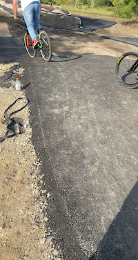
Photos of Cleveland Mountain Bike
Videos of Cleveland Mountain Bike
trail: Ohio & Erie Canal Towpath
0:05 |
69 |
Sep 18, 2022

3:06 |
17391 |
Nov 28, 2014

3:50 |
9153 |
Nov 25, 2014

5:05 |
6371 |
Nov 24, 2014
3:59 |
7278 |
Nov 24, 2014
4:52 |
7758 |
Nov 24, 2014

2:50 |
8238 |
Nov 24, 2014

3:26 |
7743 |
Nov 24, 2014
Recent Trail Reports
| status | trail | date | condition | info | user |
|---|---|---|---|---|---|
| Cleveland Foundation Centennial Trail | Nov 8, 2025 @ 11:21am (America/New_York) Nov 8, 2025 | Very Dry | prusek | ||
| Cleveland Foundation Centennial Trail | Nov 8, 2025 @ 11:21am (America/New_York) Nov 8, 2025 | Very Dry | prusek | ||
| Whisky Island Connector Trail | Nov 8, 2025 @ 11:21am (America/New_York) Nov 8, 2025 | Very Dry | prusek | ||
| Ohio & Erie Canal Towpath | Jul 23, 2025 @ 1:14pm Jul 23, 2025 | Dry | Leavellq35DUs | ||
| Center Loop | Jul 13, 2025 @ 6:34am Jul 13, 2025 | Dry | FunkBottomsGravel | ||
| Little Loop | Jul 13, 2025 @ 6:34am Jul 13, 2025 | Dry | FunkBottomsGravel | ||
| Gorge Loop | Jul 13, 2025 @ 6:34am Jul 13, 2025 | Dry | FunkBottomsGravel | ||
| Skinner's Run Trail | Jul 13, 2025 @ 6:34am Jul 13, 2025 | Very Dry | FunkBottomsGravel | ||
| Rocky River All Purpose Trail | May 11, 2025 @ 9:18am May 11, 2025 | Ideal | rgsilveira | ||
| Connector | Mar 14, 2025 @ 12:54pm Mar 14, 2025 | Ideal | Kchronister |
Activity Feed
| username | action | type | title | date |
|---|---|---|---|---|
| dustmuffins | add | trail | activity #95587018 | May 26, 2026 @ 1:30pm May 26, 2026 |
| aamcgee | wishlist | skillpark | activity #93508920 and 1 more | Apr 27, 2026 @ 4:32am Apr 27, 2026 |
| aamcgee | ridden | skillpark | activity #93508918 and 1 more | Apr 27, 2026 @ 4:32am Apr 27, 2026 |
| natescan | ridden | skillpark | activity #93236994 | Apr 23, 2026 @ 1:40pm Apr 23, 2026 |
| lmcmahon60393 | ridden | trail | activity #91616173 | Mar 30, 2026 @ 4:27pm Mar 30, 2026 |
Recent Comments
| username | type | title | comment | date |
|---|---|---|---|---|
| trail | Intense first quarter followed by a boring and... | Nov 7, 2022 @ 11:26am Nov 7, 2022 | ||
| trail | Very wet | Dec 22, 2019 @ 1:39pm Dec 22, 2019 |
Local Badges
-

Epic Mountain Bike Climb 2k0 awarded -

Climbing 10k Badge1 awarded -

Mountain Biking 100k Badge0 awarded -

Epic Ride Descent 2k0 awarded -

Descent 10k Badge1 awarded -

Descent 100k Badge0 awarded
Bike & Skill Parks
| name | type | city | rating |
|---|---|---|---|
| Ray's Indoor Bike Park - Cleveland | skill park | Cleveland | |
| Cliff's Bike Park | skill park | Cleveland |
Activity Type Stats
| activitytype | trails | distance | descent | descent distance | total vertical | rating | global rank | state rank | photos | reports | routes | ridelogs |
|---|---|---|---|---|---|---|---|---|---|---|---|---|
| Mountain Bike | 37 | 26 miles | 1,135 ft | 7 miles | 479 ft | #6,836 | #2,289 | 9 | 94 | 4,157 | ||
| E-Bike | 24 | 16 miles | 387 ft | 3 miles | 479 ft | #4,618 | #1,483 | 72 | 63 | |||
| Horse | 8 | #2,345 | #1,296 | 6 | ||||||||
| Hike | 74 | 30 miles | 1,260 ft | 8 miles | 479 ft | #4,364 | #1,535 | 94 | 268 | |||
| Trail Running | 74 | 30 miles | 1,260 ft | 8 miles | 479 ft | #4,446 | #1,360 | 94 | 178 |
Frequently Asked Questions About Cleveland
▼
What are the best places to ride in Cleveland?
Cleveland has 4 areas to explore for mountain biking. The top rated areas are:
▼
What are the highest rated mountain biking trails in Cleveland?
The highest rated mountain biking trails in Cleveland are:
- Gorge Loop (4.1/5)
- Steamboat Willie (Expert Loop) (4/5)
- Little Loop (4/5)
- Novice Loop (4/5)
- Gateway Trail (3.9/5)
▼
What is the best time of the year to ride in Cleveland?
Based on ride log data, the most popular months to ride in Cleveland are:
- April (14 activities)
- June (12 activities)
- May (11 activities)
▼
Where can I park to ride in Cleveland?
Activities
Trails
- By swampboy62 & contributors
- Admins: RAYS, CAMBA
- #6175 - 6,535 views
- cleveland activity log | embed map of Cleveland mountain bike trails | cleveland mountain biking points of interest
Downloading of trail gps tracks in kml & gpx formats is enabled for Cleveland.
You must login to download files.