close
-
Layers w
- Weather Layers
- Pro
- Pro
- Pro
- Pro
- Pro
- Pro
- More Layers
- Pro
- Pro
- Pro
- Pro
-
Upgrade to

3D
Trail Conditions
- Unknown
- Snow Groomed
- Snow Packed
- Snow Covered
- Snow Cover Partial
- Freeze/thaw Cycle
- Icy
- Prevalent Mud
- Wet
- Variable
- Ideal
- Dry
- Very Dry
Trail Flow (Ridden Direction)
Trailforks scans users ridelogs to determine the most popular direction each trail is ridden. A good flowing trail network will have most trails flowing in a single direction according to their intension.
The colour categories are based on what percentage of riders are riding a trail in its intended direction.
The colour categories are based on what percentage of riders are riding a trail in its intended direction.
- > 96%
- > 90%
- > 80%
- > 70%
- > 50%
- < 50%
- bi-directional trail
- no data
Trail Last Ridden
Trailforks scans ridelogs to determine the last time a trail was ridden.
- < 2 days
- < 1 week
- < 2 weeks
- < 1 month
- < 6 months
- > 6 months
Trail Ridden Direction
The intended direction a trail should be ridden.
- Downhill Only
- Downhill Primary
- Both Directions
- Uphill Primary
- Uphill Only
- One Direction
Contribute Details
Colors indicate trail is missing specified detail.
- Description
- Photos
- Description & Photos
- Videos
Trail Popularity ?
Trailforks scans ridelogs to determine which trails are ridden the most in the last 9 months.
Trails are compared with nearby trails in the same city region with a possible 25 colour shades.
Think of this as a heatmap, more rides = more kinetic energy = warmer colors.
- most popular
- popular
- less popular
- not popular
ATV/ORV/OHV Filter
Max Vehicle Width
inches
US Cell Coverage
Legend

Radar Time
Activity Recordings
Trailforks uses anonymized public activity data.
?
Activity Recordings
Trailforks uses anonymized public activity data.
?
Personal Heatmap
▶
Activity Types
all
/
none
▶
Options
2
Date range
month
–
Winter Trails
Warning
A routing network for winter maps does not exist. Selecting trails using the winter trails layer has been disabled.
Missing Trails
Most Popular
Least Popular
Trails are colored based on popularity. The more popular a trail is, the more red. Less popular trails trend towards green.
Jump Magnitude Heatmap
Heatmap of where riders jump on trails. Zoom in to see individual jumps, click circles to view jump details.
BC Backroad Status
![map legend]()
Service Road Atlas is a free to use, community-driven service for viewing and creating reports on the numerous back-country service roads around B.C. and Alberta.

Slope Aspect
Direction the slope faces
Trails Deemphasized
Trails are shown in grey.
Only show trails with no bike usage.
Suggested Layers
Based on selected activity type
Save the current map location and zoom level as your default home location whenever this page is loaded.
SaveThe natural surface trail system in this park consists of two trails suitable for all levels of biking and hiking. The park is named for the extensive cave off the road near the bottom of the hill.
The Spring Valley Trail is on the west side of the park and the Bluff Trail on the east side. Trail heads for both are accessed from the paved trail. There are two parking lots to access the paved trail system.
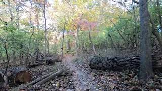
Spring Valley Trail (3.75 miles) consists of two loops, an outer one, and an inner one contained within. Both are tied together via three short connector trails. The loops vary from tight and twisty to open and flowing as they weave in and out of the many sinkholes in the area. Both loops are mostly packed dirt. While not technical, the trail design offers riding suitable for beginner as well as advanced riders.
To get to the trail head, take the paved trail, and climb up the switchbacks from the lower parking lot. From the upper parking lot, ride down the paved trail and cross the bridge, then climb up the switchbacks.
Bluff Trail (2.0 miles) offers the best technical features for the advanced rider. The trail now makes use of a previously unused section of the park from the main parking lot to just west of the overlook. It then heads down through four switchback turns followed by several technical rock gardens. The trail then transitions back to mostly packed dirt as it winds its way back up to the overlook. The newly built overlook has a beautiful view of the Mississippi River Valley. In the winter months keep an eye out for Bald Eagles.
The paved trail system offers an enjoyable place to ride when the natural trails are too wet for use. It consists of the 5 mile Mississippi River Trail loop as well as a 1.5 mile connector trail that climbs up three switch backs and connects with the bike lane on Telegraph Road. Another 1 mile spur trail climbs up to the overlook and on to the upper parking lot.
The park occupies 525 acres that include a flood plain wetland area, heavily wooded forest with a variety of old growth trees such as the Shag Bark Hickory, a picnic shelter and scenic river overlook. This area is geologically known as a Karst Plain- an area consisting of caves, sinkholes and springs formed from the dissolution of layers of bedrock. The many sinkholes provide a haven for a variety of wildlife including wild turkey, fox, rabbits, squirrel, deer and raccoon.
The trails are open to equestrians, hikers and mountain bikes. Please observe proper trail etiquette when using these trails.
The Spring Valley Trail is on the west side of the park and the Bluff Trail on the east side. Trail heads for both are accessed from the paved trail. There are two parking lots to access the paved trail system.
Spring Valley Trail (3.75 miles) consists of two loops, an outer one, and an inner one contained within. Both are tied together via three short connector trails. The loops vary from tight and twisty to open and flowing as they weave in and out of the many sinkholes in the area. Both loops are mostly packed dirt. While not technical, the trail design offers riding suitable for beginner as well as advanced riders.
To get to the trail head, take the paved trail, and climb up the switchbacks from the lower parking lot. From the upper parking lot, ride down the paved trail and cross the bridge, then climb up the switchbacks.
Bluff Trail (2.0 miles) offers the best technical features for the advanced rider. The trail now makes use of a previously unused section of the park from the main parking lot to just west of the overlook. It then heads down through four switchback turns followed by several technical rock gardens. The trail then transitions back to mostly packed dirt as it winds its way back up to the overlook. The newly built overlook has a beautiful view of the Mississippi River Valley. In the winter months keep an eye out for Bald Eagles.
The paved trail system offers an enjoyable place to ride when the natural trails are too wet for use. It consists of the 5 mile Mississippi River Trail loop as well as a 1.5 mile connector trail that climbs up three switch backs and connects with the bike lane on Telegraph Road. Another 1 mile spur trail climbs up to the overlook and on to the upper parking lot.
The park occupies 525 acres that include a flood plain wetland area, heavily wooded forest with a variety of old growth trees such as the Shag Bark Hickory, a picnic shelter and scenic river overlook. This area is geologically known as a Karst Plain- an area consisting of caves, sinkholes and springs formed from the dissolution of layers of bedrock. The many sinkholes provide a haven for a variety of wildlife including wild turkey, fox, rabbits, squirrel, deer and raccoon.
The trails are open to equestrians, hikers and mountain bikes. Please observe proper trail etiquette when using these trails.
source: Cliff Cave Park
Primary Trail Type: Cross-Country
Land Status: Municipal Park
 google parking directions
 Access Info:
Cliff Cave Park is located on the banks of the Mississippi River in South St. Louis County. Take I-255 to Telegraph road. Go south on Telegraph 1.7 miles to Cliff Cave road. Go left on Cliff Cave road and continue approx. 1 mile into park.
Links
Activities Click to view
- Mountain Bike
13 trails
- Hike
14 trails
- Trail Running
14 trails
Region Details
- 4
- 6
- 1
- 2
Region Status
Open as of Oct 16, 2025Stats
- Avg Trail Rating
- Trails (view details)
- 13
- Trails Mountain Bike
- 14
- Trails E-Bike
- 3
- Trails Horse
- 1
- Trails Hike
- 14
- Trails Trail Running
- 14
- Total Distance
- 12 miles
- Total Descent
- 1,060 ft
- Total Vertical
- 235 ft
- Highest Trailhead
- 639 ft
- Reports
- 809
- Photos
- 23
- Ridden Counter
- 3,041
Popular Cliff Cave Mountain Biking Trails
• 100 ★ 4.5 • 5,033 ft • 55 ft • 368 •
The trail now makes use of a previously unused section of the park from the main parking lot to just west of the overlook. At the South end of the trail, there is a short downhill flow/pump track with berm switchbacks and small jumps....
• 95 ★ 0.0 • 2,838 ft • 68 ft • 289 •
Popular blue difficulty singletrack. This mountain bike primary trail can be used both directions. It features jump. On average it takes 5 minutes to complete this trail.
• 95 ★ 4.0 • 5,135 ft • 79 ft • 269 •
This trail offers the best technical features for the advanced rider. It heads down through four switchback turns followed by several technical rock gardens. The trail then transitions back to mostly packed dirt as it winds its way back...
• 90 ★ 4.4 • 1,325 ft • 56 ft • 269 •
Popular white difficulty paved path. This multi-use trail can be used both directions and has a easy overall physical rating with a 56 ft green climb. On average it takes 1 minutes to complete this trail.
• 95 ★ 4.0 • 1 mile • 121 ft • 248 •
Popular green difficulty singletrack. This mountain bike primary trail can be used both directions and has a easy overall physical rating with a 121 ft green climb. On average it takes 7 minutes to complete this trail.
• 85 ★ 1.0 • 259 ft • 0 ft • 239 •
Popular green difficulty singletrack. This mountain bike primary trail can be used downhill primary and has a easy overall physical rating with a 0 ft green climb. On average it takes minutes to complete this trail.
• 80 ★ 3.0 • 1,501 ft • 12 ft • 236 •
Popular white difficulty paved path. This multi-use trail can be used both directions and has a easy overall physical rating with a 12 ft green climb. Trail visibility is always easy to follow. On average it takes 2 minutes to complete this trail.
• 95 ★ 4.0 • 511 ft • 14 ft • 234 •
Popular green difficulty singletrack. This mountain bike primary trail can be used both directions and has a easy overall physical rating with a 14 ft green climb. On average it takes minutes to complete this trail.
Photos of Cliff Cave Mountain Bike
Videos of Cliff Cave Mountain Bike
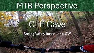
trail: Spring Valley (Inner Loop)
7:14 |
50 |
Nov 5, 2025 , St. Louis

trail: Spring Valley (Inner Loop)
22:56 |
402 |
Jun 9, 2020 , St. Louis
trail: Spring Valley (Outer Loop)
22:56 |
621 |
Jun 9, 2020 , St. Louis
Recent Trail Reports
| status | trail | date | condition | info | user |
|---|---|---|---|---|---|
| Spring Valley Connector | Oct 16, 2025 @ 10:34am (America/Indiana/Vincennes) Oct 16, 2025 | Very Dry | MojoeMurphy | ||
| Bluff Trail - South Loop | Oct 16, 2025 @ 10:34am (America/Indiana/Vincennes) Oct 16, 2025 | Very Dry | MojoeMurphy | ||
| Bluff Trail - North | Oct 16, 2025 @ 10:34am (America/Indiana/Vincennes) Oct 16, 2025 | Very Dry | MojoeMurphy | ||
| Bluff Connector | Oct 16, 2025 @ 10:34am (America/Indiana/Vincennes) Oct 16, 2025 | Very Dry | MojoeMurphy | ||
| Spring Valley (Inner Loop) | Oct 16, 2025 @ 10:34am (America/Indiana/Vincennes) Oct 16, 2025 | Very Dry | MojoeMurphy | ||
| Spring Valley (Outer Loop) | Oct 16, 2025 @ 10:34am (America/Indiana/Vincennes) Oct 16, 2025 | Very Dry | MojoeMurphy | ||
| Inner Loop Connector 1 | Sep 2, 2025 @ 1:03pm Sep 2, 2025 | Very Dry | bmcclure17 | ||
| Inner Loop Connector 2 | May 24, 2025 @ 3:47pm May 24, 2025 | Variable | brueggn | ||
| Overlook Connector | May 20, 2024 @ 12:34am May 20, 2024 | Ideal | jalb15 | ||
| Mississippi River Trail | Feb 4, 2024 @ 10:55am Feb 4, 2024 | Wet | Knelson330 |
Activity Feed
| username | action | type | title | date |
|---|---|---|---|---|
| DylanZ3Szaf | ridden | trail | activity #93056283 | Apr 20, 2026 @ 7:01pm Apr 20, 2026 |
| StarsNStripes77 | ridden | trail | activity #92556829 | Apr 13, 2026 @ 1:54pm Apr 13, 2026 |
| Kcampeau | ridden | trail | activity #92057102 and 1 more | Apr 6, 2026 @ 8:51am Apr 6, 2026 |
| jaormsby | wishlist | trail | activity #91552830 | Mar 29, 2026 @ 2:28pm Mar 29, 2026 |
| mtb-perspective | add | video | activity #83630107 | Nov 5, 2025 @ 11:11am Nov 5, 2025 |
Recent Comments
| username | type | title | comment | date |
|---|---|---|---|---|
| trail | Very fun addition to Cliff Cave. You can tell... | Aug 27, 2022 @ 2:03am Aug 27, 2022 | ||
| trail | Awesome flowy descent starting from the top... | Aug 19, 2022 @ 12:40pm Aug 19, 2022 | ||
| trail | The last 0.6 miles are less techy, with more... | Aug 19, 2022 @ 12:39pm Aug 19, 2022 | ||
| trail | The first 0.4 miles are super chunky and... | Aug 19, 2022 @ 12:38pm Aug 19, 2022 | ||
| trail | Great natural flow, nice berms. Very lap-able,... | Aug 19, 2022 @ 12:36pm Aug 19, 2022 |
Nearby Areas
| name | distance | ||||
|---|---|---|---|---|---|
| St. Louis Bike Park | 5.2 km | ||||
| Carondelet Park | 7.5 km | ||||
| Meramec Levee Recreational Park | 1 | 11.9 km | |||
| Castlewood State Park | 7 | 7 | 1 | 14.9 km | |
| Queeny Park | 4 | 15.1 km |
Activity Type Stats
| activitytype | trails | distance | descent | descent distance | total vertical | rating | global rank | state rank | photos | reports | routes | ridelogs |
|---|---|---|---|---|---|---|---|---|---|---|---|---|
| Mountain Bike | 13 | 12 miles | 1,060 ft | 6 miles | 236 ft | #4,874 | #1,754 | 23 | 842 | 4,641 | ||
| E-Bike | 3 | 2 miles | 157 ft | 4,318 ft | 82 ft | 802 | 102 | |||||
| Horse | 1 | 5,033 ft | 72 ft | 1,716 ft | 46 ft | 701 | ||||||
| Hike | 14 | 12 miles | 1,060 ft | 6 miles | 236 ft | #11,356 | #4,574 | 839 | 67 | |||
| Trail Running | 14 | 12 miles | 1,060 ft | 6 miles | 236 ft | #10,271 | #3,812 | 1 | 839 | 155 |
Frequently Asked Questions About Cliff Cave
▼
What are the highest rated mountain biking trails in Cliff Cave?
The highest rated mountain biking trails in Cliff Cave are:
- Bluff Trail - North (4.3/5)
- Bluff Connector (4.1/5)
- Spring Valley (Outer Loop) (4.1/5)
- Spring Valley (Inner Loop) (4/5)
- Bluff Trail - South Loop (4/5)
▼
What is the best time of the year to ride in Cliff Cave?
Based on ride log data, the most popular months to ride in Cliff Cave are:
- July (66 activities)
- August (52 activities)
- June (48 activities)
▼
Where can I park to ride in Cliff Cave?
There are 3 parking locations listed in Cliff Cave. The most popular parking spots are: View all parking and trailhead locations on the map to plan your visit.
▼
What is the longest trail in Cliff Cave?
The longest trail in Cliff Cave is Mississippi River Trail at 4.5 miles. View all trails sorted by distance.
Activities
Trails
Points of Interest
- By pilznr
 GORC & contributors
 - Admins: GORC
- #10238 - 9,514 views
- cliff cave activity log | embed map of Cliff Cave mountain bike trails | cliff cave mountain biking points of interest
Downloading of trail gps tracks in kml & gpx formats is enabled for Cliff Cave.
You must login to download files.