close
-
Layers w
- Weather Layers
- Pro
- Pro
- Pro
- Pro
- Pro
- Pro
- More Layers
- Pro
- Pro
- Pro
- Pro
-
Upgrade to

3D
Trail Conditions
- Unknown
- Snow Groomed
- Snow Packed
- Snow Covered
- Snow Cover Partial
- Freeze/thaw Cycle
- Icy
- Prevalent Mud
- Wet
- Variable
- Ideal
- Dry
- Very Dry
Trail Flow (Ridden Direction)
Trailforks scans users ridelogs to determine the most popular direction each trail is ridden. A good flowing trail network will have most trails flowing in a single direction according to their intension.
The colour categories are based on what percentage of riders are riding a trail in its intended direction.
The colour categories are based on what percentage of riders are riding a trail in its intended direction.
- > 96%
- > 90%
- > 80%
- > 70%
- > 50%
- < 50%
- bi-directional trail
- no data
Trail Last Ridden
Trailforks scans ridelogs to determine the last time a trail was ridden.
- < 2 days
- < 1 week
- < 2 weeks
- < 1 month
- < 6 months
- > 6 months
Trail Ridden Direction
The intended direction a trail should be ridden.
- Downhill Only
- Downhill Primary
- Both Directions
- Uphill Primary
- Uphill Only
- One Direction
Contribute Details
Colors indicate trail is missing specified detail.
- Description
- Photos
- Description & Photos
- Videos
Trail Popularity ?
Trailforks scans ridelogs to determine which trails are ridden the most in the last 9 months.
Trails are compared with nearby trails in the same city region with a possible 25 colour shades.
Think of this as a heatmap, more rides = more kinetic energy = warmer colors.
- most popular
- popular
- less popular
- not popular
ATV/ORV/OHV Filter
Max Vehicle Width
inches
US Cell Coverage
Legend

Radar Time
Activity Recordings
Trailforks uses anonymized public activity data.
?
Activity Recordings
Trailforks uses anonymized public activity data.
?
Personal Heatmap
▶
Activity Types
all
/
none
▶
Options
2
Date range
month
–
Winter Trails
Warning
A routing network for winter maps does not exist. Selecting trails using the winter trails layer has been disabled.
Missing Trails
Most Popular
Least Popular
Trails are colored based on popularity. The more popular a trail is, the more red. Less popular trails trend towards green.
Jump Magnitude Heatmap
Heatmap of where riders jump on trails. Zoom in to see individual jumps, click circles to view jump details.
BC Backroad Status
![map legend]()
Service Road Atlas is a free to use, community-driven service for viewing and creating reports on the numerous back-country service roads around B.C. and Alberta.

Slope Aspect
Direction the slope faces
Trails Deemphasized
Trails are shown in grey.
Only show trails with no bike usage.
Suggested Layers
Based on selected activity type
Save the current map location and zoom level as your default home location whenever this page is loaded.
Save
No description for Collegeville has been added yet!
Login or register to submit one.
Activities Click to view
- Mountain Bike
61 trails
- E-Bike
61 trails
- Gravel Bike
0 trails
- Adaptive Bike
0 trails
- Winter Fat Bike
0 trails
- Horse
1 trails
- Hike
71 trails
- Trail Running
71 trails
- Nordic Ski
8 trails
Region Details
- 12
- 2
- 10
- 18
- 11
Region Status
Open as of Jun 21, 2026Stats
- Avg Trail Rating
- Trails (view details)
- 60
- Trails Mountain Bike
- 69
- Trails E-Bike
- 61
- Trails Horse
- 1
- Trails Hike
- 71
- Trails Trail Running
- 71
- Trails Nordic Ski
- 8
- Total Distance
- 63 miles
- Total Descent
- 5,193 ft
- Total Vertical
- 390 ft
- Highest Trailhead
- 441 ft
- Reports
- 633
- Photos
- 122
- Ridden Counter
- 10,714
Sub Regions
-
Black Rock
- 1
- 1
- 5
- 3
-
Evansburg State Park
- 1
- 7
- 10
- 6
Popular Collegeville Mountain Biking Trails
• 100 ★ 4.0 • 2 miles • 85 ft • 404 •
Popular green difficulty singletrack. This mountain bike primary trail can be used both directions and has a easy overall physical rating with a 85 ft green climb. On average it takes 8 minutes to complete this trail.
• 95 ★ 5.0 • 446 ft • 0 ft • 318 •
Connect portion of to , with a couple of features. If you start from the intersection of and , you get a gap jump, a root jump, a big dugout to hip jump, some berms and a drop and a couple more berms before you cross , which you can...
• 65 ★ 4.0 • 2,743 ft • 35 ft • 211 •
WARNING: At the bottom of the trail right where the trail starts to curve towards the creek. There is one GIANT drop in. It is actually 2 drops. 1 quick one and then 1 bigger one right after. Be very careful in this area.
• 55 ★ 4.0 • 1 mile • 193 ft • 210 •
This trail is off-camber and most of it has a very steep exposure.
• 100 ★ 4.0 • 554 ft • 0 ft • 207 •
Quick connector from to , running through old Ranger Station
• 85 ★ 5.0 • 1 mile • 178 ft • 193 •
Popular blue difficulty singletrack. This multi-use trail can be used both directions and has a moderate overall physical rating with a 178 ft blue climb. It features jump, ladder bridge and rock garden. On average it takes 32 minutes to complete this trail.
• 95 ★ 4.0 • 1,503 ft • 168 ft • 187 •
Broken up tarmac end of . Often washed out, but usually passable.
• 70 ★ 4.0 • 1,959 ft • 71 ft • 180 •
Downhill run from top of Red, across White, and back up to the White/Red/Yellow Intersection. RIght fork towads the bottom provide a little less descent, but an easier climb (switchbacks)
Collegeville Mountain Bike Routes
7 miles • 1,177 ft • 22 • Out & Back •
This is a fun way to work your way across the hill and back, starting from the Ridge Pike Lot, all the way...
★ 5.0 • 2,854 ft • 115 ft • 0 •
This trail has starts off with a few turn that a jump over a log. Than there is a tree down that must be...
★ 5.0 • 2 miles • 298 ft • 0 •
★ 3.0 • 2 miles • 212 ft • 0 •
Photos of Collegeville Mountain Bike
Videos of Collegeville Mountain Bike
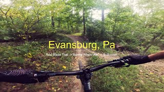
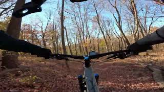
trail: Red Blaze Trail
0:03 |
|
Oct 2, 2020

2:33 |
96 |
Sep 5, 2025
0:18 |
66 |
Sep 5, 2025
0:48 |
63 |
Sep 5, 2025
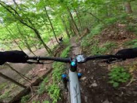
trail: Rooty
97 |
Jun 18, 2025 , Collegeville
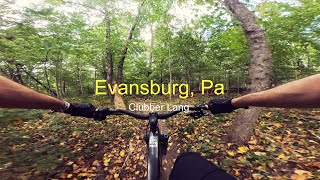
trail: Clubber Lang
0:13 |
206 |
Nov 13, 2024 , Collegeville
youtuber
![Evansburg State Park]()
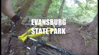
trail: Six Pack Alternate
13:02 |
477 |
Jan 23, 2019 , Collegeville
Current Trail Warnings
| status | trail | date | condition | user | info |
|---|---|---|---|---|---|
| PICTA Trail | Jun 16, 2026 @ 9:54am (America/New_York) Jun 16, 2026 | Unknown | TZxR84 | E-Bike This should not be green color, but... |
Recent Trail Reports
| status | trail | date | condition | info | user |
|---|---|---|---|---|---|
| Nature Trail Loop | Jun 21, 2026 @ 3:10pm (America/New_York) Jun 21, 2026 | Snow Packed | ChrisMann3vL | ||
| French Creek Trail | Jun 14, 2026 @ 7:52am (America/New_York) Jun 14, 2026 | Ideal | fmagic | ||
| Six Pack | Jun 4, 2026 @ 7:38pm (America/New_York) Jun 4, 2026 | Dry | Jaeheme ETW | ||
| Boobie Trail | Jun 3, 2026 @ 6:46pm (America/New_York) Jun 3, 2026 | Dry | Jaeheme ETW | ||
| The Blackhated Bandit | Jun 3, 2026 @ 6:10pm (America/New_York) Jun 3, 2026 | Unknown | Jaeheme ETW | ||
| Down from 29 | May 18, 2026 @ 11:08am (America/New_York) May 18, 2026 | Variable | Mikeoj7miO | ||
| Perkiomen Trail | May 11, 2026 @ 6:06pm (America/New_York) May 11, 2026 | Ideal | fmagic | ||
| Yellow Ruins | Apr 24, 2026 @ 4:56pm (America/New_York) Apr 24, 2026 | Unknown | Jaeheme ETW | ||
| Rooty | Apr 18, 2026 @ 1:46pm (America/New_York) Apr 18, 2026 | Dry | chriscrisp | ||
| Clubber Lang | Apr 18, 2026 @ 1:46pm (America/New_York) Apr 18, 2026 | Dry | chriscrisp |
Activity Feed
| username | action | type | title | date |
|---|---|---|---|---|
| ChrisMann3vL | add | report | activity #97508824 | Jun 21, 2026 @ 12:10pm Jun 21, 2026 |
| PatrickEisen | wishlist | trail | activity #97273220 | Jun 18, 2026 @ 1:28pm Jun 18, 2026 |
| Philliesnine77 | wishlist | region | activity #97250024 | Jun 18, 2026 @ 7:15am Jun 18, 2026 |
| TZxR84 | add | report | activity #97106564 | Jun 16, 2026 @ 6:54am Jun 16, 2026 |
| TZxR84 | add | photo | activity #97106491 | Jun 16, 2026 @ 6:53am Jun 16, 2026 |
Recent Comments
| username | type | title | comment | date |
|---|---|---|---|---|
| trail | Tree fell down blocking it | May 25, 2026 @ 3:35pm May 25, 2026 | ||
| trail | Good point Andrew. If you zoom in on the map... | May 14, 2026 @ 7:46am May 14, 2026 | ||
| trail | The bottom section of this trail is insanely... | May 13, 2026 @ 4:47pm May 13, 2026 | ||
| trail | Great suggestion! | Jan 3, 2026 @ 10:54am Jan 3, 2026 | ||
| report | Thank Justin! This one is next on my list! | Jan 2, 2026 @ 12:57pm Jan 2, 2026 |
Local Badges
-

Newbie23 awarded -

10 Blue Trails131 awarded -

Epic Ride Climb 2k17 awarded -

Climbing 10k Badge81 awarded -

Climbing 100k Badge2 awarded -

Epic Ride Descent 2k16 awarded
Activity Type Stats
| activitytype | trails | distance | descent | descent distance | total vertical | rating | global rank | state rank | photos | reports | routes | ridelogs |
|---|---|---|---|---|---|---|---|---|---|---|---|---|
| Mountain Bike | 61 | 57 miles | 4,859 ft | 24 miles | 390 ft | #1,456 | #548 | 121 | 640 | 4 | 17,507 | |
| E-Bike | 61 | 56 miles | 4,839 ft | 24 miles | 390 ft | #2,678 | #1,051 | 2 | 526 | 2 | 678 | |
| Horse | 1 | 2 miles | 144 ft | 5,157 ft | 33 ft | #3,390 | #1,958 | 86 | 1 | |||
| Hike | 71 | 61 miles | 4,560 ft | 25 miles | 371 ft | #4,079 | #1,443 | 611 | 1 | 480 | ||
| Trail Running | 71 | 61 miles | 4,560 ft | 25 miles | 371 ft | #3,619 | #1,076 | 611 | 1 | 599 | ||
| Nordic Ski | 8 | 3 miles | 335 ft | 1 mile | 348 ft | #1,753 | #908 | 60 | 61 |
Frequently Asked Questions About Collegeville
▼
What are the best places to ride in Collegeville?
Collegeville has 2 areas to explore for mountain biking. The top rated areas are:
▼
What are the highest rated mountain biking trails in Collegeville?
The highest rated mountain biking trails in Collegeville are:
- Red Blaze Trail (4.4/5)
- Bermy When Wet (4.2/5)
- Rooty (4.2/5)
- Steep AF (4.2/5)
- Down from 29 (4.2/5)
▼
What is the best time of the year to ride in Collegeville?
Based on ride log data, the most popular months to ride in Collegeville are:
- September (79 activities)
- June (73 activities)
- July (72 activities)
▼
Where can I park to ride in Collegeville?
There are 16 parking locations listed in Collegeville. The most popular parking spots are:
- Schuykill River Canal Trail Parking Lot
- Lock 60 Parking Lot
- Collegeville Trailhead Parking Lot
- Upper Schuylkill Valley Park
- Parking
Activities
Trails
Points of Interest
- By smokefish17 & contributors
- Admins: Jimwynne, brettpalumbo
- #12562 - 3,603 views
- collegeville activity log | embed map of Collegeville mountain bike trails | collegeville mountain biking points of interest
Downloading of trail gps tracks in kml & gpx formats is enabled for Collegeville.
You must login to download files.