close
-
Layers w
- Weather Layers
- Pro
- Pro
- Pro
- Pro
- Pro
- Pro
- More Layers
- Pro
- Pro
- Pro
- Pro
-
Upgrade to

3D
Trail Conditions
- Unknown
- Snow Groomed
- Snow Packed
- Snow Covered
- Snow Cover Partial
- Freeze/thaw Cycle
- Icy
- Prevalent Mud
- Wet
- Variable
- Ideal
- Dry
- Very Dry
Trail Flow (Ridden Direction)
Trailforks scans users ridelogs to determine the most popular direction each trail is ridden. A good flowing trail network will have most trails flowing in a single direction according to their intension.
The colour categories are based on what percentage of riders are riding a trail in its intended direction.
The colour categories are based on what percentage of riders are riding a trail in its intended direction.
- > 96%
- > 90%
- > 80%
- > 70%
- > 50%
- < 50%
- bi-directional trail
- no data
Trail Last Ridden
Trailforks scans ridelogs to determine the last time a trail was ridden.
- < 2 days
- < 1 week
- < 2 weeks
- < 1 month
- < 6 months
- > 6 months
Trail Ridden Direction
The intended direction a trail should be ridden.
- Downhill Only
- Downhill Primary
- Both Directions
- Uphill Primary
- Uphill Only
- One Direction
Contribute Details
Colors indicate trail is missing specified detail.
- Description
- Photos
- Description & Photos
- Videos
Trail Popularity ?
Trailforks scans ridelogs to determine which trails are ridden the most in the last 9 months.
Trails are compared with nearby trails in the same city region with a possible 25 colour shades.
Think of this as a heatmap, more rides = more kinetic energy = warmer colors.
- most popular
- popular
- less popular
- not popular
ATV/ORV/OHV Filter
Max Vehicle Width
inches
US Cell Coverage
Legend

Radar Time
Activity Recordings
Trailforks uses anonymized public activity data.
?
Activity Recordings
Trailforks uses anonymized public activity data.
?
Personal Heatmap
▶
Activity Types
all
/
none
▶
Options
2
Date range
month
–
Winter Trails
Warning
A routing network for winter maps does not exist. Selecting trails using the winter trails layer has been disabled.
Missing Trails
Most Popular
Least Popular
Trails are colored based on popularity. The more popular a trail is, the more red. Less popular trails trend towards green.
Jump Magnitude Heatmap
Heatmap of where riders jump on trails. Zoom in to see individual jumps, click circles to view jump details.
BC Backroad Status
![map legend]()
Service Road Atlas is a free to use, community-driven service for viewing and creating reports on the numerous back-country service roads around B.C. and Alberta.

Slope Aspect
Direction the slope faces
Trails Deemphasized
Trails are shown in grey.
Only show trails with no bike usage.
Suggested Layers
Based on selected activity type
Save the current map location and zoom level as your default home location whenever this page is loaded.
SaveEnglish Version Below
Collserola consta de territorios de 9 municipios (Barcelona, Cerdanyola del Vallès, Esplugues de Llobregat, Molins de Rei, Montcada i Reixac, el Papiol, Sant Cugat del Vallès, Sant Feliu de Llobregat y Sant Just Desvern) - pero los limites entre los territorios no son visibles en Trailforks.
La Serra de Collserola , o simplemente Collserola, es una cadena montañosa y parque natural (flora, fauna y terreno protegidos) entre los ríos Besòs y Llobregat.
Hay más de 250 km de senderos para caminatas en todo Collserola, donde el ciclismo está oficialmente permitido.
Los trenes aptos para bicicletas en España significan que un viaje a través de Collserola no necesariamente tiene que ser una ruta circular, porque el transporte público se puede encontrar en todos los lados fuera de las montañas, e incluso en el medio (Vallvidrera / [L = https: //www.trailforks.com/trails/les-planes-173471/] Les Planes [/L] / La Floresta).
Más información: Las montañas de Collserola son parte de la Cordillera Costera Catalana, separan Barcelona de la llanura del Vallès y su pico más alto es el [L = https: //www.trailforks.com/trails/tibidabo/] Tibidabo [/ L], a 512 m. Otras cumbres principales son: Turó del Puig, Puig d'Olorda, Turó de Valldaura, Turó de la Magarola, Puig d'Ossa y Puig Madrona. Los valles de los ríos Llobregat y Besós, la llanura de Barcelona y la cuenca del Vallès, marcan los límites geográficos del macizo de Collserola.
El Parque Natural Collserola ha publicado reglas y letreros, que prohíben explícitamente las bicicletas de descenso, y prohíben andar en bicicleta en general cuando no se sigue la red de caminos que deben tener 3 metros de ancho o más, o sea, todas las traileras
También hay un límite de velocidad de 20 km / h, y las carreras están prohibidas, organizadas o espontaneas.
Estas reglas de uso excesivamente restrictivas están ahora bajo evaluación gracias al trabajo de la CSRC en colaboración con Federació Catalana de Ciclisme e IMBA-ES. Si quieres defender el uso de la BTT, no dudéis en unirte a ellos.
Los peatones siempre tienen prioridad Por favor, disminuye la velocidad a su alrededor, y siempre respeta el estado de la naturaleza en los bordes de las traileras.
Fuente: https://www.parcnaturalcollserola.cat/collserola-en-bici/
Esa misma página también muestra las rutas donde se permiten bicicletas.
También ten cuidado con los caballos durante el día y los jabalíes por la noche.
English Version
rating system used in Spain is the European variant, green blue red black, known in Trailforks as "UK", but also promoted officially by IMBA Spain: https://www.imba.com.es/images/imba/docs/trail_solutions_2018.pdf - page 22
The Serra de Collserola, or simply Collserola, is a mountain range and Natural Park (protected flora, fauna, and terrain) between the rivers Besòs and Llobregat.
There are more than 250 km of hike paths all across Collserola, where biking is officially allowed.
Bike-friendly trains in Spain mean that a trip through Collserola doesn't necessarily have to be a loop route, because public transport can be found on all sides outside of the mountains, and even right through the middle (Vallvidrera / Les Planes / La Floresta).
More info: The Collserola mountains is part of the Catalan Coastal Range, separate Barcelona from the Vallès plain and their tallest peak is the Tibidabo, at 512 m. Other main summits are: Turó del Puig, Puig d'Olorda, Turó de Valldaura, Turó de la Magarola, Puig d'Ossa, and Puig Madrona. The valleys of the Llobregat and Besós Rivers, the plain of Barcelona, and the Vallès basin, mark the geographical boundaries of the Collserola massif.
The Natural Park Collserola has published rules and posted signs, which prohibit Downhill bikes explicitly, and prohibit biking in general when not following the network of paths which must be 3 meters wide or more, that is, all single tracks .
There is also a 20 km/h speed limit, and racing is prohibited.
These overly restrictive rules are now under full consideration thanks to the work of CSRC , in Collaboration with the “Federacio Catalana de Ciclisme” and IMBA-ES. If you want to support local MTB at Collserola don’t hesitate in joining them.
Pedestrians ALWAYS have priority [/B}. Please slow down around them. Also please respect to the upmost extend the natural environment immediately around the trails.
Source: https://www.parcnaturalcollserola.cat/collserola-en-bici/
That same page also shows the paths where bicycles are allowed.
Also watch out for horses during the day, and boars at night.
source: Wikipedia
Primary Trail Type: Cross-Country
AKA: Serra de Collserola
Land Status: National Park
 google parking directions
 Disclaimer:
El Parque Natural Collserola ha publicado reglas y letreros, que prohíben explícitamente las bicicletas de descenso, y prohíben andar en bicicleta en general cuando no se sigue la red de caminos que deben tener 3 metros de ancho o más, o sea, todas las traileras
También hay un límite de velocidad de 20 km / h, y las carreras están prohibidas, organizadas o espontaneas.
The Natural Park Collserola has published rules and posted signs, which prohibit Downhill bikes explicitly, and prohibit biking in general when not following the network of paths which must be 3 meters wide or more, that is, all Single Tracks.
There is also a 20 km/h speed limit, and racing is prohibited.
Pedestrians have priority. Please slow down around them. Also watch out for horses during the day, and boars at night.
Source: https://www.parcnaturalcollserola.cat/collserola-en-bici/
That same page also shows the paths where bicycles are allowed.
Links
This region uses the Uk/Euro style trail grading system.
Activities Click to view
- Mountain Bike
1,216 trails
- E-Bike
1,215 trails
- Horse
162 trails
- Hike
1,206 trails
- Trail Running
1,193 trails
Region Details
- 345
- 9
- 298
- 356
- 161
- 47
Region Status
Open as of Jun 15, 2026Stats
- Avg Trail Rating
- Trails (view details)
- 1,239
- Trails Mountain Bike
- 1,216
- Trails E-Bike
- 1,215
- Trails Adaptive Bike
- 52
- Trails Horse
- 162
- Trails Hike
- 1,206
- Trails Trail Running
- 1,193
- Total Distance
- 445 miles
- Total Descent
- 133,276 ft
- Total Vertical
- 1,585 ft
- Highest Trailhead
- 1,670 ft
- Reports
- 15,443
- Photos
- 1,119
- Ridden Counter
- 260,896
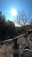
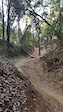
Popular Collserola Mountain Biking Trails
• 100 ★ 4.1 • 1,821 ft • 34 ft • 1,063 •
“Forapistas” is an easy trail right next to “Camí de Can Borni” Is the perfect trail for riders of all levels, especially beginners. The trail is nice and clean. Is not skinny and you have a good view of what do you have in the...
• 100 ★ 3.2 • 1,079 ft • 17 ft • 1,018 •
A trail starting just next to Casa Juanco. It starts as a narrow singletrack and just after the tower it becomes open and with few easy rock garden and loose rocks. Few brave people does it also uphill.
• 100 ★ 3.0 • 666 ft • 0 ft • 966 •
Pequeña alternativa a la . Asequible para todo el mundo
• 100 ★ 2.0 • 528 ft • 75 ft • 902 •
Este trail se usa tanto de subida como bajada. Ideal para conectar con el resto de bajadas y subidas. This trail is used in uphill and downhill direction. Be careful
• 100 ★ 3.0 • 699 ft • 0 ft • 887 •
Popular green difficulty singletrack. This multi-use trail can be used both directions and has a easy overall physical rating with a 0 ft blue climb. Trail visibility is always easy to follow. On average it takes minutes to complete this trail.
• 100 ★ 4.2 • 584 ft • 0 ft • 838 •
There are two drops in the middle but you don't have todo if you don't want
• 100 ★ 3.5 • 679 ft • 0 ft • 831 •
Popular green difficulty singletrack. This multi-use trail can be used both directions with a 0 ft blue climb. Trail visibility is always easy to follow. On average it takes minutes to complete this trail.
• 100 ★ 3.5 • 1 mile • 13 ft • 792 •
Popular green difficulty singletrack. This multi-use trail can be used both directions and has a moderate overall physical rating with a 13 ft blue climb. Trail visibility is always easy to follow. On average it takes 6 minutes to complete this trail.
Collserola Mountain Bike Routes
★ 5.0 • 20 miles • 4,021 ft • 20 • Point to Point •
Enduro ride on some of the trails around Barcelona. Focus on technical descents and your own climbing.
17 miles • 2,528 ft • 1 • Loop •
From the Velodrome we will head towards the Horta cemetery, on Calle escala Dei we will find Alta de...
42 miles • 6,854 ft • 13 • Loop •
We will begin the itinerary circulating very smoothly, warming legs on the Aigües road in the direction...
★ 1.0 • 64 miles • 11,446 ft • 44 • Loop •
Epic 100 km / 3300m loop that will keep you busy for hours! For a 75 km variant, leave out the eastern...
42 miles • 6,854 ft • 13 • Loop •
We will begin the itinerary circulating very smoothly, warming legs on the Aigües road in the direction...
9 miles • 1,774 ft • 3 •
The itinerary begins at the sports complex La Bonaigua that we will find at the end of the Paseo del Monte...
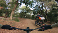
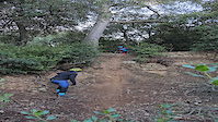
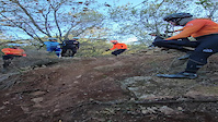
Photos of Collserola Mountain Bike
Videos of Collserola Mountain Bike
2:55 |
35 |
Oct 12, 2025
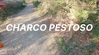
trail: Charco Pestoso
2:17 |
25 |
Jan 19, 2025

trail: Cazadores
2:17 |
27 |
Jan 19, 2025
trail: Kamikaze Can Ribes
0:10 |
|
Jan 8, 2024
trail: Kamikaze Can Ribes
0:15 |
|
Jan 8, 2024

trail: Cruza Pistas
2:26 |
27 |
Mar 28, 2023
0:45 |
63 |
Jan 29, 2023
trail: Mini Muntanya Russa Interior
0:10 |
214 |
Jan 13, 2023
Current Trail Warnings
| status | trail | date | condition | user | info |
|---|---|---|---|---|---|
| Santa Margarida / Torre del Bisbe - upper | Jun 3, 2026 @ 2:31am (America/Vancouver) Jun 3, 2026 | Ideal | josepbt | me comentan que está quedando muy muy... | |
| El Segmento Que Aun Se Puede | May 29, 2026 @ 12:27am (Europe/Madrid) May 28, 2026 | Dry | sergiorgdh | árbol caído. Después, flow y... | |
| El Jardin - Complicado | May 29, 2026 @ 12:23am (Europe/Madrid) May 28, 2026 | Unknown | sergiorgdh | La entrada cerrada por un árbol. Mal |
Recent Trail Reports
| status | trail | date | condition | info | user |
|---|---|---|---|---|---|
| Salamandra | Jun 15, 2026 @ 7:51pm (Europe/Madrid) Jun 15, 2026 | Ideal | stax999 | ||
| Arrabassada Esquerra | Jun 5, 2026 @ 11:20am (Europe/Madrid) Jun 5, 2026 | Unknown | Fancelli | ||
| Masriera a Torrent Can Cerdà | Jun 3, 2026 @ 2:23pm (Europe/Madrid) Jun 3, 2026 | Unknown | jum4l0 | ||
| Can Castellvi Bikepark | May 29, 2026 @ 12:32am (Europe/Madrid) May 28, 2026 | Unknown | sergiorgdh | ||
| Salt de l'Aigua 1 | May 29, 2026 @ 12:30am (Europe/Madrid) May 28, 2026 | Dry | sergiorgdh | ||
| El Jardin - Lower | May 29, 2026 @ 12:24am (Europe/Madrid) May 28, 2026 | Dry | sergiorgdh | ||
| Nombre y dificultad aun por confirmar | May 29, 2026 @ 12:19am (Europe/Madrid) May 28, 2026 | Variable | sergiorgdh | ||
| La Llebre | May 29, 2026 @ 12:18am (Europe/Madrid) May 28, 2026 | Dry | sergiorgdh | ||
| El Jardin - Upper | May 29, 2026 @ 12:17am (Europe/Madrid) May 28, 2026 | Dry | sergiorgdh | ||
| Serra de Can Julià a Torrent de les Bobines | May 29, 2026 @ 12:14am (Europe/Madrid) May 28, 2026 | Dry | sergiorgdh |
Activity Feed
| username | action | type | title | date |
|---|---|---|---|---|
| Chadburdyshaw | wishlist | region | activity #97117567 | Jun 16, 2026 @ 9:41am Jun 16, 2026 |
| stax999 | add | report | activity #97052738 | Jun 15, 2026 @ 10:51am Jun 15, 2026 |
| Popeye271 | wishlist | trail | activity #96851480 | Jun 13, 2026 @ 12:10am Jun 13, 2026 |
| Popeye271 | ridden | trail | activity #96851477 and 5 more | Jun 13, 2026 @ 12:09am Jun 13, 2026 |
| granaas | wishlist | route | activity #96725840 and 1 more | Jun 11, 2026 @ 3:10am Jun 11, 2026 |
Recent Comments
| username | type | title | comment | date |
|---|---|---|---|---|
| trail | Heavy metal empinada y corta. La pondría roja | May 28, 2026 @ 3:33pm May 28, 2026 | ||
| trail | divertida, medio-suave-fuerte. En buen estado | May 28, 2026 @ 3:31pm May 28, 2026 | ||
| trail | Camino para trailrunners. Por la entrada sur... | May 28, 2026 @ 3:31pm May 28, 2026 | ||
| trail | De las bajadas más divertidas de la zona.... | May 28, 2026 @ 3:16pm May 28, 2026 | ||
| trail | Bajada con muy buen potencial Per con todas... | May 28, 2026 @ 3:15pm May 28, 2026 |
Nearby Areas
| name | distance | ||||
|---|---|---|---|---|---|
| Els Tres Turons | 11 | 10 | 3.2 km | ||
| Montjuic | 32 | 25 | 5.3 km | ||
| El Remei Bikepark | 1 | 4 | 6.3 km | ||
| Rubike Naturpark | 6.4 km | ||||
| Serra de Galliners | 36 | 31 | 6.8 km |
Local Badges
-

Completionist0 awarded
Activity Type Stats
| activitytype | trails | distance | descent | descent distance | total vertical | rating | global rank | state rank | photos | reports | routes | ridelogs |
|---|---|---|---|---|---|---|---|---|---|---|---|---|
| Mountain Bike | 1,216 | 438 miles | 131,138 ft | 256 miles | 1,585 ft | #10 | #1 | 1,035 | 15,440 | 32 | 111,864 | |
| E-Bike | 1,215 | 438 miles | 130,915 ft | 256 miles | 1,585 ft | #1 | #6 | 59 | 15,030 | 21 | 15,285 | |
| Adaptive Bike | 52 | #29 | #1 | 1 | ||||||||
| Horse | 162 | 57 miles | 10,312 ft | 27 miles | 1,371 ft | #60 | #9 | 913 | ||||
| Hike | 1,206 | 441 miles | 129,505 ft | 256 miles | 1,585 ft | #5 | #5 | 13 | 15,188 | 1 | 2,379 | |
| Trail Running | 1,193 | 437 miles | 128,383 ft | 254 miles | 1,585 ft | #3 | #3 | 12 | 15,113 | 11,151 |
Frequently Asked Questions About Collserola
▼
What are the highest rated mountain biking trails in Collserola?
The highest rated mountain biking trails in Collserola are:
- Instituto - Corriol Vall de Sorgues (4.6/5)
- Dragon Kahn / Camí de Can Pasqual (4.6/5)
- Cuerpo en Llamas (4.5/5)
- Les Planes 2 (4.5/5)
- Trialera Park (4.5/5)
▼
What is the best time of the year to ride in Collserola?
Based on ride log data, the most popular months to ride in Collserola are:
- May (520 activities)
- October (476 activities)
- July (447 activities)
▼
Where can I park to ride in Collserola?
There are 12 parking locations listed in Collserola. The most popular parking spots are:
- Parking Tibidabo 2
- Parking Can Cuiàs
- Parking Pla dels Maduixers
- Parking Can Coll
- Parking del Turó d'en Cors
▼
What is the longest trail in Collserola?
The longest trail in Collserola is La Muralla China at 3.4 km. View all trails sorted by distance.
Activities
Trails
- By JaumeAmoros & contributors
- Admins: henrikenduro, Galis, kai-bcn
- #9809 - 79,157 views
- collserola activity log | embed map of Collserola mountain bike trails | collserola mountain biking points of interest polygons
Downloading of trail gps tracks in kml & gpx formats is enabled for Collserola.
You must login to download files.