close
-
Layers w
- Weather Layers
- Pro
- Pro
- Pro
- Pro
- Pro
- Pro
- More Layers
- Pro
- Pro
- Pro
- Pro
-
Upgrade to

3D
Trail Conditions
- Unknown
- Snow Groomed
- Snow Packed
- Snow Covered
- Snow Cover Partial
- Freeze/thaw Cycle
- Icy
- Prevalent Mud
- Wet
- Variable
- Ideal
- Dry
- Very Dry
Trail Flow (Ridden Direction)
Trailforks scans users ridelogs to determine the most popular direction each trail is ridden. A good flowing trail network will have most trails flowing in a single direction according to their intension.
The colour categories are based on what percentage of riders are riding a trail in its intended direction.
The colour categories are based on what percentage of riders are riding a trail in its intended direction.
- > 96%
- > 90%
- > 80%
- > 70%
- > 50%
- < 50%
- bi-directional trail
- no data
Trail Last Ridden
Trailforks scans ridelogs to determine the last time a trail was ridden.
- < 2 days
- < 1 week
- < 2 weeks
- < 1 month
- < 6 months
- > 6 months
Trail Ridden Direction
The intended direction a trail should be ridden.
- Downhill Only
- Downhill Primary
- Both Directions
- Uphill Primary
- Uphill Only
- One Direction
Contribute Details
Colors indicate trail is missing specified detail.
- Description
- Photos
- Description & Photos
- Videos
Trail Popularity ?
Trailforks scans ridelogs to determine which trails are ridden the most in the last 9 months.
Trails are compared with nearby trails in the same city region with a possible 25 colour shades.
Think of this as a heatmap, more rides = more kinetic energy = warmer colors.
- most popular
- popular
- less popular
- not popular
ATV/ORV/OHV Filter
Max Vehicle Width
inches
US Cell Coverage
Legend

Radar Time
Activity Recordings
Trailforks uses anonymized public activity data.
?
Activity Recordings
Trailforks uses anonymized public activity data.
?
Personal Heatmap
▶
Activity Types
all
/
none
▶
Options
2
Date range
month
–
Winter Trails
Warning
A routing network for winter maps does not exist. Selecting trails using the winter trails layer has been disabled.
Missing Trails
Most Popular
Least Popular
Trails are colored based on popularity. The more popular a trail is, the more red. Less popular trails trend towards green.
Jump Magnitude Heatmap
Heatmap of where riders jump on trails. Zoom in to see individual jumps, click circles to view jump details.
BC Backroad Status
![map legend]()
Service Road Atlas is a free to use, community-driven service for viewing and creating reports on the numerous back-country service roads around B.C. and Alberta.

Slope Aspect
Direction the slope faces
Trails Deemphasized
Trails are shown in grey.
Only show trails with no bike usage.
Suggested Layers
Based on selected activity type
Save the current map location and zoom level as your default home location whenever this page is loaded.
Save
No description for Colonie has been added yet!
Login or register to submit one.
Activities Click to view
- Hike
78 trails
- Mountain Bike
75 trails
- E-Bike
11 trails
- Gravel Bike
1 trails
- Adaptive Bike
0 trails
- Horse
0 trails
- Trail Running
78 trails
Region Details
- 17
- 10
- 8
- 38
- 2
Region Status
Open as of Jun 8, 2026Stats
- Avg Trail Rating
- Trails (view details)
- 77
- Trails Mountain Bike
- 76
- Trails E-Bike
- 11
- Trails Gravel Bike
- 1
- Trails Hike
- 78
- Trails Trail Running
- 78
- Total Distance
- 16 miles
- Total Descent
- 2,007 ft
- Total Vertical
- 218 ft
- Highest Trailhead
- 406 ft
- Reports
- 1,970
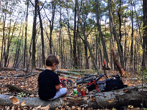
- Photos
- 61
- Ridden Counter
- 3,904
Sub Regions
-
Colonie Town Park
- 12
- 8
- 30
- 2
Popular Colonie Mountain Biking Trails
• 95 ★ 0.0 • 627 ft • 0 ft • 421 •
Popular green difficulty singletrack. This multi-use trail can be used both directions and has a moderate overall physical rating with a 0 ft green climb. On average it takes minutes to complete this trail.
• 100 ★ 5.0 • 748 ft • 0 ft • 400 •
Popular blue difficulty singletrack. This multi-use trail can be used both directions and has a moderate overall physical rating with a 0 ft blue climb. On average it takes 1 minutes to complete this trail.
• 75 ★ 0.0 • 1,755 ft • 36 ft • 399 •
Popular blue difficulty singletrack. This multi-use trail can be used both directions and has a moderate overall physical rating with a 36 ft blue climb. On average it takes 3 minutes to complete this trail.
• 85 ★ 0.0 • 1 mile • 35 ft • 394 •
Popular green difficulty singletrack. This multi-use trail can be used both directions and has a moderate overall physical rating with a 35 ft blue climb. On average it takes 12 minutes to complete this trail.
• 95 ★ 0.0 • 2,221 ft • 36 ft • 389 •
Popular blue difficulty singletrack. This multi-use trail can be used both directions and has a moderate overall physical rating with a 36 ft blue climb. On average it takes 3 minutes to complete this trail.
• 90 ★ 0.0 • 424 ft • 27 ft • 377 •
Popular blue difficulty singletrack. This multi-use trail can be used both directions and has a moderate overall physical rating with a 27 ft blue climb. On average it takes minutes to complete this trail.
• 90 ★ 0.0 • 705 ft • 0 ft • 372 •
Popular blue difficulty singletrack. This multi-use trail can be used downhill primary and has a moderate overall physical rating with a 0 ft blue climb. On average it takes 1 minutes to complete this trail.
Colonie Mountain Bike Routes
★ 3.0 • 6 miles • 416 ft • 19 • Loop •
A mix of double track and twisty single track trails. The trails are not too steep, but there are some...
★ 1.0 • 2 miles • 90 ft • 9 • Loop •
Colonie Town Park Ridge Side - Easy Loop is a 2-mile easy route located near Latham, NY. This mountain...
★ 1.0 • 4 miles • 293 ft • 22 • Loop •
Colonie Town Park Ridge Side - Intermediate Ride is a 4-mile intermediate route located near Latham, NY....
5 miles • 395 ft • 32 • Loop •
Colonie Town Park - Intermediate Full Loop (Black Arrow) is a 5-mile moderately intermediate route located...
8 miles • 592 ft • 33 • Point to Point •
Spring recommended route to avoid most of the wet/soft spots.
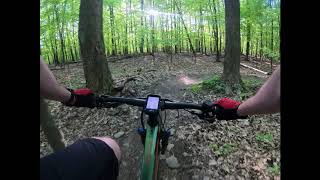
Videos of Colonie Mountain Bike
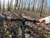
trail: Dazed & Confused
0:39 |
189 |
May 12, 2020

trail: Wicked
3:53 |
3025 |
Jul 31, 2016

trail: Wicked
3:55 |
1179 |
Jun 23, 2014

trail: Cliff Section 1
0:35 |
307 |
Sep 21, 2011
trail: Cliff Section 1
0:10 |
1803 |
Oct 27, 2010

trail: Wicked
4:36 |
8250 |
Jan 22, 2009
28:29 |
425 |
Jun 7, 2020
Current Trail Warnings
| status | trail | date | condition | user | info |
|---|---|---|---|---|---|
| Singletrack #2 | Jun 8, 2026 @ 3:26pm (America/New_York) Jun 8, 2026 | Ideal | Ralph7UnyIv | Tree down |
Recent Trail Reports
| status | trail | date | condition | info | user |
|---|---|---|---|---|---|
| Singletrack #1 | Jun 1, 2026 @ 12:00pm (America/New_York) Jun 1, 2026 | Ideal | rsp689 | ||
| Trail Connector 1 | Apr 21, 2026 @ 6:56am (America/New_York) Apr 21, 2026 | Dry | Huezee | ||
| The Ridge | Dec 3, 2025 @ 9:48am (America/New_York) Dec 3, 2025 | Snow Covered | Jpmche FCTPT | ||
| 3rd Entrance | Oct 27, 2025 @ 12:45pm (America/New_York) Oct 27, 2025 | Dry | Tcraiglinz FCTPT | ||
| Doubletrack Connector 3 | Oct 27, 2025 @ 12:45pm (America/New_York) Oct 27, 2025 | Dry | Tcraiglinz FCTPT | ||
| Red Trail | Oct 27, 2025 @ 12:45pm (America/New_York) Oct 27, 2025 | Ideal | Tcraiglinz FCTPT | ||
| Former Blue Trail | Oct 27, 2025 @ 12:45pm (America/New_York) Oct 27, 2025 | Ideal | Tcraiglinz FCTPT | ||
| French Connection | Oct 27, 2025 @ 12:45pm (America/New_York) Oct 27, 2025 | Ideal | Tcraiglinz FCTPT | ||
| Hiking | Oct 27, 2025 @ 12:45pm (America/New_York) Oct 27, 2025 | Ideal | Tcraiglinz FCTPT | ||
| Dondi's Dip | Oct 27, 2025 @ 12:45pm (America/New_York) Oct 27, 2025 | Ideal | Tcraiglinz FCTPT |
National Scenic Trails & Official Routes
-
Erie Canalway Trail
- Mountain Bike
- E-Bike
- Hike
- Trail Running
- Snowshoe
- Nordic Ski
Activity Feed
| username | action | type | title | date |
|---|---|---|---|---|
| Ralph7UnyIv | add | report | activity #97071267 | Jun 15, 2026 @ 4:04pm Jun 15, 2026 |
| BeananEnyfUf | ridden | trail | activity #96460446 | Jun 7, 2026 @ 7:50am Jun 7, 2026 |
| DanielhJxYwz | wishlist | route | activity #96134368 | Jun 2, 2026 @ 9:08pm Jun 2, 2026 |
| rslonakernu4u | wishlist | region | activity #96119994 | Jun 2, 2026 @ 4:57pm Jun 2, 2026 |
| rsp689 | add | report | activity #96021166 | Jun 1, 2026 @ 9:00am Jun 1, 2026 |
Recent Comments
| username | type | title | comment | date |
|---|---|---|---|---|
| report | I didn’t really believe this till I saw it... | Apr 21, 2026 @ 1:08pm Apr 21, 2026 | ||
| report | The tree has been cleared. | Mar 27, 2025 @ 6:17pm Mar 27, 2025 | ||
| report | Correction: This tree still in place. | Mar 27, 2025 @ 6:16pm Mar 27, 2025 | ||
| report | The tree has been cleared. | Mar 27, 2025 @ 6:15pm Mar 27, 2025 | ||
| report | Downed tree across the trail. | Mar 27, 2025 @ 6:14pm Mar 27, 2025 |
Local Badges
-

10 Blue Trails57 awarded -

Epic Mountain Bike Climb 2k0 awarded -

Climbing 10k Badge1 awarded -

Mountain Biking 100k Badge0 awarded -

Epic Ride Descent 2k0 awarded -

Descent 10k Badge1 awarded
Activity Type Stats
| activitytype | trails | distance | descent | descent distance | total vertical | rating | global rank | state rank | photos | reports | routes | ridelogs |
|---|---|---|---|---|---|---|---|---|---|---|---|---|
| Mountain Bike | 75 | 15 miles | 1,867 ft | 5 miles | 220 ft | #1,028 | #403 | 61 | 1,980 | 5 | 7,246 | |
| E-Bike | 11 | #10,206 | #3,219 | 1,718 | 120 | |||||||
| Gravel Bike | 1 | #779 | #1,269 | 1 | 17 | |||||||
| Hike | 78 | 16 miles | 2,008 ft | 6 miles | 220 ft | #6,355 | #2,224 | 1,980 | 90 | |||
| Trail Running | 78 | 16 miles | 2,008 ft | 6 miles | 220 ft | #6,328 | #2,052 | 1,980 | 183 |
Frequently Asked Questions About Colonie
▼
What are the best places to ride in Colonie?
Colonie has 2 areas to explore for mountain biking. The top rated areas are:
▼
What are the highest rated mountain biking trails in Colonie?
The highest rated mountain biking trails in Colonie are:
- Singletrack #2 (4.2/5)
- Singletrack #1 (4.2/5)
- Cliff View (4.2/5)
- Blueberry Hill West Red Trail (4.1/5)
- Bypass (4.1/5)
▼
What is the best time of the year to ride in Colonie?
Based on ride log data, the most popular months to ride in Colonie are:
- July (178 activities)
- October (157 activities)
- September (143 activities)
▼
Where can I park to ride in Colonie?
There are 6 parking locations listed in Colonie. The most popular parking spots are:
- Colonie Town Park Trail Head (Schemerthorn Rd Parking Lot)
- Bike Path / Colinie Town Park Secondary Parking (Route 9)
- Parking
- Parking
- Rapp Barrens
Activities
Trails
Points of Interest
- By PlumbBobM
 TRAILFORKS HCH & contributors
 - Admins: apply
- #52473 - 881 views
- colonie activity log | embed map of Colonie mountain bike trails | colonie mountain biking points of interest
Downloading of trail gps tracks in kml & gpx formats is enabled for Colonie.
You must login to download files.