close
-
Layers w
- Weather Layers
- Pro
- Pro
- Pro
- Pro
- Pro
- Pro
- More Layers
- Pro
- Pro
- Pro
- Pro
-
Upgrade to

3D
Trail Conditions
- Unknown
- Snow Groomed
- Snow Packed
- Snow Covered
- Snow Cover Partial
- Freeze/thaw Cycle
- Icy
- Prevalent Mud
- Wet
- Variable
- Ideal
- Dry
- Very Dry
Trail Flow (Ridden Direction)
Trailforks scans users ridelogs to determine the most popular direction each trail is ridden. A good flowing trail network will have most trails flowing in a single direction according to their intension.
The colour categories are based on what percentage of riders are riding a trail in its intended direction.
The colour categories are based on what percentage of riders are riding a trail in its intended direction.
- > 96%
- > 90%
- > 80%
- > 70%
- > 50%
- < 50%
- bi-directional trail
- no data
Trail Last Ridden
Trailforks scans ridelogs to determine the last time a trail was ridden.
- < 2 days
- < 1 week
- < 2 weeks
- < 1 month
- < 6 months
- > 6 months
Trail Ridden Direction
The intended direction a trail should be ridden.
- Downhill Only
- Downhill Primary
- Both Directions
- Uphill Primary
- Uphill Only
- One Direction
Contribute Details
Colors indicate trail is missing specified detail.
- Description
- Photos
- Description & Photos
- Videos
Trail Popularity ?
Trailforks scans ridelogs to determine which trails are ridden the most in the last 9 months.
Trails are compared with nearby trails in the same city region with a possible 25 colour shades.
Think of this as a heatmap, more rides = more kinetic energy = warmer colors.
- most popular
- popular
- less popular
- not popular
ATV/ORV/OHV Filter
Max Vehicle Width
inches
US Cell Coverage
Legend

Radar Time
Activity Recordings
Trailforks uses anonymized public activity data.
?
Activity Recordings
Trailforks uses anonymized public activity data.
?
Personal Heatmap
▶
Activity Types
all
/
none
▶
Options
2
Date range
month
–
Winter Trails
Warning
A routing network for winter maps does not exist. Selecting trails using the winter trails layer has been disabled.
Missing Trails
Most Popular
Least Popular
Trails are colored based on popularity. The more popular a trail is, the more red. Less popular trails trend towards green.
Jump Magnitude Heatmap
Heatmap of where riders jump on trails. Zoom in to see individual jumps, click circles to view jump details.
BC Backroad Status
![map legend]()
Service Road Atlas is a free to use, community-driven service for viewing and creating reports on the numerous back-country service roads around B.C. and Alberta.

Slope Aspect
Direction the slope faces
Trails Deemphasized
Trails are shown in grey.
Only show trails with no bike usage.
Suggested Layers
Based on selected activity type
Save the current map location and zoom level as your default home location whenever this page is loaded.
Save
No description for Columbus has been added yet!
Login or register to submit one.
Activities Click to view
- Mountain Bike
73 trails
- E-Bike
24 trails
- Adaptive Bike
0 trails
- Hike
65 trails
- Trail Running
65 trails
Region Details
- 3
- 1
- 19
- 20
- 10
- 1
Region Status
Open as of Mar 25, 2026Stats
- Avg Trail Rating
- Trails (view details)
- 59
- Trails Mountain Bike
- 74
- Trails E-Bike
- 24
- Trails Hike
- 65
- Trails Trail Running
- 65
- Total Distance
- 52 miles
- Total Descent
- 6,583 ft
- Total Vertical
- 357 ft
- Highest Trailhead
- 602 ft
- Reports
- 924
- Photos
- 112
- Ridden Counter
- 7,911
Sub Regions
-
Dragonfly Trails
- 1
-
Flat Rock Park
- 7
- 7
- 2
-
Standing Boy Trails
- 11
- 13
- 8
- 1
Popular Columbus Mountain Biking Trails
• 95 ★ 5.0 • 5,249 ft • 61 ft • 261 •
is a mostly gentle rolling descent with berms, rollers, and some mellow jumps. Downhill only.
• 100 ★ 4.5 • 3,983 ft • 90 ft • 252 •
is the main access to the trails and is smooth, wide, and flowy.
• 95 ★ 3.0 • 3,353 ft • 140 ft • 239 •
is a multi-directional trail that is primarily used to get to which starts at the top. The trail is wide and relatively smooth with a gradual gradient.
• 90 ★ 4.7 • 4 miles • 365 ft • 226 •
is an easy loop that's wide, smooth, and flowy. While the overall grade is gentle, there are opportunities to get some speed and even a little air. Directional by day - counterclockwise on Monday, Tuesday, Thursday, and Saturday and...
• 100 ★ 3.0 • 781 ft • 25 ft • 209 •
Popular blue difficulty singletrack. This mountain bike primary trail can be used both directions and has a moderate overall physical rating with a 25 ft green climb. It features berm, drop, jump and rock garden. Trail visibility is always easy to follow. On average it takes 3 minutes to complete this trail.
• 100 ★ 2.0 • 3,858 ft • 169 ft • 204 • • hike
is primarily a doubletrack hiking trail. It can be ridden uphill to access other trails but riding down is prohibited.
• 75 ★ 4.5 • 1 mile • 95 ft • 202 •
is a 1.3 mile intermediate gravity/downhill trail with a mix of rollers, jumps, and drops including some well-integrated rocks.
• 95 ★ 4.3 • 4,921 ft • 27 ft • 194 •
leads up to and to Spaghetti Junction which is the intersection of , , and . If you are coming from the parking lot expect a workout of a climb! There are plenty of rocks to maneuver over while climbing! Coming down is much more fun.
Columbus Mountain Bike Routes
6 miles • 674 ft • 4 • Loop •
The Green Loop is the a beginner friendly loop that has flowy sections of trails along and , then a...
5 miles • 531 ft • 3 • Loop •
5 mile loop from parking lot with lots of fun climbing flowing and downhill
6 miles • 356 ft • 6 •
Go Nuts King of the Rock XC Course & 10K Trail Run Course
7 miles • 655 ft • 4 • Loop • Race •
GA Police and Fire Games 2023 MTB race route (beginner)
6 miles • 541 ft • 3 • Loop • Race •
and counter-clockwise, stay right at Y intersections.
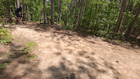
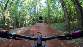
Photos of Columbus Mountain Bike
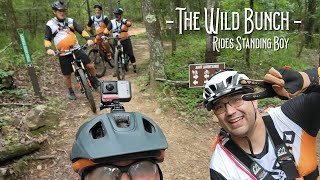
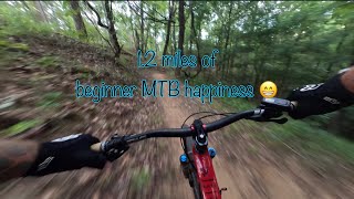
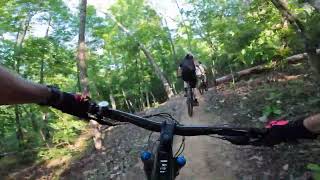
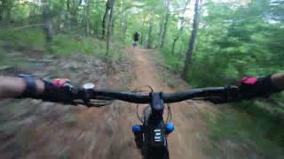
Videos of Columbus Mountain Bike
trail: Cyclone Gallop
0:17 |
|
Dec 31, 2024
trail: Swaveys
0:50 |
27 |
Jul 13, 2024

trail: The Bug
15:44 |
64 |
May 26, 2025 , Columbus
7:26 |
38 |
May 4, 2025
trail: The Bug
4:49 |
115 |
Jul 18, 2024 , Columbus
0:41 |
316 |
May 4, 2023
4:07 |
197 |
May 4, 2023
trail: Lickety Split
5:42 |
307 |
May 4, 2023 , Columbus
Recent Trail Reports
Activity Feed
| username | action | type | title | date |
|---|---|---|---|---|
| SylvesterStalloam | wishlist | region | activity #97864811 | Jun 26, 2026 @ 4:43pm 11 hours |
| rtstudios | wishlist | trail | activity #97315114 | Jun 19, 2026 @ 7:15am Jun 19, 2026 |
| papa-mo | wishlist | region | activity #95003332 | May 18, 2026 @ 3:16pm May 18, 2026 |
| jscotts | wishlist | region | activity #94685153 | May 14, 2026 @ 6:26am May 14, 2026 |
| balazshoranyi | ridden | trail | activity #94369688 | May 9, 2026 @ 12:40pm May 9, 2026 |
Recent Comments
| username | type | title | comment | date |
|---|---|---|---|---|
| report | I’m going a see a.dc . Z szz a | Jul 21, 2025 @ 11:18am Jul 21, 2025 | ||
| trail | Love this trail. It’s narrow, off camber,... | Mar 23, 2025 @ 5:38am Mar 23, 2025 | ||
| trail | Really only 2 jumps on the line that I would... | Feb 23, 2025 @ 4:07pm Feb 23, 2025 | ||
| trail | Fun jump trail. Easy to maintain speed on.... | Feb 23, 2025 @ 3:59pm Feb 23, 2025 | ||
| trail | Super fun trail. A lot of rock jumps and... | Feb 23, 2025 @ 11:23am Feb 23, 2025 |
Local Badges
-

10 Blue Trails104 awarded -

Epic Ride Climb 2k0 awarded -

Climbing 10k Badge25 awarded -

Climbing 100k Badge1 awarded -

Epic Ride Descent 2k0 awarded -

Descent 10k Badge24 awarded
Activity Type Stats
| activitytype | trails | distance | descent | descent distance | total vertical | rating | global rank | state rank | photos | reports | routes | ridelogs |
|---|---|---|---|---|---|---|---|---|---|---|---|---|
| Mountain Bike | 73 | 47 miles | 5,997 ft | 23 miles | 358 ft | #2,385 | #853 | 96 | 927 | 6 | 5,166 | |
| E-Bike | 24 | 3 miles | 643 ft | 2 miles | 220 ft | #5,927 | #1,814 | 702 | 898 | |||
| Hike | 65 | 47 miles | 5,318 ft | 21 miles | 358 ft | #2,478 | #981 | 16 | 910 | 647 | ||
| Trail Running | 65 | 47 miles | 5,318 ft | 21 miles | 358 ft | #4,365 | #1,335 | 909 | 1 | 113 |
Frequently Asked Questions About Columbus
▼
What are the best places to ride in Columbus?
Columbus has 3 areas to explore for mountain biking. The top rated areas are:
▼
What are the highest rated mountain biking trails in Columbus?
The highest rated mountain biking trails in Columbus are:
- Primary Goods (4.3/5)
- Lonely Hunter (4.2/5)
- The Bug (4.2/5)
- Lil' Bit (4.2/5)
- Cyclone Gallop (4.2/5)
▼
What is the best time of the year to ride in Columbus?
Based on ride log data, the most popular months to ride in Columbus are:
- October (32 activities)
- May (30 activities)
- September (26 activities)
▼
Where can I park to ride in Columbus?
There are 4 parking locations listed in Columbus. The most popular parking spots are: View all parking and trailhead locations on the map to plan your visit.
Activities
Trails
- By brenthillier
 NSMBA TRAILFORKS & contributors
 - Admins: CVA SORBA
- #9040 - 7,470 views
- columbus activity log | embed map of Columbus mountain bike trails | columbus mountain biking points of interest
Downloading of trail gps tracks in kml & gpx formats is enabled for Columbus.
You must login to download files.