close
-
Layers w
- Weather Layers
- Pro
- Pro
- Pro
- Pro
- Pro
- Pro
- More Layers
- Pro
- Pro
- Pro
- Pro
-
Upgrade to

3D
Trail Conditions
- Unknown
- Snow Groomed
- Snow Packed
- Snow Covered
- Snow Cover Partial
- Freeze/thaw Cycle
- Icy
- Prevalent Mud
- Wet
- Variable
- Ideal
- Dry
- Very Dry
Trail Flow (Ridden Direction)
Trailforks scans users ridelogs to determine the most popular direction each trail is ridden. A good flowing trail network will have most trails flowing in a single direction according to their intension.
The colour categories are based on what percentage of riders are riding a trail in its intended direction.
The colour categories are based on what percentage of riders are riding a trail in its intended direction.
- > 96%
- > 90%
- > 80%
- > 70%
- > 50%
- < 50%
- bi-directional trail
- no data
Trail Last Ridden
Trailforks scans ridelogs to determine the last time a trail was ridden.
- < 2 days
- < 1 week
- < 2 weeks
- < 1 month
- < 6 months
- > 6 months
Trail Ridden Direction
The intended direction a trail should be ridden.
- Downhill Only
- Downhill Primary
- Both Directions
- Uphill Primary
- Uphill Only
- One Direction
Contribute Details
Colors indicate trail is missing specified detail.
- Description
- Photos
- Description & Photos
- Videos
Trail Popularity ?
Trailforks scans ridelogs to determine which trails are ridden the most in the last 9 months.
Trails are compared with nearby trails in the same city region with a possible 25 colour shades.
Think of this as a heatmap, more rides = more kinetic energy = warmer colors.
- most popular
- popular
- less popular
- not popular
ATV/ORV/OHV Filter
Max Vehicle Width
inches
US Cell Coverage
Legend

Radar Time
Activity Recordings
Trailforks uses anonymized public activity data.
?
Activity Recordings
Trailforks uses anonymized public activity data.
?
Personal Heatmap
▶
Activity Types
all
/
none
▶
Options
2
Date range
month
–
Winter Trails
Warning
A routing network for winter maps does not exist. Selecting trails using the winter trails layer has been disabled.
Missing Trails
Most Popular
Least Popular
Trails are colored based on popularity. The more popular a trail is, the more red. Less popular trails trend towards green.
Jump Magnitude Heatmap
Heatmap of where riders jump on trails. Zoom in to see individual jumps, click circles to view jump details.
BC Backroad Status
![map legend]()
Service Road Atlas is a free to use, community-driven service for viewing and creating reports on the numerous back-country service roads around B.C. and Alberta.

Slope Aspect
Direction the slope faces
Trails Deemphasized
Trails are shown in grey.
Only show trails with no bike usage.
Suggested Layers
Based on selected activity type
Save the current map location and zoom level as your default home location whenever this page is loaded.
Save
No description for Como has been added yet!
Login or register to submit one.
Links
- Red Bull: le bike area in crescita in Italia che dovresti visitare
- Montagne Lago di Como
- Local-heroes- lake como's steep descents
This region uses the Uk/Euro style trail grading system.
Activities Click to view
- Mountain Bike
868 trails
- E-Bike
727 trails
- Horse
84 trails
- Hike
835 trails
- Trail Running
829 trails
- Snowshoe
7 trails
- Nordic Ski
0 trails
Stats
- Avg Trail Rating
- Trails (view details)
- 847
- Trails Mountain Bike
- 868
- Trails E-Bike
- 727
- Trails Gravel Bike
- 2
- Trails Adaptive Bike
- 2
- Trails Winter Fat Bike
- 4
- Trails Horse
- 84
- Trails Hike
- 835
- Trails Trail Running
- 829
- Trails Snowshoe
- 7
- Trails Backcountry Ski
- 3
- Total Distance
- 784 miles
- Total Descent
- 268,079 ft
- Total Vertical
- 5,977 ft
- Highest Trailhead
- 6,656 ft
- Reports
- 8,574
- Photos
- 1,113
- Ridden Counter
- 44,648
Sub Regions
- Albavilla (24)
- Albese Con Cassano (12)
- Alserio (6)
- Alzate Brianza (2)
- Asso (1)
- Barni (25)
- Bregnano (9)
- Brenna (9)
- Brunate (10)
- Bulgarograsso (9)
- Cabiate (2)
- Cadorago (2)
- Caglio (12)
- Cagno (29)
- Cantù (5)
- Canzo (44)
- Capiago Intimiano (30)
- Carimate (9)
- Carlazzo (21)
- Monte Pidaggia (21)
- Caslino d'Erba (6)
- Casnate con Bernate (2)
- Cermenate (3)
- Como (64)
- Monte Bisbino (22)
- Spina Verde (30)
- Triangolo Lariano (15)
- Cucciago (20)
- Domaso (31)
- Dongo (1)
- Drezzo (1)
- Erba (45)
- Erbonne (29)
- Eupilio (1)
- Figino Serenza (4)
- Gera Lario (35)
- Alto Lario (31)
- Lanzo D'Intelvi (22)
- Limido Comasco (3)
- Lomazzo (27)
- Parco del Lura (21)
- Mariano Comense (8)
- Menaggio (44)
- Rogeno (3)
- Rovellasca (1)
- Rovello Porro (4)
- San Bartolomeo VC (11)
- San Fedele Intelvi (30)
- Valle Intelvi (3)
- San Fermo Della Battaglia (8)
- Sormano (4)
- Tavernerio (57)
- Monte Boletto (36)
- Turate (4)
- Valbrona (1)
- Valsolda (11)
- Valsolda (11)
- Vertemate Con Minoprio (42)
- Parco Sorgenti del Lura (86)
- Parco Valle del Lanza (85)
Popular Como Mountain Biking Trails
• 100 ★ 3.5 • 1,070 ft • 54 ft • 483 •
Accesso al bellissimo punto panoramico del Pin Umbrela. All'inizio ripido strappo su selciata dal fondo variabile (variante singletrack sulla destra, non meno faticosa ma su fondo generalmente pulito), poi spiana e in breve si arriva a...
• 95 ★ 4.5 • 1 mile • 6 ft • 381 •
Iconic and very popular downhill only track, it's pure flow. Tight turns, short steep sections, it isn't really difficult but some points in the bottom part are exposed. A little step up close to a tibetan bridge divides the top part to...
• 100 ★ 4.4 • 2,362 ft • 3 ft • 337 •
Trail flow caratterizzato dalla presenza di diversi drop/salti con relative chicken-line.
• 90 ★ 4.6 • 2 miles • 302 ft • 334 •
Uno dei più suggestivi sentieri del circondario. Meglio se percorso nella stagione asciutta o in autunno per i colori. E' esposto prevalentemente a nord, può presentare residui di nevicate anche se le montagne intorno non presentano...
• 90 ★ 4.7 • 4,400 ft • 5 ft • 330 •
Natural single track with some jumps and tight switbacks
• 100 ★ 4.5 • 2 miles • 0 ft • 328 •
Enduro Cup Lombardia Special Stage - Used also as hiking path!
Como Mountain Bike Routes
★ 4.7 • 13 miles • 3,631 ft • 2 • Point to Point •
Si sale alla Capanna Mara dallo evitando il più possible l'asfalto. La discesa ha un primo tratto in...
★ 5.0 • 31 miles • 5,724 ft • 1 • Loop •
Bellissimo anello con spettacolare vista sul Lago di Lugano e Como. Obbligatorio salire fino in cima al...
★ 3.5 • 22 miles • 5,465 ft • 5 • Loop •
Questo emozionante percorso escursionistico si snoda tra i maestosi paesaggi montuosi dell'Alto Lago di...
★ 5.0 • 14 miles • 4,071 ft • 6 • Loop •
Salita prevalentemente in fuori strada, molto bella ed impegnativa con pendenze importanti soprattutto...
★ 3.0 • 14 miles • 3,078 ft • 2 • Loop •
L'itinerario descritto è un percorso ciclistico ad anello da affrontare in senso orario. Partendo da...
★ 4.0 • 16 miles • 4,720 ft • 3 • Loop •
Giro ad anello super panoramico alle pendici del Monte Bregagno
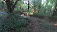
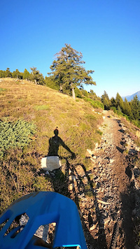
Photos of Como Mountain Bike
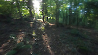
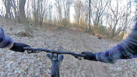
Videos of Como Mountain Bike
trail: Zocca
2:24 |
5 |
Nov 2, 2025
trail: Mula
2:03 |
29 |
Oct 31, 2025
trail: Giungla Infernale
2:08 |
86 |
Mar 20, 2025
trail: Discesa Freeride
3:28 |
81 |
Jul 24, 2024
trail: New pasturella
2:43 |
72 |
Jul 24, 2024
trail: Senter dal runcaa
0:00 |
17 |
Jul 23, 2024
trail: Alpe Pescedo
0:32 |
92 |
Mar 18, 2024
trail: New pasturella
0:31 |
84 |
May 23, 2022
Current Trail Warnings
| status | trail | date | condition | user | info |
|---|---|---|---|---|---|
| Alpe Pescedo Gera Lario | Jun 21, 2026 @ 5:04pm (Europe/Vaduz) Jun 21, 2026 | Ideal | Guret NORTHNLINE | Trail Running Rami e piante a metá trail, per il resto... | |
| BLine Spina Verde | Jun 20, 2026 @ 3:22pm (Europe/Rome) Jun 20, 2026 | Variable | bas79 | Sentiero abbandonato, pieno di foglie e... | |
| Sighignola Trail Bike Park - 3 Lanzo D'Intelvi | Jun 19, 2026 @ 11:00am (Europe/Rome) Jun 19, 2026 | Unknown | adessoomaipiu | Chiuso per lavori di ripristino dopo maltempo |
Recent Trail Reports
Activity Feed
| username | action | type | title | date |
|---|---|---|---|---|
| ChristophgfpTu | wishlist | trail | activity #97702035 | Jun 24, 2026 @ 9:03am 51 mins |
| alpinemattiyt | add | photo | activity #97694447 and 1 more | Jun 24, 2026 @ 7:00am 3 hours |
| alpinemattiyt | add | video | activity #97682832 | Jun 24, 2026 @ 2:02am 8 hours |
| Alexfallu | add | report | activity #97630006 | Jun 23, 2026 @ 8:45am 1 day |
| Alexfallu | add | report | activity #97630005 and 4 more | Jun 23, 2026 @ 8:45am 1 day |
Recent Comments
| username | type | title | comment | date |
|---|---|---|---|---|
| trail | Only short single trail sections. Overall it's... | Jun 17, 2026 @ 4:59am Jun 17, 2026 | ||
| trail | Ciao, questo che hai scritto è un "trail... | Jun 13, 2026 @ 1:38pm Jun 13, 2026 | ||
| trail | fatto oggi 13/06/2026...portatevi una motosega... | Jun 13, 2026 @ 12:26pm Jun 13, 2026 | ||
| trail | Trail divertente leggermente scassato. !Se è... | Jun 12, 2026 @ 11:17pm Jun 12, 2026 | ||
| trail | Rode it today, i am Not an beginner, and this... | Jun 8, 2026 @ 1:24pm Jun 8, 2026 |
Local Badges
-

Big Ride 30k537 awarded -

Descent 100k Badge0 awarded -
Descent 100k Badge0 awarded -
Descent 100k Badge0 awarded -
Descent 100k Badge0 awarded -
Big Ride 30k186 awarded
Bike & Skill Parks
| name | type | city | rating |
|---|---|---|---|
| Pumptrack Cucciago | skill park | Cucciago | |
| Pumptruck | skill park | Gera Lario | |
| Bike Park Alpe del Vicerè | skill park | Albavilla |
Activity Type Stats
| activitytype | trails | distance | descent | descent distance | total vertical | rating | global rank | state rank | photos | reports | routes | ridelogs |
|---|---|---|---|---|---|---|---|---|---|---|---|---|
| Mountain Bike | 868 | 774 miles | 264,642 ft | 404 miles | 5,978 ft | 1,069 | 8,569 | 40 | 49,445 | |||
| E-Bike | 727 | 667 miles | 246,017 ft | 355 miles | 5,978 ft | 37 | 7,931 | 23 | 9,234 | |||
| Gravel Bike | 2 | 16 | 71 | 1 | 516 | |||||||
| Adaptive Bike | 2 | 10 | ||||||||||
| Winter Fat Bike | 4 | 26 | ||||||||||
| Horse | 84 | 109 miles | 25,413 ft | 47 miles | 5,856 ft | 655 | 3 | |||||
| Hike | 835 | 753 miles | 256,440 ft | 390 miles | 5,978 ft | 6 | 8,403 | 8 | 3,130 | |||
| Trail Running | 829 | 752 miles | 255,505 ft | 391 miles | 5,978 ft | 8,400 | 7 | 2,712 | ||||
| Snowshoe | 7 | 17 miles | 6,640 ft | 10 miles | 5,758 ft | 26 | 1 | 18 | ||||
| Backcountry Ski | 3 | 6 miles | 49 ft | 758 ft | 4,665 ft | 1 | 1 | 49 |
Frequently Asked Questions About Como
▼
What are the best places to ride in Como?
Como has 12 areas to explore for mountain biking. The top rated areas are:
▼
What are the highest rated mountain biking trails in Como?
The highest rated mountain biking trails in Como are:
- Monte Olimpino DH (4.5/5)
- Sentiero dei Faggi (4.4/5)
- Black Snake (4.4/5)
- Pinera (4.4/5)
- New pasturella (4.4/5)
▼
What is the best time of the year to ride in Como?
Based on ride log data, the most popular months to ride in Como are:
- May (203 activities)
- June (177 activities)
- August (177 activities)
▼
What is the longest trail in Como?
The longest trail in Como is Ponciv - Bellagio (Dorsale Lariana) at 6.2 miles. View all trails sorted by distance.
Activities
Trails
Points of Interest
- Panorama dal "Balcone d'Italia" Viewpoint
- Chiesa di San Miro al Monte Sight
- Marmitta dei Giganti Sight
- Corno di Canzo Occidentale 1373 m Summit
- Dascio Viewpoint
- Monte Generoso 1701 m Summit
- Monte Puscio (1141 m s.l.m) Summit
- Passo della Vacca TTF
- Agriturismo CA MARIN Other
- B&B La Casa delle Farfalle Lodge
- Monte Marmontana (7,516 ft)
- Monte Torresella (7,244 ft)
- Cima di Cugn (7,238 ft)
- By brenthillier
 NSMBA TRAILFORKS & contributors
 - Admins: denitopia, marcoangeletti, cemoorelife, marcoangeletti, adessoomaipiu, micheletraversi, NORTHNLINE, adessoomaipiu
- #9504 - 17,544 views
- como activity log | embed map of Como mountain bike trails | como mountain biking points of interest
Downloading of trail gps tracks in kml & gpx formats is enabled for Como.
You must login to download files.