close
-
Layers w
- Weather Layers
- Pro
- Pro
- Pro
- Pro
- Pro
- Pro
- More Layers
- Pro
- Pro
- Pro
- Pro
-
Upgrade to

3D
Trail Conditions
- Unknown
- Snow Groomed
- Snow Packed
- Snow Covered
- Snow Cover Partial
- Freeze/thaw Cycle
- Icy
- Prevalent Mud
- Wet
- Variable
- Ideal
- Dry
- Very Dry
Trail Flow (Ridden Direction)
Trailforks scans users ridelogs to determine the most popular direction each trail is ridden. A good flowing trail network will have most trails flowing in a single direction according to their intension.
The colour categories are based on what percentage of riders are riding a trail in its intended direction.
The colour categories are based on what percentage of riders are riding a trail in its intended direction.
- > 96%
- > 90%
- > 80%
- > 70%
- > 50%
- < 50%
- bi-directional trail
- no data
Trail Last Ridden
Trailforks scans ridelogs to determine the last time a trail was ridden.
- < 2 days
- < 1 week
- < 2 weeks
- < 1 month
- < 6 months
- > 6 months
Trail Ridden Direction
The intended direction a trail should be ridden.
- Downhill Only
- Downhill Primary
- Both Directions
- Uphill Primary
- Uphill Only
- One Direction
Contribute Details
Colors indicate trail is missing specified detail.
- Description
- Photos
- Description & Photos
- Videos
Trail Popularity ?
Trailforks scans ridelogs to determine which trails are ridden the most in the last 9 months.
Trails are compared with nearby trails in the same city region with a possible 25 colour shades.
Think of this as a heatmap, more rides = more kinetic energy = warmer colors.
- most popular
- popular
- less popular
- not popular
ATV/ORV/OHV Filter
Max Vehicle Width
inches
US Cell Coverage
Legend

Radar Time
Activity Recordings
Trailforks uses anonymized public activity data.
?
Activity Recordings
Trailforks uses anonymized public activity data.
?
Personal Heatmap
▶
Activity Types
all
/
none
▶
Options
2
Date range
month
–
Winter Trails
Warning
A routing network for winter maps does not exist. Selecting trails using the winter trails layer has been disabled.
Missing Trails
Most Popular
Least Popular
Trails are colored based on popularity. The more popular a trail is, the more red. Less popular trails trend towards green.
Jump Magnitude Heatmap
Heatmap of where riders jump on trails. Zoom in to see individual jumps, click circles to view jump details.
BC Backroad Status
![map legend]()
Service Road Atlas is a free to use, community-driven service for viewing and creating reports on the numerous back-country service roads around B.C. and Alberta.

Slope Aspect
Direction the slope faces
Trails Deemphasized
Trails are shown in grey.
Only show trails with no bike usage.
Suggested Layers
Based on selected activity type
Save the current map location and zoom level as your default home location whenever this page is loaded.
SaveZona collinare del Compitese, comprendente le aree di
S.GINESE DI COMPITO
S.ANDREA DI COMPITO
COLLE DI COMPITO
PIEVE DI COMPITO
SAN GIUSTO DI COMPITO
CASTELVECCHIO DI COMPITO
RUOTA
S.GINESE DI COMPITO
S.ANDREA DI COMPITO
COLLE DI COMPITO
PIEVE DI COMPITO
SAN GIUSTO DI COMPITO
CASTELVECCHIO DI COMPITO
RUOTA
Primary Trail Type: Cross-Country
eBikes Allowed:
Yes
This region uses the Uk/Euro style trail grading system.
Activities Click to view
- Mountain Bike
33 trails
- E-Bike
24 trails
- Hike
25 trails
- Trail Running
26 trails
Region Details
- 9
- 1
- 19
- 2
Region Status
Caution as of Jun 6, 2026Stats
- Avg Trail Rating
- Trails (view details)
- 32
- Trails Mountain Bike
- 33
- Trails E-Bike
- 24
- Trails Horse
- 1
- Trails Hike
- 25
- Trails Trail Running
- 26
- Total Distance
- 34 miles
- Total Descent Distance
- 19 miles
- Total Descent
- 11,698 ft
- Total Vertical
- 2,552 ft
- Highest Trailhead
- 2,632 ft
- Reports
- 207
- Photos
- 52
- Ridden Counter
- 902
Popular Compitese Mountain Biking Trails
• 50 ★ 3.0 • 3,484 ft • 11 ft • 62 •
Moderately popular green difficulty singletrack. This multi-use trail can be used downhill primary. On average it takes 21 minutes to complete this trail.
• 95 ★ 4.0 • 1 mile • 15 ft • 58 •
Popular green difficulty doubletrack. This multi-use trail can be used both directions and has a moderate overall physical rating with a 15 ft green climb. Trail visibility is always easy to follow. On average it takes 5 minutes to complete this trail.
• 75 ★ 4.0 • 2 miles • 19 ft • 57 •
Sentiero che collega il Monte Serra col paese di Ruota e tutto il Compitese
• 45 ★ 4.2 • 1 mile • 0 ft • 52 •
Moderately popular black difficulty singletrack. This multi-use trail can be used downhill only with a 0 ft black diamond climb. On average it takes 29 minutes to complete this trail.
• 65 ★ 0.0 • 4,577 ft • 30 ft • 39 •
Sentiero largo, terreno regolare, che collega la discesa del monte piavola in prossimità del il monumento ai caduti verso la strada in direzione Colle Di Compito nel versante lucchese.
• 80 ★ 4.0 • 1,024 ft • 0 ft • 37 •
Popular green difficulty dirt/gravel road. This mountain bike primary trail can be used both directions with a 0 ft blue climb. Trail visibility is always easy to follow. On average it takes 1 minutes to complete this trail.
• 55 ★ 4.0 • 4,298 ft • 3 ft • 28 •
Singletrack con tratti allargati, fondo misto tra pinete e uliveti.
• 5 ★ 3.0 • 4,140 ft • 131 ft • 15 •
Less popular green difficulty singletrack. This multi-use trail can be used downhill primary and has a easy overall physical rating with a 131 ft blue climb. Trail visibility is always easy to follow. On average it takes 10 minutes to complete this trail.
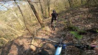
Photos of Compitese Mountain Bike
Videos of Compitese Mountain Bike
trail: Via Del Tromba
6:05 |
128 |
Feb 22, 2025 , Lucca
Recent Trail Reports
| status | trail | date | condition | info | user |
|---|---|---|---|---|---|
| Colle Dei Lecci | Jun 7, 2026 @ 8:53am (Europe/Rome) Jun 6, 2026 | Ideal | FraV8 | ||
| Climb "Prato A Sillori" | May 22, 2026 @ 12:42pm (Europe/San_Marino) May 22, 2026 | Ideal | Giobike73 | ||
| Colle Del Moro | Mar 5, 2026 @ 2:00pm (Europe/San_Marino) Mar 5, 2026 | Ideal | Gaddo60 | ||
| I Guadi Di San Giusto | Nov 16, 2025 @ 2:52pm (Europe/Rome) Nov 16, 2025 | Wet | luirossini | ||
| Hansen | Oct 29, 2025 @ 12:26pm (Europe/San_Marino) Oct 29, 2025 | Variable | Giobike73 | ||
| Il Pergolone | Oct 29, 2025 @ 12:26pm (Europe/San_Marino) Oct 29, 2025 | Wet | Giobike73 | ||
| Il Compitese | Sep 1, 2025 @ 4:44am Sep 1, 2025 | Ideal | Pallacce91 | ||
| Sassobodda | Sep 1, 2025 @ 4:43am Sep 1, 2025 | Wet | Pallacce91 | ||
| 134 | Sep 1, 2025 @ 4:43am Sep 1, 2025 | Wet | Pallacce91 | ||
| The Wolf | Sep 1, 2025 @ 4:43am Sep 1, 2025 | Wet | Pallacce91 |
Activity Feed
| username | action | type | title | date |
|---|---|---|---|---|
| FraV8 | add | report | activity #96526912 | Jun 8, 2026 @ 2:10am Jun 8, 2026 |
| Giobike73 | add | report | activity #95487083 | May 25, 2026 @ 7:33am May 25, 2026 |
| Hannya1977 | wishlist | region | activity #94694020 | May 14, 2026 @ 9:03am May 14, 2026 |
| Ulii6bKBi | wishlist | trail | activity #92484661 | Apr 12, 2026 @ 11:04am Apr 12, 2026 |
| Pier7o | wishlist | trail | activity #90074836 | Mar 6, 2026 @ 11:30am Mar 6, 2026 |
Recent Comments
| username | type | title | comment | date |
|---|---|---|---|---|
| trail | Non usabile pieno di vegetazione. Non tenuto! | Jun 26, 2025 @ 6:05am Jun 26, 2025 | ||
| trail | Non percorribile rovi stretti sul sentiero... | Sep 6, 2024 @ 1:00pm Sep 6, 2024 | ||
| trail | Da ripulire........ Molto chiuso da vegetazione | Sep 5, 2023 @ 10:14am Sep 5, 2023 | ||
| trail | La prima parte tecnica e divertente, poi... | Sep 16, 2021 @ 2:18pm Sep 16, 2021 | ||
| trail | Trail molto bello, tecnico e di soddisfazione. | Jan 29, 2021 @ 2:08am Jan 29, 2021 |
Nearby Areas
| name | distance | ||||
|---|---|---|---|---|---|
| Vorno Trail Area | 23 | 20 | 2 km | ||
| Padule | 2 | 2.6 km | |||
| Monte Pisano | 20 | 22 | 11 | 4.6 km | |
| 4 Venti | 12 | 16 | 3 | 4.9 km | |
| Ciapino Trail Area | 7 | 8 | 1 | 6.3 km |
Local Badges
-

Completionist0 awarded
Activity Type Stats
| activitytype | trails | distance | descent | descent distance | total vertical | rating | global rank | state rank | photos | reports | routes | ridelogs |
|---|---|---|---|---|---|---|---|---|---|---|---|---|
| Mountain Bike | 33 | 34 miles | 11,699 ft | 19 miles | 2,552 ft | #5,647 | #285 | 51 | 207 | 416 | ||
| E-Bike | 24 | 19 miles | 7,113 ft | 10 miles | 2,257 ft | #4,675 | #315 | 1 | 191 | 126 | ||
| Horse | 1 | 4,560 ft | 207 ft | 3,688 ft | 200 ft | 11 | ||||||
| Hike | 25 | 24 miles | 6,309 ft | 10 miles | 2,552 ft | #7,282 | #280 | 197 | 7 | |||
| Trail Running | 26 | 25 miles | 7,480 ft | 12 miles | 2,552 ft | #6,174 | #254 | 198 | 6 |
Frequently Asked Questions About Compitese
▼
What are the highest rated mountain biking trails in Compitese?
The highest rated mountain biking trails in Compitese are:
- 134 (4.1/5)
- Via Del Tromba (4.1/5)
- Ruota (4/5)
- Link 134-128 (4/5)
- 134 (4/5)
▼
What is the best time of the year to ride in Compitese?
Based on ride log data, the most popular months to ride in Compitese are:
- May (4 activities)
- July (4 activities)
- June (4 activities)
▼
Where can I park to ride in Compitese?
Check the Compitese trail map for trailhead and parking information. Community members regularly update access and parking details for trails in the area.
▼
What is the longest trail in Compitese?
The longest trail in Compitese is Il Compitese at 3.1 miles. View all trails sorted by distance.
- compitese activity log | embed map of Compitese mountain bike trails |
Downloading of trail gps tracks in kml & gpx formats is enabled for Compitese.
You must login to download files.