close
-
Layers w
- Weather Layers
- Pro
- Pro
- Pro
- Pro
- Pro
- Pro
- More Layers
- Pro
- Pro
- Pro
- Pro
-
Upgrade to

3D
Trail Conditions
- Unknown
- Snow Groomed
- Snow Packed
- Snow Covered
- Snow Cover Partial
- Freeze/thaw Cycle
- Icy
- Prevalent Mud
- Wet
- Variable
- Ideal
- Dry
- Very Dry
Trail Flow (Ridden Direction)
Trailforks scans users ridelogs to determine the most popular direction each trail is ridden. A good flowing trail network will have most trails flowing in a single direction according to their intension.
The colour categories are based on what percentage of riders are riding a trail in its intended direction.
The colour categories are based on what percentage of riders are riding a trail in its intended direction.
- > 96%
- > 90%
- > 80%
- > 70%
- > 50%
- < 50%
- bi-directional trail
- no data
Trail Last Ridden
Trailforks scans ridelogs to determine the last time a trail was ridden.
- < 2 days
- < 1 week
- < 2 weeks
- < 1 month
- < 6 months
- > 6 months
Trail Ridden Direction
The intended direction a trail should be ridden.
- Downhill Only
- Downhill Primary
- Both Directions
- Uphill Primary
- Uphill Only
- One Direction
Contribute Details
Colors indicate trail is missing specified detail.
- Description
- Photos
- Description & Photos
- Videos
Trail Popularity ?
Trailforks scans ridelogs to determine which trails are ridden the most in the last 9 months.
Trails are compared with nearby trails in the same city region with a possible 25 colour shades.
Think of this as a heatmap, more rides = more kinetic energy = warmer colors.
- most popular
- popular
- less popular
- not popular
ATV/ORV/OHV Filter
Max Vehicle Width
inches
US Cell Coverage
Legend

Radar Time
Activity Recordings
Trailforks uses anonymized public activity data.
?
Activity Recordings
Trailforks uses anonymized public activity data.
?
Personal Heatmap
▶
Activity Types
all
/
none
▶
Options
2
Date range
month
–
Winter Trails
Warning
A routing network for winter maps does not exist. Selecting trails using the winter trails layer has been disabled.
Missing Trails
Most Popular
Least Popular
Trails are colored based on popularity. The more popular a trail is, the more red. Less popular trails trend towards green.
Jump Magnitude Heatmap
Heatmap of where riders jump on trails. Zoom in to see individual jumps, click circles to view jump details.
BC Backroad Status
![map legend]()
Service Road Atlas is a free to use, community-driven service for viewing and creating reports on the numerous back-country service roads around B.C. and Alberta.

Slope Aspect
Direction the slope faces
Trails Deemphasized
Trails are shown in grey.
Only show trails with no bike usage.
Suggested Layers
Based on selected activity type
Save the current map location and zoom level as your default home location whenever this page is loaded.
Save
No description for Comrie has been added yet!
Login or register to submit one.
This region uses the Uk/Euro style trail grading system.
Activities Click to view
- Mountain Bike
38 trails
- E-Bike
38 trails
- Gravel Bike
0 trails
- Winter Fat Bike
0 trails
- Horse
5 trails
- Hike
19 trails
- Trail Running
19 trails
Region Details
- 12
- 3
- 7
- 8
- 6
Region Status
Open as of May 30, 2026Stats
- Avg Trail Rating
- Trails (view details)
- 36
- Trails Mountain Bike
- 38
- Trails E-Bike
- 38
- Trails Horse
- 5
- Trails Hike
- 19
- Trails Trail Running
- 19
- Total Distance
- 34 miles
- Total Descent
- 4,448 ft
- Total Vertical
- 2,822 ft
- Highest Trailhead
- 3,025 ft
- Reports
- 716
- Photos
- 37
- Ridden Counter
- 12,699
Sub Regions
-
Ben Chonzie
- 1
-
Comrie Croft
- 2
- 10
- 11
- 6
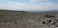
Popular Comrie Mountain Biking Trails
• 95 ★ 4.4 • 1,280 ft • 52 ft • 1,517 •
Highly rated popular blue difficulty singletrack. This mountain bike primary trail can be used one direction and has a moderate overall physical rating with a 52 ft blue climb. It features bridge. Trail visibility is always easy to follow. On average it takes 3 minutes to complete this trail.
• 95 ★ 4.7 • 3,179 ft • 42 ft • 1,466 •
The most obviously man made trail at Comrie. Starts at the cattle grid, or as a continuation of the blue upper. If your new, you can roll the whole thing, you might have to pedal a bit. Experienced riders will love the way the trail...
• 90 ★ 3.8 • 1,457 ft • 3 ft • 1,361 •
Outward from fireroad that leads to blue, red and black routes
• 70 ★ 4.1 • 1,529 ft • 24 ft • 1,286 •
Small climb about halfway through. Little bit more technical than a standard Forestry Commission blue route. There area couple of extra sections with black grade sections too, so it's worth riding even if you'd normally skip blue routes.
• 85 ★ 4.2 • 1,975 ft • 0 ft • 1,223 •
Tight, rocky harsh trail with steep corners and tricky rocky obstacles. Little bit pedally at the top and bottom. This trail is nothing like any Forestry Commission red graded trail, or even the new red graded trail - it's far more...
• 90 ★ 4.5 • 689 ft • 0 ft • 1,196 •
Highly rated popular blue difficulty machine groomed. This mountain bike primary trail can be used one direction and has a easy overall physical rating with a 0 ft blue climb. It features berm. Trail visibility is always easy to follow. On average it takes 5 minutes to complete this trail.
• 65 ★ 4.3 • 2,392 ft • 23 ft • 1,161 •
Bridges, rocks, lots of extra optional sections as close to feeling natural as it gets at a trail centre.
• 65 ★ 3.8 • 2,766 ft • 156 ft • 1,100 •
Tough climb with some varied, natural technical features, a stream crossing (it can be pretty deep and cold) and a bedrock crossing.
Comrie Mountain Bike Routes
3 miles • 594 ft • 9 • Race •
S5/6 Race Route - Scottish Schools Mountain Bike Championships
11 miles • 2,714 ft • 26 • Loop • Race •
Clans at The Croft is the first Enduro in the UK where you can join forces with your riding buddies to...
2 miles • 370 ft • 6 • Race •
S1/2 & S3/4 Race Route - Scottish Schools Mountain Bike Championships
9 miles • 2,015 ft • 20 • Race •
Clans at The Croft is the first Enduro in the UK where you can join forces with your riding buddies to...
• 16 miles • 3,448 ft • 51 •
• 14 miles • 2,905 ft • 41 •
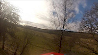
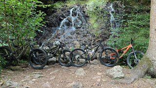
Photos of Comrie Mountain Bike
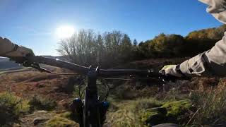
Videos of Comrie Mountain Bike
trail: Ben Chonzie Path
0:48 |
20 |
Jun 8, 2023
trail: Dark Side of the Blue
13:43 |
604 |
Feb 25, 2013

5:58 |
77 |
Nov 20, 2024
17:19 |
129 |
Oct 5, 2024
14:34 |
68 |
Aug 2, 2024
youtuber
![Ben Chonzie Munro. AERIAL ROUTE MAP. Ben...]()
trail: Ben Chonzie Path
3:43 |
198 |
Jun 8, 2023 , Comrie
youtuber
![Ben Chonzie Munro. Part 3. THE DESCENT. Ben...]()
trail: Ben Chonzie Path
13:10 |
329 |
Jun 8, 2023 , Comrie
youtuber
![Ben Chonzie Munro. Part 1. THE CLIMB. Ben...]()
trail: Ben Chonzie Path
27:34 |
214 |
Jun 8, 2023 , Comrie
Recent Trail Reports
Activity Feed
| username | action | type | title | date |
|---|---|---|---|---|
| AndyLscotland | ridden | trail | activity #96525871 and 2 more | Jun 8, 2026 @ 1:09am Jun 8, 2026 |
| stevenRVizH8 | add | report | activity #95843123 and 1 more | May 30, 2026 @ 5:57am May 30, 2026 |
| Natacar27 | wishlist | region | activity #95703245 | May 28, 2026 @ 6:39am May 28, 2026 |
| ALRC | add | report | activity #95495622 and 15 more | May 25, 2026 @ 9:20am May 25, 2026 |
| alastairrc | wishlist | region | activity #95439679 | May 24, 2026 @ 1:09pm May 24, 2026 |
Recent Comments
| username | type | title | comment | date |
|---|---|---|---|---|
| trail | Really nice trail through the woods, would... | Jul 27, 2025 @ 5:27am Jul 27, 2025 | ||
| trail | D | Apr 30, 2025 @ 12:23pm Apr 30, 2025 | ||
| trail | Definitely the best tech trail in the area. ... | Oct 28, 2024 @ 2:24am Oct 28, 2024 | ||
| trail | The "Dark Side" relates to the big rock drop... | Jul 21, 2024 @ 8:26am Jul 21, 2024 | ||
| trail | On | Mar 8, 2024 @ 12:00pm Mar 8, 2024 |
Local Badges
-

Completionist9 awarded -

Epic Mountain Bike Climb 2k33 awarded -

Climbing 10k Badge10 awarded -

Mountain Biking 100k Badge2 awarded -

Epic Ride Descent 2k33 awarded -

Descent 10k Badge10 awarded
Activity Type Stats
| activitytype | trails | distance | descent | descent distance | total vertical | rating | global rank | state rank | photos | reports | routes | ridelogs |
|---|---|---|---|---|---|---|---|---|---|---|---|---|
| Mountain Bike | 38 | 34 miles | 4,449 ft | 11 miles | 2,822 ft | #1,443 | #52 | 37 | 716 | 4 | 5,964 | |
| E-Bike | 38 | 34 miles | 4,449 ft | 11 miles | 2,822 ft | #2,646 | #95 | 699 | 1 | 1,260 | ||
| Horse | 5 | 9 miles | 659 ft | 3 miles | 509 ft | #2,341 | #120 | 72 | ||||
| Hike | 19 | 29 miles | 2,726 ft | 8 miles | 2,822 ft | #6,236 | #157 | 644 | 276 | |||
| Trail Running | 19 | 29 miles | 2,726 ft | 8 miles | 2,822 ft | #6,054 | #161 | 644 | 127 |
Frequently Asked Questions About Comrie
▼
What are the best places to ride in Comrie?
Comrie has 2 areas to explore for mountain biking. The top rated areas are:
▼
What are the highest rated mountain biking trails in Comrie?
The highest rated mountain biking trails in Comrie are:
- Cookie Monster (4.5/5)
- Natural Gold (2022) (4.3/5)
- Natural Gold (4.3/5)
- Phil MaBracken (4.3/5)
- Dual of the Earn (4.3/5)
▼
What is the best time of the year to ride in Comrie?
Based on ride log data, the most popular months to ride in Comrie are:
- May (30 activities)
- October (23 activities)
- July (15 activities)
▼
Where can I park to ride in Comrie?
Check the Comrie trail map for trailhead and parking information. Community members regularly update access and parking details for trails in the area.
Activities
Trails
- By gav-s
 & contributors
 - Admins: DMBinS, FLS, TTA
- #42679 - 1,729 views
- comrie activity log | embed map of Comrie mountain bike trails | comrie mountain biking points of interest polygons
Downloading of trail gps tracks in kml & gpx formats is enabled for Comrie.
You must login to download files.