close
-
Layers w
- Weather Layers
- Pro
- Pro
- Pro
- Pro
- Pro
- Pro
- More Layers
- Pro
- Pro
- Pro
- Pro
-
Upgrade to

3D
Trail Conditions
- Unknown
- Snow Groomed
- Snow Packed
- Snow Covered
- Snow Cover Partial
- Freeze/thaw Cycle
- Icy
- Prevalent Mud
- Wet
- Variable
- Ideal
- Dry
- Very Dry
Trail Flow (Ridden Direction)
Trailforks scans users ridelogs to determine the most popular direction each trail is ridden. A good flowing trail network will have most trails flowing in a single direction according to their intension.
The colour categories are based on what percentage of riders are riding a trail in its intended direction.
The colour categories are based on what percentage of riders are riding a trail in its intended direction.
- > 96%
- > 90%
- > 80%
- > 70%
- > 50%
- < 50%
- bi-directional trail
- no data
Trail Last Ridden
Trailforks scans ridelogs to determine the last time a trail was ridden.
- < 2 days
- < 1 week
- < 2 weeks
- < 1 month
- < 6 months
- > 6 months
Trail Ridden Direction
The intended direction a trail should be ridden.
- Downhill Only
- Downhill Primary
- Both Directions
- Uphill Primary
- Uphill Only
- One Direction
Contribute Details
Colors indicate trail is missing specified detail.
- Description
- Photos
- Description & Photos
- Videos
Trail Popularity ?
Trailforks scans ridelogs to determine which trails are ridden the most in the last 9 months.
Trails are compared with nearby trails in the same city region with a possible 25 colour shades.
Think of this as a heatmap, more rides = more kinetic energy = warmer colors.
- most popular
- popular
- less popular
- not popular
ATV/ORV/OHV Filter
Max Vehicle Width
inches
US Cell Coverage
Legend

Radar Time
Activity Recordings
Trailforks uses anonymized public activity data.
?
Activity Recordings
Trailforks uses anonymized public activity data.
?
Personal Heatmap
▶
Activity Types
all
/
none
▶
Options
2
Date range
month
–
Winter Trails
Warning
A routing network for winter maps does not exist. Selecting trails using the winter trails layer has been disabled.
Missing Trails
Most Popular
Least Popular
Trails are colored based on popularity. The more popular a trail is, the more red. Less popular trails trend towards green.
Jump Magnitude Heatmap
Heatmap of where riders jump on trails. Zoom in to see individual jumps, click circles to view jump details.
BC Backroad Status
![map legend]()
Service Road Atlas is a free to use, community-driven service for viewing and creating reports on the numerous back-country service roads around B.C. and Alberta.

Slope Aspect
Direction the slope faces
Trails Deemphasized
Trails are shown in grey.
Only show trails with no bike usage.
Suggested Layers
Based on selected activity type
Save the current map location and zoom level as your default home location whenever this page is loaded.
SaveConnor Park is a Sunshine Coast Regional District park. It's a beautiful forested area with lots of short trails most of which are easy or intermediate difficulty for those of you riding. Near the entrance to the park and parking lot there are playing fields, washrooms, a playground and a fun bike skills area.
Many of the trails in Connor Park and Halfmoon Bay were built and are maintained by the local Sprockids group.
Many of the trails in Connor Park and Halfmoon Bay were built and are maintained by the local Sprockids group.
source: Connor Park Trails
Primary Trail Type: Cross-Country
Land Status: Municipal Park
 google parking directions
 Access Info:
How to get to Connor Park: From Sechelt drive about 7 or 8 kms or 10 minutes northeast and turn left on Redrooffs Rd. Follow along Redrooffs for about 3 or 4 kms until you come to Southwood on your right (3rd road you come to on the right). Take the first left up Westwood Rd. and at the stop sign at Northwood Rd. go straight into the park on the gravel access road.
Activities Click to view
- Mountain Bike
25 trails
- E-Bike
25 trails
- Hike
31 trails
- Trail Running
31 trails
Region Details
- 1
- 13
- 11
Region Status
Open as of Nov 26, 2025Stats
- Avg Trail Rating
- Trails (view details)
- 30
- Trails Mountain Bike
- 25
- Trails E-Bike
- 25
- Trails Hike
- 31
- Trails Trail Running
- 31
- Total Distance
- 8 miles
- Total Descent
- 1,845 ft
- Total Vertical
- 694 ft
- Highest Trailhead
- 813 ft
- Reports
- 153
- Photos
- 103
- Ridden Counter
- 3,914
Popular Connor Park Mountain Biking Trails
• 95 ★ 4.0 • 510 ft • 30 ft • 217 •
Popular green difficulty singletrack. This mountain bike primary trail can be used both directions and has a easy overall physical rating with a 30 ft green climb. On average it takes 1 minutes to complete this trail.
• 100 ★ 4.0 • 1,120 ft • 7 ft • 179 •
Popular blue difficulty singletrack. This mountain bike primary trail can be used both directions with a 7 ft green climb. On average it takes 1 minutes to complete this trail.
• 85 ★ 2.4 • 847 ft • 0 ft • 161 •
Popular green difficulty singletrack. This mountain bike primary trail can be used downhill primary. On average it takes minutes to complete this trail.
• 100 ★ 4.0 • 433 ft • 8 ft • 161 •
Popular green difficulty singletrack. This mountain bike primary trail can be used both directions and has a easy overall physical rating with a 8 ft green climb. On average it takes minutes to complete this trail.
• 100 ★ 4.0 • 565 ft • 5 ft • 156 •
Popular blue difficulty singletrack. This mountain bike primary trail can be used downhill primary. On average it takes minutes to complete this trail.
Connor Park Mountain Bike Routes
★ 5.0 • 23 miles • 2,128 ft • 35 •
Day 1 of Great Explorations - Sunshine Coast Challenge! We start in the beautiful trails of Halfmoon Bay...
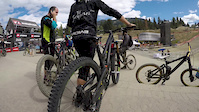
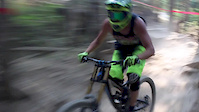
Photos of Connor Park Mountain Bike
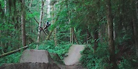
Videos of Connor Park Mountain Bike

trail: Dry
0:51 |
26 |
Nov 1, 2017

trail: Nick (Hiking Only)
12:39 |
187 |
Oct 4, 2017
trail: Dry
5:16 |
124 |
Sep 6, 2017
trail: Dry
0:49 |
93 |
Aug 10, 2017

trail: Dry
0:02 |
347 |
Aug 10, 2017

trail: Dry
12:19 |
45 |
Mar 2, 2017
trail: Dry
0:48 |
13231 |
Feb 16, 2017
trail: Nick (Hiking Only)
2:38 |
27394 |
Feb 7, 2017
Recent Trail Reports
| status | trail | date | condition | info | user |
|---|---|---|---|---|---|
| A1 | Nov 26, 2025 @ 1:43pm (America/Vancouver) Nov 26, 2025 | Variable | 421coast | ||
| Roller Coaster | Nov 26, 2025 @ 1:43pm (America/Vancouver) Nov 26, 2025 | Variable | 421coast | ||
| Spica | Sep 13, 2025 @ 3:35pm (America/Vancouver) Sep 13, 2025 | Ideal | Endorphinjunkie1 | ||
| Squiggley | Jun 29, 2025 @ 4:27pm Jun 29, 2025 | Ideal | 421coast | ||
| Sprokids Run | Jun 29, 2025 @ 4:27pm Jun 29, 2025 | Ideal | 421coast | ||
| eX | Jun 29, 2025 @ 4:27pm Jun 29, 2025 | Ideal | 421coast | ||
| XX | May 5, 2025 @ 3:54pm May 5, 2025 | Ideal | 421coast | ||
| Out & In | Apr 11, 2025 @ 2:43pm Apr 11, 2025 | Variable | 421coast | ||
| In & Out | Mar 22, 2025 @ 1:28pm Mar 22, 2025 | Variable | Endorphinjunkie1 | ||
| Owl | Mar 22, 2025 @ 1:15pm Mar 22, 2025 | Wet | Endorphinjunkie1 |
Activity Feed
| username | action | type | title | date |
|---|---|---|---|---|
| trailforks | add | video | activity #97187910 | Jun 17, 2026 @ 9:00am 2 days |
| AnnaCatharinajn9KR7 | wishlist | route | activity #96374820 | Jun 6, 2026 @ 8:38am Jun 6, 2026 |
| Gypsysoul | wishlist | region | activity #95179895 | May 21, 2026 @ 9:12am May 21, 2026 |
| Nick-Send-It | wishlist | trail | activity #93987737 | May 3, 2026 @ 3:09pm May 3, 2026 |
| trailforks | add | video | activity #93168020 | Apr 22, 2026 @ 1:00pm Apr 22, 2026 |
Recent Comments
| username | type | title | comment | date |
|---|---|---|---|---|
| trail | I really enjoyed this trail. I ended up... | Aug 29, 2025 @ 6:42am Aug 29, 2025 | ||
| trail | Fast, straight, flat, and boring. The... | Aug 29, 2025 @ 6:38am Aug 29, 2025 | ||
| trail | Nothing special. Just a zero flow straight... | May 16, 2025 @ 7:34pm May 16, 2025 | ||
| trail | Like most of the trails near the school this... | May 16, 2025 @ 7:31pm May 16, 2025 | ||
| report | Large tree down about same distance from... | Sep 9, 2024 @ 12:30pm Sep 9, 2024 |
Nearby Areas
| name | distance | ||||
|---|---|---|---|---|---|
| Halfmoon Bay | 10 | 36 | 2 | 1.5 km | |
| West Sechelt | 19 | 58 | 45 | 3 | 3.2 km |
| Kinnikinnick Park | 15 | 1 | 4.7 km | ||
| MiddlePoint | 14 | 12 | 5 | 7.4 km | |
| Coast Gravity Park | 1 | 5 | 1 | 7.5 km |
Local Badges
-

Completionist6 awarded
Bike & Skill Parks
| name | type | city | rating |
|---|---|---|---|
| Connor Park | skill park | Sechelt |
Activity Type Stats
| activitytype | trails | distance | descent | descent distance | total vertical | rating | global rank | state rank | photos | reports | routes | ridelogs |
|---|---|---|---|---|---|---|---|---|---|---|---|---|
| Mountain Bike | 25 | 5 miles | 935 ft | 3 miles | 341 ft | #5,862 | #254 | 103 | 152 | 1 | 882 | |
| E-Bike | 25 | 5 miles | 935 ft | 3 miles | 341 ft | #5,979 | #224 | 149 | 94 | |||
| Hike | 31 | 8 miles | 1,847 ft | 4 miles | 692 ft | #7,935 | #313 | 153 | 355 | |||
| Trail Running | 31 | 8 miles | 1,847 ft | 4 miles | 692 ft | #8,067 | #302 | 153 | 201 |
Frequently Asked Questions About Connor Park
▼
What are the highest rated mountain biking trails in Connor Park?
The highest rated mountain biking trails in Connor Park are:
- Roller Coaster (4.2/5)
- R.E.M. (4.1/5)
- Spica (4.1/5)
- A1 (4/5)
- J-Lo (4/5)
▼
What is the best time of the year to ride in Connor Park?
Based on ride log data, the most popular months to ride in Connor Park are:
- July (41 activities)
- August (25 activities)
- May (20 activities)
▼
Where can I park to ride in Connor Park?
There are 1 parking locations listed in Connor Park. The most popular parking spots are:
▼
What is the longest trail in Connor Park?
The longest trail in Connor Park is Roller Coaster at 3,071 ft. View all trails sorted by distance.
- By 1partatatime
 PACA & contributors
 - Admins: CMBTA, SCDBA, Wabmatrix, CMBTA
- #6406 - 5,988 views
- connor park activity log | embed map of Connor Park mountain bike trails | connor park mountain biking points of interest
Downloading of trail gps tracks in kml & gpx formats is enabled for Connor Park.
You must login to download files.