close
-
Layers w
- Weather Layers
- Pro
- Pro
- Pro
- Pro
- Pro
- Pro
- More Layers
- Pro
- Pro
- Pro
- Pro
-
Upgrade to

3D
Trail Conditions
- Unknown
- Snow Groomed
- Snow Packed
- Snow Covered
- Snow Cover Partial
- Freeze/thaw Cycle
- Icy
- Prevalent Mud
- Wet
- Variable
- Ideal
- Dry
- Very Dry
Trail Flow (Ridden Direction)
Trailforks scans users ridelogs to determine the most popular direction each trail is ridden. A good flowing trail network will have most trails flowing in a single direction according to their intension.
The colour categories are based on what percentage of riders are riding a trail in its intended direction.
The colour categories are based on what percentage of riders are riding a trail in its intended direction.
- > 96%
- > 90%
- > 80%
- > 70%
- > 50%
- < 50%
- bi-directional trail
- no data
Trail Last Ridden
Trailforks scans ridelogs to determine the last time a trail was ridden.
- < 2 days
- < 1 week
- < 2 weeks
- < 1 month
- < 6 months
- > 6 months
Trail Ridden Direction
The intended direction a trail should be ridden.
- Downhill Only
- Downhill Primary
- Both Directions
- Uphill Primary
- Uphill Only
- One Direction
Contribute Details
Colors indicate trail is missing specified detail.
- Description
- Photos
- Description & Photos
- Videos
Trail Popularity ?
Trailforks scans ridelogs to determine which trails are ridden the most in the last 9 months.
Trails are compared with nearby trails in the same city region with a possible 25 colour shades.
Think of this as a heatmap, more rides = more kinetic energy = warmer colors.
- most popular
- popular
- less popular
- not popular
ATV/ORV/OHV Filter
Max Vehicle Width
inches
US Cell Coverage
Legend

Radar Time
Activity Recordings
Trailforks uses anonymized public activity data.
?
Activity Recordings
Trailforks uses anonymized public activity data.
?
Personal Heatmap
▶
Activity Types
all
/
none
▶
Options
2
Date range
month
–
Winter Trails
Warning
A routing network for winter maps does not exist. Selecting trails using the winter trails layer has been disabled.
Missing Trails
Most Popular
Least Popular
Trails are colored based on popularity. The more popular a trail is, the more red. Less popular trails trend towards green.
Jump Magnitude Heatmap
Heatmap of where riders jump on trails. Zoom in to see individual jumps, click circles to view jump details.
BC Backroad Status
![map legend]()
Service Road Atlas is a free to use, community-driven service for viewing and creating reports on the numerous back-country service roads around B.C. and Alberta.

Slope Aspect
Direction the slope faces
Trails Deemphasized
Trails are shown in grey.
Only show trails with no bike usage.
Suggested Layers
Based on selected activity type
Save the current map location and zoom level as your default home location whenever this page is loaded.
Save
No description for Cooma has been added yet!
Login or register to submit one.
Activities Click to view
- Mountain Bike
80 trails
- E-Bike
21 trails
- Adaptive Bike
0 trails
- Winter Fat Bike
0 trails
- Horse
1 trails
- Hike
18 trails
- Trail Running
20 trails
Region Details
- 8
- 23
- 35
- 12
Region Status
Open as of Apr 23, 2026Stats
- Avg Trail Rating
- Trails (view details)
- 79
- Trails Mountain Bike
- 80
- Trails E-Bike
- 21
- Trails Horse
- 1
- Trails Hike
- 18
- Trails Trail Running
- 20
- Total Distance
- 44 miles
- Total Descent
- 7,681 ft
- Total Vertical
- 966 ft
- Highest Trailhead
- 3,520 ft
- Reports
- 93
- Photos
- 44
- Ridden Counter
- 9,686
Sub Regions
-
Lambie Reserve
- 4
- 3
- 1
-
Mount Gladstone
- 5
- 8
- 4
-
North Ridge
- 8
- 9
- 4
-
Pine Range
- 5
- 12
- 3
-
Zalka Heights
- 1
- 3
Popular Cooma Mountain Biking Trails
• 100 ★ 4.5 • 2,510 ft • 17 ft • 659 •
Popular green difficulty singletrack. This mountain bike primary trail can be used one direction and has a easy overall physical rating. It features berm, jump and gap jump. Trail visibility is always easy to follow. On average it takes 23 minutes to complete this trail.
• 95 ★ 4.7 • 1 mile • 6 ft • 632 •
Popular blue difficulty machine groomed. This mountain bike primary trail can be used one direction and has a moderate overall physical rating. It features berm, drop, jump, rock face, rock garden and roller coaster. Trail visibility is always easy to follow. On average it takes 5 minutes to complete this trail.
• 95 ★ 2.5 • 2,526 ft • 89 ft • 497 •
Popular green difficulty singletrack. This mountain bike primary trail can be used one direction and has a easy overall physical rating with a 89 ft green climb. Trail visibility is always easy to follow. On average it takes 4 minutes to complete this trail.
• 90 ★ 5.0 • 1,125 ft • 0 ft • 475 •
Popular blue difficulty machine groomed. This mountain bike primary trail can be used downhill only and has a moderate overall physical rating. It features berm, jump and gap jump. Trail visibility is always easy to follow. On average it takes 1 minutes to complete this trail.
• 100 ★ 5.0 • 5,259 ft • 0 ft • 466 •
Popular black diamond difficulty machine groomed. This mountain bike primary trail can be used one direction and has a moderate overall physical rating. It features berm, drop, jump, gap jump, rock garden and roller coaster. Trail visibility is always easy to follow. On average it takes 4 minutes to complete this trail.
• 95 ★ 4.0 • 2 miles • 292 ft • 382 •
Loose and rocky but certainly worth it for tge view at the top and the descent back down either or
• 95 ★ 5.0 • 2,110 ft • 53 ft • 365 •
Popular green difficulty singletrack. This mountain bike primary trail can be used one direction and has a easy overall physical rating with a 53 ft green climb. Trail visibility is always easy to follow. On average it takes 4 minutes to complete this trail.
• 75 ★ 0.0 • 1,299 ft • 0 ft • 348 •
Popular blue difficulty singletrack. This mountain bike primary trail can be used one direction and has a moderate overall physical rating. Trail visibility is always easy to follow. On average it takes 1 minutes to complete this trail.
Cooma Mountain Bike Routes
★ 5.0 • 6 miles • 905 ft • 7 • Loop •
Easy to moderate loop taking you up Longview, down Shuttlecock, back up Caboose, and finally down Galdiator.
★ 5.0 • 5 miles • 677 ft • 32 • Loop •
Starting with an easy climb up Longview, descending on Skidmark, cut across to get to the start of the...
★ 5.0 • 3 miles • 514 ft • 18 • Loop •
Riding up Kick Start My Heart, and down Shred Flanders.
5 miles • 557 ft • 5 • Loop •
Just stitching several flowy sections of Mt Gladstone into a short route :-)
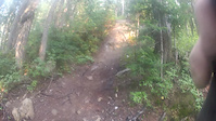
Photos of Cooma Mountain Bike
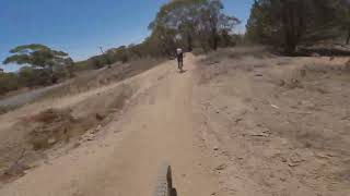
Videos of Cooma Mountain Bike

trail: Gladiator
0:08 |
132 |
Jul 13, 2022
trail: Goats Gully
0:29 |
626 |
Sep 20, 2019
trail: Gladiator
4:59 |
339 |
Dec 22, 2023 , Cooma

trail: Shred Flanders
3:42 |
313 |
Dec 22, 2023 , Cooma

trail: Shred Flanders
4:00 |
373 |
May 2, 2023 , Cooma

trail: Rubber Side Down
3:27 |
289 |
Apr 30, 2023 , Cooma

trail: Rubber Side Down
3:16 |
625 |
Mar 15, 2022 , Cooma

trail: Shred Flanders
12:59 |
531 |
Mar 15, 2022 , Cooma
Recent Trail Reports
| status | trail | date | condition | info | user |
|---|---|---|---|---|---|
| Hidden Valley | Oct 4, 2025 @ 10:11am (Australia/Sydney) Oct 3, 2025 | Ideal | RomanMark | ||
| Shuttlecock | Feb 18, 2025 @ 1:12pm Feb 18, 2025 | Very Dry | Willharvey04 | ||
| Gladiator | Jan 2, 2025 @ 6:01pm Jan 2, 2025 | Dry | Willharvey04 | ||
| Shred Flanders | Jan 2, 2025 @ 6:00pm Jan 2, 2025 | Very Dry | Willharvey04 | ||
| Skidmark | Jan 2, 2025 @ 5:59pm Jan 2, 2025 | Dry | Willharvey04 | ||
| Piney Ridge Fire Trail | Nov 20, 2024 @ 12:32pm Nov 20, 2024 | Very Dry | Mick62 | ||
| Franks Loop | May 14, 2024 @ 1:13am May 14, 2024 | Ideal | Msmyth | ||
| Franks Loop | May 14, 2024 @ 1:13am May 14, 2024 | Ideal | Msmyth | ||
| Fence Line | May 14, 2024 @ 1:13am May 14, 2024 | Ideal | Msmyth | ||
| No Heart Left | Jan 20, 2024 @ 6:25pm Jan 20, 2024 | Very Dry | zokstar |
Activity Feed
| username | action | type | title | date |
|---|---|---|---|---|
| REJB | ridden | region | activity #96850376 | Jun 12, 2026 @ 11:24pm Jun 12, 2026 |
| benduffy | wishlist | trail | activity #95803551 | May 29, 2026 @ 2:47pm May 29, 2026 |
| caseypyne | wishlist | route | activity #93200695 | Apr 23, 2026 @ 2:18am Apr 23, 2026 |
| RandSzFDeR6 | ridden | trail | activity #91870580 | Apr 3, 2026 @ 10:23pm Apr 3, 2026 |
| mty10 | like | directory | activity #91564680 | Mar 29, 2026 @ 5:43pm Mar 29, 2026 |
Recent Comments
| username | type | title | comment | date |
|---|---|---|---|---|
| trail | Super rocky sections | Mar 4, 2023 @ 12:04am Mar 4, 2023 | ||
| report | Hi what is a shuttle ? | Apr 30, 2022 @ 9:36pm Apr 30, 2022 | ||
| trail | Abandoned | Apr 5, 2022 @ 12:38am Apr 5, 2022 | ||
| trail | Very loose | Jan 25, 2021 @ 10:48pm Jan 25, 2021 | ||
| trail | Fairly gentle up trail with pretty landscape. | Jan 10, 2021 @ 5:48pm Jan 10, 2021 |
Local Badges
-

Completionist1 awarded -

10 Blue Trails96 awarded -

10 Green Trails61 awarded -

Top 10 Trails5 awarded -
Completionist0 awarded -
Completionist0 awarded
Activity Type Stats
| activitytype | trails | distance | descent | descent distance | total vertical | rating | global rank | state rank | photos | reports | routes | ridelogs |
|---|---|---|---|---|---|---|---|---|---|---|---|---|
| Mountain Bike | 80 | 44 miles | 7,644 ft | 20 miles | 965 ft | #1,850 | #91 | 42 | 93 | 17 | 5,974 | |
| E-Bike | 21 | 13 miles | 1,837 ft | 5 miles | 902 ft | #4,342 | #202 | 2 | 67 | 14 | 657 | |
| Horse | 1 | 2 miles | 269 ft | 4,383 ft | 272 ft | #1,561 | #63 | 20 | ||||
| Hike | 18 | 11 miles | 1,663 ft | 4 miles | 902 ft | #7,527 | #232 | 1 | 68 | 41 | ||
| Trail Running | 20 | 14 miles | 2,031 ft | 5 miles | 902 ft | #6,603 | #211 | 68 | 173 |
Frequently Asked Questions About Cooma
▼
What are the best places to ride in Cooma?
Cooma has 5 areas to explore for mountain biking. The top rated areas are:
▼
What are the highest rated mountain biking trails in Cooma?
The highest rated mountain biking trails in Cooma are:
- Kick Start My Heart (4.2/5)
- Rubber Side Down (4.2/5)
- Gladiator (4.2/5)
- Shred Flanders (4.1/5)
- Cherry Red (4.1/5)
▼
What is the best time of the year to ride in Cooma?
Based on ride log data, the most popular months to ride in Cooma are:
- April (79 activities)
- January (71 activities)
- December (64 activities)
▼
Where can I park to ride in Cooma?
There are 2 parking locations listed in Cooma. The most popular parking spots are:
Activities
Trails
Points of Interest
- By Addzz
 TRAILFORKS NEMTB & contributors
 - Admins: stuartrichardson, Gooldin
- #17696 - 8,494 views
- cooma activity log | embed map of Cooma mountain bike trails | cooma mountain biking points of interest
Downloading of trail gps tracks in kml & gpx formats is enabled for Cooma.
You must login to download files.