close
-
Layers w
- Weather Layers
- Pro
- Pro
- Pro
- Pro
- Pro
- Pro
- More Layers
- Pro
- Pro
- Pro
- Pro
-
Upgrade to

3D
Trail Conditions
- Unknown
- Snow Groomed
- Snow Packed
- Snow Covered
- Snow Cover Partial
- Freeze/thaw Cycle
- Icy
- Prevalent Mud
- Wet
- Variable
- Ideal
- Dry
- Very Dry
Trail Flow (Ridden Direction)
Trailforks scans users ridelogs to determine the most popular direction each trail is ridden. A good flowing trail network will have most trails flowing in a single direction according to their intension.
The colour categories are based on what percentage of riders are riding a trail in its intended direction.
The colour categories are based on what percentage of riders are riding a trail in its intended direction.
- > 96%
- > 90%
- > 80%
- > 70%
- > 50%
- < 50%
- bi-directional trail
- no data
Trail Last Ridden
Trailforks scans ridelogs to determine the last time a trail was ridden.
- < 2 days
- < 1 week
- < 2 weeks
- < 1 month
- < 6 months
- > 6 months
Trail Ridden Direction
The intended direction a trail should be ridden.
- Downhill Only
- Downhill Primary
- Both Directions
- Uphill Primary
- Uphill Only
- One Direction
Contribute Details
Colors indicate trail is missing specified detail.
- Description
- Photos
- Description & Photos
- Videos
Trail Popularity ?
Trailforks scans ridelogs to determine which trails are ridden the most in the last 9 months.
Trails are compared with nearby trails in the same city region with a possible 25 colour shades.
Think of this as a heatmap, more rides = more kinetic energy = warmer colors.
- most popular
- popular
- less popular
- not popular
ATV/ORV/OHV Filter
Max Vehicle Width
inches
US Cell Coverage
Legend

Radar Time
Activity Recordings
Trailforks uses anonymized public activity data.
?
Activity Recordings
Trailforks uses anonymized public activity data.
?
Personal Heatmap
▶
Activity Types
all
/
none
▶
Options
2
Date range
month
–
Winter Trails
Warning
A routing network for winter maps does not exist. Selecting trails using the winter trails layer has been disabled.
Missing Trails
Most Popular
Least Popular
Trails are colored based on popularity. The more popular a trail is, the more red. Less popular trails trend towards green.
Jump Magnitude Heatmap
Heatmap of where riders jump on trails. Zoom in to see individual jumps, click circles to view jump details.
BC Backroad Status
![map legend]()
Service Road Atlas is a free to use, community-driven service for viewing and creating reports on the numerous back-country service roads around B.C. and Alberta.

Slope Aspect
Direction the slope faces
Trails Deemphasized
Trails are shown in grey.
Only show trails with no bike usage.
Suggested Layers
Based on selected activity type
Save the current map location and zoom level as your default home location whenever this page is loaded.
SavePort Alberni riding isn't as varied as other communities on the Island. While there is some nice cruising on old logging roads and the odd section of cross-country riding, what Port Alberni is known for is super steep downhills. From the Beaufort Mountain Lookout near Coombs riders can access an old rail grade. Logging roads climb up and gnarly, jump and ramp filled single track brings riders back down.
 google parking directions
 Access Info:
Coombs Country Candy store parking lot
Links
Files
- candy store map.pdf (957 KB)
Activities Click to view
- Mountain Bike
70 trails
- E-Bike
18 trails
- Horse
8 trails
- Hike
63 trails
- Trail Running
63 trails
- Dirtbike/Moto
9 trails
- ATV/ORV/OHV
7 trails
Region Details
- 25
- 3
- 8
- 23
- 8
- 1
Region Status
Caution as of May 15, 2026Stats
- Avg Trail Rating
- Trails (view details)
- 71
- Trails Mountain Bike
- 71
- Trails E-Bike
- 18
- Trails Horse
- 8
- Trails Hike
- 63
- Trails Trail Running
- 63
- Trails Dirtbike/Moto
- 9
- Trails ATV/ORV/OHV
- 7
- Total Distance
- 38 miles
- Total Descent
- 8,784 ft
- Total Vertical
- 1,719 ft
- Highest Trailhead
- 1,896 ft
- Reports
- 604
- Photos
- 173
- Ridden Counter
- 6,401
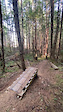
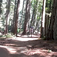
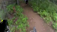
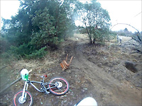
Popular Coombs Candy Mountain Biking Trails
• 90 ★ 4.9 • 3,648 ft • 0 ft • 384 •
Fast flowy trail with berms and several jumps. This blue trail has a handful of black diamond optional features. Look before you leap. Downhill users beware as the trail is actively hiked. Make noise often.
• 90 ★ 4.7 • 2,041 ft • 0 ft • 253 •
Old Island Cup DH track. One of the OG island downhill trails.
• 75 ★ 4.3 • 4,613 ft • 95 ft • 206 •
This trail is a unique up and down with several ladder bridges, rock rolls and some fun flow. Makes for a good loop after climbing citizens climb.
Coombs Candy Mountain Bike Routes
★ 3.5 • 6 miles • 1,300 ft • 5 • Loop •
One of the most mellow loops at the Candy Store network.
9 miles • 1,977 ft • 7 • Loop •
Some of the steeper more tech trails at the candy store.
★ 2.5 • 17 miles • 2,516 ft • 0 • Out & Back •
From Port Alberni to the route utilizes active, partially and/or well maintained logging roads. On the...
★ 5.0 • 17 miles • 3,496 ft • 11 • Loop • Race •
The Jumping Slug bike shop is stoked to present the first ever P.A. ENDURO!! We have been busy buffing the...
17 miles • 3,502 ft • 12 • Loop • Race •
The Jumping Slug bike shop is stoked to present the first ever P.A. ENDURO!! We have been busy buffing the...
17 miles • 3,655 ft • 12 • Race •
Stage 1 Bear Stage 2 911- Willys ( Or Gods plan) Stage 3 Stage 4 Stage 5
Photos of Coombs Candy Mountain Bike
Videos of Coombs Candy Mountain Bike
trail: Goose Tracks
0:05 |
196 |
Aug 28, 2023

trail: Scorpion
0:08 |
136 |
Sep 17, 2020

trail: Talent DH
2:12 |
4288 |
Dec 1, 2016

trail: Resurrection
4:37 |
347 |
Aug 28, 2016

trail: 911
0:52 |
1652 |
Oct 18, 2014
trail: 911
0:15 |
378 |
Jul 31, 2014
trail: Purgatory
5:25 |
512 |
Aug 21, 2013
trail: The Face
0:16 |
3347 |
Dec 18, 2012
Recent Trail Reports
| status | trail | date | condition | info | user |
|---|---|---|---|---|---|
| Talent DH | May 15, 2026 @ 12:32pm (America/Vancouver) May 15, 2026 | Ideal | JqdzD3oS | ||
| Keep on Cooking | May 8, 2026 @ 6:25pm (America/Vancouver) May 8, 2026 | Unknown | jpsd | ||
| Upper Goose Tracks | May 8, 2026 @ 6:25pm (America/Vancouver) May 8, 2026 | Dry | jpsd | ||
| Purgatory | May 6, 2026 @ 2:38pm (America/Vancouver) May 6, 2026 | Ideal | p3riderforlife | ||
| Cookhouse | May 6, 2026 @ 2:26pm (America/Vancouver) May 6, 2026 | Variable | p3riderforlife | ||
| Home Stretch | May 6, 2026 @ 2:26pm (America/Vancouver) May 6, 2026 | Variable | p3riderforlife | ||
| Scorpa | May 6, 2026 @ 2:19pm (America/Vancouver) May 6, 2026 | Ideal | p3riderforlife | ||
| Resurrection | May 4, 2026 @ 5:55am (America/Vancouver) May 4, 2026 | Dry | Hmwright | ||
| Panorpa | May 3, 2026 @ 12:27pm (America/Vancouver) May 3, 2026 | Unknown | overit | ||
| Citizen Climb | Apr 26, 2026 @ 9:30pm (America/Vancouver) Apr 26, 2026 | Dry | dglass ROAV |
Activity Feed
| username | action | type | title | date |
|---|---|---|---|---|
| RyderqIv2gT | wishlist | trail | activity #97272688 | Jun 18, 2026 @ 1:18pm 21 hours |
| riderjh | ridden | trail | activity #96719528 | Jun 10, 2026 @ 10:41pm Jun 10, 2026 |
| mtayler | wishlist | route | activity #95909302 | May 30, 2026 @ 9:33pm May 30, 2026 |
| jamespage | wishlist | route | activity #95908805 | May 30, 2026 @ 9:10pm May 30, 2026 |
| MWBORTHWICK | wishlist | route | activity #95889782 | May 30, 2026 @ 2:58pm May 30, 2026 |
Recent Comments
| username | type | title | comment | date |
|---|---|---|---|---|
| trail | This trails running great right now. The extra... | May 4, 2026 @ 7:08am May 4, 2026 | ||
| trail | All clear. | Sep 21, 2025 @ 1:10pm Sep 21, 2025 | ||
| trail | Rideable on a MTB. This would be really... | Sep 8, 2025 @ 12:31pm Sep 8, 2025 | ||
| trail | This is a 4x4 / MTB climb! I wanted to do the... | Sep 8, 2025 @ 12:26pm Sep 8, 2025 | ||
| trail | Can someone explain to me why most of these... | Aug 6, 2025 @ 8:24pm Aug 6, 2025 |
Nearby Areas
| name | distance | ||||
|---|---|---|---|---|---|
| Burde Trails | 1 | 1.8 km | |||
| MaquinnaTrails | 26 | 9 | 1 | 3.4 km | |
| Horne Lake Caves Provincal Park | 2 | 5.5 km | |||
| Horne Lake | 1 | 2 | 1 | 6.3 km | |
| Upper Little Qualicum River Woodlands | 1 | 1 | 7.6 km |
Local Badges
-

Completionist0 awarded
Local Mountain Biking Directory
-
Riders Of Alberni ValleyClub
![Riders Of Alberni Valley]()
-
Port Alberni Cycling ClubClub
-
Jumping Slug Community CycleryBike Shop
![Jumping Slug Community Cyclery]()
Local Products
Activity Type Stats
| activitytype | trails | distance | descent | descent distance | total vertical | rating | global rank | state rank | photos | reports | routes | ridelogs |
|---|---|---|---|---|---|---|---|---|---|---|---|---|
| Mountain Bike | 70 | 37 miles | 8,780 ft | 15 miles | 1,719 ft | #1,381 | #100 | 166 | 604 | 9 | 4,736 | |
| E-Bike | 18 | 8 miles | 1,719 ft | 4 miles | 1,047 ft | #6,005 | #226 | 374 | 6 | 336 | ||
| Horse | 8 | 3 miles | 236 ft | 3,596 ft | 840 ft | #1,732 | #52 | 93 | 1 | 1 | ||
| Hike | 63 | 33 miles | 6,893 ft | 12 miles | 1,686 ft | #4,854 | #203 | 7 | 581 | 427 | ||
| Trail Running | 63 | 33 miles | 6,893 ft | 12 miles | 1,686 ft | #4,124 | #133 | 581 | 296 | |||
| Dirtbike/Moto | 9 | 3 miles | 236 ft | 3,596 ft | 840 ft | #703 | #65 | 92 | 23 | |||
| ATV/ORV/OHV | 7 | 3 miles | 184 ft | 2,618 ft | 518 ft | #462 | #42 | 90 | 7 |
Frequently Asked Questions About Coombs Candy
▼
What are the highest rated mountain biking trails in Coombs Candy?
The highest rated mountain biking trails in Coombs Candy are:
- Lower DH (4.6/5)
- Bear Necessities (4.6/5)
- Goose Tracks (4.5/5)
- Over the rock (4.5/5)
- Purple Rain (4.5/5)
▼
What is the best time of the year to ride in Coombs Candy?
Based on ride log data, the most popular months to ride in Coombs Candy are:
- August (63 activities)
- July (56 activities)
- September (45 activities)
▼
Where can I park to ride in Coombs Candy?
There are 2 parking locations listed in Coombs Candy. The most popular parking spots are:
▼
What is the longest trail in Coombs Candy?
The longest trail in Coombs Candy is Citizen Climb at 1.6 miles. View all trails sorted by distance.
Activities
Trails
Points of Interest
- By canadaka
 Trailforks & contributors
 - Admins: ROAV
- #1460 - 14,205 views
- coombs candy activity log | embed map of Coombs Candy mountain bike trails | coombs candy mountain biking points of interest
Downloading of trail gps tracks in kml & gpx formats is enabled for Coombs Candy.
You must login to download files.