close
-
Layers w
- Weather Layers
- Pro
- Pro
- Pro
- Pro
- Pro
- Pro
- More Layers
- Pro
- Pro
- Pro
- Pro
-
Upgrade to

3D
Trail Conditions
- Unknown
- Snow Groomed
- Snow Packed
- Snow Covered
- Snow Cover Partial
- Freeze/thaw Cycle
- Icy
- Prevalent Mud
- Wet
- Variable
- Ideal
- Dry
- Very Dry
Trail Flow (Ridden Direction)
Trailforks scans users ridelogs to determine the most popular direction each trail is ridden. A good flowing trail network will have most trails flowing in a single direction according to their intension.
The colour categories are based on what percentage of riders are riding a trail in its intended direction.
The colour categories are based on what percentage of riders are riding a trail in its intended direction.
- > 96%
- > 90%
- > 80%
- > 70%
- > 50%
- < 50%
- bi-directional trail
- no data
Trail Last Ridden
Trailforks scans ridelogs to determine the last time a trail was ridden.
- < 2 days
- < 1 week
- < 2 weeks
- < 1 month
- < 6 months
- > 6 months
Trail Ridden Direction
The intended direction a trail should be ridden.
- Downhill Only
- Downhill Primary
- Both Directions
- Uphill Primary
- Uphill Only
- One Direction
Contribute Details
Colors indicate trail is missing specified detail.
- Description
- Photos
- Description & Photos
- Videos
Trail Popularity ?
Trailforks scans ridelogs to determine which trails are ridden the most in the last 9 months.
Trails are compared with nearby trails in the same city region with a possible 25 colour shades.
Think of this as a heatmap, more rides = more kinetic energy = warmer colors.
- most popular
- popular
- less popular
- not popular
ATV/ORV/OHV Filter
Max Vehicle Width
inches
US Cell Coverage
Legend

Radar Time
Activity Recordings
Trailforks uses anonymized public activity data.
?
Activity Recordings
Trailforks uses anonymized public activity data.
?
Personal Heatmap
▶
Activity Types
all
/
none
▶
Options
2
Date range
month
–
Winter Trails
Warning
A routing network for winter maps does not exist. Selecting trails using the winter trails layer has been disabled.
Missing Trails
Most Popular
Least Popular
Trails are colored based on popularity. The more popular a trail is, the more red. Less popular trails trend towards green.
Jump Magnitude Heatmap
Heatmap of where riders jump on trails. Zoom in to see individual jumps, click circles to view jump details.
BC Backroad Status
![map legend]()
Service Road Atlas is a free to use, community-driven service for viewing and creating reports on the numerous back-country service roads around B.C. and Alberta.

Slope Aspect
Direction the slope faces
Trails Deemphasized
Trails are shown in grey.
Only show trails with no bike usage.
Suggested Layers
Based on selected activity type
Save the current map location and zoom level as your default home location whenever this page is loaded.
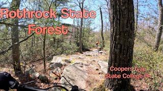
SaveA series of trails within Rothrock State forest. These are more flowy trails than found in the Galbraith Gap area and many are part of the IMBA Coopers Gap Epic
Primary Trail Type: Cross-Country
Land Status: State Forest
 google parking directions
 Access Info:
There are 3 parking areas; The Shale Pit where Coopers Gap Rd and Stone Creek Rd meet, Peep Lot where Peep trail meets Coopers Gap Rd and Shitaka lot where Shitaka trail crosses Coopers Gap Rd
Activities Click to view
- Mountain Bike
51 trails
- E-Bike
50 trails
- Hike
53 trails
- Trail Running
53 trails
Region Details
- 11
- 4
- 16
- 14
- 4
Region Status
Caution as of Jun 10, 2026Stats
- Avg Trail Rating
- Trails (view details)
- 50
- Trails Mountain Bike
- 51
- Trails E-Bike
- 50
- Trails Hike
- 53
- Trails Trail Running
- 53
- Total Distance
- 69 miles
- Total Descent
- 12,446 ft
- Total Vertical
- 1,564 ft
- Highest Trailhead
- 2,382 ft
- Reports
- 562
- Photos
- 70
- Ridden Counter
- 7,522
Popular Coopers Gap (Rothrock State Forest) Trails
• 100 ★ 4.0 • 2 miles • 32 ft • 539 •
Flowing single track. One of the newer trails in Coopers Gap, replacing the actual "spring" portion of . This trail meanders fairly close to Cooper's Gap Road and several recently timbered areas, so it isn't as remote feeling as some of...
• 100 ★ 3.5 • 4,781 ft • 112 ft • 521 •
In either direction, is both pleasure and pain. In spots, it has rocks as far as the eye can see, and in other spots it has a great twisty flow that keeps you moving. has been a staple of endurance events in the area since 2002 and it...
• 95 ★ 4.2 • 1 mile • 188 ft • 434 •
Flowing single track with a few tight hairpins on the climb or the downhill regardless of the direction ridden. Beats riding the road anyday
• 90 ★ 3.8 • 2 miles • 466 ft • 391 •
A multiple switchback ascent out of Cooper's Gap, this climb is definitely not the easy way to the top. There are lots of roots and rock gardens, with a few steep pitches thrown in. However, it's pretty much the only way up at that end...
• 90 ★ 4.6 • 3 miles • 57 ft • 319 •
Fast flowing ridge ride in the downhill direction to
• 90 ★ 4.5 • 3,303 ft • 83 ft • 293 •
This is creates the loop off , basically a short connector
• 95 ★ 4.4 • 1 mile • 166 ft • 269 •
Short single track that used to run along a deer fence at times that links one to Trail from . Fun track punctuated by the odd rock outcrop typical of this area. At the intersection with Trail it makes a 90 turn and drops down to in a...
Mountain Bike Routes
★ 4.6 • 26 miles • 2,708 ft • 16 • Loop •
This covers all the greatness found in Coopers Gap and is an IMBA epic ride Be very careful during hunting...
★ 5.0 • 17 miles • 1,771 ft • 8 •
This is an abbreviated version of the Super Happy Fun Cooper's Gap route. It avoids the long climb up and...
★ 5.0 • 9 miles • 1,044 ft • 6 • Loop •
This intermediate route covers 9 miles and just under 1000ft of elevation. Starting at the Lot, this route...
★ 5.0 • 11 miles • 997 ft • 4 • Out & Back •
This is a great beginner loop, despite being essentially out and back it is completely different in the...
★ 5.0 • 16 miles • 1,937 ft • 10 • Loop •
A grand tour of most of the core trails in Coopers Gap. Riders will encounter around 2000ft of climbing...
★ 5.0 • 19 miles • 2,099 ft • 10 •
This is a great tour of the Cooper's Gap area starting from one of the most popular parking areas. It...
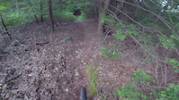
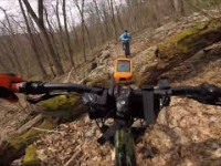
Photos of Coopers Gap (Rothrock State Forest) Mountain Bike
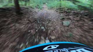
Videos of Coopers Gap (Rothrock State Forest) Mountain Bike
trail: Ross Trail
8:15 |
775 |
Jun 13, 2019

trail: Shitaka Trail (Upper)
81 |
Jun 7, 2025 , State College

trail: Deer Tick Trail
73 |
Jun 7, 2025 , State College

trail: Beautiful Trail
62 |
Jun 7, 2025 , State College

trail: Indian Trail (lower)
46 |
Jun 7, 2025 , State College
trail: Brush Ridge Trail
82 |
Jun 7, 2025 , State College
trail: Pigpile Trail
7:02 |
392 |
Apr 20, 2024 , State College
trail: Sassafras Trail-(lower)
4:58 |
214 |
Sep 8, 2022 , State College
Recent Trail Reports
| status | trail | date | condition | info | user |
|---|---|---|---|---|---|
| Beautiful Trail | Jun 10, 2026 @ 12:45pm (America/New_York) Jun 10, 2026 | Ideal | Jkerickon | ||
| Shitaka Trail (Upper) | May 14, 2026 @ 3:39pm (America/New_York) May 14, 2026 | Ideal | b3rnardino | ||
| Brush Ridge Extension | May 14, 2026 @ 3:39pm (America/New_York) May 14, 2026 | Variable | b3rnardino | ||
| Chestnut Spring | May 14, 2026 @ 3:39pm (America/New_York) May 14, 2026 | Ideal | b3rnardino | ||
| Sand Hole Trail | May 14, 2026 @ 3:39pm (America/New_York) May 14, 2026 | Ideal | b3rnardino | ||
| Shitaka Trail (Lower) | May 14, 2026 @ 3:39pm (America/New_York) May 14, 2026 | Ideal | b3rnardino | ||
| Shitaka - Chicken Peter Connector | May 14, 2026 @ 3:39pm (America/New_York) May 14, 2026 | Ideal | b3rnardino | ||
| Chicken Peter | May 14, 2026 @ 3:39pm (America/New_York) May 14, 2026 | Ideal | b3rnardino | ||
| Dutch Alvin | May 14, 2026 @ 3:39pm (America/New_York) May 14, 2026 | Ideal | b3rnardino | ||
| Ruff Gap Trail | Nov 9, 2025 @ 11:59am (America/New_York) Nov 9, 2025 | Variable | mckpat03 |
Activity Feed
| username | action | type | title | date |
|---|---|---|---|---|
| dparse | wishlist | route | activity #97408555 | Jun 20, 2026 @ 10:06am 17 hours |
| TyacieCorley8S | wishlist | route | activity #97105242 | Jun 16, 2026 @ 6:30am Jun 16, 2026 |
| scottiyost | wishlist | route | activity #96874016 | Jun 13, 2026 @ 7:21am Jun 13, 2026 |
| rgetley | wishlist | region | activity #96859402 | Jun 13, 2026 @ 3:35am Jun 13, 2026 |
| Jkerickon | add | report | activity #96679375 | Jun 10, 2026 @ 9:45am Jun 10, 2026 |
Recent Comments
| username | type | title | comment | date |
|---|---|---|---|---|
| trail | Pretty fun trail that appears to not be used... | Apr 12, 2026 @ 5:32pm Apr 12, 2026 | ||
| trail | Just a shout out to whoever maintains coopers... | Sep 20, 2025 @ 11:46am Sep 20, 2025 | ||
| trail | E-bikes allowed | Aug 4, 2025 @ 8:28am Aug 4, 2025 | ||
| trail | E-bikes allowed | Aug 4, 2025 @ 8:28am Aug 4, 2025 | ||
| trail | E-bikes allowed | Aug 4, 2025 @ 8:27am Aug 4, 2025 |
Nearby Areas
| name | distance | ||||
|---|---|---|---|---|---|
| Galbraith Gap (Rothrock State Forest) | 11 | 19 | 20 | 13 | 4.2 km |
| Colyer Lake | 4 | 3 | 2 | 5.1 km | |
| Greenwood Furnace State Park | 5 | 11 | 3 | 1 | 5.8 km |
| Seven Mountains | 7 | 18 | 10 | 6 km | |
| Harvest Fields Community Trails | 7 | 6 | 5 | 7.8 km |
Local Badges
-

Completionist0 awarded
Local Mountain Biking Directory
-
Nittany Mountain Bike Association
![Nittany Mountain Bike Association]()
-
Happy Valley Woemen's Cycling
![Happy Valley Woemen's Cycling]()
-
Freeze Thaw CyclesBike Shop
![Freeze Thaw Cycles]()
-
The Bicycle ShopBike Shop
![The Bicycle Shop]()
-
Eddie's Bicycles And Sport EquipmentBike Shop
![Eddie's Bicycles And Sport Equipment]()
Local Products
Activity Type Stats
| activitytype | trails | distance | descent | descent distance | total vertical | rating | global rank | state rank | photos | reports | routes | ridelogs |
|---|---|---|---|---|---|---|---|---|---|---|---|---|
| Mountain Bike | 51 | 69 miles | 11,742 ft | 36 miles | 1,565 ft | #2,079 | #703 | 70 | 558 | 18 | 3,752 | |
| E-Bike | 50 | 6 miles | 535 ft | 4 miles | 1,243 ft | #5,320 | #1,474 | 459 | 5 | 74 | ||
| Hike | 53 | 69 miles | 12,448 ft | 37 miles | 1,565 ft | #3,513 | #1,215 | 559 | 1 | 83 | ||
| Trail Running | 53 | 69 miles | 12,448 ft | 37 miles | 1,565 ft | #2,779 | #700 | 559 | 22 |
Frequently Asked Questions About Coopers Gap (Rothrock State Forest)
▼
What are the highest rated mountain biking trails in Coopers Gap (Rothrock State Forest)?
The highest rated mountain biking trails in Coopers Gap (Rothrock State Forest) are:
- Sass-XX (4.6/5)
- Ruff Gap Trail (4.4/5)
- Lingle Valley Trail (4.4/5)
- Pigpile Trail (4.3/5)
- Ross Trail (4.2/5)
▼
What is the best time of the year to ride in Coopers Gap (Rothrock State Forest)?
Based on ride log data, the most popular months to ride in Coopers Gap (Rothrock State Forest) are:
- August (62 activities)
- July (58 activities)
- September (57 activities)
▼
Where can I park to ride in Coopers Gap (Rothrock State Forest)?
There are 3 parking locations listed in Coopers Gap (Rothrock State Forest). The most popular parking spots are: View all parking and trailhead locations on the map to plan your visit.
▼
What is the longest trail in Coopers Gap (Rothrock State Forest)?
The longest trail in Coopers Gap (Rothrock State Forest) is Brush Ridge Trail at 5.4 km. View all trails sorted by distance.
Activities
Trails
- Hard trails in Coopers Gap (Rothrock State Forest)
- Easy trails in Coopers Gap (Rothrock State Forest)
- Favorite trails in Coopers Gap (Rothrock State Forest)
- Most ridden trails in Coopers Gap (Rothrock State Forest)
- Singletrack in Coopers Gap (Rothrock State Forest)
- Viewpoint trails in Coopers Gap (Rothrock State Forest)
- Trails with technical features in Coopers Gap (Rothrock State Forest)
- Race routes in Coopers Gap (Rothrock State Forest)
- By Saclydesdale
 NMBA & contributors
 - Admins: NMBA
- #6483 - 18,969 views
- coopers gap (rothrock state forest) activity log | embed map of Coopers Gap (Rothrock State Forest) mountain bike trails | coopers gap (rothrock state forest) mountain biking points of interest
Downloading of trail gps tracks in kml & gpx formats is enabled for Coopers Gap (Rothrock State Forest).
You must login to download files.