close
-
Layers w
- Weather Layers
- Pro
- Pro
- Pro
- Pro
- Pro
- Pro
- More Layers
- Pro
- Pro
- Pro
- Pro
-
Upgrade to

3D
Trail Conditions
- Unknown
- Snow Groomed
- Snow Packed
- Snow Covered
- Snow Cover Partial
- Freeze/thaw Cycle
- Icy
- Prevalent Mud
- Wet
- Variable
- Ideal
- Dry
- Very Dry
Trail Flow (Ridden Direction)
Trailforks scans users ridelogs to determine the most popular direction each trail is ridden. A good flowing trail network will have most trails flowing in a single direction according to their intension.
The colour categories are based on what percentage of riders are riding a trail in its intended direction.
The colour categories are based on what percentage of riders are riding a trail in its intended direction.
- > 96%
- > 90%
- > 80%
- > 70%
- > 50%
- < 50%
- bi-directional trail
- no data
Trail Last Ridden
Trailforks scans ridelogs to determine the last time a trail was ridden.
- < 2 days
- < 1 week
- < 2 weeks
- < 1 month
- < 6 months
- > 6 months
Trail Ridden Direction
The intended direction a trail should be ridden.
- Downhill Only
- Downhill Primary
- Both Directions
- Uphill Primary
- Uphill Only
- One Direction
Contribute Details
Colors indicate trail is missing specified detail.
- Description
- Photos
- Description & Photos
- Videos
Trail Popularity ?
Trailforks scans ridelogs to determine which trails are ridden the most in the last 9 months.
Trails are compared with nearby trails in the same city region with a possible 25 colour shades.
Think of this as a heatmap, more rides = more kinetic energy = warmer colors.
- most popular
- popular
- less popular
- not popular
ATV/ORV/OHV Filter
Max Vehicle Width
inches
US Cell Coverage
Legend

Radar Time
Activity Recordings
Trailforks uses anonymized public activity data.
?
Activity Recordings
Trailforks uses anonymized public activity data.
?
Personal Heatmap
▶
Activity Types
all
/
none
▶
Options
2
Date range
month
–
Winter Trails
Warning
A routing network for winter maps does not exist. Selecting trails using the winter trails layer has been disabled.
Missing Trails
Most Popular
Least Popular
Trails are colored based on popularity. The more popular a trail is, the more red. Less popular trails trend towards green.
Jump Magnitude Heatmap
Heatmap of where riders jump on trails. Zoom in to see individual jumps, click circles to view jump details.
BC Backroad Status
![map legend]()
Service Road Atlas is a free to use, community-driven service for viewing and creating reports on the numerous back-country service roads around B.C. and Alberta.

Slope Aspect
Direction the slope faces
Trails Deemphasized
Trails are shown in grey.
Only show trails with no bike usage.
Suggested Layers
Based on selected activity type
Save the current map location and zoom level as your default home location whenever this page is loaded.
SaveThe Copeland Forest is a 4,400 acre Resource Management Area in Simcoe County, Ontario, Canada, owned by the Ministry of Natural Resources and Forests. The size, beauty, and unfettered use of the forest by a wide variety of recreational users inspired an initiative to conserve the natural integrity of the forest and facilitate compatible recreational use. The Copeland Forest Friends Association (CFFA) help to maintain access to the forest. An annual donation from members helps use maintain the trail network, as well as access points into the forest. Please consider donating $25 at http://www.copelandfriends.ca/ to become a member and assist in our efforts.
source: Copeland Forest Friends
Primary Trail Type: Cross-Country
Land Status: Crown Land
Land Manager: MNRF
 google parking directions
 Disclaimer:
There is no trail building allowed in the Copeland Forest. In coordination with the MNRF, the Copeland Forest Friends Association (CFFS) works to ensure access to all users (hiking, riding, equestrian, anglers, hunters, snowshoeing, XC skiing) have equal access to the area. The CFFA helps promote enjoyable use of the forest by providing trail maintenance, parking lot plowing, and forest sustainability (garlic mustard pull, water testing). Unauthorized trail building will potentially put MTB acitivites at risk in the forest.
Links
Activities Click to view
- Mountain Bike
185 trails
- E-Bike
172 trails
- Horse
172 trails
- Hike
183 trails
- Trail Running
183 trails
- Snowshoe
119 trails
- Nordic Ski
53 trails
Region Details
- 83
- 59
- 29
- 13
Region Status
Caution as of Jun 22, 2026Stats
- Avg Trail Rating
- Trails (view details)
- 227
- Trails Mountain Bike
- 185
- Trails E-Bike
- 172
- Trails Winter Fat Bike
- 2
- Trails Horse
- 172
- Trails Hike
- 183
- Trails Trail Running
- 183
- Trails Snowshoe
- 119
- Trails Nordic Ski
- 53
- Total Distance
- 73 miles
- Total Descent
- 7,881 ft
- Total Vertical
- 400 ft
- Highest Trailhead
- 1,171 ft
- Reports
- 3,754
- Photos
- 228
- Ridden Counter
- 80,133
Popular Copeland Forest Mountain Biking Trails
• 100 ★ 0.0 • 719 ft • 0 ft • 1,211 •
Popular green difficulty singletrack. This multi-use trail can be used both directions and has a easy overall physical rating with a 0 ft green climb. On average it takes minutes to complete this trail.
• 100 ★ 4.0 • 2,766 ft • 187 ft • 1,191 •
is primarily used to climb up to the "5 Points" ridge top. The climb is a tough one, with tight turns, punchy climbs and littered with roots. It will get the blood flowing.
• 100 ★ 5.0 • 3,340 ft • 78 ft • 1,135 •
Popular green difficulty singletrack. This multi-use trail can be used both directions and has a easy overall physical rating with a 78 ft green climb. On average it takes 5 minutes to complete this trail.
• 100 ★ 3.0 • 578 ft • 40 ft • 1,116 •
Popular green difficulty singletrack. This multi-use trail can be used both directions and has a easy overall physical rating with a 40 ft green climb. On average it takes minutes to complete this trail.
• 100 ★ 4.9 • 2,513 ft • 10 ft • 1,061 •
The trail features a mostly flat beginning, but that soon changes as the trail tosses you down the valley between two ridge sections. The start of the trail is flat, featuring some turns and roller sections. At the midway point, there...
• 95 ★ 0.0 • 446 ft • 0 ft • 1,056 •
A baby-head rock filled alternative ending just after .
• 95 ★ 4.2 • 1 mile • 52 ft • 1,018 •
Highly rated popular blue difficulty singletrack. This multi-use trail can be used both directions and has a easy overall physical rating with a 52 ft green climb. On average it takes 10 minutes to complete this trail.
• 90 ★ 4.9 • 2 miles • 106 ft • 1,005 •
A trail that follows along the railway tracks and creek bed. It is fairly flat with nothing too difficult. There are a few bridges to cross the creeks and a few sections of roots.
Copeland Forest Mountain Bike Routes
★ 3.5 • 7 miles • 890 ft • 16 • Loop •
Hope you enjoy this great tour of the Copeland Forest! Starts and ends at the parking lot north of...
★ 3.2 • 13 miles • 1,349 ft • 95 • Out & Back •
A good 20km route through Copeland, showcasing some of the 'key' trails in the forest. A good variety of...
★ 2.0 • 7 miles • 445 ft • 30 • Loop •
The Copleland Lowlands is a great flowy ride for a casual scenic trailride or a fun high paced XC ride...
★ 2.4 • 15 miles • 992 ft • 27 • Loop •
Double uphill loops with a mix of technical singletrack, steep rocky technical descents, fast flowy...
7 miles • 844 ft • 17 • Loop •
Based on the popular " " route - avoids construction, a long sandy hill you have to walk your bike up...
★ 1.0 • 2 miles • 64 ft • 10 • Loop •
Winter snowshoe route following the and the banks of the big pond in Copeland Forest. This route can be...
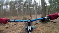
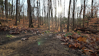
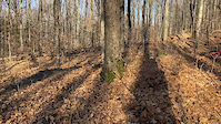
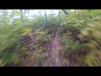
Photos of Copeland Forest Mountain Bike
Videos of Copeland Forest Mountain Bike
featured
![Copeland - April 16th, 2017]()
trail: Copeland Downhill
4:14 |
907 |
Apr 16, 2017

trail: Copeland Downhill
2:15 |
260 |
May 30, 2021
trail: Purple Star
2:05 |
99 |
Nov 13, 2020
trail: Purple Star
0:12 |
94 |
Nov 9, 2020
trail: Copeland Downhill
2:06 |
339 |
Oct 14, 2019

trail: 5th Dimension
2:52 |
629 |
Aug 1, 2019

trail: 5th Dimension
2:45 |
456 |
Aug 1, 2019
trail: Copeland Downhill
2:12 |
333 |
May 20, 2019
Current Trail Warnings
| status | trail | date | condition | user | info |
|---|---|---|---|---|---|
| Purple Urkle | Jun 22, 2026 @ 8:27am (America/Toronto) Jun 22, 2026 | Unknown | Canadmos TRAILFORKS | Section is blocked with trees. | |
| Double Track - Sign Post 4 to 5 | Jun 20, 2026 @ 12:03pm (America/Vancouver) Jun 20, 2026 | Unknown | trailforks Trailforks | ||
| Pines | Jun 3, 2026 @ 10:20pm (America/Toronto) Jun 3, 2026 | Dry | Canadmos TRAILFORKS | This trail os completely blocked with trees. |
Recent Trail Reports
Activity Feed
| username | action | type | title | date |
|---|---|---|---|---|
| Canadmos | update | poi | activity #97555043 | Jun 22, 2026 @ 5:30am Jun 22, 2026 |
| Canadmos | add | report | activity #97554949 | Jun 22, 2026 @ 5:27am Jun 22, 2026 |
| Canadmos | add | trail | activity #97554873 | Jun 22, 2026 @ 5:25am Jun 22, 2026 |
| Canadmos | add | report | activity #97537333 and 1 more | Jun 21, 2026 @ 6:49pm Jun 21, 2026 |
| trailforks | add | report | activity #97420422 | Jun 20, 2026 @ 12:03pm Jun 20, 2026 |
Recent Comments
| username | type | title | comment | date |
|---|---|---|---|---|
| report | AMEN | Jun 1, 2026 @ 3:07pm Jun 1, 2026 | ||
| trail | Someone cut the easy log ride over the creek... | May 20, 2026 @ 7:48pm May 20, 2026 | ||
| report | I should have said the lower quarter, 3/4 is... | Sep 4, 2025 @ 4:39pm Sep 4, 2025 | ||
| trail | Tree down | Jul 28, 2025 @ 3:33pm Jul 28, 2025 | ||
| report | Mmmmfoi my my k huh o My junkm Mmm o mm I... | Jun 22, 2025 @ 9:11am Jun 22, 2025 |
Nearby Areas
| name | distance | ||||
|---|---|---|---|---|---|
| SCMBC - Amos Tract Trail Network | 1 | 1 | 0.9 km | ||
| Simcoe County Forest - Amos Tract | 3 | 2 | 1 km | ||
| SCMBC - Heights of Horseshoe | 3 | 1 | 5 | 2 | 1.1 km |
| The Heights Ski & Country Club | 4 | 1 | 1.3 km | ||
| Oro Hills | 4 | 1.5 km |
Local Badges
-

Completionist0 awarded
Activity Type Stats
| activitytype | trails | distance | descent | descent distance | total vertical | rating | global rank | state rank | photos | reports | routes | ridelogs |
|---|---|---|---|---|---|---|---|---|---|---|---|---|
| Mountain Bike | 185 | 57 miles | 6,280 ft | 20 miles | 400 ft | #157 | #9 | 201 | 3,741 | 14 | 18,137 | |
| E-Bike | 172 | 55 miles | 6,020 ft | 20 miles | 384 ft | #572 | #73 | 15 | 2,755 | 2 | 495 | |
| Winter Fat Bike | 2 | #134 | #11 | 2 | 13 | 1 | 5 | |||||
| Horse | 172 | 56 miles | 6,043 ft | 20 miles | 384 ft | #43 | #8 | 992 | 93 | |||
| Hike | 183 | 57 miles | 6,280 ft | 20 miles | 400 ft | #1,299 | #43 | 10 | 3,597 | 1 | 2,092 | |
| Trail Running | 183 | 57 miles | 6,280 ft | 20 miles | 400 ft | #791 | #10 | 3,597 | 1 | 1,629 | ||
| Snowshoe | 119 | 42 miles | 4,990 ft | 16 miles | 400 ft | #33 | #4 | 2 | 1,090 | 5 | 258 | |
| Nordic Ski | 53 | 20 miles | 1,617 ft | 6 miles | 348 ft | #110 | #8 | 274 | 1,053 |
Frequently Asked Questions About Copeland Forest
▼
What are the highest rated mountain biking trails in Copeland Forest?
The highest rated mountain biking trails in Copeland Forest are:
- Copeland Downhill (4.6/5)
- 5th Dimension (4.5/5)
- Rail Trail (4.4/5)
- Left Bank (4.4/5)
- Fast Track (4.4/5)
▼
What is the best time of the year to ride in Copeland Forest?
Based on ride log data, the most popular months to ride in Copeland Forest are:
- July (605 activities)
- June (528 activities)
- May (505 activities)
▼
Where can I park to ride in Copeland Forest?
There are 6 parking locations listed in Copeland Forest. The most popular parking spots are: View all parking and trailhead locations on the map to plan your visit.
▼
What is the longest trail in Copeland Forest?
The longest trail in Copeland Forest is Rail Trail at 1.9 miles. View all trails sorted by distance.
Activities
Trails
- By brenthillier
 NSMBA TRAILFORKS & contributors
 - Admins: CFF
- #11503 - 67,490 views
- copeland forest activity log | embed map of Copeland Forest mountain bike trails | copeland forest mountain biking points of interest
Downloading of trail gps tracks in kml & gpx formats is enabled for Copeland Forest.
You must login to download files.