close
-
Layers w
- Weather Layers
- Pro
- Pro
- Pro
- Pro
- Pro
- Pro
- More Layers
- Pro
- Pro
- Pro
- Pro
-
Upgrade to

3D
Trail Conditions
- Unknown
- Snow Groomed
- Snow Packed
- Snow Covered
- Snow Cover Partial
- Freeze/thaw Cycle
- Icy
- Prevalent Mud
- Wet
- Variable
- Ideal
- Dry
- Very Dry
Trail Flow (Ridden Direction)
Trailforks scans users ridelogs to determine the most popular direction each trail is ridden. A good flowing trail network will have most trails flowing in a single direction according to their intension.
The colour categories are based on what percentage of riders are riding a trail in its intended direction.
The colour categories are based on what percentage of riders are riding a trail in its intended direction.
- > 96%
- > 90%
- > 80%
- > 70%
- > 50%
- < 50%
- bi-directional trail
- no data
Trail Last Ridden
Trailforks scans ridelogs to determine the last time a trail was ridden.
- < 2 days
- < 1 week
- < 2 weeks
- < 1 month
- < 6 months
- > 6 months
Trail Ridden Direction
The intended direction a trail should be ridden.
- Downhill Only
- Downhill Primary
- Both Directions
- Uphill Primary
- Uphill Only
- One Direction
Contribute Details
Colors indicate trail is missing specified detail.
- Description
- Photos
- Description & Photos
- Videos
Trail Popularity ?
Trailforks scans ridelogs to determine which trails are ridden the most in the last 9 months.
Trails are compared with nearby trails in the same city region with a possible 25 colour shades.
Think of this as a heatmap, more rides = more kinetic energy = warmer colors.
- most popular
- popular
- less popular
- not popular
ATV/ORV/OHV Filter
Max Vehicle Width
inches
US Cell Coverage
Legend

Radar Time
Activity Recordings
Trailforks uses anonymized public activity data.
?
Activity Recordings
Trailforks uses anonymized public activity data.
?
Personal Heatmap
▶
Activity Types
all
/
none
▶
Options
2
Date range
month
–
Winter Trails
Warning
A routing network for winter maps does not exist. Selecting trails using the winter trails layer has been disabled.
Missing Trails
Most Popular
Least Popular
Trails are colored based on popularity. The more popular a trail is, the more red. Less popular trails trend towards green.
Jump Magnitude Heatmap
Heatmap of where riders jump on trails. Zoom in to see individual jumps, click circles to view jump details.
BC Backroad Status
![map legend]()
Service Road Atlas is a free to use, community-driven service for viewing and creating reports on the numerous back-country service roads around B.C. and Alberta.

Slope Aspect
Direction the slope faces
Trails Deemphasized
Trails are shown in grey.
Only show trails with no bike usage.
Suggested Layers
Based on selected activity type
Save the current map location and zoom level as your default home location whenever this page is loaded.
SaveSuper fun freeride trails. Features for beginners and features that will challenge experienced riders.
Primary Trail Type: All-Mountain & Downhill
Land Status: County Park
 google parking directions
 Access Info:
From Copper Ridge sign off of Silver Lake rd: Go up the drive to behind the vein center, you should have passed a huge mirror on the way up. Once behind the vein center, there should be a series of parking lots, leading towards the woods, go to the farthest one back, you should have reached the trail head. It is a two track sized opening in the woods to your left, while looking at the opening there is loads of trails, try to keep to the left side of all the trails and push a bike to the top. From the top, have fun exploring all the trails! Any other questions about how to get there ask a local bike shop.
Activities Click to view
- Mountain Bike
24 trails
- Hike
18 trails
- Trail Running
18 trails
Region Details
- 14
- 4
- 6
Region Status
Open as of Jun 7, 2026Stats
- Avg Trail Rating
- Trails (view details)
- 24
- Trails Mountain Bike
- 24
- Trails E-Bike
- 3
- Trails Hike
- 18
- Trails Trail Running
- 18
- Total Distance
- 7 miles
- Total Descent
- 2,068 ft
- Total Vertical
- 338 ft
- Highest Trailhead
- 990 ft
- Reports
- 189
- Photos
- 389
- Ridden Counter
- 1,423
Popular Copper Ridge Mountain Biking Trails
• 100 ★ 5.0 • 1,558 ft • 0 ft • 149 •
Rider built trail with flow and DH features.
• 75 ★ 0.0 • 4,221 ft • 49 ft • 107 •
Popular blue difficulty singletrack. This multi-use trail can be used both directions. On average it takes 5 minutes to complete this trail.
• 95 ★ 4.0 • 663 ft • 0 ft • 104 •
Popular blue difficulty singletrack. This multi-use trail can be used uphill primary. On average it takes minutes to complete this trail.
• 95 ★ 5.0 • 865 ft • 18 ft • 104 •
Popular black diamond difficulty singletrack. This mountain bike primary trail can be used downhill only. It features berm, drop, jump and gap jump. On average it takes 5 minutes to complete this trail.
• 80 ★ 5.0 • 1,240 ft • 19 ft • 97 •
Popular black diamond difficulty singletrack. This mountain bike primary trail can be used downhill only. It features berm, drop, jump and gap jump. On average it takes 2 minutes to complete this trail.
• 75 ★ 0.0 • 2,850 ft • 29 ft • 84 •
Popular green difficulty singletrack. This multi-use trail can be used both directions. On average it takes 2 minutes to complete this trail.
• 70 ★ 0.0 • 1,795 ft • 0 ft • 80 •
Popular green difficulty singletrack. This multi-use trail can be used both directions. On average it takes 1 minutes to complete this trail.
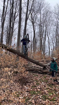
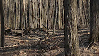
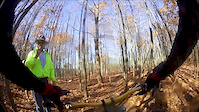
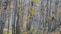
Photos of Copper Ridge Mountain Bike
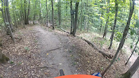
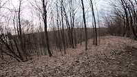
Videos of Copper Ridge Mountain Bike
trail: Foxcraft
0:22 |
51 |
Sep 9, 2025
trail: Onion
3:43 |
126 |
Aug 11, 2024

trail: Copper Ridge
5:42 |
220 |
Nov 13, 2020
trail: Copper Ridge
0:44 |
161 |
Apr 25, 2020
trail: Copper Ridge
2:12 |
229 |
Apr 13, 2020
trail: Stoner's Secret Stash
5:14 |
455 |
Jan 28, 2017
trail: Stoner's Secret Stash
4:38 |
284 |
Jan 21, 2017

trail: Stoner's Secret Stash
5:12 |
282 |
Nov 30, 2016
Recent Trail Reports
| status | trail | date | condition | info | user |
|---|---|---|---|---|---|
| Stoner Mesa | Oct 10, 2025 @ 3:36pm (America/Denver) Oct 10, 2025 | Unknown | zac-bassuener RTA | ||
| Uptown | Jun 4, 2025 @ 5:24pm Jun 4, 2025 | Dry | EjMats | ||
| Connector | May 6, 2025 @ 4:39pm May 6, 2025 | Ideal | Schoppkeeper | ||
| Cedar Cathedral | May 6, 2025 @ 4:39pm May 6, 2025 | Ideal | Schoppkeeper | ||
| Stoner's Secret Stash | May 6, 2025 @ 4:39pm May 6, 2025 | Ideal | Schoppkeeper | ||
| Log Jam | May 6, 2025 @ 4:39pm May 6, 2025 | Ideal | Schoppkeeper | ||
| Foxcraft | May 6, 2025 @ 4:39pm May 6, 2025 | Ideal | Schoppkeeper | ||
| Meadow Loop | Sep 26, 2024 @ 4:28pm Sep 26, 2024 | Ideal | Schoppkeeper | ||
| Connector | Sep 14, 2024 @ 8:38am Sep 14, 2024 | Ideal | Schoppkeeper | ||
| DC-TC Trail | Jun 11, 2024 @ 10:09am Jun 11, 2024 | Ideal | Schoppkeeper |
Activity Feed
| username | action | type | title | date |
|---|---|---|---|---|
| Plimptonma | add | video | activity #96452236 | Jun 7, 2026 @ 6:02am Jun 7, 2026 |
| ChrystalnNteUc | wishlist | region | activity #94624290 | May 13, 2026 @ 6:56am May 13, 2026 |
| PaullyMTB180 | ridden | trail | activity #93826304 | May 1, 2026 @ 6:44pm May 1, 2026 |
| PaullyMTB180 | add | report | activity #92905016 | Apr 18, 2026 @ 4:57pm Apr 18, 2026 |
| MattK7Tuxd | wishlist | region | activity #80180132 | Sep 12, 2025 @ 9:07am Sep 12, 2025 |
Recent Comments
| username | type | title | comment | date |
|---|---|---|---|---|
| report | You will often see people riding UP Big Ring... | Aug 18, 2024 @ 3:30pm Aug 18, 2024 | ||
| report | This is well known. The only part of the park... | Aug 18, 2024 @ 3:28pm Aug 18, 2024 | ||
| report | See earlier trail report of significant issues. | Aug 1, 2020 @ 11:08am Aug 1, 2020 |
Nearby Areas
| name | distance | ||||
|---|---|---|---|---|---|
| Miller Creek Nature Preserve | 9 | 2.1 km | |||
| Boardman Valley Nature Preserve | 5 | 1 | 2.9 km | ||
| Deyoung Natural Area | 7 | 4.3 km | |||
| Cedar Run Creek Natural Area | 7.9 km | ||||
| Lost Lake Pathway | 8.3 km |
Local Badges
-

Completionist0 awarded
Activity Type Stats
| activitytype | trails | distance | descent | descent distance | total vertical | rating | global rank | state rank | photos | reports | routes | ridelogs |
|---|---|---|---|---|---|---|---|---|---|---|---|---|
| Mountain Bike | 24 | 7 miles | 2,067 ft | 4 miles | 338 ft | #4,565 | #1,615 | 384 | 188 | 2,797 | ||
| E-Bike | 3 | 3,556 ft | 66 ft | 1,204 ft | 66 ft | 169 | 22 | |||||
| Hike | 18 | 6 miles | 1,260 ft | 3 miles | 289 ft | #12,972 | #5,449 | 4 | 175 | 357 | ||
| Trail Running | 18 | 6 miles | 1,260 ft | 3 miles | 289 ft | #12,637 | #5,105 | 175 | 71 |
Frequently Asked Questions About Copper Ridge
▼
What are the highest rated mountain biking trails in Copper Ridge?
The highest rated mountain biking trails in Copper Ridge are:
- Stoner's Secret Stash (4.3/5)
- Foxcraft (4.2/5)
- Log Jam (4.2/5)
- Onion (4.2/5)
- Bobit (4.1/5)
▼
What is the best time of the year to ride in Copper Ridge?
Based on ride log data, the most popular months to ride in Copper Ridge are:
- August (11 activities)
- September (11 activities)
- October (11 activities)
▼
Where can I park to ride in Copper Ridge?
There are 4 parking locations listed in Copper Ridge. The most popular parking spots are: View all parking and trailhead locations on the map to plan your visit.
▼
What is the longest trail in Copper Ridge?
The longest trail in Copper Ridge is Copper Ridge at 4,221 ft. View all trails sorted by distance.
Activities
Trails
Points of Interest
- By SKIGAN14 & contributors
- Admins: NMMBA
- #15700 - 13,065 views
- copper ridge activity log | embed map of Copper Ridge mountain bike trails | copper ridge mountain biking points of interest
Downloading of trail gps tracks in kml & gpx formats is enabled for Copper Ridge.
You must login to download files.