close
-
Layers w
- Weather Layers
- Pro
- Pro
- Pro
- Pro
- Pro
- Pro
- More Layers
- Pro
- Pro
- Pro
- Pro
-
Upgrade to

3D
Trail Conditions
- Unknown
- Snow Groomed
- Snow Packed
- Snow Covered
- Snow Cover Partial
- Freeze/thaw Cycle
- Icy
- Prevalent Mud
- Wet
- Variable
- Ideal
- Dry
- Very Dry
Trail Flow (Ridden Direction)
Trailforks scans users ridelogs to determine the most popular direction each trail is ridden. A good flowing trail network will have most trails flowing in a single direction according to their intension.
The colour categories are based on what percentage of riders are riding a trail in its intended direction.
The colour categories are based on what percentage of riders are riding a trail in its intended direction.
- > 96%
- > 90%
- > 80%
- > 70%
- > 50%
- < 50%
- bi-directional trail
- no data
Trail Last Ridden
Trailforks scans ridelogs to determine the last time a trail was ridden.
- < 2 days
- < 1 week
- < 2 weeks
- < 1 month
- < 6 months
- > 6 months
Trail Ridden Direction
The intended direction a trail should be ridden.
- Downhill Only
- Downhill Primary
- Both Directions
- Uphill Primary
- Uphill Only
- One Direction
Contribute Details
Colors indicate trail is missing specified detail.
- Description
- Photos
- Description & Photos
- Videos
Trail Popularity ?
Trailforks scans ridelogs to determine which trails are ridden the most in the last 9 months.
Trails are compared with nearby trails in the same city region with a possible 25 colour shades.
Think of this as a heatmap, more rides = more kinetic energy = warmer colors.
- most popular
- popular
- less popular
- not popular
ATV/ORV/OHV Filter
Max Vehicle Width
inches
US Cell Coverage
Legend

Radar Time
Activity Recordings
Trailforks uses anonymized public activity data.
?
Activity Recordings
Trailforks uses anonymized public activity data.
?
Personal Heatmap
▶
Activity Types
all
/
none
▶
Options
2
Date range
month
–
Winter Trails
Warning
A routing network for winter maps does not exist. Selecting trails using the winter trails layer has been disabled.
Missing Trails
Most Popular
Least Popular
Trails are colored based on popularity. The more popular a trail is, the more red. Less popular trails trend towards green.
Jump Magnitude Heatmap
Heatmap of where riders jump on trails. Zoom in to see individual jumps, click circles to view jump details.
BC Backroad Status
![map legend]()
Service Road Atlas is a free to use, community-driven service for viewing and creating reports on the numerous back-country service roads around B.C. and Alberta.

Slope Aspect
Direction the slope faces
Trails Deemphasized
Trails are shown in grey.
Only show trails with no bike usage.
Suggested Layers
Based on selected activity type
Save the current map location and zoom level as your default home location whenever this page is loaded.
Save
No description for Cork has been added yet!
Login or register to submit one.
This region uses the Uk/Euro style trail grading system.
Activities Click to view
- Mountain Bike
17 trails
- E-Bike
0 trails
- Adaptive Bike
0 trails
- Winter Fat Bike
0 trails
- Hike
17 trails
- Trail Running
17 trails
Region Details
- 2
- 4
- 5
- 4
- 1
Region Status
Caution as of Jun 2, 2026Stats
- Avg Trail Rating
- Trails (view details)
- 17
- Trails Mountain Bike
- 17
- Trails Hike
- 17
- Trails Trail Running
- 17
- Total Distance
- 10 miles
- Total Descent
- 3,201 ft
- Total Vertical
- 448 ft
- Highest Trailhead
- 500 ft
- Reports
- 21
- Photos
- 3
- Ridden Counter
- 430
Sub Regions
-
Curragh Woods
- 3
- 4
- 1
-
Garryduff
- 3
-
Naggles mountains
-
Woods
- 6
Popular Cork Mountain Biking Trails
• 90 ★ 4.0 • 1,413 ft • 0 ft • 41 •
Popular red difficulty singletrack. This mountain bike primary trail can be used downhill primary. It features drop and jump. On average it takes 2 minutes to complete this trail.
• 95 ★ 4.0 • 1,290 ft • 0 ft • 37 •
Popular red difficulty singletrack. This mountain bike primary trail can be used downhill primary. It features drop and jump. On average it takes 3 minutes to complete this trail.
• 85 ★ 3.0 • 3 miles • 709 ft • 35 •
NPS cross country loop in Tracton built by the MBCC club based in Cork. no huge climbs but LOTS of roots and rollers to keep you on your toes
• 60 ★ 4.0 • 4,189 ft • 54 ft • 30 •
Moderately popular green difficulty singletrack. This mountain bike primary trail can be used downhill primary. On average it takes 6 minutes to complete this trail.
• 80 ★ 4.5 • 1,390 ft • 5 ft • 30 •
Popular red difficulty singletrack. This mountain bike primary trail can be used downhill primary. It features drop and jump. On average it takes 1 minutes to complete this trail.
• 5 ★ 4.0 • 2,665 ft • 3 ft • 29 •
Less popular green difficulty singletrack. This mountain bike primary trail can be used downhill primary and has a easy overall physical rating with a 3 ft green climb. It features berm and jump. On average it takes 3 minutes to complete this trail.
• 50 ★ 5.0 • 1,695 ft • 53 ft • 24 •
Moderately popular green difficulty singletrack. This mountain bike primary trail can be used both directions. On average it takes 2 minutes to complete this trail.
• 65 ★ 5.0 • 1,901 ft • 2 ft • 24 •
Moderately popular black difficulty singletrack. This mountain bike primary trail can be used downhill primary. It features jump. On average it takes 6 minutes to complete this trail.
Cork Mountain Bike Routes
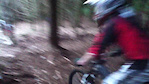
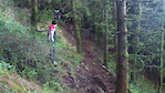
Photos of Cork Mountain Bike
Videos of Cork Mountain Bike
trail: Guinea Pig
0:08 |
1492 |
Apr 13, 2011
trail: Off Camber
0:11 |
1078 |
Apr 12, 2011
Current Trail Warnings
| status | trail | date | condition | user | info |
|---|---|---|---|---|---|
| Off Camber | Jun 2, 2026 @ 7:29pm (Europe/Dublin) Jun 2, 2026 | Unknown | YXWgtv | Couldn’t find. I guess its very old and... |
Recent Trail Reports
| status | trail | date | condition | info | user |
|---|---|---|---|---|---|
| Hip Twister | Jun 16, 2022 @ 9:25am Jun 16, 2022 | Dry | tohalloran | ||
| Tracton XC loop | Dec 29, 2021 @ 7:12am Dec 29, 2021 | Wet | Alan1997 | ||
| Wall Run | Jul 30, 2019 @ 4:08am Jul 30, 2019 | Very Dry | Niallkirranemtb |
Activity Feed
| username | action | type | title | date |
|---|---|---|---|---|
| YXWgtv | add | report | activity #96098760 | Jun 2, 2026 @ 11:29am Jun 2, 2026 |
| N1kal | ridden | trail | activity #95479938 | May 25, 2026 @ 5:26am May 25, 2026 |
| maverickride | like | directory | activity #94117440 | May 5, 2026 @ 3:16pm May 5, 2026 |
| MorganwCKDId | ridden | trail | activity #88103931 | Jan 31, 2026 @ 11:38am Jan 31, 2026 |
| jorge0136 | wishlist | region | activity #75679519 | Jul 11, 2025 @ 1:22pm Jul 11, 2025 |
Recent Comments
| username | type | title | comment | date |
|---|---|---|---|---|
| trail | All the Garryduff trails have fairly new signs... | Apr 3, 2023 @ 6:28am Apr 3, 2023 | ||
| trail | By the time I got out her from Ballincollig I... | Sep 24, 2019 @ 4:08am Sep 24, 2019 |
Local Badges
-

Epic Ride Climb 2k7 awarded -

Climbing 10k Badge12 awarded -

Climbing 100k Badge0 awarded -

Epic Ride Descent 2k7 awarded -

Descent 10k Badge12 awarded -

Descent 100k Badge0 awarded
Bike & Skill Parks
| name | type | city | rating |
|---|---|---|---|
| Cork BMX track | skill park | Cork |
Activity Type Stats
| activitytype | trails | distance | descent | descent distance | total vertical | rating | global rank | state rank | photos | reports | routes | ridelogs |
|---|---|---|---|---|---|---|---|---|---|---|---|---|
| Mountain Bike | 17 | 10 miles | 3,202 ft | 6 miles | 449 ft | #3,107 | #16 | 3 | 21 | 1 | 3,189 | |
| Hike | 17 | 10 miles | 3,202 ft | 6 miles | 449 ft | #2,417 | #13 | 21 | 54 | |||
| Trail Running | 17 | 10 miles | 3,202 ft | 6 miles | 449 ft | #1,942 | #13 | 21 | 15 |
Frequently Asked Questions About Cork
▼
What are the best places to ride in Cork?
Cork has 4 areas to explore for mountain biking. The top rated areas are:
▼
What are the highest rated mountain biking trails in Cork?
The highest rated mountain biking trails in Cork are:
- Stomper (4.3/5)
- Off Camber (4.2/5)
- Upper Wall Run (4.1/5)
- Squirrel (4.1/5)
- Hip Twister (4/5)
▼
What is the best time of the year to ride in Cork?
Based on ride log data, the most popular months to ride in Cork are:
- July (33 activities)
- May (26 activities)
- September (19 activities)
▼
Where can I park to ride in Cork?
There are 3 parking locations listed in Cork. The most popular parking spots are: View all parking and trailhead locations on the map to plan your visit.
- By canadaka
 Trailforks & contributors
 - Admins: apply
- #7660 - 18,672 views
- cork activity log | embed map of Cork mountain bike trails | cork mountain biking points of interest
Downloading of trail gps tracks in kml & gpx formats is enabled for Cork.
You must login to download files.