close
-
Layers w
- Weather Layers
- Pro
- Pro
- Pro
- Pro
- Pro
- Pro
- More Layers
- Pro
- Pro
- Pro
- Pro
-
Upgrade to

3D
Trail Conditions
- Unknown
- Snow Groomed
- Snow Packed
- Snow Covered
- Snow Cover Partial
- Freeze/thaw Cycle
- Icy
- Prevalent Mud
- Wet
- Variable
- Ideal
- Dry
- Very Dry
Trail Flow (Ridden Direction)
Trailforks scans users ridelogs to determine the most popular direction each trail is ridden. A good flowing trail network will have most trails flowing in a single direction according to their intension.
The colour categories are based on what percentage of riders are riding a trail in its intended direction.
The colour categories are based on what percentage of riders are riding a trail in its intended direction.
- > 96%
- > 90%
- > 80%
- > 70%
- > 50%
- < 50%
- bi-directional trail
- no data
Trail Last Ridden
Trailforks scans ridelogs to determine the last time a trail was ridden.
- < 2 days
- < 1 week
- < 2 weeks
- < 1 month
- < 6 months
- > 6 months
Trail Ridden Direction
The intended direction a trail should be ridden.
- Downhill Only
- Downhill Primary
- Both Directions
- Uphill Primary
- Uphill Only
- One Direction
Contribute Details
Colors indicate trail is missing specified detail.
- Description
- Photos
- Description & Photos
- Videos
Trail Popularity ?
Trailforks scans ridelogs to determine which trails are ridden the most in the last 9 months.
Trails are compared with nearby trails in the same city region with a possible 25 colour shades.
Think of this as a heatmap, more rides = more kinetic energy = warmer colors.
- most popular
- popular
- less popular
- not popular
ATV/ORV/OHV Filter
Max Vehicle Width
inches
US Cell Coverage
Legend

Radar Time
Activity Recordings
Trailforks uses anonymized public activity data.
?
Activity Recordings
Trailforks uses anonymized public activity data.
?
Personal Heatmap
▶
Activity Types
all
/
none
▶
Options
2
Date range
month
–
Winter Trails
Warning
A routing network for winter maps does not exist. Selecting trails using the winter trails layer has been disabled.
Missing Trails
Most Popular
Least Popular
Trails are colored based on popularity. The more popular a trail is, the more red. Less popular trails trend towards green.
Jump Magnitude Heatmap
Heatmap of where riders jump on trails. Zoom in to see individual jumps, click circles to view jump details.
BC Backroad Status
![map legend]()
Service Road Atlas is a free to use, community-driven service for viewing and creating reports on the numerous back-country service roads around B.C. and Alberta.

Slope Aspect
Direction the slope faces
Trails Deemphasized
Trails are shown in grey.
Only show trails with no bike usage.
Suggested Layers
Based on selected activity type
Save the current map location and zoom level as your default home location whenever this page is loaded.
Save
No description for Cornwall has been added yet!
Login or register to submit one.
This region uses the Uk/Euro style trail grading system.
Activities Click to view
- Mountain Bike
261 trails
- E-Bike
34 trails
- Horse
19 trails
- Hike
252 trails
- Trail Running
252 trails
- Dirtbike/Moto
0 trails
- ATV/ORV/OHV
0 trails
- Nordic Ski
0 trails
Region Details
- 22
- 4
- 74
- 102
- 25
- 7
- 1
Stats
- Avg Trail Rating
- Trails (view details)
- 253
- Trails Mountain Bike
- 263
- Trails E-Bike
- 34
- Trails Horse
- 19
- Trails Hike
- 252
- Trails Trail Running
- 252
- Total Distance
- 125 miles
- Total Descent
- 24,660 ft
- Total Vertical
- 766 ft
- Highest Trailhead
- 777 ft
- Reports
- 1,216
- Photos
- 641
- Ridden Counter
- 13,967
Articles
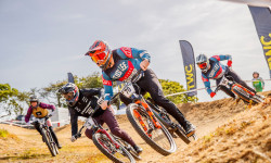
Connor Hudson & Jake Hart Split Wins at British 4X Series Rounds 3 & 4
Jun 10, 2026 from pinkbike.com
The Schwalbe British 4X Series headed to Falmouth Bike Park in Cornwall, where Connor Hudson continued his winning form before Jake Hart claimed...
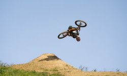
Video: Tom Isted and Tom Caldwell Team Up for a Masterclass in British Freeride
Jun 9, 2026 from pinkbike.com
In "Working From Home," Giant freeride star Tom Isted takes a break from the global stage to unleash total chaos on his custom-spec Reign SX at...

Race Report: British 4X Series Rounds 7 & 8: Falmouth, Cornwall
Aug 13, 2025 from pinkbike.com
This weekend was one of the best prepared tracks we have ever seen.

Video: DMR Dirt Wars Round 2 2025 - Old Hill Bike Park
Jul 2, 2025 from pinkbike.com
Some great dirt jump action from round 2 of the Dirt Wars Series.
Sub Regions
- Bodmin (66)
- "GBH" (15)
- Cardinham Woods (3)
- Lanhydrock Woods (6)
- Falmouth (5)
- Hayle (2)
- Helston (17)
- Penzance (1)
- Portreath (26)
- Redruth (91)
- Carn Brea (70)
- Poldice Valley (4)
- St Agnes (14)
- Wadebridge (1)
- Idless Woods (1)
- Pendeen (3)
- St Mary's (17)
- Steeple Woods (1)
- Woody's Bike Park (7)
Popular Cornwall Mountain Biking Trails
• 100 ★ 4.4 • 2,945 ft • 19 ft • 391 •
Popular blue difficulty singletrack. This mountain bike primary trail can be used one direction. On average it takes 3 minutes to complete this trail.
• 100 ★ 4.0 • 1 mile • 204 ft • 388 •
Popular blue difficulty singletrack. This mountain bike primary trail can be used one direction. On average it takes 13 minutes to complete this trail.
• 95 ★ 4.0 • 1,080 ft • 21 ft • 367 •
Popular blue difficulty singletrack. This mountain bike primary trail can be used one direction. On average it takes minutes to complete this trail.
• 95 ★ 3.9 • 1 mile • 270 ft • 349 •
Good all weather trail centre, forestry commission site. Some tight switchbacks that are poorly designed but some great flow sections. Park at Cardinham and follow the signposted route. Cafè on site too
• 85 ★ 4.4 • 4,197 ft • 205 ft • 280 •
Hell’s teeth, it’s steep! After a tough climb, with some very steep sections, you’ll be rewarded at the top with some narrow, flowing trail featuring numerous technical features. The trail ends with a steep, bermed descent back...
• 85 ★ 4.5 • 3,580 ft • 7 ft • 239 •
The is one of the blue trails in Lanhydrock Woods, it is mostly downhill, but does have two short uphill sections which help to break it up a little. The tail starts near the start of and Heart Trails and is well sign posted (as all...
• 80 ★ 4.3 • 2,920 ft • 9 ft • 225 •
Fast all weather surfaced blue trail suitable for intermediates and higher skills. Although classed as DH there are no jumps or drops and only a few small rollers. Turns vary from very tight to long open berms so good for practice. Very...
• 80 ★ 3.0 • 1,728 ft • 64 ft • 219 •
Popular red difficulty singletrack. This mountain bike primary trail can be used downhill primary. On average it takes 4 minutes to complete this trail.
Cornwall Mountain Bike Routes
★ 5.0 • 12 miles • 533 ft • 1 • Point to Point •
This route is called the which is a part of the Mineral Tramways Network in Cornwall. It was one of the...
★ 5.0 • 147 miles • 8,461 ft • 5 • Loop •
The West Kernow Way starts in Penzance and links stunning coves, clifftop views, charming villages,...
★ 5.0 • 31 miles • 2,246 ft • 9 • Loop •
Local freeride over both Carns and out to the coast and back.
★ 5.0 • 130 miles • 14,513 ft • 3 • Point to Point •
A route taking in the entire South West coast of Cornwall
★ 3.0 • 5 miles • 421 ft • 3 • Out & Back •
A nice route between The Great Flat lode and Porthreath. Quite a lot of trail with minimal road sections....
★ 3.0 • 3 miles • 95 ft • 3 • Point to Point •
Generally level and mostly off -road. This multi-use trail through the parkland setting of Tehidy links...
Photos of Cornwall Mountain Bike
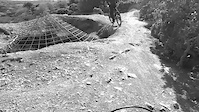
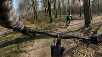
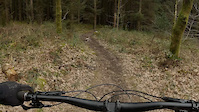
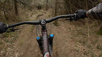
Videos of Cornwall Mountain Bike
trail: Kitty mainline
0:09 |
18 |
Nov 28, 2025
trail: Twisted Sister
0:33 |
108 |
Jul 16, 2022
trail: Poldice
0:11 |
50 |
May 9, 2021
trail: Grogley DH link
2:28 |
209 |
May 9, 2021
trail: Grogley DH link
0:42 |
74 |
Mar 30, 2021
trail: Grogley DH link
0:37 |
84 |
Mar 30, 2021
trail: Ridge Racer
0:05 |
86 |
Mar 8, 2021

trail: Poldice
0:12 |
15 |
Mar 1, 2021
Recent Trail Reports
| status | trail | date | condition | info | user |
|---|---|---|---|---|---|
| WB St Agnes | Jun 17, 2026 @ 9:24pm (Europe/London) 19 hours | Variable | ripsilver Cornwall | ||
| Last leg St Agnes | Jun 17, 2026 @ 9:19pm (Europe/London) 19 hours | Ideal | ripsilver Cornwall | ||
| Beacon downhill St Agnes | Jun 17, 2026 @ 9:18pm (Europe/London) 19 hours | Ideal | ripsilver Cornwall | ||
| Beacon north line St Agnes | Jun 17, 2026 @ 9:17pm (Europe/London) 19 hours | Ideal | ripsilver Cornwall | ||
| Tolgus Mount Valley Redruth | May 25, 2026 @ 6:39pm (Europe/London) May 25, 2026 | Ideal | ripsilver Cornwall | ||
| Tolgus Valley slow climb Camborne | May 25, 2026 @ 6:38pm (Europe/London) May 25, 2026 | Dry | ripsilver Cornwall | ||
| Monument Descent Helston | May 23, 2026 @ 9:13pm (Europe/London) May 23, 2026 | Ideal | ripsilver Cornwall | ||
| Rinsey Rampage Helston | May 23, 2026 @ 9:12pm (Europe/London) May 23, 2026 | Ideal | ripsilver Cornwall | ||
| Coombe valley Hayle | May 4, 2026 @ 5:20pm (Europe/London) May 4, 2026 | Variable | ripsilver Cornwall | ||
| Coombe-a-Ma'Tarka Portreath | May 4, 2026 @ 5:17pm (Europe/London) May 4, 2026 | Ideal | ripsilver Cornwall |
Activity Feed
| username | action | type | title | date |
|---|---|---|---|---|
| 1KP1Wh | ridden | route | activity #97234060 | Jun 17, 2026 @ 11:03pm 10 hours |
| ripsilver | update | trail | activity #97206319 and 1 more | Jun 17, 2026 @ 1:23pm 19 hours |
| ripsilver | add | report | activity #97206001 and 3 more | Jun 17, 2026 @ 1:17pm 19 hours |
| trailforks | add | article_links | activity #96677955 | Jun 10, 2026 @ 9:22am Jun 10, 2026 |
| trailforks | add | article_links | activity #96614739 | Jun 9, 2026 @ 10:22am Jun 9, 2026 |
Recent Comments
| username | type | title | comment | date |
|---|---|---|---|---|
| trail | Trail has been resurrected and rebuilt 👍 | Dec 20, 2025 @ 11:07am Dec 20, 2025 | ||
| trail | Terrible jumps have been built at the top over... | Jun 29, 2025 @ 6:41am Jun 29, 2025 | ||
| trail | This is a Public Footpath and very popular... | Oct 13, 2024 @ 7:38am Oct 13, 2024 | ||
| trail | Lower half of trail doesn’t really get... | Sep 16, 2024 @ 2:41pm Sep 16, 2024 | ||
| trail | This is not an MTB trail but a Public Footpath... | Jul 14, 2024 @ 10:06am Jul 14, 2024 |
Local Badges
-

Epic Ride 50k134 awarded -

Big Ride 30k170 awarded -
Epic Ride 50k134 awarded -
Big Ride 30k248 awarded -
Epic Ride 50k78 awarded -
Epic Ride 50k48 awarded
Bike & Skill Parks
| name | type | city | rating |
|---|---|---|---|
| Friendship Woods | skill park | Helston | |
| Lanhydrock skills area/pump track. | skill park | Bodmin | |
| Cornwall BMX Track | skill park | Redruth | |
| Falmouth Pumptrack | skill park | Falmouth | |
| The Track | skill park | Portreath |
Activity Type Stats
| activitytype | trails | distance | descent | descent distance | total vertical | rating | global rank | state rank | photos | reports | routes | ridelogs |
|---|---|---|---|---|---|---|---|---|---|---|---|---|
| Mountain Bike | 261 | 124 miles | 24,488 ft | 71 miles | 768 ft | 632 | 1,210 | 17 | 22,895 | |||
| E-Bike | 34 | 17 miles | 2,356 ft | 9 miles | 725 ft | 983 | 4 | 2,929 | ||||
| Horse | 19 | 13 miles | 1,427 ft | 7 miles | 725 ft | 520 | 2 | |||||
| Hike | 252 | 120 miles | 23,225 ft | 69 miles | 768 ft | 9 | 1,201 | 2 | 1,497 | |||
| Trail Running | 252 | 120 miles | 23,225 ft | 69 miles | 768 ft | 1,201 | 1 | 878 |
Frequently Asked Questions About Cornwall
▼
What are the best places to ride in Cornwall?
Cornwall has 12 areas to explore for mountain biking. The top rated areas are:
▼
What are the highest rated mountain biking trails in Cornwall?
The highest rated mountain biking trails in Cornwall are:
- Blue Jump (4.4/5)
- Dirt Wave (4.4/5)
- The Rabbit Hole (4.2/5)
- Timber Trail (4.2/5)
- The Cribbar (4.2/5)
▼
What is the best time of the year to ride in Cornwall?
Based on ride log data, the most popular months to ride in Cornwall are:
- July (186 activities)
- June (135 activities)
- May (126 activities)
▼
What is the longest trail in Cornwall?
The longest trail in Cornwall is The long way back at 3.3 miles. View all trails sorted by distance.
Activities
Trails
Points of Interest
- By brenthillier
 NSMBA TRAILFORKS & contributors
 - Admins: UKTP, 20twenty-p, wisey, MathieuC, cemoorelife, Cornwall
- #6770 - 39,885 views
- cornwall activity log | embed map of Cornwall mountain bike trails | cornwall mountain biking points of interest
Downloading of trail gps tracks in kml & gpx formats is enabled for Cornwall.
You must login to download files.