close
-
Layers w
- Weather Layers
- Pro
- Pro
- Pro
- Pro
- Pro
- Pro
- More Layers
- Pro
- Pro
- Pro
- Pro
-
Upgrade to

3D
Trail Conditions
- Unknown
- Snow Groomed
- Snow Packed
- Snow Covered
- Snow Cover Partial
- Freeze/thaw Cycle
- Icy
- Prevalent Mud
- Wet
- Variable
- Ideal
- Dry
- Very Dry
Trail Flow (Ridden Direction)
Trailforks scans users ridelogs to determine the most popular direction each trail is ridden. A good flowing trail network will have most trails flowing in a single direction according to their intension.
The colour categories are based on what percentage of riders are riding a trail in its intended direction.
The colour categories are based on what percentage of riders are riding a trail in its intended direction.
- > 96%
- > 90%
- > 80%
- > 70%
- > 50%
- < 50%
- bi-directional trail
- no data
Trail Last Ridden
Trailforks scans ridelogs to determine the last time a trail was ridden.
- < 2 days
- < 1 week
- < 2 weeks
- < 1 month
- < 6 months
- > 6 months
Trail Ridden Direction
The intended direction a trail should be ridden.
- Downhill Only
- Downhill Primary
- Both Directions
- Uphill Primary
- Uphill Only
- One Direction
Contribute Details
Colors indicate trail is missing specified detail.
- Description
- Photos
- Description & Photos
- Videos
Trail Popularity ?
Trailforks scans ridelogs to determine which trails are ridden the most in the last 9 months.
Trails are compared with nearby trails in the same city region with a possible 25 colour shades.
Think of this as a heatmap, more rides = more kinetic energy = warmer colors.
- most popular
- popular
- less popular
- not popular
ATV/ORV/OHV Filter
Max Vehicle Width
inches
US Cell Coverage
Legend

Radar Time
Activity Recordings
Trailforks uses anonymized public activity data.
?
Activity Recordings
Trailforks uses anonymized public activity data.
?
Personal Heatmap
▶
Activity Types
all
/
none
▶
Options
2
Date range
month
–
Winter Trails
Warning
A routing network for winter maps does not exist. Selecting trails using the winter trails layer has been disabled.
Missing Trails
Most Popular
Least Popular
Trails are colored based on popularity. The more popular a trail is, the more red. Less popular trails trend towards green.
Jump Magnitude Heatmap
Heatmap of where riders jump on trails. Zoom in to see individual jumps, click circles to view jump details.
BC Backroad Status
![map legend]()
Service Road Atlas is a free to use, community-driven service for viewing and creating reports on the numerous back-country service roads around B.C. and Alberta.

Slope Aspect
Direction the slope faces
Trails Deemphasized
Trails are shown in grey.
Only show trails with no bike usage.
Suggested Layers
Based on selected activity type
Save the current map location and zoom level as your default home location whenever this page is loaded.
Save
No description for Corse has been added yet!
Login or register to submit one.
eBikes Allowed:
Yes
AKA: Corsica
This region uses the Uk/Euro style trail grading system.
Stats
- Avg Trail Rating
- Trails (view details)
- 204
- Trails Mountain Bike
- 187
- Trails E-Bike
- 159
- Trails Gravel Bike
- 18
- Trails Adaptive Bike
- 10
- Trails Horse
- 28
- Trails Hike
- 198
- Trails Trail Running
- 184
- Total Distance
- 331 miles
- Total Descent
- 91,239 ft
- Total Vertical
- 6,835 ft
- Highest Trailhead
- 6,836 ft
- Reports
- 160
- Photos
- 163
- Ridden Counter
- 1,117
Sub Regions
- Corse-du-Sud (56)
- ajaccio (20)
- Bastelica (9)
- Cala D'Oru (1)
- Coti-Chiavari (16)
- Porto Vecchio (3)
- Southern Corsica (2)
- Verghia (6)
- Alta Rocca (6)
- Zonza (8)
- ajaccio (20)
- Haute-Corse (131)
- Albertacce (2)
- Bastia (9)
- Calacuccia (17)
- Calvi (18)
- Calvi (3)
- Campile (1)
- Corte (8)
- L'île-Rousse (41)
- Prato-di-Giovellina (3)
- Saint Florent (11)
- Albertacce (2)
Popular Corse Mountain Biking Trails
• 60 ★ 3.6 • 2 miles • 3 ft • 19 •
In the first section, up- and downhill trough some bizarre rock formations and pine trees. Then, enter into a tiny single trail. Difficult sections and some loose rocks follow. Towards the end, the trail becomes easier but also a bit...
• ★ 4.0 • 4,895 ft • 171 ft • 15 •
Commence par une descente technique jusqu'à la rivière, suivie d'un excellent singletrack. Le chemin devient plus raide et plus technique à l'approche de Corbara.
• 20 ★ 3.7 • 3,189 ft • 6 ft • 15 •
Some euro-pallet berms in the beginning, then a bit more technical and overgrown, but always flowy.
• 80 ★ 4.0 • 2,415 ft • 0 ft • 15 •
Short line with around five jumps. Can be used as variant to the existing trails. Nice shaped curves. Track built by hand...
• 5 ★ 2.0 • 2 miles • 7 ft • 12 •
Less popular blue difficulty singletrack. This mountain bike primary trail can be used downhill primary and has a moderate overall physical rating. It features jump. On average it takes 56 minutes to complete this trail.
• 100 ★ 4.0 • 1 mile • 15 ft • 12 •
Popular red difficulty singletrack. This mountain bike primary trail can be used one direction and has a hard overall physical rating with a 15 ft blue climb. It features rock face and rock garden. Trail visibility is always easy to follow. On average it takes 9 minutes to complete this trail.
• 95 ★ 0.0 • 3,786 ft • 0 ft • 11 •
This mostly flowy trail connects Pietralba and L’Île-Rousse. Although it is mostly greenish, there are some blue sections in it. Ce sentier en grande partie avec du flow et relie Pietralba à L’Île-Rousse. Bien qu’il soit...
• 40 ★ 3.0 • 1,096 ft • 0 ft • 9 •
Washed out and rocky. Quite technical and sometimes steep.
Corse Mountain Bike Routes
12 miles • 1,447 ft • 3 • Loop •
Belle boucle avec seulement quelques sections techniques, pouvant être reliée à l'autre boucle (Parasu)...
18 miles • 3,871 ft • 0 • Loop •
29km 1100D+ is a red singletrack trail located near L'île-Rousse. This e-bike only trail can be used both...
11 miles • 1,975 ft • 0 • Loop •
Une boucle autour de Castineta en Corse
• 1 mile • 18 ft • 0 •
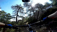
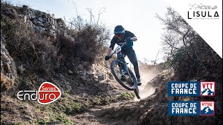
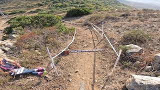
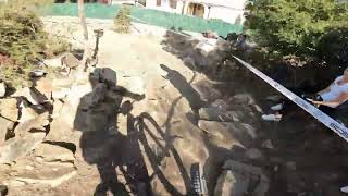
Photos of Corse Mountain Bike
Videos of Corse Mountain Bike
trail: Ospedale DH
4:15 |
606 |
Sep 3, 2015
6:26 |
123 |
Aug 9, 2025 , L'île-Rousse
5:39 |
108 |
Aug 16, 2025 , L'île-Rousse
5:51 |
79 |
Aug 9, 2025 , L'île-Rousse
Recent Trail Reports
| status | trail | date | condition | info | user |
|---|---|---|---|---|---|
| Spelunca Gorge Downhill Albertacce | May 21, 2026 @ 4:07pm (Europe/Paris) May 21, 2026 | Ideal | Dominik-B | ||
| Rock'n'Roll above Calvi Haute-Corse | May 10, 2026 @ 10:38pm (Europe/Paris) May 10, 2026 | Ideal | Dominik-B | ||
| Depart Sous Bois Longue Haute-Corse | May 10, 2026 @ 9:17am (Europe/Paris) May 10, 2026 | Dry | etride1 | ||
| JumpLine Calvi Haute-Corse | Apr 5, 2026 @ 9:29pm (Europe/Paris) Apr 5, 2026 | Unknown | dieHilde | ||
| Enduro Chasseur Coti-Chiavari | Feb 16, 2026 @ 7:09pm (Europe/Paris) Feb 16, 2026 | Unknown | Jcexdescretes | ||
| Frosty Gap Cranberry Backcountry | Sep 8, 2025 @ 6:04pm Sep 8, 2025 | Dry | taosmith365 RVMBA | ||
| Lavatoggio Bas L'île-Rousse | Aug 26, 2025 @ 6:52am Aug 26, 2025 | Very Dry | Glaucovassallo | ||
| Les Epingles Bleues Calvi | Aug 26, 2025 @ 6:52am Aug 26, 2025 | Very Dry | Glaucovassallo | ||
| Pigna-Corbara Haute-Corse | Aug 26, 2025 @ 6:52am Aug 26, 2025 | Very Dry | Glaucovassallo | ||
| Carbunaghja - Corbara Haute-Corse | Aug 26, 2025 @ 6:52am Aug 26, 2025 | Very Dry | Glaucovassallo |
Activity Feed
| username | action | type | title | date |
|---|---|---|---|---|
| janklonz | wishlist | trail | activity #96554741 and 2 more | Jun 8, 2026 @ 11:47am Jun 8, 2026 |
| acXMun | wishlist | trail | activity #96521371 | Jun 7, 2026 @ 10:25pm Jun 7, 2026 |
| PartyPeder | comment | trail | activity #95558841 | May 26, 2026 @ 5:53am May 26, 2026 |
| PartyPeder | vote | trail | activity #95558794 | May 26, 2026 @ 5:52am May 26, 2026 |
| PartyPeder | vote | trail | activity #95558778 | May 26, 2026 @ 5:52am May 26, 2026 |
Recent Comments
| username | type | title | comment | date |
|---|---|---|---|---|
| trail | Hard to navigate, tricky uphill section,... | May 26, 2026 @ 5:53am May 26, 2026 | ||
| trail | Nice narrow trail in the woods with several... | May 26, 2026 @ 5:30am May 26, 2026 | ||
| trail | Au | May 26, 2026 @ 2:41am May 26, 2026 | ||
| report | Not nice;-(( | Jun 7, 2025 @ 5:18am Jun 7, 2025 | ||
| trail | Joli petit sentier, généralement fluide,... | May 16, 2025 @ 8:42am May 16, 2025 |
Bike & Skill Parks
| name | type | city | rating |
|---|---|---|---|
| Circuit Corse | skill park | Porto Vecchio |
Activity Type Stats
| activitytype | trails | distance | descent | descent distance | total vertical | rating | global rank | state rank | photos | reports | routes | ridelogs |
|---|---|---|---|---|---|---|---|---|---|---|---|---|
| Mountain Bike | 187 | 275 miles | 74,813 ft | 141 miles | 5,253 ft | 71 | 134 | 4 | 6,222 | |||
| E-Bike | 159 | 235 miles | 58,743 ft | 116 miles | 5,246 ft | 33 | 97 | 2 | 700 | |||
| Gravel Bike | 18 | 52 miles | 6,752 ft | 18 miles | 6,604 ft | 1 | 103 | |||||
| Adaptive Bike | 10 | 27 miles | 3,245 ft | 10 miles | 2,822 ft | 12 | ||||||
| Horse | 28 | 31 miles | 11,243 ft | 18 miles | 5,207 ft | 40 | 1 | |||||
| Hike | 198 | 328 miles | 90,085 ft | 164 miles | 6,834 ft | 59 | 153 | 3,048 | ||||
| Trail Running | 184 | 318 miles | 86,283 ft | 157 miles | 6,834 ft | 151 | 539 |
Activities
Trails
Points of Interest
- Col De Saint Eustache Summit
- Bocca Di Gradeddu Summit
- pénitencier de Coti Chiavari Sight
- Bocca Di U Curtonu Summit
- Tour Génoise D'Agnello Sight
- Eglise Sainte Marie de la chapelle Sight
- La Parata Viewpoint
- Croce D'Arbitro Summit
- Chapelle San Nicolao Sight
- Cima Di A Campana Summit
- Monte Cinto (8,652 ft)
- Capu Ciuntrone (8,573 ft)
- Pointe des Éboulis (8,488 ft)
- By canadaka
 Trailforks & contributors
 - Admins: TFFRANCE, elyari, freerider48, provencemb
- #5488 - 15,531 views
- corse activity log | embed map of Corse mountain bike trails | corse mountain biking points of interest polygons
Downloading of trail gps tracks in kml & gpx formats is enabled for Corse.
You must login to download files.