close
-
Layers w
- Weather Layers
- Pro
- Pro
- Pro
- Pro
- Pro
- Pro
- More Layers
- Pro
- Pro
- Pro
- Pro
-
Upgrade to

3D
Trail Conditions
- Unknown
- Snow Groomed
- Snow Packed
- Snow Covered
- Snow Cover Partial
- Freeze/thaw Cycle
- Icy
- Prevalent Mud
- Wet
- Variable
- Ideal
- Dry
- Very Dry
Trail Flow (Ridden Direction)
Trailforks scans users ridelogs to determine the most popular direction each trail is ridden. A good flowing trail network will have most trails flowing in a single direction according to their intension.
The colour categories are based on what percentage of riders are riding a trail in its intended direction.
The colour categories are based on what percentage of riders are riding a trail in its intended direction.
- > 96%
- > 90%
- > 80%
- > 70%
- > 50%
- < 50%
- bi-directional trail
- no data
Trail Last Ridden
Trailforks scans ridelogs to determine the last time a trail was ridden.
- < 2 days
- < 1 week
- < 2 weeks
- < 1 month
- < 6 months
- > 6 months
Trail Ridden Direction
The intended direction a trail should be ridden.
- Downhill Only
- Downhill Primary
- Both Directions
- Uphill Primary
- Uphill Only
- One Direction
Contribute Details
Colors indicate trail is missing specified detail.
- Description
- Photos
- Description & Photos
- Videos
Trail Popularity ?
Trailforks scans ridelogs to determine which trails are ridden the most in the last 9 months.
Trails are compared with nearby trails in the same city region with a possible 25 colour shades.
Think of this as a heatmap, more rides = more kinetic energy = warmer colors.
- most popular
- popular
- less popular
- not popular
ATV/ORV/OHV Filter
Max Vehicle Width
inches
US Cell Coverage
Legend

Radar Time
Activity Recordings
Trailforks uses anonymized public activity data.
?
Activity Recordings
Trailforks uses anonymized public activity data.
?
Personal Heatmap
▶
Activity Types
all
/
none
▶
Options
2
Date range
month
–
Winter Trails
Warning
A routing network for winter maps does not exist. Selecting trails using the winter trails layer has been disabled.
Missing Trails
Most Popular
Least Popular
Trails are colored based on popularity. The more popular a trail is, the more red. Less popular trails trend towards green.
Jump Magnitude Heatmap
Heatmap of where riders jump on trails. Zoom in to see individual jumps, click circles to view jump details.
BC Backroad Status
![map legend]()
Service Road Atlas is a free to use, community-driven service for viewing and creating reports on the numerous back-country service roads around B.C. and Alberta.

Slope Aspect
Direction the slope faces
Trails Deemphasized
Trails are shown in grey.
Only show trails with no bike usage.
Suggested Layers
Based on selected activity type
Save the current map location and zoom level as your default home location whenever this page is loaded.
Save
No description for Corvallis has been added yet!
Login or register to submit one.
Activities Click to view
- Mountain Bike
297 trails
- E-Bike
124 trails
- Gravel Bike
1 trails
- Adaptive Bike
1 trails
- Winter Fat Bike
0 trails
- Horse
224 trails
- Hike
325 trails
- Trail Running
326 trails
Region Details
- 56
- 116
- 91
- 25
- 4
Region Status
Open as of 3 daysLocal Trail Association
Stats
- Avg Trail Rating
- Trails (view details)
- 310
- Trails Mountain Bike
- 298
- Trails E-Bike
- 124
- Trails Gravel Bike
- 1
- Trails Adaptive Bike
- 1
- Trails Horse
- 224
- Trails Hike
- 326
- Trails Trail Running
- 326
- Total Distance
- 162 miles
- Total Descent
- 23,194 ft
- Total Vertical
- 1,937 ft
- Highest Trailhead
- 2,146 ft
- Reports
- 7,264
- Photos
- 389
- Ridden Counter
- 27,877
Sub Regions
-
Alder Creek
- 3
- 4
-
Bald Hill Natural Area
- 2
- 14
- 2
-
Brandis Natural Area
- 5
-
Chip Ross Park
- 5
-
Dunn Research Forest
- 1
-
McDonald Forest
- 3
- 29
- 15
- 4
Popular Corvallis Mountain Biking Trails
• 95 ★ 3.5 • 2,602 ft • 11 ft • 350 •
Official multi-use bidirectional gravel trail. The trail is open year-round to bikes as well as equestrian and pedestrian traffic. Bikes are required by OSU to yield to all other users. One of the longest continuous trails in the...
• 95 ★ 3.5 • 2,769 ft • 0 ft • 338 •
Official multi-use bidirectional gravel trail. The trail is open year-round to bikes as well as equestrian and pedestrian traffic. Bikes are required by OSU to yield to all other users. The trail consists of a series of switchbacks...
• 90 ★ 3.4 • 1 mile • 49 ft • 336 •
Official multi-use bidirectional gravel trail. The trail is open year-round to bikes as well as equestrian and pedestrian traffic. Bikes are required by OSU to yield to all other users. The trail starts with a series of punchy climbs...
• 100 ★ 3.4 • 1,329 ft • 170 ft • 332 •
Short official multi-use bidirectional gravel trail. The trail is open year-round to bikes as well as equestrian and pedestrian traffic. Bikes are required by OSU to yield to all other users. A series of short-legged switchbacks between...
• 90 ★ 3.9 • 2 miles • 3 ft • 323 •
Official multi-use bidirectional gravel trail. The trail is open year-round to bikes as well as equestrian and pedestrian traffic. Bikes are required by OSU to yield to all other users. One of the longest continuous trails in the...
• 90 ★ 3.8 • 3,205 ft • 75 ft • 303 •
Official multi-use bidirectional gravel trail. The trail is open year-round to bikes as well as equestrian and pedestrian traffic. Bikes are required by OSU to yield to all other users. Trail starts with a steep punchy climb, then a...
• 95 ★ 4.3 • 2 miles • 77 ft • 294 •
Cross-country trail that climbs west from the 5010 and 500 road intersection up to the peak of the mountain it is named after, then descends to Lewisburg Saddle. Mix of adopted old unauthorized trail with new sections of sustainable...
• 95 ★ 3.5 • 1,847 ft • 3 ft • 291 •
Cross-country style singletrack that climbs into a recent white oak habitat restoration thinned section of forest before winding its way down the opposite side of the . Several rock gardens and brief bursts of climbing on the way down...
Corvallis Mountain Bike Routes
18 miles • 1,723 ft • 6 • Loop •
Start near campus, up to Oak Creek towards McCulloch to Sulphur Springs Rd to Main Parking Lot at...
★ 1.0 • 7 miles • 1,427 ft • 6 •
Skillings the road to the top pretty much, then South Ridget, to , then to to Narnia, back to , and then...
★ 3.0 • 13 miles • 1,798 ft • 15 • Loop •
This trail starts at the Adair village entrance, climbs up to the lake, stays left on the main road with...
★ 3.0 • 2 miles • 254 ft • 0 •
This will take you on a fire road from the top of the Dan's/Horse Connector to the Lewisburg Saddle
• 14 miles • 2,388 ft • 9 •
• 15 miles • 2,500 ft • 9 •
Photos of Corvallis Mountain Bike
Videos of Corvallis Mountain Bike
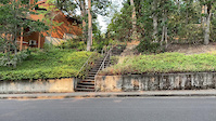
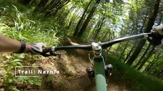
trail: Thirteenth Stairs
0:17 |
|
Sep 6, 2021
trail: Homestead
2:14 |
87 |
Sep 12, 2019
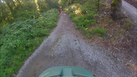
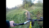
trail: Walnut Barn Access Rd
0:39 |
457 |
Jan 11, 2016
trail: Walnut Barn Access Rd
8:22 |
601 |
Jun 12, 2013
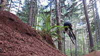
trail: Word to Your Mother
8:55 |
45 |
Dec 24, 2025 , Corvallis
trail: Walnut Barn Access Rd
0:31 |
594 |
Apr 25, 2012

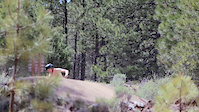
trail: Hole in the Bucket
2:28 |
340 |
Aug 12, 2023 , Corvallis

trail: Walnut Barn Access Rd
4:04 |
525 |
Sep 5, 2010
Current Trail Warnings
| status | trail | date | condition | user | info |
|---|---|---|---|---|---|
| High Horse | Jun 19, 2026 @ 9:17am (America/Los_Angeles) 3 days | Dry | tbmaddux Team Dirt | Dry. Do your logs hang low? | |
| Upper Dan's | Jun 14, 2026 @ 2:50pm (America/Los_Angeles) Jun 14, 2026 | Dry | tbmaddux Team Dirt | Large tree down about 3/4 way down the trail. | |
| Word to Your Mother | Jun 4, 2026 @ 8:32am (America/Los_Angeles) Jun 4, 2026 | Ideal | tbmaddux Team Dirt | Closed from Road 770 down to Stark Naked... |
Recent Trail Reports
Activity Feed
| username | action | type | title | date |
|---|---|---|---|---|
| Golffreak001 | wishlist | trail | activity #97495193 | Jun 21, 2026 @ 9:49am 16 hours |
| Golffreak001 | wishlist | region | activity #97494867 | Jun 21, 2026 @ 9:46am 16 hours |
| Jeremy4xWjQk | wishlist | region | activity #97451884 | Jun 20, 2026 @ 7:58pm 1 day |
| BKL | wishlist | trail | activity #97358375 and 6 more | Jun 19, 2026 @ 6:13pm 2 days |
| tbmaddux | add | report | activity #97336638 and 8 more | Jun 19, 2026 @ 12:17pm 3 days |
Recent Comments
| username | type | title | comment | date |
|---|---|---|---|---|
| report | Report any cougar sighting or encounter to our... | May 11, 2026 @ 6:50am May 11, 2026 | ||
| report | Second tree down just after where the trail... | Dec 29, 2025 @ 2:56pm Dec 29, 2025 | ||
| trail | Mellow XC trail. TONS of poison oak | Jul 5, 2025 @ 10:21am Jul 5, 2025 | ||
| report | Thanks for including the location. I'm... | May 20, 2025 @ 8:48am May 20, 2025 | ||
| report | Oouiot | May 6, 2025 @ 5:58pm May 6, 2025 |
Local Badges
-

10 Green Trails224 awarded -

10 Blue Trails139 awarded -

Epic Ride Climb 2k63 awarded -

Climbing 10k Badge110 awarded -

Climbing 100k Badge21 awarded -

Epic Ride Descent 2k66 awarded
Bike & Skill Parks
| name | type | city | rating |
|---|---|---|---|
| BMX Track | skill park | Corvallis |
Activity Type Stats
| activitytype | trails | distance | descent | descent distance | total vertical | rating | global rank | state rank | photos | reports | routes | ridelogs |
|---|---|---|---|---|---|---|---|---|---|---|---|---|
| Mountain Bike | 297 | 151 miles | 21,424 ft | 59 miles | 1,936 ft | #551 | #200 | 399 | 7,336 | 3 | 35,537 | |
| E-Bike | 124 | 35 miles | 1,145 ft | 11 miles | 269 ft | #2,551 | #1,022 | 5,330 | 774 | |||
| Gravel Bike | 1 | #421 | #1,004 | 15 | 1 | 222 | ||||||
| Adaptive Bike | 1 | #379 | #1,723 | 4 | 1 | |||||||
| Horse | 224 | 116 miles | 15,443 ft | 44 miles | 1,936 ft | #181 | #410 | 2,124 | ||||
| Hike | 325 | 162 miles | 23,192 ft | 63 miles | 1,936 ft | #856 | #391 | 2 | 7,235 | 1,849 | ||
| Trail Running | 326 | 162 miles | 23,192 ft | 63 miles | 1,936 ft | #479 | #187 | 7,235 | 7,973 |
Frequently Asked Questions About Corvallis
▼
What are the best places to ride in Corvallis?
Corvallis has 7 areas to explore for mountain biking. The top rated areas are:
▼
What are the highest rated mountain biking trails in Corvallis?
The highest rated mountain biking trails in Corvallis are:
- Play Time (4.5/5)
- Narnia Forest (4.3/5)
- Hole in the Bucket (4.2/5)
- Lower As You Wish (4.2/5)
- Word to Your Mother (4.2/5)
▼
What is the best time of the year to ride in Corvallis?
Based on ride log data, the most popular months to ride in Corvallis are:
- July (266 activities)
- August (185 activities)
- October (167 activities)
▼
Where can I park to ride in Corvallis?
There are 18 parking locations listed in Corvallis. The most popular parking spots are: View all parking and trailhead locations on the map to plan your visit.
Activities
Trails
Points of Interest
- McCulloch Peak Viewpoint
- Dimple Hill Viewpoint
- Chip Ross Viewpoint
- Soap Creek Info Information
- Road 830 Info Information
- Western viewpoint
- Fitton Green viewpoint
- Old Chimney and Concrete Pad Sight
- Jackson Creek Bridge
- Information Kiosk
- McCulloch Peak (2,159 ft)
- Scott Mountain (2,139 ft)
- Reception Peak (1,965 ft)
- By tbmaddux
 Team Dirt Alsea Falls TC & contributors
 - Admins: Team Dirt
- #6121 - 30,982 views
- corvallis activity log | embed map of Corvallis mountain bike trails | corvallis mountain biking points of interest
Downloading of trail gps tracks in kml & gpx formats is enabled for Corvallis.
You must login to download files.