close
-
Layers w
- Weather Layers
- Pro
- Pro
- Pro
- Pro
- Pro
- Pro
- More Layers
- Pro
- Pro
- Pro
- Pro
-
Upgrade to

3D
Trail Conditions
- Unknown
- Snow Groomed
- Snow Packed
- Snow Covered
- Snow Cover Partial
- Freeze/thaw Cycle
- Icy
- Prevalent Mud
- Wet
- Variable
- Ideal
- Dry
- Very Dry
Trail Flow (Ridden Direction)
Trailforks scans users ridelogs to determine the most popular direction each trail is ridden. A good flowing trail network will have most trails flowing in a single direction according to their intension.
The colour categories are based on what percentage of riders are riding a trail in its intended direction.
The colour categories are based on what percentage of riders are riding a trail in its intended direction.
- > 96%
- > 90%
- > 80%
- > 70%
- > 50%
- < 50%
- bi-directional trail
- no data
Trail Last Ridden
Trailforks scans ridelogs to determine the last time a trail was ridden.
- < 2 days
- < 1 week
- < 2 weeks
- < 1 month
- < 6 months
- > 6 months
Trail Ridden Direction
The intended direction a trail should be ridden.
- Downhill Only
- Downhill Primary
- Both Directions
- Uphill Primary
- Uphill Only
- One Direction
Contribute Details
Colors indicate trail is missing specified detail.
- Description
- Photos
- Description & Photos
- Videos
Trail Popularity ?
Trailforks scans ridelogs to determine which trails are ridden the most in the last 9 months.
Trails are compared with nearby trails in the same city region with a possible 25 colour shades.
Think of this as a heatmap, more rides = more kinetic energy = warmer colors.
- most popular
- popular
- less popular
- not popular
ATV/ORV/OHV Filter
Max Vehicle Width
inches
US Cell Coverage
Legend

Radar Time
Activity Recordings
Trailforks uses anonymized public activity data.
?
Activity Recordings
Trailforks uses anonymized public activity data.
?
Personal Heatmap
▶
Activity Types
all
/
none
▶
Options
2
Date range
month
–
Winter Trails
Warning
A routing network for winter maps does not exist. Selecting trails using the winter trails layer has been disabled.
Missing Trails
Most Popular
Least Popular
Trails are colored based on popularity. The more popular a trail is, the more red. Less popular trails trend towards green.
Jump Magnitude Heatmap
Heatmap of where riders jump on trails. Zoom in to see individual jumps, click circles to view jump details.
BC Backroad Status
![map legend]()
Service Road Atlas is a free to use, community-driven service for viewing and creating reports on the numerous back-country service roads around B.C. and Alberta.

Slope Aspect
Direction the slope faces
Trails Deemphasized
Trails are shown in grey.
Only show trails with no bike usage.
Suggested Layers
Based on selected activity type
Save the current map location and zoom level as your default home location whenever this page is loaded.
SaveEl Parque Nacional Cotopaxi
Region Details
- 35
- 1
- 10
- 11
- 2
Stats
- Avg Trail Rating
- Trails (view details)
- 59
- Trails Mountain Bike
- 59
- Trails E-Bike
- 45
- Trails Hike
- 62
- Trails Trail Running
- 62
- Total Distance
- 33 miles
- Total Descent
- 22,596 ft
- Total Vertical
- 4,906 ft
- Highest Trailhead
- 13,112 ft
- Reports
- 15
- Photos
- 21
- Ridden Counter
- 795
Articles

Video: Rob Warner and Finn Iles Meet Cowboys and Shamans and Ride Ecuador's Highest Volcano
Nov 27, 2019 from pinkbike.com
Iles and Warner break new ground in South America.
Sub Regions
- Latacunga (56)
Popular Cotopaxi Mountain Biking Trails
• 85 ★ 0.0 • 4,324 ft • 0 ft • 53 •
Popular green difficulty singletrack. This mountain bike primary trail can be used both directions. On average it takes 5 minutes to complete this trail.
• 100 ★ 0.0 • 1,732 ft • 0 ft • 48 •
Popular black diamond difficulty singletrack. This mountain bike primary trail can be used downhill only.
• 100 ★ 0.0 • 1,604 ft • 0 ft • 45 •
Popular black diamond difficulty singletrack. This mountain bike primary trail can be used downhill only.
• 100 ★ 0.0 • 2,100 ft • 0 ft • 44 •
Popular black diamond difficulty singletrack. This mountain bike primary trail can be used downhill only.
• 95 ★ 0.0 • 1 mile • 0 ft • 37 •
Popular black diamond difficulty singletrack. This mountain bike primary trail can be used downhill only.
• 90 ★ 0.0 • 2 miles • 18 ft • 35 •
Popular blue difficulty singletrack. This mountain bike primary trail can be used downhill only. On average it takes 23 minutes to complete this trail.
• 90 ★ 0.0 • 2,707 ft • 0 ft • 14 •
Popular blue difficulty singletrack. This multi-use trail can be used downhill primary and has a moderate overall physical rating with a 0 ft blue climb. Trail visibility is always easy to follow.
Cotopaxi Mountain Bike Routes
Photos of Cotopaxi Mountain Bike
Videos of Cotopaxi Mountain Bike
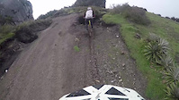
trail: KachiYaku
0:20 |
127 |
Feb 17, 2017
Recent Trail Reports
| status | trail | date | condition | info | user |
|---|---|---|---|---|---|
| Venado Blanco Latacunga | Jan 5, 2024 @ 2:16am Jan 5, 2024 | Ideal | Santiago2t9eQM | ||
| Conejo Sabio Latacunga | Oct 28, 2023 @ 2:45am Oct 28, 2023 | Ideal | Santiago2t9eQM | ||
| Gnomos Latacunga | Jul 3, 2022 @ 10:30am Jul 3, 2022 | Variable | allaroundjoe | ||
| El Último Inca - Primes 1 Cotopaxi | Oct 24, 2019 @ 8:13pm Oct 24, 2019 | Variable | yzsven | ||
| Provincial Putzalahua Latacunga | Nov 20, 2016 @ 12:50pm Nov 20, 2016 | Dry | Paking MTBECUADOR | ||
| Nacional Putzalahua Latacunga | Nov 20, 2016 @ 12:49pm Nov 20, 2016 | Very Dry | Paking MTBECUADOR | ||
| KachiYaku Latacunga | Apr 9, 2016 @ 4:51pm Apr 9, 2016 | Prevalent Mud | Paking MTBECUADOR |
Activity Feed
| username | action | type | title | date |
|---|---|---|---|---|
| ertman | wishlist | trail | activity #87058134 | Jan 11, 2026 @ 5:01pm Jan 11, 2026 |
| 5y84eb | ridden | trail | activity #84862149 | Nov 28, 2025 @ 12:25pm Nov 28, 2025 |
| Proktah | comment | trail | activity #84482054 | Nov 21, 2025 @ 7:04am Nov 21, 2025 |
| AMG | add | trail | activity #68102674 and 3 more | Mar 20, 2025 @ 1:58pm Mar 20, 2025 |
| AMG | add | trail | activity #67733075 and 43 more | Mar 14, 2025 @ 6:19am Mar 14, 2025 |
Recent Comments
| username | type | title | comment | date |
|---|---|---|---|---|
| trail | Trail officially closed by authorities of... | Nov 21, 2025 @ 7:04am Nov 21, 2025 | ||
| trail | BIENOS DIAS, EN EL MAPA ACTUAL DEL BIKE PARK,... | May 19, 2021 @ 6:41am May 19, 2021 |
Local Badges
-

Epic Mountain Bike Climb 2k0 awarded -

Climbing 10k Badge0 awarded -

Mountain Biking 100k Badge0 awarded -

Epic Ride Descent 2k0 awarded -

Descent 10k Badge0 awarded -

Descent 100k Badge0 awarded
Activity Type Stats
| activitytype | trails | distance | descent | descent distance | total vertical | rating | global rank | state rank | photos | reports | routes | ridelogs |
|---|---|---|---|---|---|---|---|---|---|---|---|---|
| Mountain Bike | 59 | 33 miles | 22,595 ft | 25 miles | 4,905 ft | 21 | 15 | 1 | 2,609 | |||
| E-Bike | 45 | 12 miles | 5,879 ft | 7 miles | 4,793 ft | 13 | 92 | |||||
| Hike | 62 | 24 miles | 16,946 ft | 17 miles | 4,905 ft | 8 | 403 | |||||
| Trail Running | 62 | 24 miles | 16,946 ft | 17 miles | 4,905 ft | 8 | 9 |
Activities
Trails
Points of Interest
- By Paking MTBECUADOR & contributors
- Admins: elyari
- #9859 - 4,363 views
- cotopaxi activity log | embed map of Cotopaxi mountain bike trails |
Downloading of trail gps tracks in kml & gpx formats is enabled for Cotopaxi.
You must login to download files.