close
-
Layers w
- Weather Layers
- Pro
- Pro
- Pro
- Pro
- Pro
- Pro
- More Layers
- Pro
- Pro
- Pro
- Pro
-
Upgrade to

3D
Trail Conditions
- Unknown
- Snow Groomed
- Snow Packed
- Snow Covered
- Snow Cover Partial
- Freeze/thaw Cycle
- Icy
- Prevalent Mud
- Wet
- Variable
- Ideal
- Dry
- Very Dry
Trail Flow (Ridden Direction)
Trailforks scans users ridelogs to determine the most popular direction each trail is ridden. A good flowing trail network will have most trails flowing in a single direction according to their intension.
The colour categories are based on what percentage of riders are riding a trail in its intended direction.
The colour categories are based on what percentage of riders are riding a trail in its intended direction.
- > 96%
- > 90%
- > 80%
- > 70%
- > 50%
- < 50%
- bi-directional trail
- no data
Trail Last Ridden
Trailforks scans ridelogs to determine the last time a trail was ridden.
- < 2 days
- < 1 week
- < 2 weeks
- < 1 month
- < 6 months
- > 6 months
Trail Ridden Direction
The intended direction a trail should be ridden.
- Downhill Only
- Downhill Primary
- Both Directions
- Uphill Primary
- Uphill Only
- One Direction
Contribute Details
Colors indicate trail is missing specified detail.
- Description
- Photos
- Description & Photos
- Videos
Trail Popularity ?
Trailforks scans ridelogs to determine which trails are ridden the most in the last 9 months.
Trails are compared with nearby trails in the same city region with a possible 25 colour shades.
Think of this as a heatmap, more rides = more kinetic energy = warmer colors.
- most popular
- popular
- less popular
- not popular
ATV/ORV/OHV Filter
Max Vehicle Width
inches
US Cell Coverage
Legend

Radar Time
Activity Recordings
Trailforks uses anonymized public activity data.
?
Activity Recordings
Trailforks uses anonymized public activity data.
?
Personal Heatmap
▶
Activity Types
all
/
none
▶
Options
2
Date range
month
–
Winter Trails
Warning
A routing network for winter maps does not exist. Selecting trails using the winter trails layer has been disabled.
Missing Trails
Most Popular
Least Popular
Trails are colored based on popularity. The more popular a trail is, the more red. Less popular trails trend towards green.
Jump Magnitude Heatmap
Heatmap of where riders jump on trails. Zoom in to see individual jumps, click circles to view jump details.
BC Backroad Status
![map legend]()
Service Road Atlas is a free to use, community-driven service for viewing and creating reports on the numerous back-country service roads around B.C. and Alberta.

Slope Aspect
Direction the slope faces
Trails Deemphasized
Trails are shown in grey.
Only show trails with no bike usage.
Suggested Layers
Based on selected activity type
Save the current map location and zoom level as your default home location whenever this page is loaded.
SaveThis region is Unsanctioned, Ride at your own Risk!
No description for County Armagh has been added yet! Login or register to submit one.AKA: Ard Mhacha
This region uses the Uk/Euro style trail grading system.
Activities Click to view
- Mountain Bike
44 trails
- E-Bike
44 trails
- Hike
28 trails
- Trail Running
28 trails
Region Details
- 24
- 5
- 12
- 2
Stats
- Avg Trail Rating
- Trails (view details)
- 43
- Trails Mountain Bike
- 44
- Trails E-Bike
- 44
- Trails Hike
- 28
- Trails Trail Running
- 28
- Total Distance
- 29 miles
- Total Descent
- 1,426 ft
- Total Vertical
- 338 ft
- Highest Trailhead
- 379 ft
- Reports
- 170
- Photos
- 21
- Ridden Counter
- 2,957
Sub Regions
- Markethill (40)
- Gosford Forest Park (39)
- Craigavon Lakes (1)
Popular County Armagh Mountain Biking Trails
• 85 ★ 4.0 • 1,808 ft • 0 ft • 152 •
Short but fast, flowy hardpack Blue trail with multiple small drops and some berm turns.
• 100 ★ 3.0 • 2,671 ft • 20 ft • 150 •
Flowy hardpack Blue trail with some very small drops, berm turns and small jumps. A couple of bigger doubles near the end of the trail but most people can't carry enough speed through the previous corner to clear these doubles. Short...
• 100 ★ 1.0 • 879 ft • 29 ft • 148 •
Popular blue difficulty singletrack. This mountain bike primary trail can be used one direction. Trail visibility is always easy to follow. On average it takes 2 minutes to complete this trail.
• 95 ★ 2.0 • 1,890 ft • 22 ft • 147 •
Popular blue difficulty family friendly singletrack. This mountain bike primary trail can be used one direction. Trail visibility is always easy to follow. On average it takes 2 minutes to complete this trail.
• 90 ★ 2.0 • 3,045 ft • 27 ft • 145 •
Popular blue difficulty family friendly singletrack. This mountain bike primary trail can be used one direction. Trail visibility is always easy to follow. On average it takes 3 minutes to complete this trail.
• 90 ★ 2.4 • 5,055 ft • 71 ft • 144 •
Popular blue difficulty family friendly singletrack. This mountain bike primary trail can be used one direction. Trail visibility is always easy to follow. On average it takes 7 minutes to complete this trail.
• 95 ★ 2.0 • 1,036 ft • 23 ft • 139 •
Popular blue difficulty family friendly singletrack. This mountain bike primary trail can be used one direction. Trail visibility is always easy to follow. On average it takes minutes to complete this trail.
• 75 ★ 3.0 • 1 mile • 63 ft • 136 •
Popular blue difficulty singletrack. This mountain bike primary trail can be used one direction. Trail visibility is always easy to follow. On average it takes 8 minutes to complete this trail.
Photos of County Armagh Mountain Bike
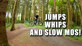
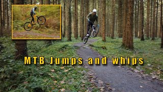
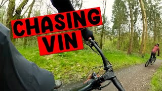
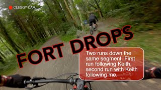
Videos of County Armagh Mountain Bike
12:23 |
56 |
Aug 16, 2024
2:30 |
66 |
Jun 16, 2024
4:32 |
152 |
May 21, 2023

5:31 |
115 |
Feb 18, 2023

trail: Speedy
3:04 |
180 |
Oct 31, 2022 , Markethill
trail: Speedy
2:37 |
203 |
Jul 16, 2022 , Markethill
trail: Mind The Birds
0:57 |
363 |
Jul 16, 2022 , Markethill

11:33 |
148 |
May 29, 2022
Recent Trail Reports
Activity Feed
| username | action | type | title | date |
|---|---|---|---|---|
| DylangW94tj | add | poi | activity #96562475 | Jun 8, 2026 @ 1:57pm Jun 8, 2026 |
| PhilipcT8W73 | wishlist | trail | activity #94383653 | May 9, 2026 @ 3:38pm May 9, 2026 |
| cleggycyclist | add | report | activity #93643483 | Apr 29, 2026 @ 6:31am Apr 29, 2026 |
| cleggycyclist | add | report | activity #93632106 and 4 more | Apr 29, 2026 @ 12:34am Apr 29, 2026 |
| cleggycyclist | add | trail | activity #93166025 | Apr 22, 2026 @ 12:22pm Apr 22, 2026 |
Local Badges
-

Epic Ride Climb 2k4 awarded -

Climbing 10k Badge19 awarded -

Climbing 100k Badge0 awarded -

Epic Ride Descent 2k4 awarded -

Descent 10k Badge19 awarded -

Descent 100k Badge0 awarded
Bike & Skill Parks
| name | type | city | rating |
|---|---|---|---|
| Craigavon Pump Track | skill park | Portadown |
Activity Type Stats
| activitytype | trails | distance | descent | descent distance | total vertical | rating | global rank | state rank | photos | reports | routes | ridelogs |
|---|---|---|---|---|---|---|---|---|---|---|---|---|
| Mountain Bike | 44 | 29 miles | 1,427 ft | 11 miles | 338 ft | 21 | 170 | 4,952 | ||||
| E-Bike | 44 | 29 miles | 1,427 ft | 11 miles | 338 ft | 170 | 530 | |||||
| Hike | 28 | 22 miles | 915 ft | 8 miles | 322 ft | 155 | 21 | |||||
| Trail Running | 28 | 22 miles | 915 ft | 8 miles | 322 ft | 155 | 163 |
Frequently Asked Questions About County Armagh
▼
What are the best places to ride in County Armagh?
County Armagh has 2 areas to explore for mountain biking. The top rated areas are:
▼
What are the highest rated mountain biking trails in County Armagh?
The highest rated mountain biking trails in County Armagh are:
- Larky's Loamage (4.1/5)
- Towpath (4.1/5)
- Speedy (4/5)
- Mind The Birds (3.8/5)
- Lake Loop (3.7/5)
▼
What is the best time of the year to ride in County Armagh?
Based on ride log data, the most popular months to ride in County Armagh are:
- July (40 activities)
- February (20 activities)
- June (9 activities)
▼
What is the longest trail in County Armagh?
The longest trail in County Armagh is Lake Loop at 6.3 miles. View all trails sorted by distance.
Activities
- By brenthillier
 NSMBA TRAILFORKS & contributors
 - Admins: UKTP, 20twenty-p, GRASS
- #6451 - 3,898 views
- county armagh activity log | embed map of County Armagh mountain bike trails | county armagh mountain biking points of interest
Downloading of trail gps tracks in kml & gpx formats is enabled for County Armagh.
You must login to download files.