close
-
Layers w
- Weather Layers
- Pro
- Pro
- Pro
- Pro
- Pro
- Pro
- More Layers
- Pro
- Pro
- Pro
- Pro
-
Upgrade to

3D
Trail Conditions
- Unknown
- Snow Groomed
- Snow Packed
- Snow Covered
- Snow Cover Partial
- Freeze/thaw Cycle
- Icy
- Prevalent Mud
- Wet
- Variable
- Ideal
- Dry
- Very Dry
Trail Flow (Ridden Direction)
Trailforks scans users ridelogs to determine the most popular direction each trail is ridden. A good flowing trail network will have most trails flowing in a single direction according to their intension.
The colour categories are based on what percentage of riders are riding a trail in its intended direction.
The colour categories are based on what percentage of riders are riding a trail in its intended direction.
- > 96%
- > 90%
- > 80%
- > 70%
- > 50%
- < 50%
- bi-directional trail
- no data
Trail Last Ridden
Trailforks scans ridelogs to determine the last time a trail was ridden.
- < 2 days
- < 1 week
- < 2 weeks
- < 1 month
- < 6 months
- > 6 months
Trail Ridden Direction
The intended direction a trail should be ridden.
- Downhill Only
- Downhill Primary
- Both Directions
- Uphill Primary
- Uphill Only
- One Direction
Contribute Details
Colors indicate trail is missing specified detail.
- Description
- Photos
- Description & Photos
- Videos
Trail Popularity ?
Trailforks scans ridelogs to determine which trails are ridden the most in the last 9 months.
Trails are compared with nearby trails in the same city region with a possible 25 colour shades.
Think of this as a heatmap, more rides = more kinetic energy = warmer colors.
- most popular
- popular
- less popular
- not popular
ATV/ORV/OHV Filter
Max Vehicle Width
inches
US Cell Coverage
Legend

Radar Time
Activity Recordings
Trailforks uses anonymized public activity data.
?
Activity Recordings
Trailforks uses anonymized public activity data.
?
Personal Heatmap
▶
Activity Types
all
/
none
▶
Options
2
Date range
month
–
Winter Trails
Warning
A routing network for winter maps does not exist. Selecting trails using the winter trails layer has been disabled.
Missing Trails
Most Popular
Least Popular
Trails are colored based on popularity. The more popular a trail is, the more red. Less popular trails trend towards green.
Jump Magnitude Heatmap
Heatmap of where riders jump on trails. Zoom in to see individual jumps, click circles to view jump details.
BC Backroad Status
![map legend]()
Service Road Atlas is a free to use, community-driven service for viewing and creating reports on the numerous back-country service roads around B.C. and Alberta.

Slope Aspect
Direction the slope faces
Trails Deemphasized
Trails are shown in grey.
Only show trails with no bike usage.
Suggested Layers
Based on selected activity type
Save the current map location and zoom level as your default home location whenever this page is loaded.
Save
No description for County Down has been added yet!
Login or register to submit one.
AKA: An Dún
This region uses the Uk/Euro style trail grading system.
Activities Click to view
- Mountain Bike
395 trails
- E-Bike
381 trails
- Horse
54 trails
- Hike
182 trails
- Trail Running
182 trails
Stats
- Avg Trail Rating
- Trails (view details)
- 400
- Trails Mountain Bike
- 395
- Trails E-Bike
- 381
- Trails Gravel Bike
- 30
- Trails Adaptive Bike
- 87
- Trails Winter Fat Bike
- 186
- Trails Horse
- 54
- Trails Hike
- 182
- Trails Trail Running
- 182
- Total Distance
- 181 miles
- Total Descent
- 51,652 ft
- Total Vertical
- 2,760 ft
- Highest Trailhead
- 2,767 ft
- Reports
- 2,699
- Photos
- 617
- Ridden Counter
- 39,097
Sub Regions
- Ballynachinch (27)
- Drumkeeragh Forest (27)
- Bangor (19)
- Helen's Tower (18)
- Castlewellan (44)
- Dundonald (14)
- Billy Neill (9)
- Newcastle (170)
- Donard Forest (69)
- Moneyscalp Forest (3)
- Tollymore (95)
- Newry (21)
- Big Wood (21)
- Rostrevor (95)
- Ballyedmond Forest (5)
- Ballymoney Wood (4)
- Rostrevor Forest (84)
- Strangford (5)
- Castle Ward (4)
Popular County Down Mountain Biking Trails
• 95 ★ 3.6 • 2,503 ft • 182 ft • 424 •
Popular red difficulty machine groomed. This mountain bike primary trail can be used one direction and has a moderate overall physical rating with a 182 ft blue climb. Trail visibility is always easy to follow. On average it takes 6 minutes to complete this trail.
• 95 ★ 3.4 • 1 mile • 372 ft • 420 •
The red trail climb continues, this section is still mostly uphill, Kodak Corner is an ideal place to stop for refreshments. Some technical climbing obstacles are present, but nothing too challenging.
• 95 ★ 4.2 • 2 miles • 80 ft • 413 •
Highly rated popular red difficulty machine groomed. This mountain bike primary trail can be used one direction and has a easy overall physical rating with a 80 ft green climb. It features berm, jump and rock garden. Trail visibility is always easy to follow. On average it takes 10 minutes to complete this trail.
• 95 ★ 3.5 • 2,215 ft • 0 ft • 390 •
Popular red difficulty machine groomed. This mountain bike primary trail can be used one direction and has a moderate overall physical rating with a 0 ft blue climb. It features berm, jump and rock garden. On average it takes 2 minutes to complete this trail.
• 80 ★ 3.7 • 2 miles • 200 ft • 390 •
Popular red difficulty machine groomed. This mountain bike primary trail can be used one direction and has a moderate overall physical rating with a 200 ft blue climb. It features berm, bridge, jump and rock garden. Trail visibility is always easy to follow. On average it takes 16 minutes to complete this trail.
• 90 ★ 1.8 • 1,804 ft • 26 ft • 378 •
Popular red difficulty machine groomed. This mountain bike primary trail can be used one direction and has a moderate overall physical rating with a 26 ft blue climb. It features rock garden. Trail visibility is always easy to follow. On average it takes 2 minutes to complete this trail.
• 95 ★ 3.0 • 3,028 ft • 11 ft • 373 •
Popular blue difficulty machine groomed. This mountain bike primary trail can be used one direction and has a easy overall physical rating with a 11 ft blue climb. Trail visibility is always easy to follow. On average it takes 3 minutes to complete this trail.
• 85 ★ 2.8 • 1,368 ft • 24 ft • 363 •
Popular red difficulty machine groomed. This mountain bike primary trail can be used one direction and has a easy overall physical rating with a 24 ft green climb. It features berm and drop. Trail visibility is always easy to follow. On average it takes 1 minutes to complete this trail.
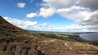
County Down Mountain Bike Routes
★ 4.0 • 9 miles • 949 ft • 42 • Loop •
This enjoys the initial flowing singletrack and incredible panoramic views found on Castlewellan's blue...
★ 4.0 • 17 miles • 2,251 ft • 45 • Loop •
This red trail will start off with a lung-busting ascent to the heights of Slievemartin, where you can...
★ 3.0 • 11 miles • 1,747 ft • 36 • Loop •
This black trail follows the same route as the red trail to the summit of Slievemartin and around...
★ 3.0 • 13 miles • 1,527 ft • 56 • Loop •
This loop includes both the red and black trail centre loops, while overlapping as little as possible.
3 miles • 152 ft • 13 • Loop •
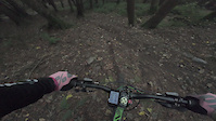
Photos of County Down Mountain Bike
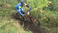
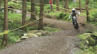
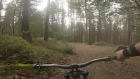
Videos of County Down Mountain Bike
trail: Heathen Part 3
0:24 |
25 |
Oct 18, 2025

trail: Helter Skelter upper
2:56 |
79 |
Mar 25, 2022
trail: The Skidz
4:25 |
|
Oct 23, 2021
trail: The Skidz
0:47 |
|
Aug 15, 2021
trail: Quit Yer Slabberin
0:33 |
68 |
Sep 6, 2020
trail: Red Trail 10
5:34 |
170 |
Sep 20, 2019
trail: Original On The Pulse
2:25 |
124 |
Jul 26, 2019
trail: Naturalist
0:47 |
276 |
Oct 6, 2018
Recent Trail Reports
Activity Feed
| username | action | type | title | date |
|---|---|---|---|---|
| DanielMTB123456789 | ridden | trail | activity #95882876 and 12 more | May 30, 2026 @ 1:29pm May 30, 2026 |
| DanielMTB123456789 | ridden | trail | activity #95882675 | May 30, 2026 @ 1:26pm May 30, 2026 |
| DanielMTB123456789 | ridden | trail | activity #95882639 and 3 more | May 30, 2026 @ 1:25pm May 30, 2026 |
| DanielMTB123456789 | ridden | trail | activity #95882565 and 5 more | May 30, 2026 @ 1:24pm May 30, 2026 |
| seamus171 | ridden | trail | activity #95874041 | May 30, 2026 @ 11:45am May 30, 2026 |
Recent Comments
| username | type | title | comment | date |
|---|---|---|---|---|
| trail | real steep, tech and loose. good fun! | May 30, 2026 @ 7:04am May 30, 2026 | ||
| trail | Don’t bother. It’s over grown and not rideable | Apr 12, 2026 @ 8:38am Apr 12, 2026 | ||
| report | First two sections cleared | Apr 3, 2026 @ 11:40am Apr 3, 2026 | ||
| trail | Tree down on lower section 13/12/25 | Dec 14, 2025 @ 1:27pm Dec 14, 2025 | ||
| trail | Trail closed, many many trees down halfway... | Jun 30, 2025 @ 11:49am Jun 30, 2025 |
Local Badges
-

Completionist0 awarded -

Descent 10k Badge5 awarded -

Descent 100k Badge0 awarded -

Big Ride 30k305 awarded -

Epic Ride 50k140 awarded -

Epic Mountain Bike Climb 2k0 awarded
Bike & Skill Parks
| name | type | city | rating |
|---|---|---|---|
| Tollymore National Outdoor Centre | skill park | Newcastle | |
| Killinchy Pump Track | skill park | Strangford | |
| Dromara Pump Track | skill park |
Activity Type Stats
| activitytype | trails | distance | descent | descent distance | total vertical | rating | global rank | state rank | photos | reports | routes | ridelogs |
|---|---|---|---|---|---|---|---|---|---|---|---|---|
| Mountain Bike | 395 | 175 miles | 51,043 ft | 95 miles | 1,890 ft | 608 | 2,699 | 9 | 22,340 | |||
| E-Bike | 381 | 172 miles | 49,524 ft | 93 miles | 1,890 ft | 8 | 2,610 | 6 | 2,939 | |||
| Gravel Bike | 30 | 32 miles | 3,451 ft | 13 miles | 1,627 ft | 255 | 1 | 23 | ||||
| Adaptive Bike | 87 | 58 miles | 7,690 ft | 24 miles | 1,493 ft | 302 | ||||||
| Winter Fat Bike | 186 | 108 miles | 18,655 ft | 52 miles | 1,476 ft | 1 | 1,096 | |||||
| Horse | 54 | 39 miles | 4,633 ft | 17 miles | 1,250 ft | 154 | ||||||
| Hike | 182 | 113 miles | 16,450 ft | 46 miles | 2,759 ft | 2,289 | 1,268 | |||||
| Trail Running | 182 | 113 miles | 16,450 ft | 46 miles | 2,759 ft | 2,289 | 1,513 |
Frequently Asked Questions About County Down
▼
What are the best places to ride in County Down?
County Down has 12 areas to explore for mountain biking. The top rated areas are:
▼
What are the highest rated mountain biking trails in County Down?
The highest rated mountain biking trails in County Down are:
- Heathen Part 1 (4.5/5)
- Clumsy Hawk (4.4/5)
- Bins 1 (Upper) (4.4/5)
- Reindeer Hunter (4.4/5)
- Heathen Part 3 (4.4/5)
▼
What is the best time of the year to ride in County Down?
Based on ride log data, the most popular months to ride in County Down are:
- June (137 activities)
- July (113 activities)
- September (106 activities)
▼
What is the longest trail in County Down?
The longest trail in County Down is Bangor Coastal path at 7.4 km. View all trails sorted by distance.
Activities
Trails
- By brenthillier
 NSMBA TRAILFORKS & contributors
 - Admins: UKTP, 20twenty-p, GRASS
- #6444 - 5,424 views
- county down activity log | embed map of County Down mountain bike trails | county down mountain biking points of interest polygons
Downloading of trail gps tracks in kml & gpx formats is enabled for County Down.
You must login to download files.