close
-
Layers w
- Weather Layers
- Pro
- Pro
- Pro
- Pro
- Pro
- Pro
- More Layers
- Pro
- Pro
- Pro
- Pro
-
Upgrade to

3D
Trail Conditions
- Unknown
- Snow Groomed
- Snow Packed
- Snow Covered
- Snow Cover Partial
- Freeze/thaw Cycle
- Icy
- Prevalent Mud
- Wet
- Variable
- Ideal
- Dry
- Very Dry
Trail Flow (Ridden Direction)
Trailforks scans users ridelogs to determine the most popular direction each trail is ridden. A good flowing trail network will have most trails flowing in a single direction according to their intension.
The colour categories are based on what percentage of riders are riding a trail in its intended direction.
The colour categories are based on what percentage of riders are riding a trail in its intended direction.
- > 96%
- > 90%
- > 80%
- > 70%
- > 50%
- < 50%
- bi-directional trail
- no data
Trail Last Ridden
Trailforks scans ridelogs to determine the last time a trail was ridden.
- < 2 days
- < 1 week
- < 2 weeks
- < 1 month
- < 6 months
- > 6 months
Trail Ridden Direction
The intended direction a trail should be ridden.
- Downhill Only
- Downhill Primary
- Both Directions
- Uphill Primary
- Uphill Only
- One Direction
Contribute Details
Colors indicate trail is missing specified detail.
- Description
- Photos
- Description & Photos
- Videos
Trail Popularity ?
Trailforks scans ridelogs to determine which trails are ridden the most in the last 9 months.
Trails are compared with nearby trails in the same city region with a possible 25 colour shades.
Think of this as a heatmap, more rides = more kinetic energy = warmer colors.
- most popular
- popular
- less popular
- not popular
ATV/ORV/OHV Filter
Max Vehicle Width
inches
US Cell Coverage
Legend

Radar Time
Activity Recordings
Trailforks uses anonymized public activity data.
?
Activity Recordings
Trailforks uses anonymized public activity data.
?
Personal Heatmap
▶
Activity Types
all
/
none
▶
Options
2
Date range
month
–
Winter Trails
Warning
A routing network for winter maps does not exist. Selecting trails using the winter trails layer has been disabled.
Missing Trails
Most Popular
Least Popular
Trails are colored based on popularity. The more popular a trail is, the more red. Less popular trails trend towards green.
Jump Magnitude Heatmap
Heatmap of where riders jump on trails. Zoom in to see individual jumps, click circles to view jump details.
BC Backroad Status
![map legend]()
Service Road Atlas is a free to use, community-driven service for viewing and creating reports on the numerous back-country service roads around B.C. and Alberta.

Slope Aspect
Direction the slope faces
Trails Deemphasized
Trails are shown in grey.
Only show trails with no bike usage.
Suggested Layers
Based on selected activity type
Save the current map location and zoom level as your default home location whenever this page is loaded.
Save
No description for County Tyrone has been added yet!
Login or register to submit one.
AKA: Tír Eoghain
This region uses the Uk/Euro style trail grading system.
Activities Click to view
- Mountain Bike
65 trails
- E-Bike
65 trails
- Hike
49 trails
- Trail Running
49 trails
Stats
- Avg Trail Rating
- Trails (view details)
- 66
- Trails Mountain Bike
- 65
- Trails E-Bike
- 65
- Trails Hike
- 49
- Trails Trail Running
- 49
- Total Distance
- 45 miles
- Total Descent
- 6,460 ft
- Total Vertical
- 1,490 ft
- Highest Trailhead
- 1,736 ft
- Reports
- 782
- Photos
- 112
- Ridden Counter
- 5,386
Sub Regions
- Cookstown (30)
- Davagh Forest (30)
- Fivemiletown (11)
- Blessingbourne (11)
- Omagh (17)
- Gortin Glen (17)
- Knockmany Forest (6)
Popular County Tyrone Mountain Biking Trails
• 40 ★ 3.4 • 1,896 ft • 19 ft • 209 •
Moderately popular red difficulty singletrack. This mountain bike primary trail. On average it takes 5 minutes to complete this trail.
• 85 ★ 1.0 • 2,894 ft • 31 ft • 196 •
Popular blue difficulty singletrack. This mountain bike primary trail. On average it takes 3 minutes to complete this trail.
• 40 ★ 4.4 • 2,251 ft • 0 ft • 192 •
Highly rated moderately popular red difficulty singletrack. This mountain bike primary trail. On average it takes 3 minutes to complete this trail.
• 80 ★ 1.0 • 2,575 ft • 80 ft • 190 •
Popular blue difficulty singletrack. This mountain bike primary trail. On average it takes 4 minutes to complete this trail.
• 70 ★ 3.0 • 2,494 ft • 4 ft • 189 •
Popular red difficulty singletrack. This mountain bike primary trail. On average it takes 7 minutes to complete this trail.
• 90 ★ 2.0 • 706 ft • 0 ft • 185 •
Popular red difficulty singletrack. This mountain bike primary trail. On average it takes minutes to complete this trail.
• 100 ★ 3.7 • 3,219 ft • 3 ft • 185 •
Popular red difficulty singletrack. This mountain bike primary trail. On average it takes 3 minutes to complete this trail.
• 100 ★ 4.2 • 2,746 ft • 45 ft • 181 •
Short section of gravel groomed trail what was once a rider built trail with good jumps.
County Tyrone Mountain Bike Routes
10 miles • 1,992 ft • 38 • Loop •
This route follows the official forest roads to guide users to all the official trails in the Gortin Glens...
5 miles • 1,004 ft • 15 • Loop •
This route follows the official forest roads to guide users to the blue trails in the Gortin Glens forest...
• 11 miles • 1,417 ft • 11 •
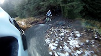
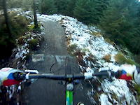
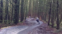
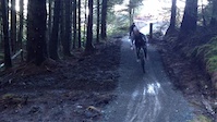
Photos of County Tyrone Mountain Bike
Videos of County Tyrone Mountain Bike

trail: Stream Trail
2:13 |
161 |
Jun 9, 2015

0:28 |
443 |
Jan 8, 2015

0:11 |
164 |
Jan 8, 2015
trail: Stream Trail
2:12 |
370 |
Jan 3, 2015
trail: Stream Trail
0:44 |
213 |
Jan 3, 2015
trail: Stream Trail
0:18 |
254 |
Jan 2, 2015
trail: Stream Trail
0:26 |
251 |
Jan 2, 2015
trail: Stream Trail
0:36 |
210 |
Dec 31, 2014
Recent Trail Reports
| status | trail | date | condition | info | user |
|---|---|---|---|---|---|
| All the way down! Knockmany Forest | Mar 23, 2026 @ 11:15am (Europe/London) Mar 23, 2026 | Ideal | cleggycyclist | ||
| The Roller Coaster Gortin Glen | Feb 17, 2026 @ 1:50pm (Europe/London) Feb 17, 2026 | Wet | mountainhash | ||
| River Run Gortin Glen | Feb 17, 2026 @ 1:50pm (Europe/London) Feb 17, 2026 | Wet | mountainhash | ||
| Skills Trail Gortin Glen | Feb 17, 2026 @ 1:50pm (Europe/London) Feb 17, 2026 | Wet | mountainhash | ||
| The Mountain Gortin Glen | Feb 17, 2026 @ 1:50pm (Europe/London) Feb 17, 2026 | Wet | mountainhash | ||
| Kelans Chase Gortin Glen | Feb 17, 2026 @ 1:50pm (Europe/London) Feb 17, 2026 | Icy | mountainhash | ||
| Skills Trail Gortin Glen | Feb 17, 2026 @ 1:50pm (Europe/London) Feb 17, 2026 | Wet | mountainhash | ||
| Kelans Chase Climb Gortin Glen | Feb 17, 2026 @ 1:50pm (Europe/London) Feb 17, 2026 | Wet | mountainhash | ||
| Sika's Run Gortin Glen | Feb 17, 2026 @ 1:50pm (Europe/London) Feb 17, 2026 | Variable | mountainhash | ||
| Run Ragley Run Davagh Forest | Sep 21, 2025 @ 3:32pm (Europe/London) Sep 21, 2025 | Wet | jdw12 |
Activity Feed
| username | action | type | title | date |
|---|---|---|---|---|
| Roman8ycztK | ridden | trail | activity #94359323 and 1 more | May 9, 2026 @ 10:54am May 9, 2026 |
| Roman8ycztK | ridden | trail | activity #94359051 | May 9, 2026 @ 10:51am May 9, 2026 |
| mountainhash | add | report | activity #89117783 and 7 more | Feb 18, 2026 @ 4:01am Feb 18, 2026 |
| GarbZero1979 | wishlist | region | activity #84233073 | Nov 16, 2025 @ 4:10am Nov 16, 2025 |
| caoimhinmarsh | add | report | activity #82705899 and 1 more | Oct 20, 2025 @ 6:01am Oct 20, 2025 |
Recent Comments
| username | type | title | comment | date |
|---|---|---|---|---|
| report | All dry | Jun 8, 2018 @ 10:56am Jun 8, 2018 | ||
| trail | Take 5 pound coins for the car park. Vending... | May 30, 2018 @ 11:41am May 30, 2018 | ||
| trail | Best bit of the red but lacks any small jumps,... | Nov 18, 2014 @ 9:17am Nov 18, 2014 | ||
| trail | Groomed flat gravel surface with corner into... | Nov 18, 2014 @ 9:15am Nov 18, 2014 | ||
| trail | Groomed flat gravel surface with corner into... | Nov 18, 2014 @ 9:14am Nov 18, 2014 |
Local Badges
-

Climbing 10k Badge9 awarded -

Epic Ride Descent 2k1 awarded -
Epic Ride Descent 2k1 awarded -

Mountain Biking 100k Badge0 awarded -
Mountain Biking 100k Badge0 awarded -

Epic Mountain Bike Climb 2k1 awarded
Activity Type Stats
| activitytype | trails | distance | descent | descent distance | total vertical | rating | global rank | state rank | photos | reports | routes | ridelogs |
|---|---|---|---|---|---|---|---|---|---|---|---|---|
| Mountain Bike | 65 | 45 miles | 6,165 ft | 18 miles | 1,490 ft | 110 | 782 | 3 | 5,403 | |||
| E-Bike | 65 | 45 miles | 6,165 ft | 18 miles | 1,490 ft | 2 | 781 | 3 | 486 | |||
| Hike | 49 | 37 miles | 3,973 ft | 13 miles | 1,490 ft | 763 | 59 | |||||
| Trail Running | 49 | 37 miles | 3,973 ft | 13 miles | 1,490 ft | 763 | 32 |
Frequently Asked Questions About County Tyrone
▼
What are the best places to ride in County Tyrone?
County Tyrone has 4 areas to explore for mountain biking. The top rated areas are:
▼
What are the highest rated mountain biking trails in County Tyrone?
The highest rated mountain biking trails in County Tyrone are:
- Kelans Chase (4.2/5)
- Wolf's Hill (4.2/5)
- Stream Trail (4.1/5)
- Bourne To Be Wild (4.1/5)
- 2nd Trail (4.1/5)
▼
What is the best time of the year to ride in County Tyrone?
Based on ride log data, the most popular months to ride in County Tyrone are:
- March (27 activities)
- October (23 activities)
- April (23 activities)
▼
What is the longest trail in County Tyrone?
The longest trail in County Tyrone is Blue Trail at 3.4 km. View all trails sorted by distance.
Activities
Trails
Points of Interest
- By brenthillier
 NSMBA TRAILFORKS & contributors
 - Admins: UKTP, 20twenty-p, GRASS
- #6448 - 3,625 views
- county tyrone activity log | embed map of County Tyrone mountain bike trails | county tyrone mountain biking points of interest
Downloading of trail gps tracks in kml & gpx formats is enabled for County Tyrone.
You must login to download files.