close
-
Layers w
- Weather Layers
- Pro
- Pro
- Pro
- Pro
- Pro
- Pro
- More Layers
- Pro
- Pro
- Pro
- Pro
-
Upgrade to

3D
Trail Conditions
- Unknown
- Snow Groomed
- Snow Packed
- Snow Covered
- Snow Cover Partial
- Freeze/thaw Cycle
- Icy
- Prevalent Mud
- Wet
- Variable
- Ideal
- Dry
- Very Dry
Trail Flow (Ridden Direction)
Trailforks scans users ridelogs to determine the most popular direction each trail is ridden. A good flowing trail network will have most trails flowing in a single direction according to their intension.
The colour categories are based on what percentage of riders are riding a trail in its intended direction.
The colour categories are based on what percentage of riders are riding a trail in its intended direction.
- > 96%
- > 90%
- > 80%
- > 70%
- > 50%
- < 50%
- bi-directional trail
- no data
Trail Last Ridden
Trailforks scans ridelogs to determine the last time a trail was ridden.
- < 2 days
- < 1 week
- < 2 weeks
- < 1 month
- < 6 months
- > 6 months
Trail Ridden Direction
The intended direction a trail should be ridden.
- Downhill Only
- Downhill Primary
- Both Directions
- Uphill Primary
- Uphill Only
- One Direction
Contribute Details
Colors indicate trail is missing specified detail.
- Description
- Photos
- Description & Photos
- Videos
Trail Popularity ?
Trailforks scans ridelogs to determine which trails are ridden the most in the last 9 months.
Trails are compared with nearby trails in the same city region with a possible 25 colour shades.
Think of this as a heatmap, more rides = more kinetic energy = warmer colors.
- most popular
- popular
- less popular
- not popular
ATV/ORV/OHV Filter
Max Vehicle Width
inches
US Cell Coverage
Legend

Radar Time
Activity Recordings
Trailforks uses anonymized public activity data.
?
Activity Recordings
Trailforks uses anonymized public activity data.
?
Personal Heatmap
▶
Activity Types
all
/
none
▶
Options
2
Date range
month
–
Winter Trails
Warning
A routing network for winter maps does not exist. Selecting trails using the winter trails layer has been disabled.
Missing Trails
Most Popular
Least Popular
Trails are colored based on popularity. The more popular a trail is, the more red. Less popular trails trend towards green.
Jump Magnitude Heatmap
Heatmap of where riders jump on trails. Zoom in to see individual jumps, click circles to view jump details.
BC Backroad Status
![map legend]()
Service Road Atlas is a free to use, community-driven service for viewing and creating reports on the numerous back-country service roads around B.C. and Alberta.

Slope Aspect
Direction the slope faces
Trails Deemphasized
Trails are shown in grey.
Only show trails with no bike usage.
Suggested Layers
Based on selected activity type
Save the current map location and zoom level as your default home location whenever this page is loaded.
SaveThis area contains the Crestridge Ecolological Reserve as well as the general area surround the reserve to include Flynn Springs County Park. The Crestridge Ecological Reserve proper and is managed by the CA Department of Fishing and Wildlife. This reserve is the first (and currently only) CDFW managed property in the entire state that allows mountain biking.
This area can get extremely hot and dry during the summer. October through May is kinda the season in this area.
This area can get extremely hot and dry during the summer. October through May is kinda the season in this area.
Primary Trail Type: Cross-Country
Land Status: Conservation Reserve
 google parking directions
 Activities Click to view
- Mountain Bike
23 trails
- Horse
4 trails
- Hike
19 trails
- Trail Running
14 trails
Region Details
- 5
- 15
- 2
Region Status
Caution as of Feb 5, 2026Stats
- Avg Trail Rating
- Trails (view details)
- 22
- Trails Mountain Bike
- 23
- Trails E-Bike
- 1
- Trails Horse
- 4
- Trails Hike
- 19
- Trails Trail Running
- 14
- Total Distance
- 16 miles
- Total Descent Distance
- 7 miles
- Total Descent
- 3,082 ft
- Total Vertical
- 954 ft
- Highest Trailhead
- 1,747 ft
- Reports
- 179
- Photos
- 82
- Ridden Counter
- 3,313
Popular Crestridge Mountain Biking Trails
• 90 ★ 3.0 • 2,110 ft • 133 ft • 222 •
This spur trail climbs to a vista that offers view of downtown San Diego, Coronado, Point Loma and the Pacific Ocean
• 95 ★ 5.0 • 2,566 ft • 0 ft • 220 •
This popular trail hosts some of the finest features in the area. It should only be ridden downhill. It includes berms, drops and jumps.
• 85 ★ 2.5 • 1,220 ft • 0 ft • 123 •
This trail goes from the bottom of the south to the North Crest Fire Rd
• 75 ★ 4.0 • 3,045 ft • 3 ft • 103 •
This singletrack goes off of the top of the dirt road after the gate at Lake View Lane down to Valley View Trail Trail.
• 60 ★ 3.0 • 3,061 ft • 62 ft • 95 •
This is an old fireroad that has dwindled down do near singletrack
Crestridge Mountain Bike Routes
★ 2.4 • 17 miles • 3,344 ft • 18 • Out & Back •
This route exposes the rider to almost all of the singletrack in the region. It minimizes the use of the...
Photos of Crestridge Mountain Bike
Videos of Crestridge Mountain Bike

trail: Coors Original
8:55 |
113 |
Nov 4, 2024 , Crest

trail: Coors Original
12:18 |
88 |
Nov 4, 2024 , Crest

trail: Camino De La Vista
12:18 |
165 |
Nov 4, 2024 , Crest

trail: "A" Game
12:18 |
250 |
Nov 4, 2024 , Crest

trail: Test Pilot
12:18 |
191 |
Nov 4, 2024 , Crest
trail: Den Trail
8:55 |
182 |
Oct 24, 2024 , Crest

trail: Crestridge 3A
8:55 |
119 |
Oct 24, 2024 , Crest

trail: Coors Banquet
8:55 |
126 |
Oct 24, 2024 , Crest
Recent Trail Reports
| status | trail | date | condition | info | user |
|---|---|---|---|---|---|
| Coors Original | Feb 5, 2026 @ 11:55am (America/Los_Angeles) Feb 5, 2026 | Dry | joeshuart | ||
| Vista De Montemar (Upper) | Jun 20, 2025 @ 8:04am Jun 20, 2025 | Very Dry | BenLow2019 | ||
| Vista De Montemar (Lower) | Jun 20, 2025 @ 8:04am Jun 20, 2025 | Very Dry | BenLow2019 | ||
| Visitor Center Loop | Jun 20, 2025 @ 8:04am Jun 20, 2025 | Very Dry | BenLow2019 | ||
| Valley-to-Tank | Jun 20, 2025 @ 8:04am Jun 20, 2025 | Very Dry | BenLow2019 | ||
| Valley View Truck Trail | Jun 20, 2025 @ 8:04am Jun 20, 2025 | Very Dry | BenLow2019 | ||
| Valley Trail | Jun 20, 2025 @ 8:04am Jun 20, 2025 | Very Dry | BenLow2019 | ||
| Valley Trail | Jun 20, 2025 @ 8:04am Jun 20, 2025 | Very Dry | BenLow2019 | ||
| Test Pilot | Jun 20, 2025 @ 8:04am Jun 20, 2025 | Very Dry | BenLow2019 | ||
| Rios Canyon Connector | Jun 20, 2025 @ 8:03am Jun 20, 2025 | Very Dry | BenLow2019 |
Activity Feed
| username | action | type | title | date |
|---|---|---|---|---|
| wznsI0 | wishlist | trail | activity #96476125 | Jun 7, 2026 @ 10:27am Jun 7, 2026 |
| Totogogo | wishlist | trail | activity #96405587 | Jun 6, 2026 @ 2:14pm Jun 6, 2026 |
| onen | wishlist | region | activity #96250499 | Jun 4, 2026 @ 1:53pm Jun 4, 2026 |
| dirtnomad95 | ridden | trail | activity #92240754 | Apr 9, 2026 @ 2:28am Apr 9, 2026 |
| hillbomber39 | ridden | trail | activity #92103686 | Apr 7, 2026 @ 1:18am Apr 7, 2026 |
Recent Comments
| username | type | title | comment | date |
|---|---|---|---|---|
| trail | Extremely rutted | Feb 5, 2026 @ 11:53am Feb 5, 2026 | ||
| trail | Such large ruts, multiple times I had to... | Mar 22, 2025 @ 8:14pm Mar 22, 2025 | ||
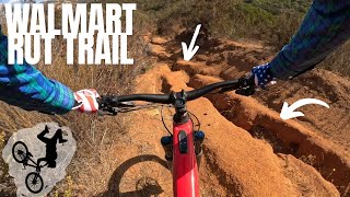
| trail | Super Rutted up hill and way over grown | Aug 4, 2024 @ 9:58am Aug 4, 2024 | ||
| trail | Super rutted, not recommended | Mar 11, 2024 @ 10:33am Mar 11, 2024 | ||
| trail | Really steep and deeply rutted badly. Line... | Feb 26, 2022 @ 12:28pm Feb 26, 2022 |
Nearby Areas
| name | distance | ||||
|---|---|---|---|---|---|
| Flume Trails | 1 | 5 | 1 | 1 | 4.2 km |
| Oakoasis Preserve | 2 | 1 | 1 | 6.2 km | |
| Wright's Field | 6 | 13 | 7 | 6.6 km | |
| Anderson Truck Trail | 4 | 5 | 4 | 7.3 km | |
| Sycamore Canyon/Goodan Ranch | 4 | 8 | 7.3 km |
Local Badges
-

Completionist4 awarded
Activity Type Stats
| activitytype | trails | distance | descent | descent distance | total vertical | rating | global rank | state rank | photos | reports | routes | ridelogs |
|---|---|---|---|---|---|---|---|---|---|---|---|---|
| Mountain Bike | 23 | 16 miles | 3,081 ft | 7 miles | 955 ft | #7,263 | #2,780 | 82 | 179 | 1 | 2,875 | |
| E-Bike | 1 | 4 miles | 338 ft | 1 mile | 692 ft | 78 | 546 | |||||
| Horse | 4 | 1 mile | 456 ft | 5,003 ft | 364 ft | #3,692 | #2,252 | 39 | ||||
| Hike | 19 | 14 miles | 2,257 ft | 6 miles | 955 ft | #10,453 | #4,128 | 161 | 97 | |||
| Trail Running | 14 | 12 miles | 1,972 ft | 5 miles | 942 ft | #10,860 | #4,119 | 138 | 63 |
Frequently Asked Questions About Crestridge
▼
What are the highest rated mountain biking trails in Crestridge?
The highest rated mountain biking trails in Crestridge are:
- Test Pilot (4.3/5)
- Den Trail (4.1/5)
- Crestridge 3A (4/5)
- Coors Light (3.9/5)
- "A" Game (3.9/5)
▼
What is the best time of the year to ride in Crestridge?
Based on ride log data, the most popular months to ride in Crestridge are:
- October (10 activities)
- December (9 activities)
- April (8 activities)
▼
Where can I park to ride in Crestridge?
There are 2 parking locations listed in Crestridge. The most popular parking spots are:
▼
What is the longest trail in Crestridge?
The longest trail in Crestridge is Flinn Springs Overlook Trail at 1.8 miles. View all trails sorted by distance.
Activities
Trails
Points of Interest
- By trailthug
 & contributors
 - Admins: SDMBA, SDMBA, SDMBA-CR
- #20153 - 5,829 views
- crestridge activity log | embed map of Crestridge mountain bike trails | crestridge mountain biking points of interest
Downloading of trail gps tracks in kml & gpx formats is enabled for Crestridge.
You must login to download files.