close
-
Layers w
- Weather Layers
- Pro
- Pro
- Pro
- Pro
- Pro
- Pro
- More Layers
- Pro
- Pro
- Pro
- Pro
-
Upgrade to

3D
Trail Conditions
- Unknown
- Snow Groomed
- Snow Packed
- Snow Covered
- Snow Cover Partial
- Freeze/thaw Cycle
- Icy
- Prevalent Mud
- Wet
- Variable
- Ideal
- Dry
- Very Dry
Trail Flow (Ridden Direction)
Trailforks scans users ridelogs to determine the most popular direction each trail is ridden. A good flowing trail network will have most trails flowing in a single direction according to their intension.
The colour categories are based on what percentage of riders are riding a trail in its intended direction.
The colour categories are based on what percentage of riders are riding a trail in its intended direction.
- > 96%
- > 90%
- > 80%
- > 70%
- > 50%
- < 50%
- bi-directional trail
- no data
Trail Last Ridden
Trailforks scans ridelogs to determine the last time a trail was ridden.
- < 2 days
- < 1 week
- < 2 weeks
- < 1 month
- < 6 months
- > 6 months
Trail Ridden Direction
The intended direction a trail should be ridden.
- Downhill Only
- Downhill Primary
- Both Directions
- Uphill Primary
- Uphill Only
- One Direction
Contribute Details
Colors indicate trail is missing specified detail.
- Description
- Photos
- Description & Photos
- Videos
Trail Popularity ?
Trailforks scans ridelogs to determine which trails are ridden the most in the last 9 months.
Trails are compared with nearby trails in the same city region with a possible 25 colour shades.
Think of this as a heatmap, more rides = more kinetic energy = warmer colors.
- most popular
- popular
- less popular
- not popular
ATV/ORV/OHV Filter
Max Vehicle Width
inches
US Cell Coverage
Legend

Radar Time
Activity Recordings
Trailforks uses anonymized public activity data.
?
Activity Recordings
Trailforks uses anonymized public activity data.
?
Personal Heatmap
▶
Activity Types
all
/
none
▶
Options
2
Date range
month
–
Winter Trails
Warning
A routing network for winter maps does not exist. Selecting trails using the winter trails layer has been disabled.
Missing Trails
Most Popular
Least Popular
Trails are colored based on popularity. The more popular a trail is, the more red. Less popular trails trend towards green.
Jump Magnitude Heatmap
Heatmap of where riders jump on trails. Zoom in to see individual jumps, click circles to view jump details.
BC Backroad Status
![map legend]()
Service Road Atlas is a free to use, community-driven service for viewing and creating reports on the numerous back-country service roads around B.C. and Alberta.

Slope Aspect
Direction the slope faces
Trails Deemphasized
Trails are shown in grey.
Only show trails with no bike usage.
Suggested Layers
Based on selected activity type
Save the current map location and zoom level as your default home location whenever this page is loaded.
Save
No description for Creswick has been added yet!
Login or register to submit one.
Activities Click to view
- Mountain Bike
111 trails
- E-Bike
90 trails
- Gravel Bike
0 trails
- Adaptive Bike
0 trails
- Hike
36 trails
- Trail Running
37 trails
Region Details
- 2
- 21
- 56
- 11
- 1
Region Status
Open as of 1 dayStats
- Avg Trail Rating
- Trails (view details)
- 93
- Trails Mountain Bike
- 113
- Trails E-Bike
- 90
- Trails Hike
- 36
- Trails Trail Running
- 37
- Total Distance
- 98 miles
- Total Descent
- 11,663 ft
- Total Vertical
- 1,008 ft
- Highest Trailhead
- 2,398 ft
- Reports
- 826
- Photos
- 71
- Ridden Counter
- 19,081
Sub Regions
-
Creswick State Forest
- 2
- 30
- 3
-
Djuwang Baring
- 16
- 21
- 8
- 1
-
RACV Goldfields Resort
- 3
- 6
Popular Creswick Mountain Biking Trails
• 100 ★ 4.7 • 5,187 ft • 245 ft • 690 •
Cruisy climb to the start of (G10) which links to the rest of the gravity trails. This and (G4) are your climb trails for this area
• 100 ★ 4.7 • 3,327 ft • 53 ft • 599 •
Two way traverse trail that forms the spine of the gravity zone, linking your climbs and descents
• 95 ★ 4.5 • 3,081 ft • 0 ft • 522 •
Popular blue difficulty singletrack. This mountain bike primary trail can be used downhill only.
• 100 ★ 4.7 • 3,179 ft • 0 ft • 479 •
Popular blue difficulty singletrack. This mountain bike primary trail can be used downhill only.
• 85 ★ 4.0 • 3,091 ft • 240 ft • 432 •
A much steeper climbing trail than (G7), not technically challenging but will test your fitness and strength
• 85 ★ 4.7 • 2,274 ft • 0 ft • 432 •
Popular blue difficulty singletrack. This mountain bike primary trail can be used downhill only.
• 100 ★ 3.5 • 1,959 ft • 51 ft • 426 •
Popular blue difficulty singletrack. This mountain bike primary trail can be used downhill only.
• 95 ★ 4.5 • 1 mile • 189 ft • 418 •
Popular blue difficulty singletrack. This mountain bike primary trail can be used one direction.
Creswick Mountain Bike Routes
5 miles • 632 ft • 5 • Loop •
The Wallaby Loop is an officially signposted loop that gives a great introduction to riding at Djuwang...
4 miles • 392 ft • 6 • Loop •
The RACV Goldfields Resort loop skirts around the edge of the golf course of the resort. The trails are...
★ 5.0 • 5 miles • 462 ft • 0 • Out & Back •
Excellent array of berms, single track and pinch climbs
31 miles • 2,834 ft • 0 • Point to Point •
Swagmen used to talk about “taking to the wallaby track” and swamp wallabies are common in the...
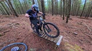
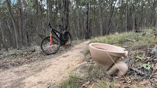
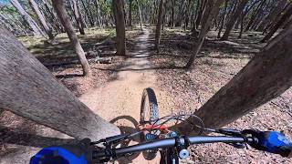
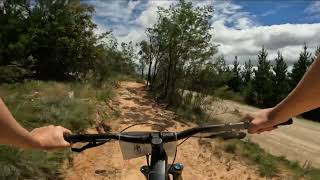
Photos of Creswick Mountain Bike
Videos of Creswick Mountain Bike
trail: Slightly Miffed Dunnart
18:20 |
3 |
Jun 11, 2026 , Creswick
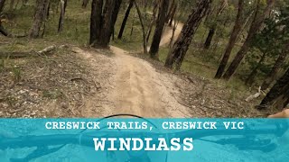
trail: Kingfisher
18:04 |
34 |
Mar 13, 2026 , Creswick
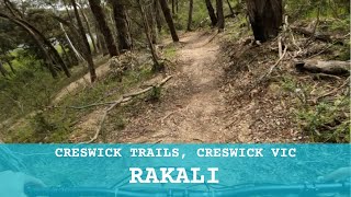
trail: Yapuka
10:51 |
57 |
Mar 7, 2026 , Creswick
youtuber
![Creswick Trails - Goldfields Track #S3/#S4]()
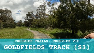
trail: Goldfields Track
3:41 |
49 |
Dec 10, 2025 , Creswick
Current Trail Warnings
| status | trail | date | condition | user | info |
|---|---|---|---|---|---|
| Green Apple | Jun 17, 2026 @ 3:03pm (Australia/Melbourne) 1 day | Unknown | CaraMG2CmC | Has closed sign at start of trail 17/6/26 |
Recent Trail Reports
| status | trail | date | condition | info | user |
|---|---|---|---|---|---|
| Riverside Gold | Jun 10, 2026 @ 10:17pm (Australia/Melbourne) Jun 10, 2026 | Unknown | Jackdubnz | ||
| Marsupial | Jun 6, 2026 @ 12:15am (Australia/Melbourne) Jun 5, 2026 | Wet | SuperFrodo | ||
| Warami Galk Galk | Jun 5, 2026 @ 2:29pm (Australia/Melbourne) Jun 4, 2026 | Wet | SuperFrodo | ||
| Windlass | Jun 5, 2026 @ 2:29pm (Australia/Melbourne) Jun 4, 2026 | Ideal | SuperFrodo | ||
| Rainbow Way | Jun 5, 2026 @ 2:29pm (Australia/Melbourne) Jun 4, 2026 | Wet | SuperFrodo | ||
| Yapuka | Jun 5, 2026 @ 2:29pm (Australia/Melbourne) Jun 4, 2026 | Wet | SuperFrodo | ||
| Barramal | Jun 5, 2026 @ 2:29pm (Australia/Melbourne) Jun 4, 2026 | Ideal | SuperFrodo | ||
| Mining Expedition | Jun 5, 2026 @ 2:29pm (Australia/Melbourne) Jun 4, 2026 | Ideal | SuperFrodo | ||
| Gurnmil | May 20, 2026 @ 5:23pm (Australia/Melbourne) May 20, 2026 | Wet | SuperFrodo | ||
| Goldfields Track | May 18, 2026 @ 7:01am (Australia/Melbourne) May 17, 2026 | Unknown | SuperFrodo |
Activity Feed
| username | action | type | title | date |
|---|---|---|---|---|
| CaraMG2CmC | add | report | activity #97162678 | Jun 16, 2026 @ 10:03pm 1 day |
| QYlOeC | add | photo | activity #97155705 | Jun 16, 2026 @ 7:03pm 1 day |
| SuperFrodo | vote | trail | activity #96725578 | Jun 11, 2026 @ 2:57am Jun 11, 2026 |
| SuperFrodo | add | video | activity #96725512 | Jun 11, 2026 @ 2:55am Jun 11, 2026 |
| Jackdubnz | add | report | activity #96665493 and 1 more | Jun 10, 2026 @ 5:16am Jun 10, 2026 |
Recent Comments
| username | type | title | comment | date |
|---|---|---|---|---|
| trail | Cool old technical trail with some woodwork... | May 19, 2026 @ 2:38pm May 19, 2026 | ||
| trail | Seems perfect for beginners. Very flowey with... | Mar 4, 2026 @ 1:59am Mar 4, 2026 | ||
| trail | Tree down | Jan 14, 2026 @ 5:10pm Jan 14, 2026 | ||
| trail | I’m | Jan 13, 2026 @ 3:27am Jan 13, 2026 | ||
| trail | Listed as Black (difficult) on the official... | Jan 2, 2026 @ 6:12pm Jan 2, 2026 |
Local Badges
-

Completionist0 awarded -

10 Blue Trails172 awarded -
Completionist0 awarded -

Top 10 Trails0 awarded -

10 Black Trails13 awarded -

10 Green Trails38 awarded
Bike & Skill Parks
| name | type | city | rating |
|---|---|---|---|
| Galki Wawa Skills Area | skill park | Creswick | |
| Hammon Park Pump Track | skill park | Creswick |
Activity Type Stats
| activitytype | trails | distance | descent | descent distance | total vertical | rating | global rank | state rank | photos | reports | routes | ridelogs |
|---|---|---|---|---|---|---|---|---|---|---|---|---|
| Mountain Bike | 111 | 94 miles | 11,204 ft | 41 miles | 1,007 ft | 70 | 827 | 4 | 8,030 | |||
| E-Bike | 90 | 80 miles | 9,491 ft | 34 miles | 1,007 ft | #831 | #62 | 745 | 2 | 2,376 | ||
| Hike | 36 | 52 miles | 4,616 ft | 23 miles | 1,007 ft | #2,842 | #81 | 652 | 144 | |||
| Trail Running | 37 | 52 miles | 4,616 ft | 23 miles | 1,007 ft | #2,369 | #66 | 658 | 1 | 96 |
Frequently Asked Questions About Creswick
▼
What are the best places to ride in Creswick?
Creswick has 3 areas to explore for mountain biking. The top rated areas are:
▼
What are the highest rated mountain biking trails in Creswick?
The highest rated mountain biking trails in Creswick are:
- Bronzewing (4.2/5)
- BrackenBerm (4.2/5)
- Yam Daisy (4.2/5)
- Guwak (4.2/5)
- Green Apple (4.2/5)
▼
What is the best time of the year to ride in Creswick?
Based on ride log data, the most popular months to ride in Creswick are:
- February (50 activities)
- November (40 activities)
- January (35 activities)
▼
Where can I park to ride in Creswick?
There are 6 parking locations listed in Creswick. The most popular parking spots are: View all parking and trailhead locations on the map to plan your visit.
Activities
Trails
- By Reecemartin & contributors
- Admins: Victoria
- #12757 - 24,753 views
- creswick activity log | embed map of Creswick mountain bike trails | creswick mountain biking points of interest
Downloading of trail gps tracks in kml & gpx formats is enabled for Creswick.
You must login to download files.