close
-
Layers w
- Weather Layers
- Pro
- Pro
- Pro
- Pro
- Pro
- Pro
- More Layers
- Pro
- Pro
- Pro
- Pro
-
Upgrade to

3D
Trail Conditions
- Unknown
- Snow Groomed
- Snow Packed
- Snow Covered
- Snow Cover Partial
- Freeze/thaw Cycle
- Icy
- Prevalent Mud
- Wet
- Variable
- Ideal
- Dry
- Very Dry
Trail Flow (Ridden Direction)
Trailforks scans users ridelogs to determine the most popular direction each trail is ridden. A good flowing trail network will have most trails flowing in a single direction according to their intension.
The colour categories are based on what percentage of riders are riding a trail in its intended direction.
The colour categories are based on what percentage of riders are riding a trail in its intended direction.
- > 96%
- > 90%
- > 80%
- > 70%
- > 50%
- < 50%
- bi-directional trail
- no data
Trail Last Ridden
Trailforks scans ridelogs to determine the last time a trail was ridden.
- < 2 days
- < 1 week
- < 2 weeks
- < 1 month
- < 6 months
- > 6 months
Trail Ridden Direction
The intended direction a trail should be ridden.
- Downhill Only
- Downhill Primary
- Both Directions
- Uphill Primary
- Uphill Only
- One Direction
Contribute Details
Colors indicate trail is missing specified detail.
- Description
- Photos
- Description & Photos
- Videos
Trail Popularity ?
Trailforks scans ridelogs to determine which trails are ridden the most in the last 9 months.
Trails are compared with nearby trails in the same city region with a possible 25 colour shades.
Think of this as a heatmap, more rides = more kinetic energy = warmer colors.
- most popular
- popular
- less popular
- not popular
ATV/ORV/OHV Filter
Max Vehicle Width
inches
US Cell Coverage
Legend

Radar Time
Activity Recordings
Trailforks uses anonymized public activity data.
?
Activity Recordings
Trailforks uses anonymized public activity data.
?
Personal Heatmap
▶
Activity Types
all
/
none
▶
Options
2
Date range
month
–
Winter Trails
Warning
A routing network for winter maps does not exist. Selecting trails using the winter trails layer has been disabled.
Missing Trails
Most Popular
Least Popular
Trails are colored based on popularity. The more popular a trail is, the more red. Less popular trails trend towards green.
Jump Magnitude Heatmap
Heatmap of where riders jump on trails. Zoom in to see individual jumps, click circles to view jump details.
BC Backroad Status
![map legend]()
Service Road Atlas is a free to use, community-driven service for viewing and creating reports on the numerous back-country service roads around B.C. and Alberta.

Slope Aspect
Direction the slope faces
Trails Deemphasized
Trails are shown in grey.
Only show trails with no bike usage.
Suggested Layers
Based on selected activity type
Save the current map location and zoom level as your default home location whenever this page is loaded.
Save
No description for Crete has been added yet!
Login or register to submit one.
Region Details
- 1
- 2
- 11
- 15
- 9
- 1
Stats
- Avg Trail Rating
- Trails (view details)
- 39
- Trails Mountain Bike
- 45
- Trails E-Bike
- 21
- Trails Horse
- 1
- Trails Hike
- 40
- Trails Trail Running
- 39
- Total Distance
- 33 miles
- Total Descent
- 16,924 ft
- Total Vertical
- 3,401 ft
- Highest Trailhead
- 3,414 ft
- Reports
- 21
- Photos
- 119
- Ridden Counter
- 361
Articles

Exploring The Lesser Known Trails Of Crete: A Mountain Bike Journey
Nov 23, 2022 from pinkbike.com
Loose rock and perfect views on this venture through the stunning and culturally rich island of Crete.
Sub Regions
- Chania (7)
- Chania (7)
- Astritsi (0)
- Prevadorio (2)
- Chania (7)
- Heraklion Prefecture (36)
- Heraklion (22)
- Giouchtas (6)
- Karteros (5)
- Sifis (0)
- Strouboulas (3)
- Hersonisos (13)
- Malia (5)
- Malevizi (1)
- Fodele (1)
- Heraklion (22)
Popular Crete Mountain Biking Trails
• 70 ★ 5.0 • 2 miles • 43 ft • 39 •
Technical challenge traversing the karfi mountain. You end up dropping into Krasi. Fantastic loose, raw and quick trail for advanced riders. Gives you a taste of the true cretan mtb terrain. MAKE SURE TO CLOSE ANY GATES THAT YOU OPEN....
• 85 ★ 5.0 • 2 miles • 90 ft • 21 •
Old road that was used for trade between malia and moxos. Watch for hikers and close gates behind you.
• 55 ★ 5.0 • 2 miles • 333 ft • 17 •
Flow trail with some rock gardens and switchbacks. Requires a 10-15min hike a bike to the top and then a very rewarding downhill with techy and flow features. This is also a hiking trail, so be careful and aware of other people using it.
• 100 ★ 5.0 • 1,027 ft • 0 ft • 17 •
Popular blue difficulty singletrack. This mountain bike primary trail can be used both directions. On average it takes 3 minutes to complete this trail.
• 90 ★ 4.4 • 3,941 ft • 77 ft • 15 •
The "A-Line" here in Crete. Really fast and flowy with a lot of burms, jumps, wooden jumps and really steep in a couple parts. This place was an old testing range for the millitary here in Greece and the name comes from an old bazooka...
• 40 ★ 5.0 • 2 miles • 97 ft • 14 •
Starts from the main road that goes up to lasithi and ends in gonies. This trail includes some urban riding sine you will go through the Monastery and even thru gonies village. It has 2-3 steep and loose dirt sections but other than...
• 100 ★ 0.0 • 2 miles • 446 ft • 14 •
Popular green difficulty mixed. This mountain bike primary trail can be used both directions and has a moderate overall physical rating with a 446 ft blue climb. On average it takes 4 hours23 minutes to complete this trail.
• 100 ★ 5.0 • 3,278 ft • 0 ft • 14 •
The path starts parallel to the K. Mitsotaki road. It is a path with natural obstacles without big drops and jumps. The terrain is mainly downhill with a few sections that may need a little pedaling. It has a mixed terrain of dirt with...
Crete Mountain Bike Routes
16 miles • 1,365 ft • 0 • Loop •
the most famous off road tour of cyclingcreta starting from Lyttos beach hotel
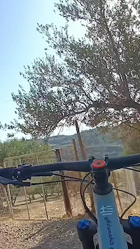
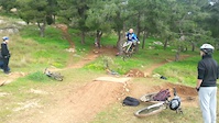
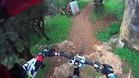
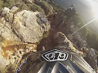
Photos of Crete Mountain Bike
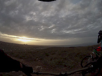
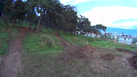
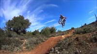
Videos of Crete Mountain Bike
trail: Rampes trail
0:18 |
51 |
Jun 12, 2024

trail: Fodele All-Mountain
5:09 |
583 |
Mar 1, 2016
trail: Bomb Trail
2:33 |
331 |
May 28, 2015
trail: Prevadorio #2
0:38 |
238 |
Feb 27, 2015
trail: Prevadorio #2
2:39 |
330 |
Feb 7, 2015
trail: Prevadorio #1
0:33 |
240 |
Jan 30, 2015
trail: Prevadorio #1
0:35 |
238 |
Jan 30, 2015
trail: Strouboulas
0:22 |
547 |
Nov 20, 2014
Recent Trail Reports
| status | trail | date | condition | info | user |
|---|---|---|---|---|---|
| Nail The Trail Malia | Jun 25, 2025 @ 7:42am Jun 25, 2025 | Dry | fokos | ||
| Los39 the trail Strouboulas | Sep 15, 2024 @ 10:07am Sep 15, 2024 | Dry | Harrispro | ||
| xalepa trail 1 Giouchtas | Jul 1, 2024 @ 12:24pm Jul 1, 2024 | Dry | Harrispro | ||
| Giouchtas DH#1 Giouchtas | Jun 23, 2024 @ 6:12am Jun 23, 2024 | Unknown | manosadj | ||
| Rampes trail Giouchtas | Jun 19, 2024 @ 11:31am Jun 19, 2024 | Very Dry | manosadj | ||
| Fourni trail 1 Giouchtas | Jun 18, 2024 @ 10:02am Jun 18, 2024 | Very Dry | manosadj | ||
| Donkey Trail Malia | Jun 3, 2024 @ 4:17am Jun 3, 2024 | Ideal | Matt-c-dorset-UK | ||
| Kera Trail Malia | Jun 3, 2024 @ 4:17am Jun 3, 2024 | Very Dry | Matt-c-dorset-UK | ||
| Prevadorio #2 Prevadorio | Feb 6, 2022 @ 9:52am Feb 6, 2022 | Ideal | KonGamer19 | ||
| Prevadorio #1 Prevadorio | Feb 6, 2022 @ 9:52am Feb 6, 2022 | Ideal | KonGamer19 |
Activity Feed
| username | action | type | title | date |
|---|---|---|---|---|
| ptldbkr | wishlist | trail | activity #96722356 | Jun 11, 2026 @ 12:37am Jun 11, 2026 |
| mlu5252 | add | video | activity #90669738 | Mar 15, 2026 @ 4:54pm Mar 15, 2026 |
| Honky1ch | ridden | trail | activity #88920620 | Feb 14, 2026 @ 2:59pm Feb 14, 2026 |
| JohnlbKTPs | wishlist | trail | activity #88823049 | Feb 13, 2026 @ 3:54am Feb 13, 2026 |
| fokos | vote | trail | activity #88627111 and 1 more | Feb 9, 2026 @ 8:07am Feb 9, 2026 |
Recent Comments
| username | type | title | comment | date |
|---|---|---|---|---|
| report | Back to Feed fokos avatar Faidonas Kargatzis... | Feb 5, 2026 @ 10:54pm Feb 5, 2026 | ||
| trail | any update on this on 2024?? I am looking... | Feb 27, 2025 @ 11:49pm Feb 27, 2025 | ||
| trail | If the stars align, I plan to ride this one of... | Feb 4, 2025 @ 3:29pm Feb 4, 2025 | ||
| trail | half the trail is in extremly bad condition... | Jun 30, 2024 @ 5:50am Jun 30, 2024 | ||
| trail | 35.280283, 25.075297 this is the starting... | Nov 27, 2023 @ 12:16am Nov 27, 2023 |
Local Badges
-

Descent 10k Badge1 awarded -

Climbing 10k Badge1 awarded -

Mountain Biking 100k Badge0 awarded -

Epic Ride Descent 2k0 awarded -

Big Ride 30k5 awarded -

Epic Ride 50k2 awarded
Bike & Skill Parks
| name | type | city | rating |
|---|---|---|---|
| BMX/DIRT/SKATE (paralia) | skill park | Heraklion | |
| ΒΜΧ RACING - 4X Olympic Track | skill park | Heraklion |
Local Mountain Biking Directory
-
Daring Trails
![Daring Trails]()
-
Hellas BikeGuides & Tours
Activity Type Stats
| activitytype | trails | distance | descent | descent distance | total vertical | rating | global rank | state rank | photos | reports | routes | ridelogs |
|---|---|---|---|---|---|---|---|---|---|---|---|---|
| Mountain Bike | 45 | 33 miles | 16,926 ft | 22 miles | 3,402 ft | 119 | 21 | 2 | 7,714 | |||
| E-Bike | 21 | 10 miles | 6,663 ft | 8 miles | 3,186 ft | 15 | 1 | 408 | ||||
| Horse | 1 | 5 | ||||||||||
| Hike | 40 | 32 miles | 16,089 ft | 21 miles | 3,402 ft | 19 | 1,692 | |||||
| Trail Running | 39 | 32 miles | 16,089 ft | 21 miles | 3,402 ft | 19 | 61 |
Activities
Trails
Points of Interest
- By grshindig & contributors
- Admins: haristheodoropoulos, mikesf, grshindig
- #5797 - 13,611 views
- crete activity log | embed map of Crete mountain bike trails | crete mountain biking points of interest
Downloading of trail gps tracks in kml & gpx formats is enabled for Crete.
You must login to download files.